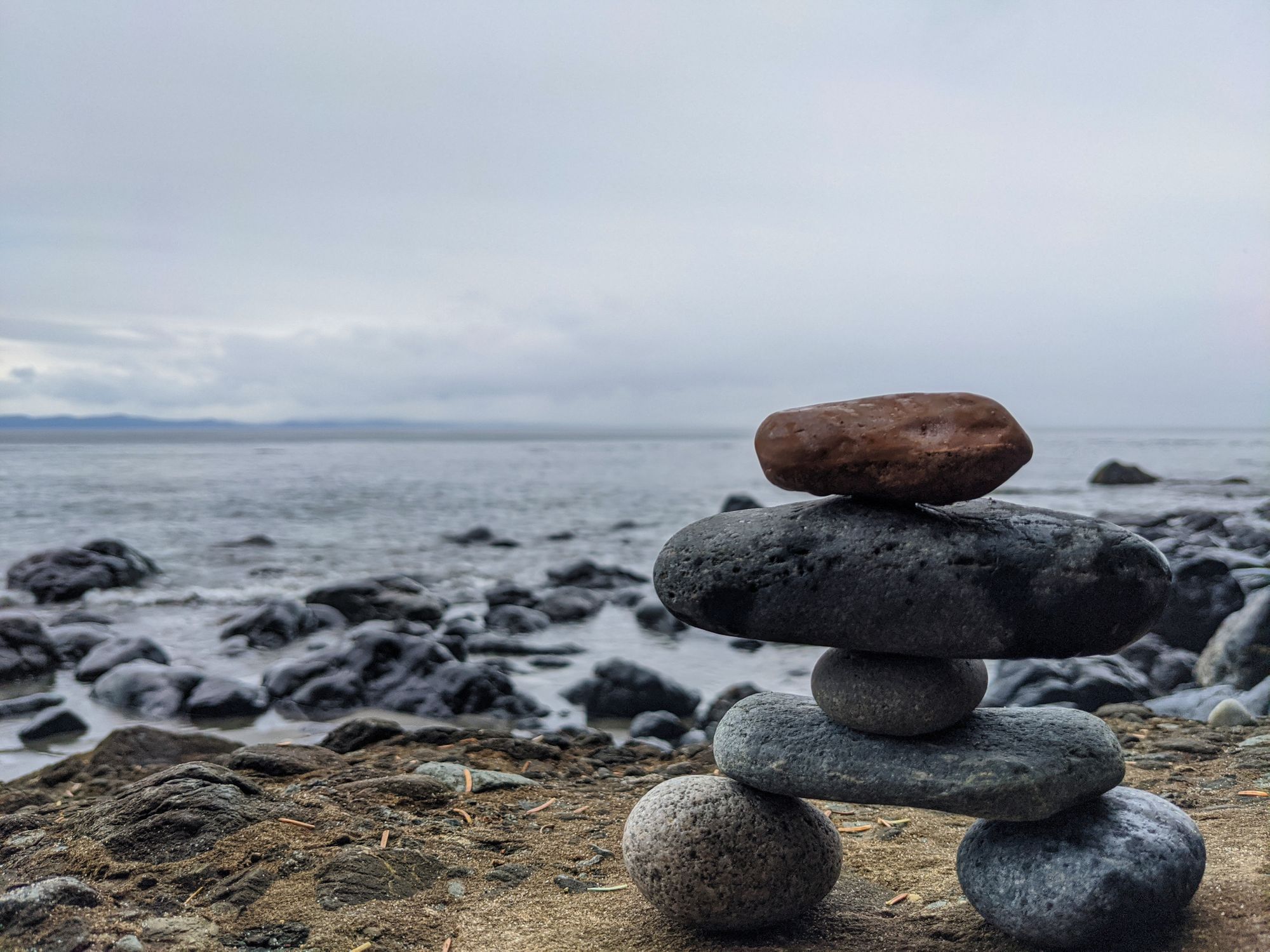
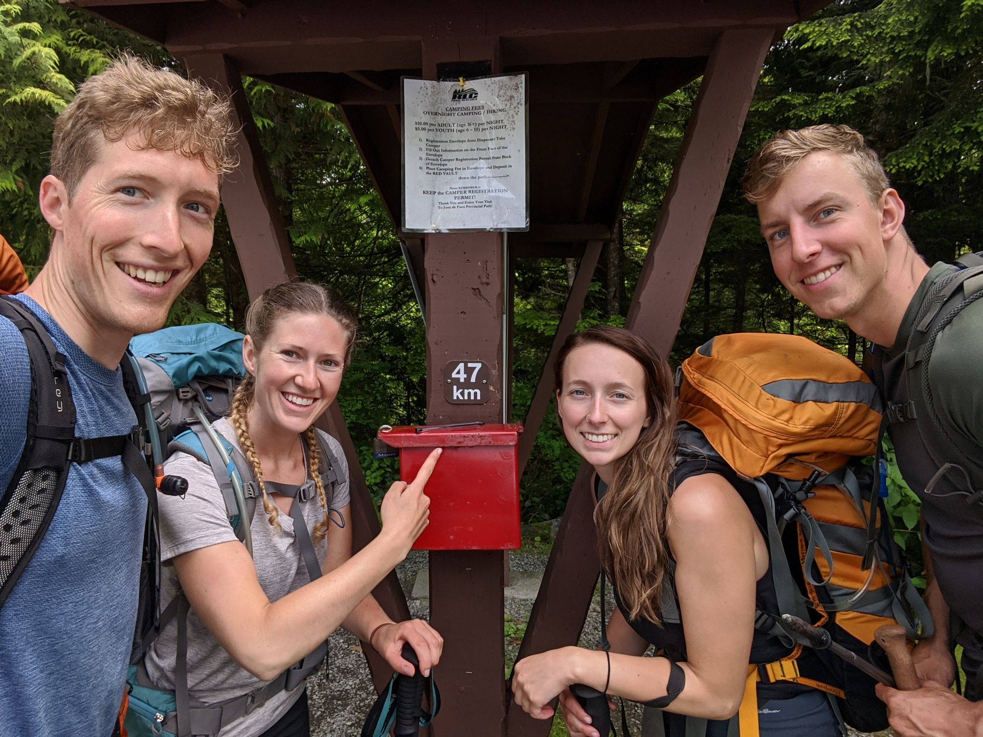
Juan de Fuca Marine Trail
47km of true West Coast wilderness, Juan de Fuca is often described as "West Coast Trail Lite", overshadowed by it's longer brother to the north. But this Island classic has some bite of its own; it may be tougher due to the terrain and lack of easier beach hiking stretches.

Route Outline
| Difficulty | Moderate to Difficult (due to mud) |
|---|---|
| Synopsis | At 47km in length, this point-to-point trail should not be attempted by the faint of heart. This trail takes hikers up, down, and around the headlands of Vancouver Island's southwestern coast from Jordan River to Port Renfrew. With more hiking in the trees than on the beach, this coastal hike might not be quite what you expect. No matter the season, be prepared for an abundance of mud. |
| Getting There |
To start at the east end like we did: from Victoria, follow the Trans-Canada Hwy to Westshore Pkwy in Langford, then follow the BC-14 W to Jordan River, continuing to the Chin Beach Campsite & Trailhead. To start at the west end: same as above but continue on BC-14 W to Port Renfrew, then continue onto Parkinson and then Cerantes Rd, signs for Botanical Beach. |
| Facilities | Outhouses and bear caches at every campsite. |
| Fees | $10 per person, per night. |
| Notes | Pole and gaiters are must-haves for this trail. |
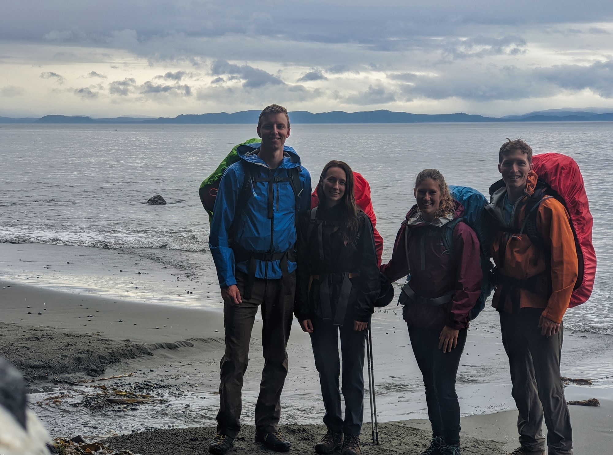
July 11-14 2020
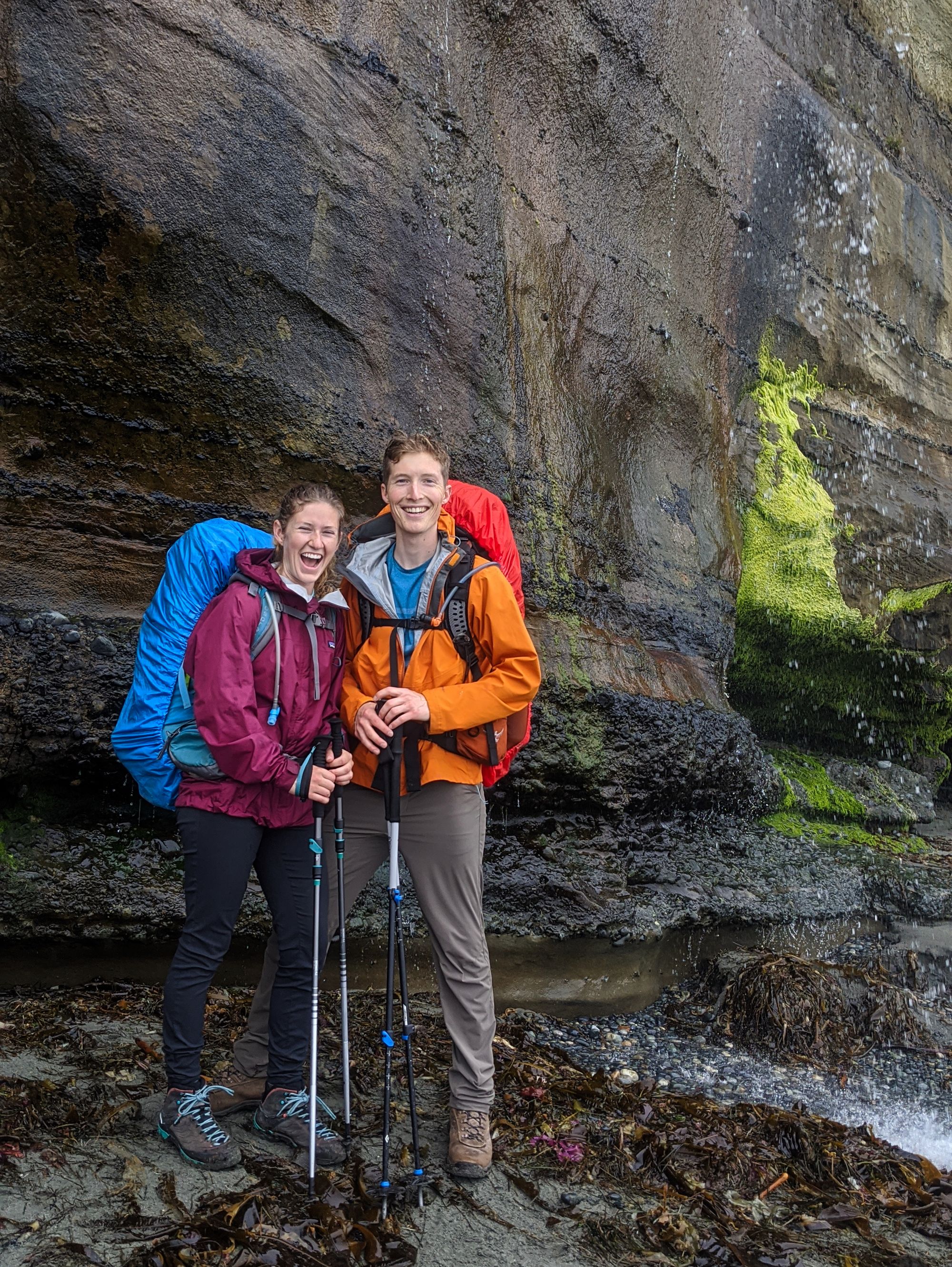
Hikers: Ryan, Katie, Trevor, and Isabelle
Trip Report
Day 1 - China Beach Trailhead to Bear Beach
Distance: 9 km
Time: 4 hr
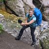
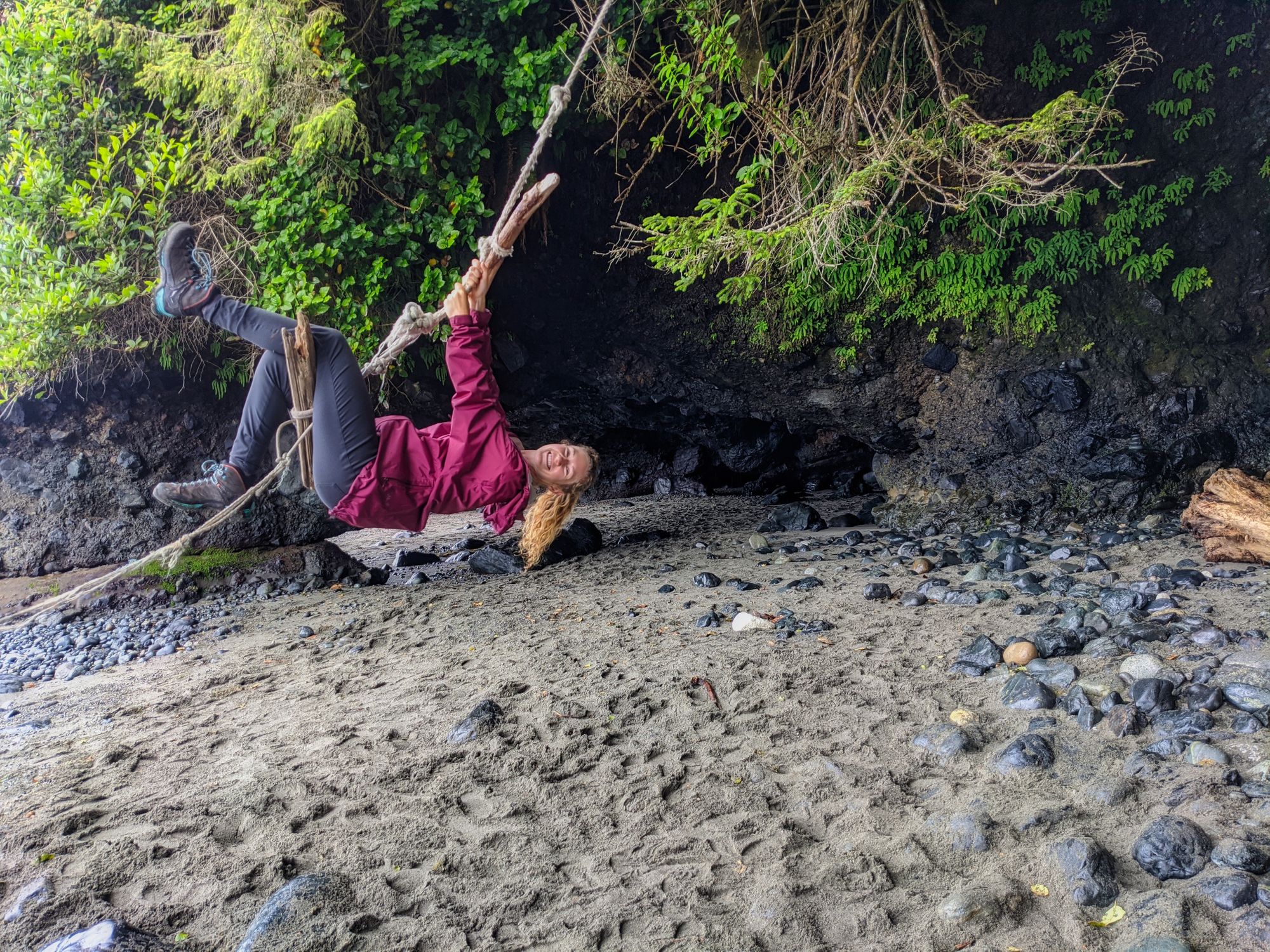
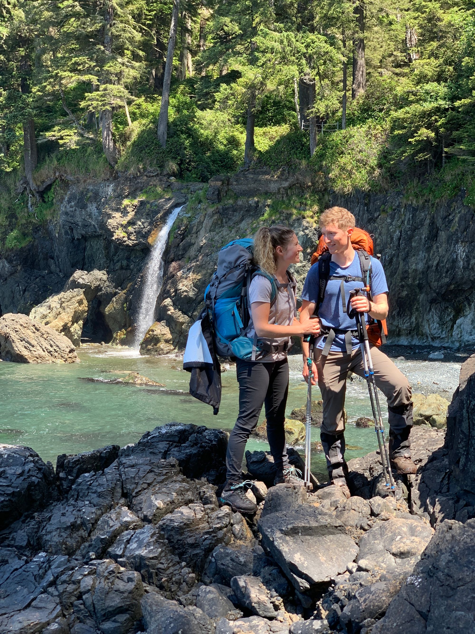
We arrived at the China Beach parking lot around 2:00pm and managed to snag the last parking spot near the trailhead. Shouldering gear quickly amidst the spitting rain, we hit the trail to find the air drying out once we got under tree cover. The first 2km to Mystic Beach was muddy but easy hiking, and we passed many day hikers as we traversed the short boardwalks and wooden stairs. After 45 minutes we arrived at the beach, packed with campers and day hikers enjoying the nearby waterfall and rope swing.
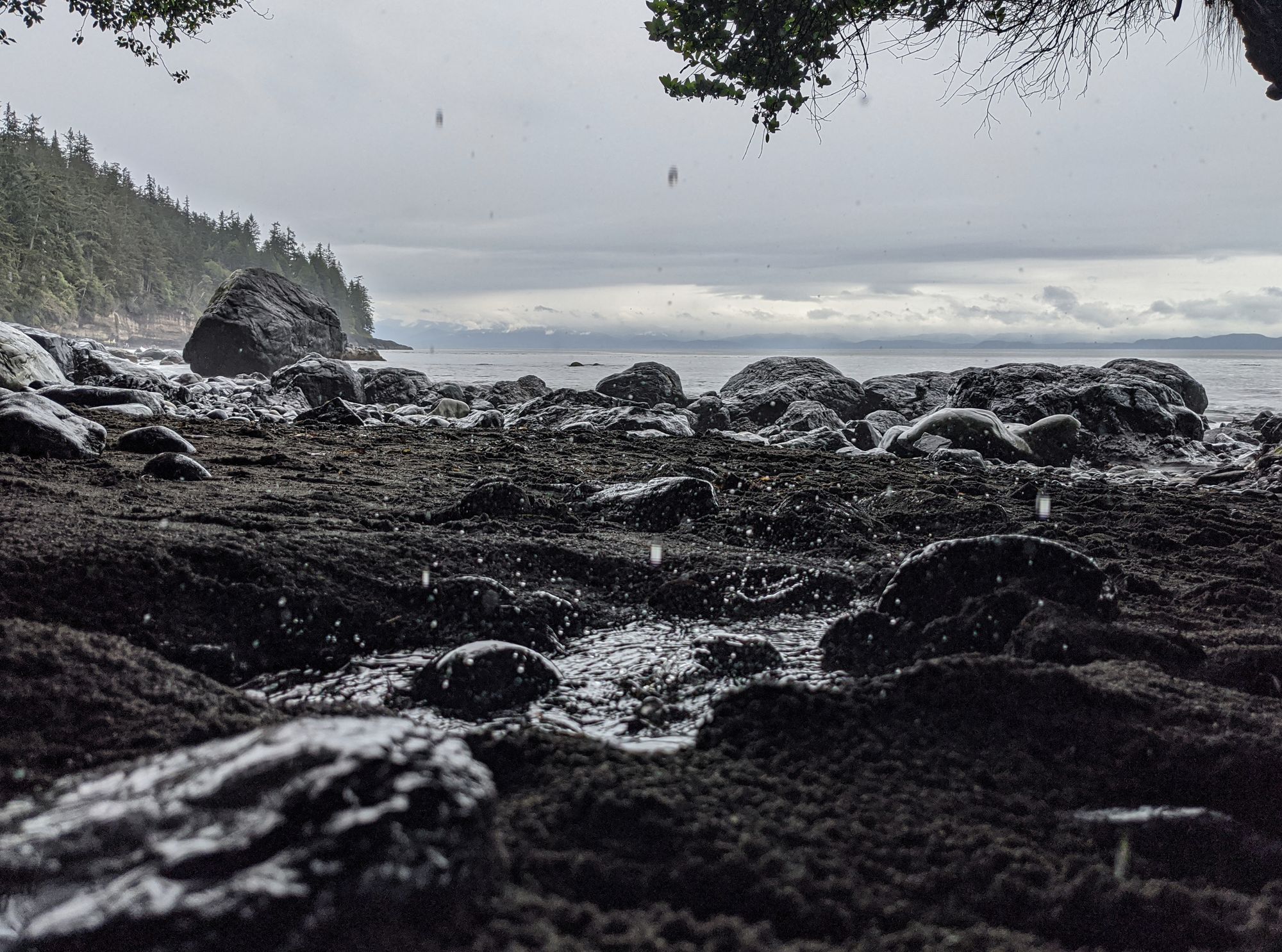
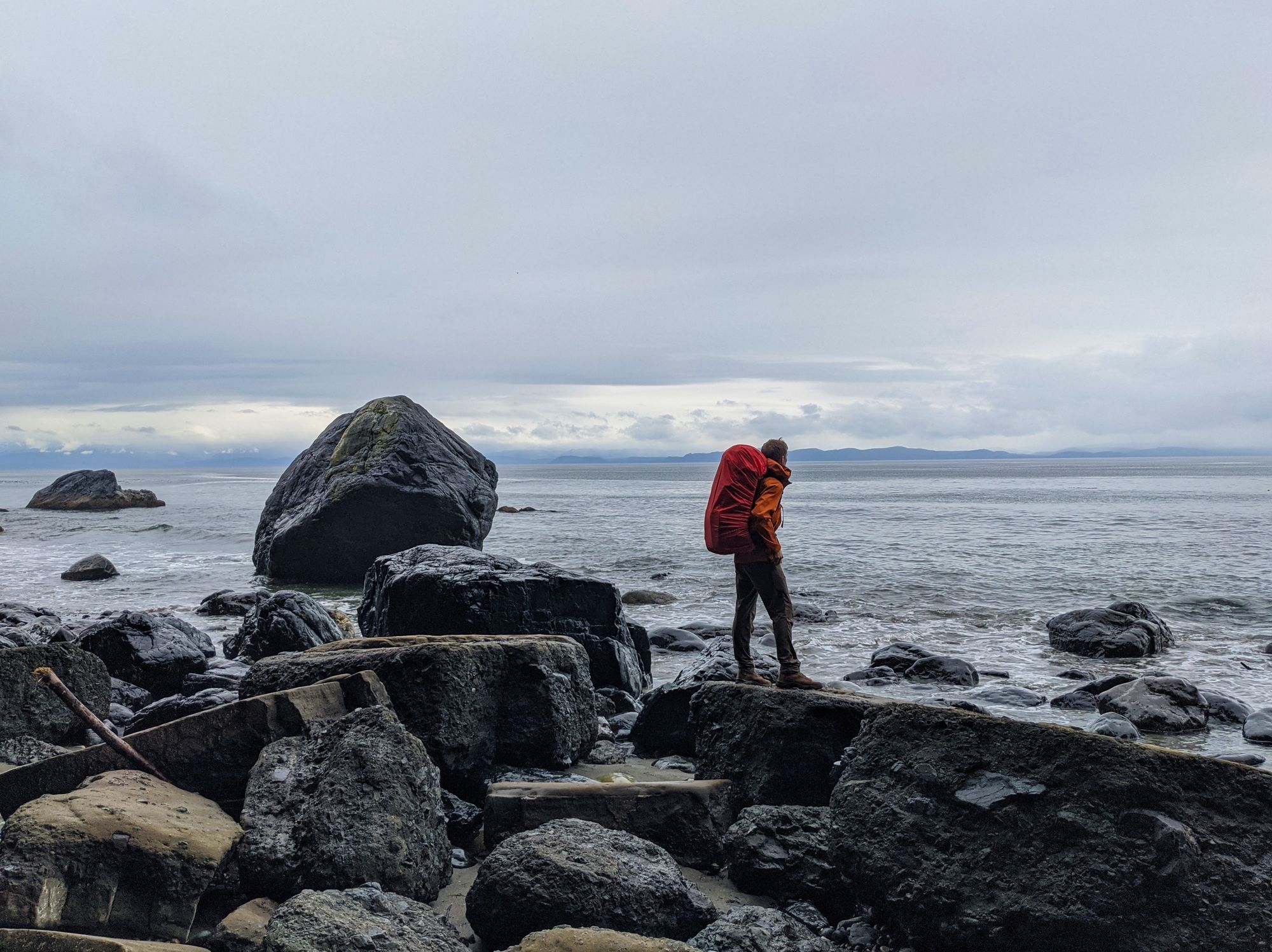
From Mystic Beach the path rolled over headlands and down through river valleys; with a lot of elevation change, the light rain was no longer enough to keep us cool in our jackets. The trail here was much less beaten in than the first two kilometres and, as expected, we saw far fewer hikers. The trail was in good shape and we only had to climb over a few pieces of deadfall. Despite the rain, we kept fairly dry in the trees, except when we had to push through stretches of salal bush near the coast. Small rivers provided picturesque waterfalls and regular water supply along the trail, as well as an abundance of bridges for photo ops. Many little viewpoints opened up as the trail kissed cliff edges, giving us great views of the waterfront and Washington Peninsula.
Many areas of the trail looked like they used to have well-groomed, built up dirt stairs supported by wooden pieces, but the earth has long since been eroded away. In many places, the horizontal wooden pieces stand a foot or so up from the trail. We lost ourselves in the scenery and the trail until the 8km marker post, which was quickly followed by a steep downhill that dropped us down to Bear Beach. Poles were definitely an asset navigating the rain sodden log steps here.
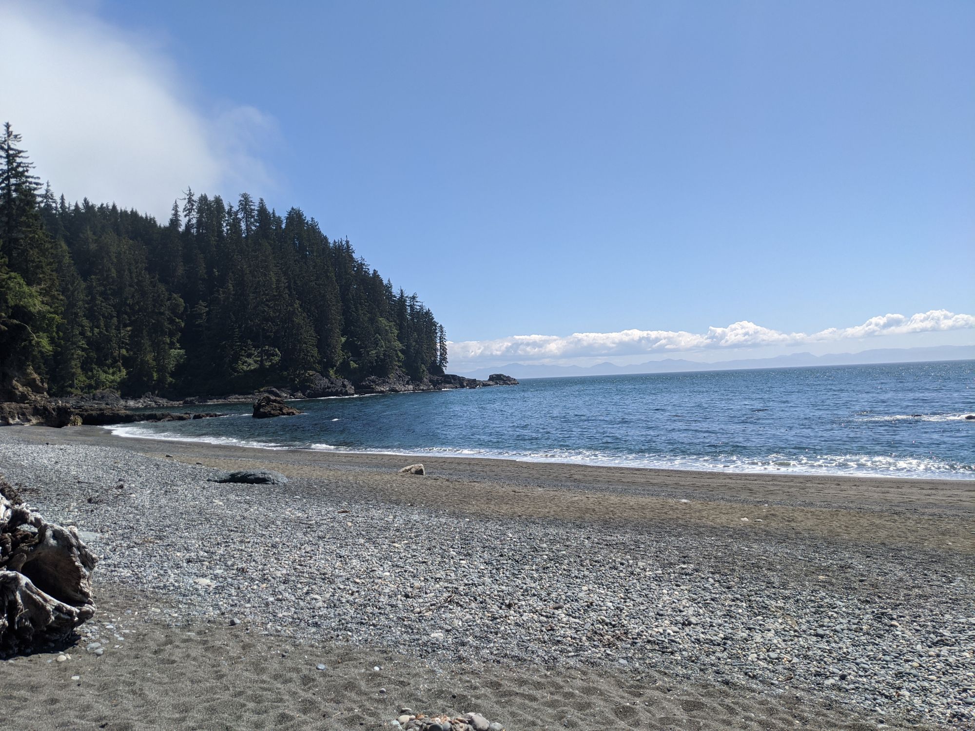
Once on the beach, we quickly saw several campsites followed by the bear cache and outhouse at the east side of Bear Beach. We arrived fairly late in the evening so most of the sites were full; we carried on towards the west end of the beach, where we found lots more campsites, another outhouse, and a bear cache.
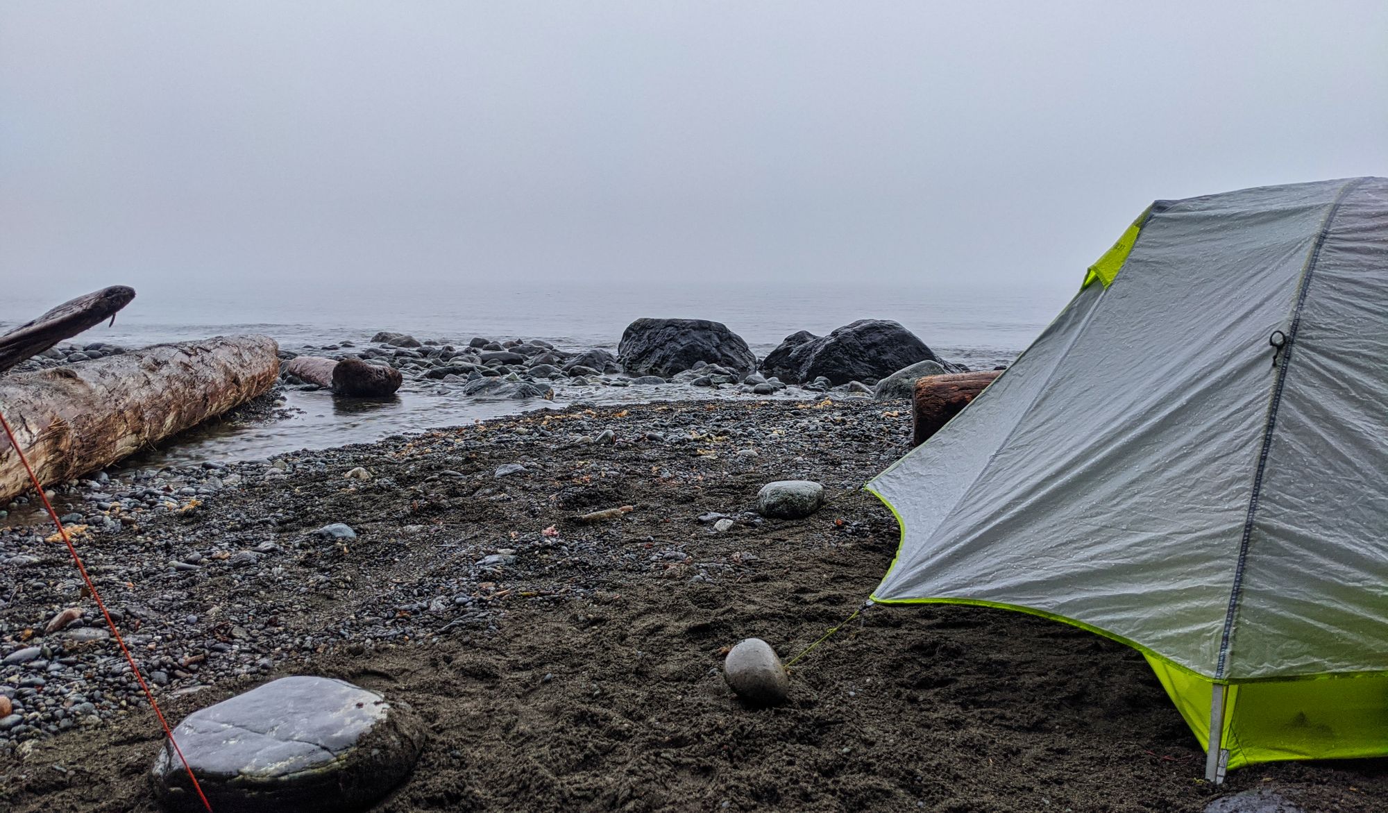
We weren't able to find a spot big enough for our entire group, so the two of us picked a sandy spot next to a small creek while our friends set up their tent under partial tree cover on the opposite side. We set up camp rapidly as the rain picked up, raising a tarp for added shelter. Our late supper warmed us after the long, damp day while we watched the fog roll in, dashing hopes of a sunset. We went to bed shortly after 10:00pm, hoping for an early start the next day.
Day 2 - Bear Beach to Chin Beach
Distance: 12 km
Time: 6.5 hr
We rose at 7:00am in hopes of an early departure, the grey sky hanging low on the beachfront. As we made breakfast we spotted two sea otters hanging out on a rock just out from our tent. While we ate it started to rain, forcing us into the tent for a short while and delaying our start. An hour later we began to have hope of a clearer day as the sun started to burn through the thick clouds. The sky cleared around 9:30am and we hit the trail.
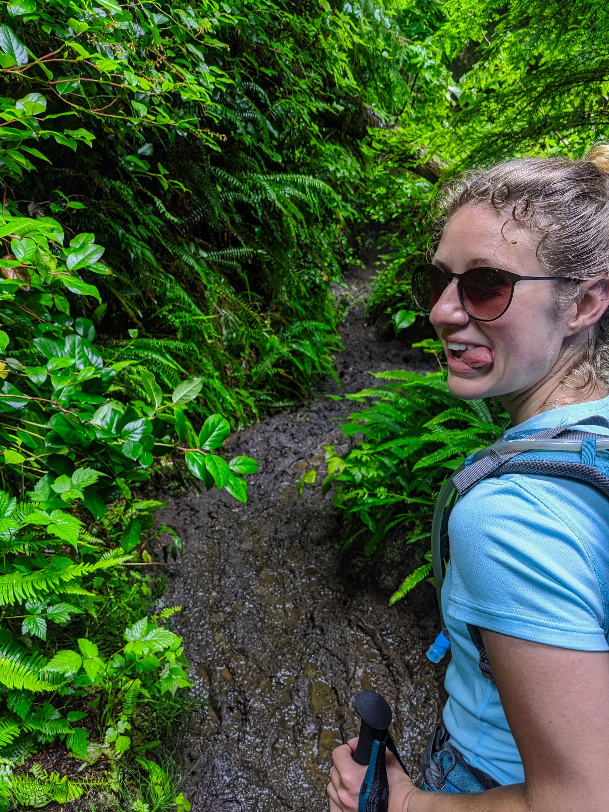
We cruised along the beach as the sun began to shine in earnest. A short stint navigating the rocky beach led us to the next trail opening - we would be off the beach until we got to our next camp at Chin Beach that night. We forged a path upwards away from the beach, and our mudbath began.
Later, we heard that the local park rangers had described the previous week as "one of the wettest they have ever seen in the area." To say that the trail was damp and muddy is an understatement! The trail rose and fell like a roller coaster. We climbed higher onto the headlands, and then descended back down to the slippery, muddy morass. Rinse (off our boots), and repeat.
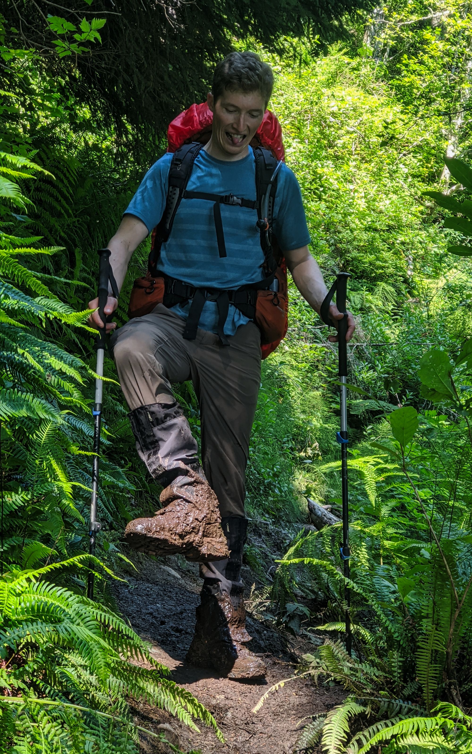
Eventually we stopped for lunch on a knife ridge with good views of the trail ahead of us. Winding up, down, and around the muddy headlands, the trail carried on. As we picked our way down a short, steep, slippery section around 18.5km, Katie discovered the existence of a mud-wasp nest, getting stung on the shin as we passed through. After that, stretches of dry trail led us to believe that the trail was starting to dry up, but we quickly realized that was not the case. The trail continued to tease us, giving us some drier stretches of hope before crashing us back down into the swamp.
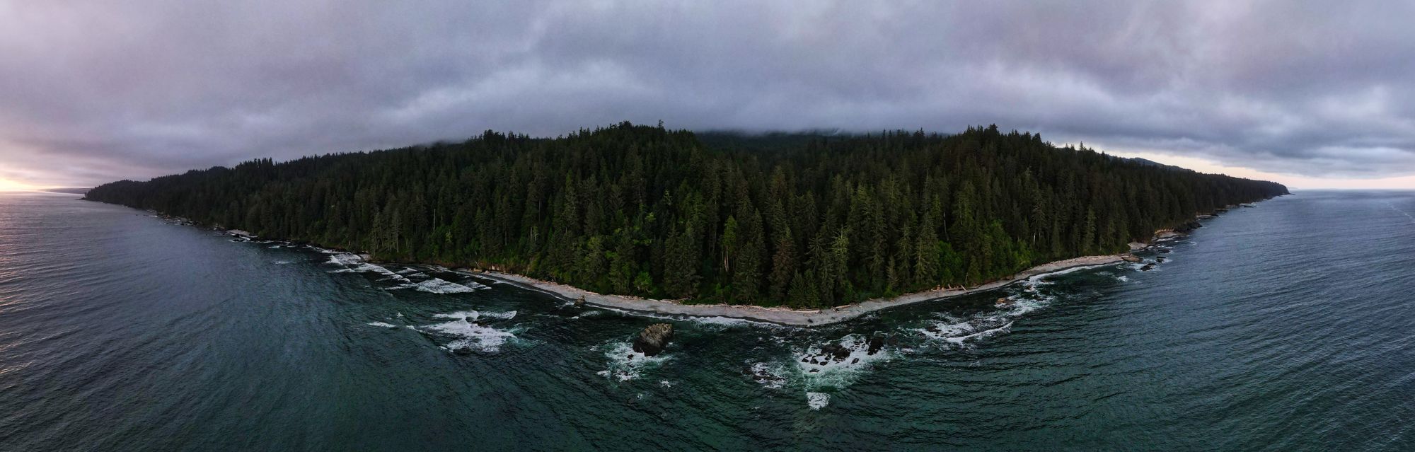
Just before 4:00pm we passed the 20km marker, which meant we had almost reached our destination for the night: Chin Beach. We quickly came upon a welcome site - the trail's emergency shelter, a cozy building with three bunk beds and a sunroom with clothesline, plus an outhouse. From the shelter we descended a short set of new wooden steps to the beach. A few hundred metres of beach walking led us to a nice campsite tucked back into the trees near a creek.
A bright sunny afternoon dried our damp gear, and we refreshed with a quick dip in the (chilly) ocean water. After dinner we spotted a pod of 5 humpback whales right in front of our campsite! The pod came up for air half a dozen times in the same spot, their spray shining in the evening sun. Following that excitement, a nice warm beach fire marked a lovely end to the evening. Sadly a good Pacific sunset still eluded us as the cooling air built up a bank of low cloud across the coastline.
Day 3 - Chin Beach to Little Kuitshe Creek
Distance: 12 km
Time: 8.5 hr
We rose at 7:00am again and had a nice oatmeal breakfast. The grey skies marked another normal morning on the coast, but the sun quickly burned off the thin layers to reveal lovely blue skies just like the day before. A mama and baby seal swam to the shore and greeted us as we sat and sipped our morning coffee. Motivated by the quickly warming sun, we got on the trail just after 9:00am.
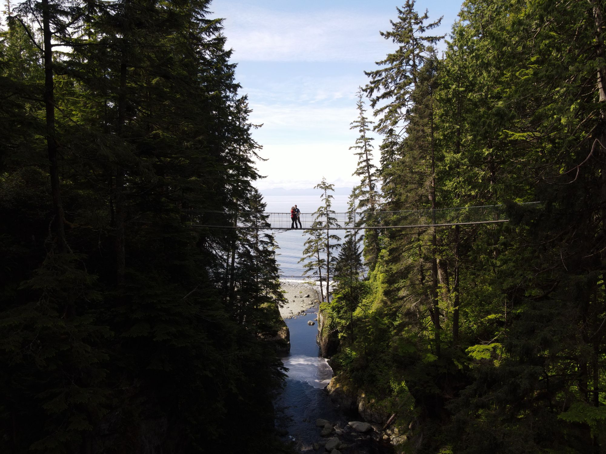
A quick jaunt across the beach led to the trailhead, where the route launched us up a short scramble to the headlands and into the mud once again. Hiking at a slow pace due to an injury in our group, we reached the trail's biggest suspension bridge around km 23 at 10:30am.
The section of trail after the bridge diverted us around an area that was cluttered with newly fallen trees. This path was much softer and more difficult walking than the main trail, with a couple of deadfall trees that we had to clamber under. The mud prevailed as we continued on until the 25km mark, at which point the trail became flat and wide as it began to follow an old logging road. The trail followed the road for approximately a km before ducking off, while the road appeared to track straight and connect out of sight to Hwy 14 on our Gaia GPS.
As the trail narrowed, it brought us onto a neat skinny knife ridge. It wound along the top of ridge then descended abruptly into the salal as we caught a glimpse of the ocean and heard the waves faintly crashing on Sombrio Point below. A gentle slope gave way to steeply swerving switchbacks leading down to the valley floor, where we reached a longer wooden boardwalk in very good condition. Then more mud! Once through a short muddy section we are treated to views of the rocky outcropping of Sombrio Point. We clambered down the rocks and took off our packs for a break in the beautiful sunshine.
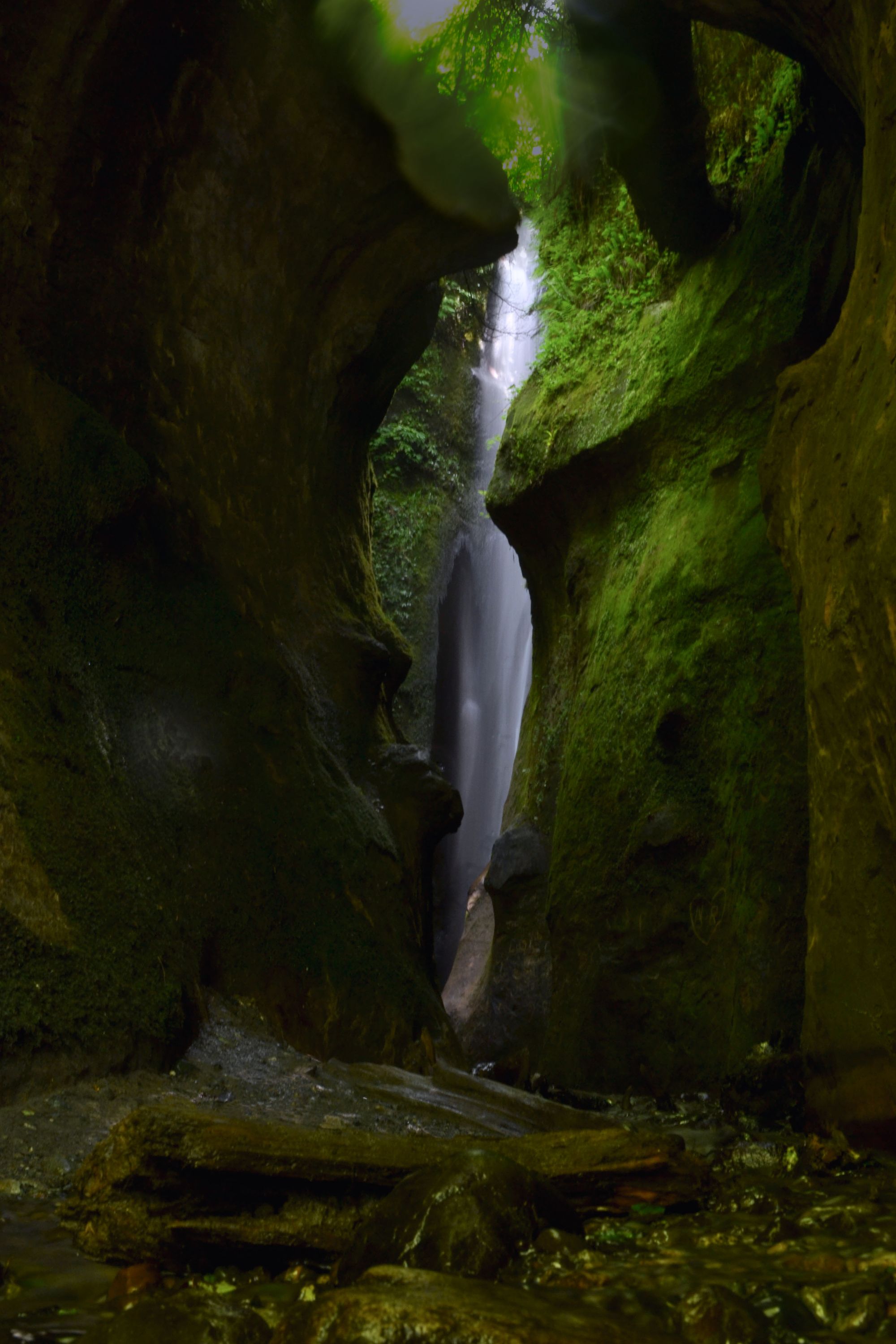
From Sombrio Point to Sombrio Beach was another 1.5km of mud, including a couple of sections where we had to climb up and over gnarled roots. Once on the beach we ate lunch, spent some time flying our drone, and checked out the hidden waterfall.
The next section of trail was on the beach, and we ended up missing the trailhead in the trees as it is not well marked (the orange buoys that used to mark it have been removed). We got as far as Sombrio River and saw the small suspension bridge a couple hundred metres up-river, but there was no way for us to safely cross the river where we were and no trails through the bush to get to the bridge. We turned around and found the proper trail.
A couple minutes along we crossed the small suspension bridge over the river, this one not nearly as cool as the first we crossed, as it was much closer to the water. 20 minutes later the trail took us right back onto the "beach," the unrelenting sun beating down and reflecting off the water. We walked over boulders varying in size from toaster to armchair for a few minutes before getting back into the woodsy trail. This beach exit was well-marked by a couple of orange buoys and took us up a short, steep scramble. Even in the shade of the forested sections, we could still feel the heat of the sun.
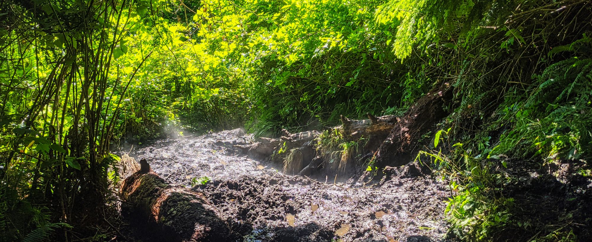
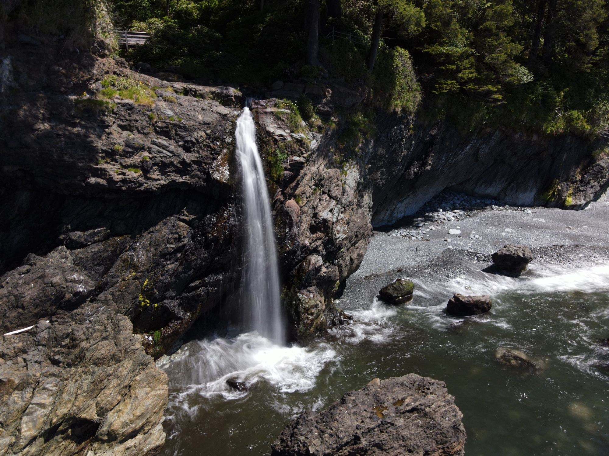
The trail looped us over a headland then dropped us down to a small creek that had buoys marking its location along the beach. The trail on the far side of the creek looked muddy, steep, and in ill-repair, so we opted to walk this section on the beach. We found the next piece of trail marked by another orange buoy, the 30km marker just off the beach. Less than 100m into this "trail" we opted to turn around and go back on the beach. The trail was a super slick, thick mud, and a treacherous looking climb made us think twice. The beach showed off a neat little waterfall and a smooth sandstone plateau to walk on once we got past some medium-sized rocks. A 100m stretch of pebbled beach gave way to smooth sandstone and flat(ish) composite rock, making for speedy walking. We got to a couple more buoys and, thinking this beach exit was mandatory, headed back into the muddy trail.
Unrelenting mud and muck plagued the next kilometres of our journey past the small suspension bridge over Minute Creek and all the way to Little Kuitshe Campground. After an almost unbearably long day, we reached the busy campsite just before 5:30pm.
We managed to find two mostly-dry spots to pitch our tents, and on tired feet we walked down the short steep trail to the water. With no real beach, the Little Kuitshe Campground was very different than the last two. We collected water for dinner at the outflow of a small creek and made a little fire to dry out our gear before going to bed early.
Day 4 - Little Kuitshe Creek to Botanical Beach
Distance: 14 km
Time: 7 hr
We rose a bit earlier than usual in anticipation of a longer day. We shook out our damp gear, packed up, and hit the trail by 8:30am. Immediately back into the mud, we found the trail was gentler and less washed out than the stretches between Sombrio and Kuitshe. A nice viewpoint one kilometre west of the campsite provided a dry spot to drop layers and do a few gear adjustments before the trail carried on into the salal. The swampy trail continued through the morning, but a shallower grade kept our speed and spirits high.
Right around the 35km mark were two natural tarns suitable for tenting, though there was no water access nearby.
Two kilometres later we reached the mosquito-infested Parkinson Creek parking lot, and the trail leveled out even more. We made good time and before we knew it we were passing through the last campsite: Payzant Creek at km 40. With an increasing number of boardwalks in this more-traveled section of the trail, our pace crept up and we were able to make it down to Providence Cove for a lunch stop before noon.
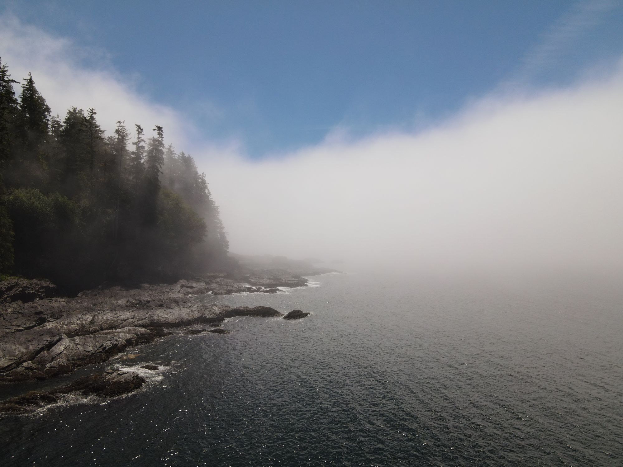
The cove provided a lovely and eerie view, as fog had filled the mouth of the cove and was slowly wafting into the trees. The hot summer sun burned it off as it moved inland, but the fog bank held steady just off the coast.
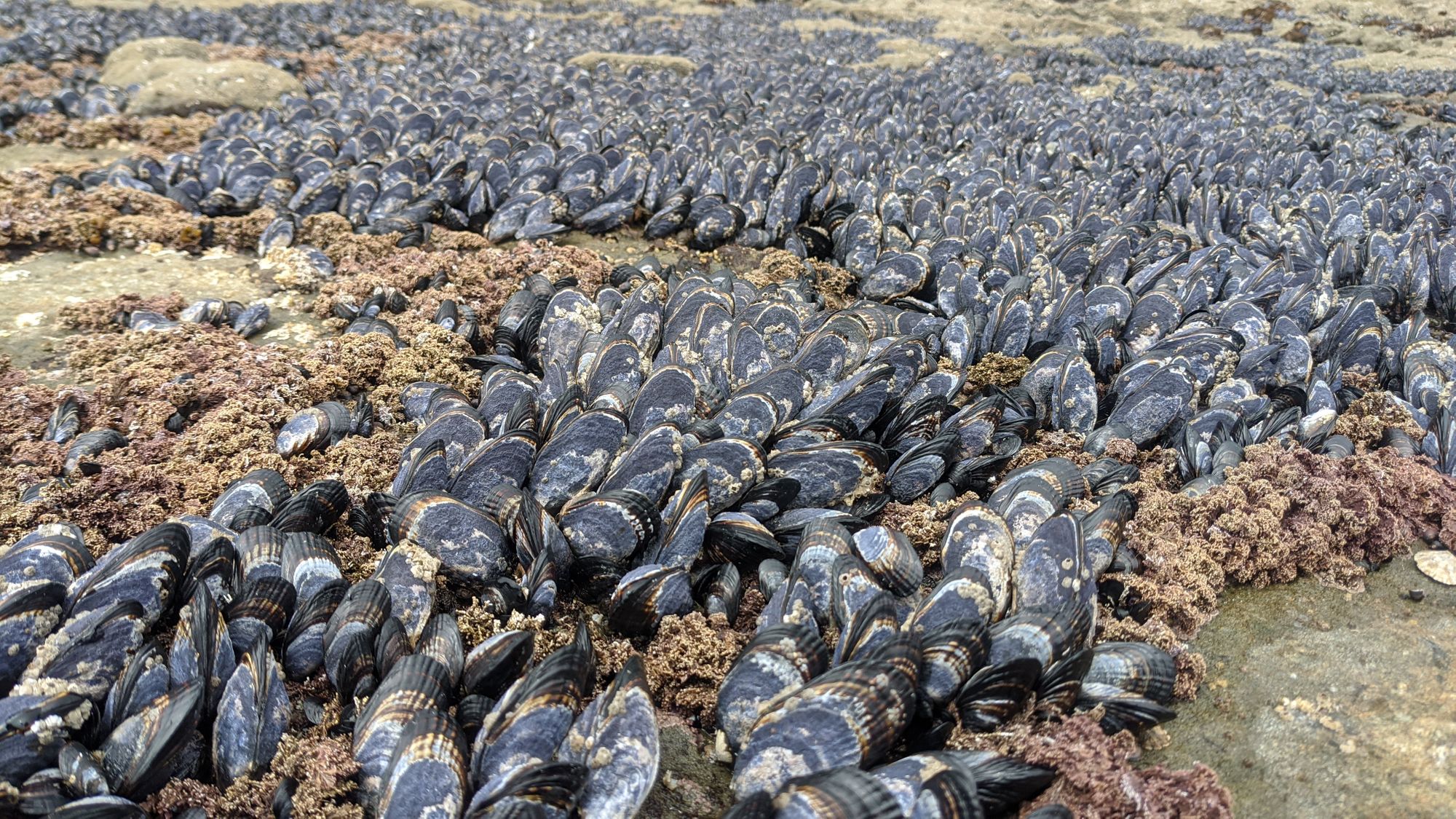
After lunch we spent another hour walking the trail before taking a short break at the 44km marker with a nice view of the ocean beyond the jagged rocks below us. 15 more minutes down the trail, we ventured down onto the sandstone beach to try making it the rest of the way to Botanical Beach. However, we got a little ways along and found an impasse at a deep and too-wide-to-jump-across inlet. It might have been passable at a lower tide, but we're not sure. The detour was not wasted, as we saw lots of barnacles, mussels, and one small coral organism in a tide pool.
As soon as we were back on the trail, we lost it momentarily as it went over a log jam crossing Tom Baird Creek. There were a couple more large log jams blocking the trail that we had to climb over before returning to the flat terrain with boardwalks.
We finally reached the eastern end of Botanical Beach just before 3:00pm. We opted to add an extra kilometre to our trek by taking the Botanical Beach Loop rather than walking the gravel road straight back to the parking lot.
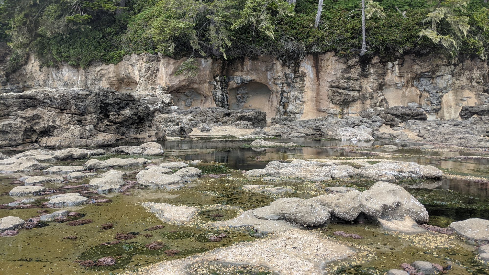
Katie's earlier temptation to swim was quickly dampened by the cool fog blowing in from the ocean, which gave the beach some eerie vibes as we poked around the tide pools. When the hard sandstone of the beach was replaced by course sand we hopped back onto the slightly inland developed trail to complete our loop around the beach, finally reaching our car after what felt like the longest kilometre in the world.
On our way home, we stopped at Stoked Wood Fired Pizzeria and enjoyed the best food we had had in days!