The Golden Hinde
Vancouver Island's tallest peak, standing at 2195m, had eluded Ryan twice before. At 55+ km return, the summit access trail is a challenge in itself. Read on to see how we fared!
Route Outline
| Difficulty | Hard. | ||||
|---|---|---|---|---|---|
| Synopsis |
At 55+ km return and with nearly 4000m in total elevation gain, the Golden Hinde trail is not for the faint of heart. We took 6 days to complete this trail, though there are some hikers who do it in 3, and ultra-marathon runners will do it in less than 24h. The trail begins by ascending and then traversing Phillips Ridge. From there, it descends into the valley which holds Carter and Schjelderup Lakes. From Schjelderup, the trail ascends and traverses Burman Ridge, all the way to the south bowl of the Hinde's lower slopes. Other common access routes exist from the Elk River Valley and from Marble Meadows (by boat). From the bowl, there are a number of routes which provide hikers access to the summit. These should be researched and a planned route chosen beforehand. We climbed the slope of the bowl, following the "SE gulley route" as described in Island Alpine (P.Stone). |
||||
| Getting There |
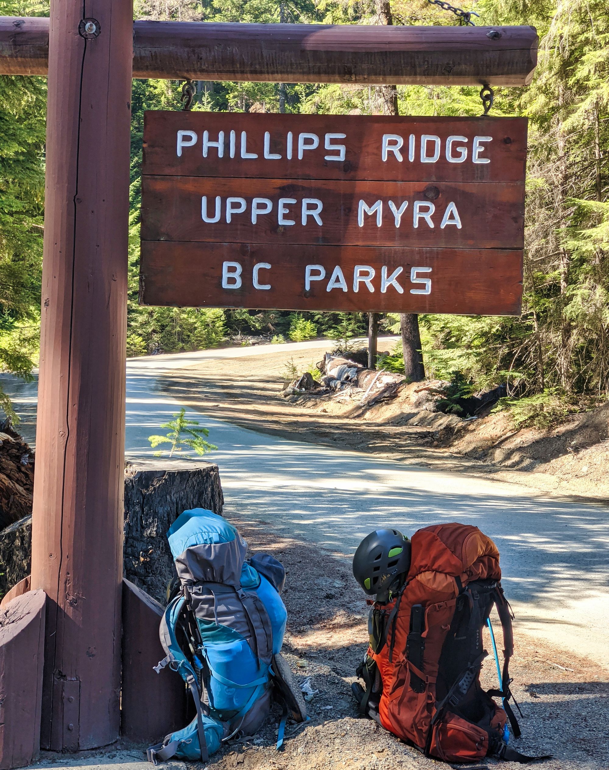
From Campbell River, follow Highway 28 towards Gold River for approx 47km. Continue straight onto Westmin Rd and follow for another 38km until you reach the mine. Drive straight through the mine (obeying all signs) to the small, signed BC Parks parking lot. You will find the Phillips Ridge trailhead on your right just past the yellow gate. |
||||
| Facilities | Outhouse at the parking lot, pit toilet at Arnica Lake. Apparently there is cell service at the summit, but we couldnt connect. |
||||
| Fees | None. | ||||
September 6-11, 2020
Author's Note:
This trip would be my third attempt to summit the Hinde. My first attempt, over 5 years ago, was one of the first times I had headed into the backcountry without a more experienced hiker leading - I was alone with my brother and we had no safety net. Ultimately, we underestimated the mountain and didn't leave ourselves the time to complete the hike, turning away unsuccessfully partway up the northwest ridge route of the Hinde.
The second time, I was turned around by weather. Rain, high winds, and the threat of snow had our team bugging out of the backcountry, opting to leave before we got stuck somewhere. This third trip though, we were well-prepared, we had the weather on our side, and I was determined. It's hard not to let that determination take over, to push beyond safe limits in order to climb past your abilities. "Its so close" or "we're almost there" can quickly push a group into the danger zone. Limits need to be challenged in order to grow and improve, but to a safe degree so that you aren't riding out in a helicopter!
As still a fairly amateur mountaineer, I stepped onto the trail that summit day recognizing that it would be a big day for me. Whether we succeeded or failed in our attempt, I knew I would learn a lot - about managing myself and a group in an alpine scenario, and making the necessary safety call when the time was right. As she is a very new mountaineer, I knew that I had to be mindful of Katie's limits - assessing what boundaries could be pushed without compromising either of our safety. And if at any point the scrambling, the sheer faces, or just the altitude became too much for her, we would have to call it for safety's sake.
And learn we did. Mistakes were made, recognized, and overcome one step at a time. This could be our first Alpine Club Island Qualifier, read about it below!
Trip Report
Day 1: Trailhead to Arnica Lake, 7.5 km
Living in Victoria, just getting to the trailhead is a chore. We left early in the morning, only making a quick stop for gas and a drive-thru coffee in Duncan until we reached Campbell River. There, we had a wonderful last non-dehydrated meal at Duke's Dockside Grill prior to continuing our drive into Strathcona Park.
We rolled into the parking area at Myra Falls Mine to find it busier than we have ever seen before - cars were stuffed in the parking areas on both sides of the road and wherever people could find enough room to get off the main road and out of the way of mining machinery. After sorting out gear and getting some trail reports from a few people that had just gotten down from Phillips Ridge, we stepped off at 2:50pm.
Although this is our first time writing about Phillips Ridge, we'd hiked here many times before. Familiar footsteps fell into place as the trail quickly bore us up and away from the hustle and bustle of the mine. The trees quickly muted the noisy machinery; overcome by wind humming in the treetops and small creeks bubbling through the woods.
We ascended swiftly up the slopes, the trees protecting us from the hot afternoon sun. We soon reached the first creek "viewpoint;" but although we couldn't see the water, we could definitely hear it! We took note that the summer would be fairly dry at this point, and we would have to be extra careful planning our water resupplies.
A few turns later, we found the creek again at a point marked with a wooden sign. The sign was dated 1985 by the Comox District Mountaineering Club. The club has the old wooden signs placed all across Strathcona Park, the weathered signage lending a nice ambiance to the trail. Although this sign was standing a year ago when we were here last, dead fall had knocked over the tree it was mounted on, and the sign now lay on the ground in front of the creek.
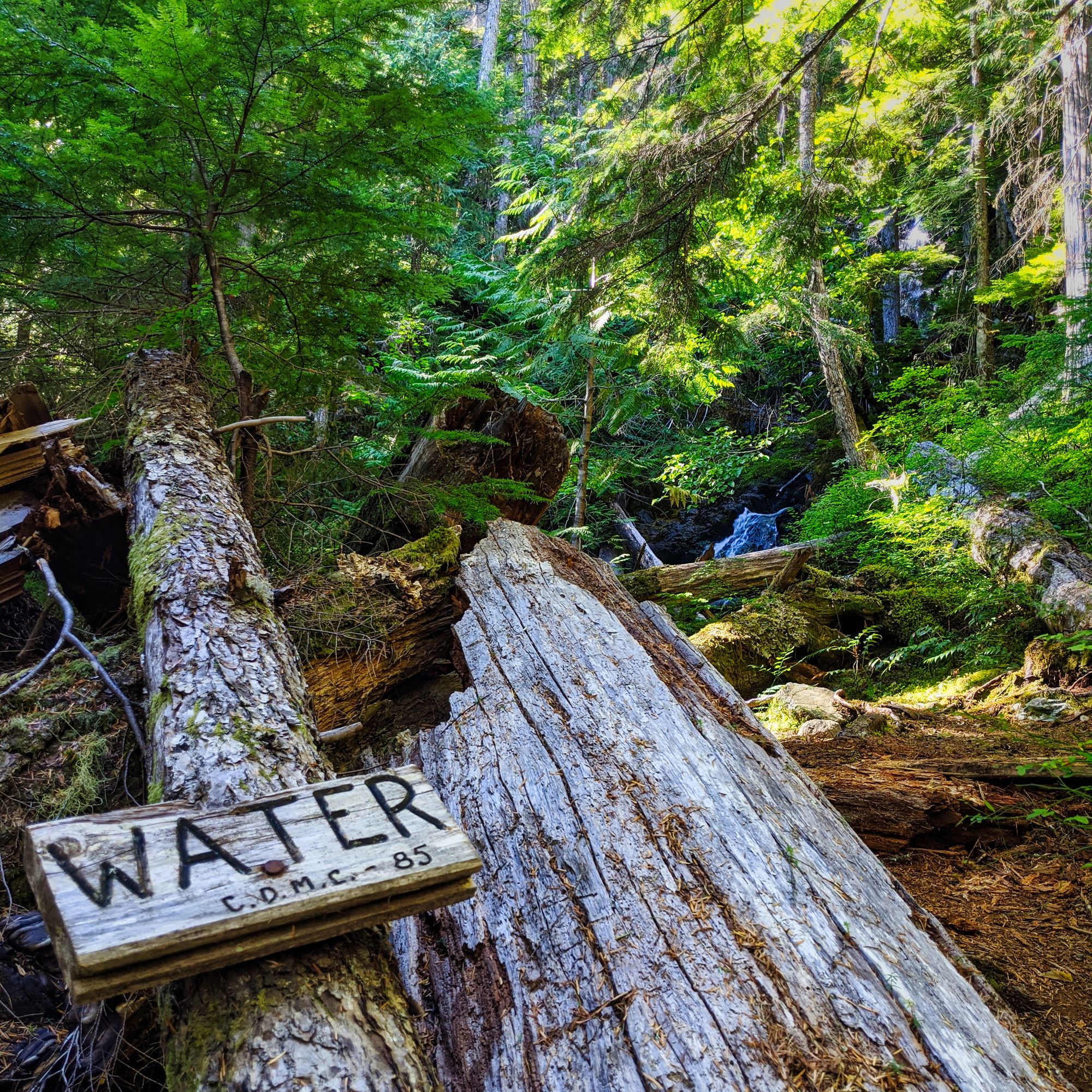

A half hour later we passed the second water access point. Slightly off the trail, it is well-marked by another wooden sign nailed to a tree. The switchbacks began to blend into one another as we wove our way through the trees. The next hour passed quickly as we climbed. Familiar sights, such as a small rock slide bisected by the well booted trail drew us back to reality, but we soon returned to the grind. We took a break at the third water sign, sitting at 970 meters. The air was beginning to cool as the sun sank lower into the trees in the early evening, which was nice as the wind earlier had died as the sun sank through the afternoon.
The trail eventually leveled out and we broke into the meadows just before Arnica Lake. As we picked our way through the more level ground we noticed blueberries - nice and ripe - growing happily on both sides of the trail. Harvesting a few, we carried on towards the lake. We soon met up with the creek that flows down from Arnica Lake. A short water access trail and small waterfall gave us a nice welcome to this gorgeous sub-alpine meadow.
At the lake we were blown away by the gorgeous view, despite having been here many times before. After a quick stop for a picture next to the lake, we crossed the rocky bridge at the outflow of the lake. There is also a metal bridge a few steps further down the creek that was installed within the last few years, but it has a very slippery bank on the far side and just isn't as nice to cross over.
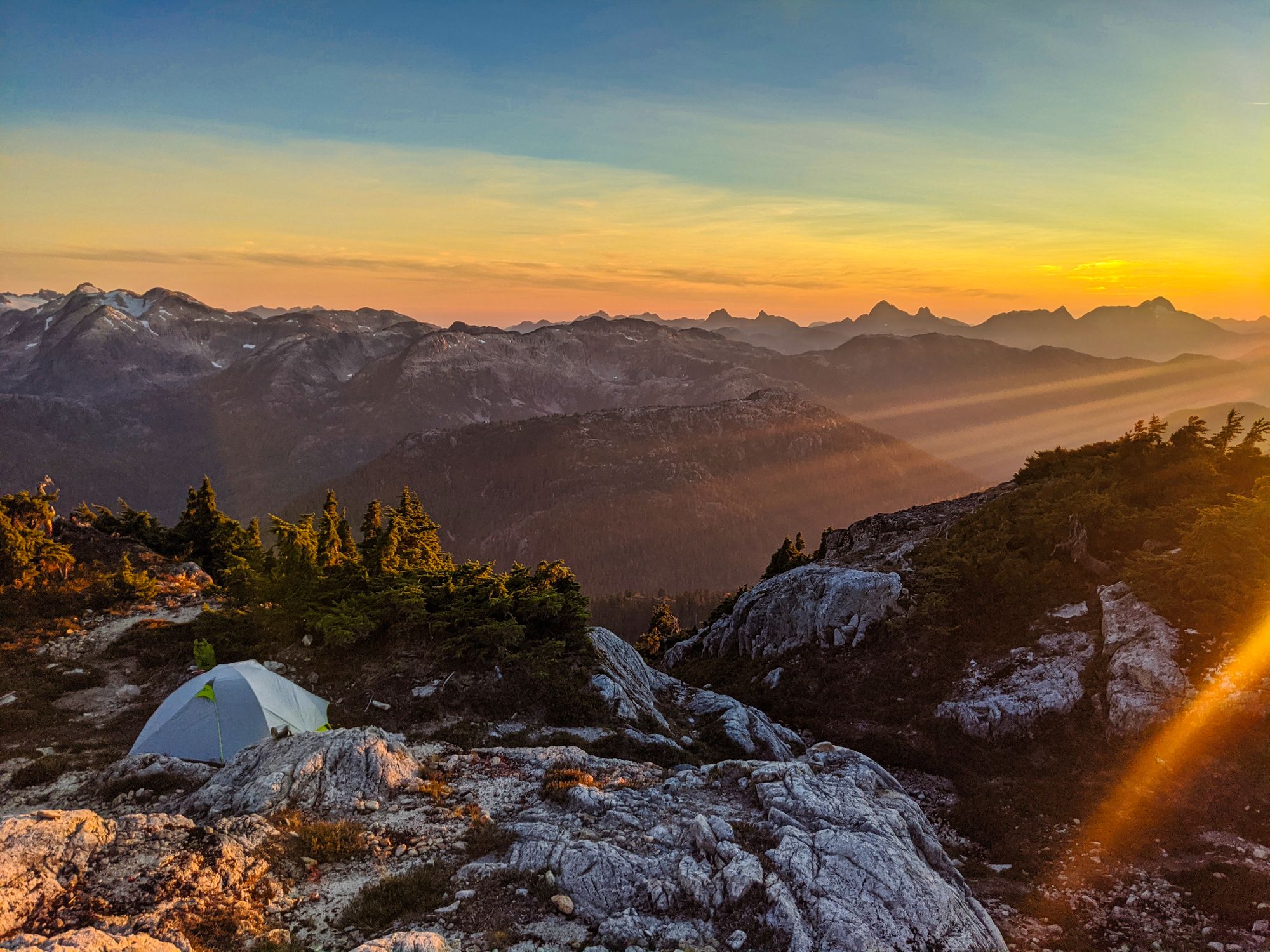
We circled the lake and packed down to get some water. After we spent the time to purify our water for the next day, we looked at the time and decided that we had gone far enough for the day. Unloading our packs and setting up camp, we ate one of the most disappointing freeze dried dinners that we've had to date. Avoid the AlpineAire "Southwestern Style Masa with Beef" unless you really like spiced cornmeal!
After dinner we went back down to the lake and enjoyed the golden hour views. The distant peaks were lit up in rose gold, and the calm lake reflected the mountains, trees and sky back to us. We were amazed to have the camp area at Arnica all to ourselves. We sat down with a cup of tea and let the evening pass.
Day 2: Arnica Lake to Schjelderup Lake, 21.4 km
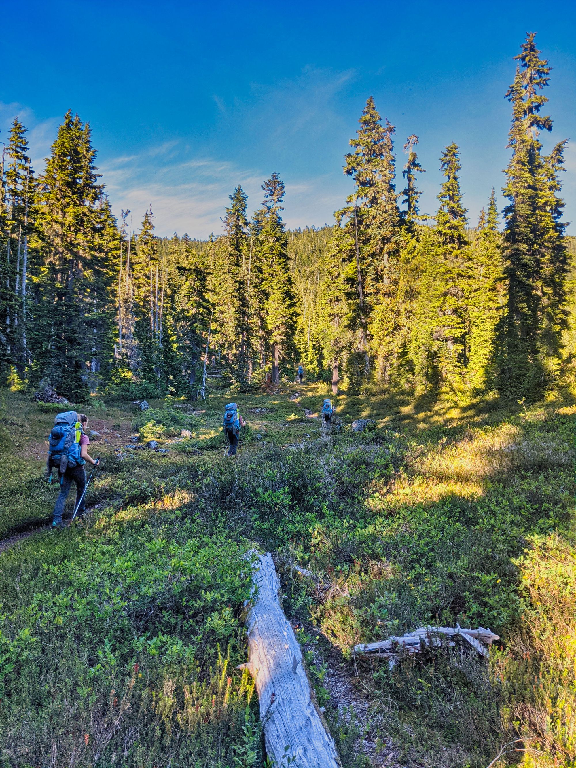
We rose early in anticipation of a long day ahead. We packed the tent by moonlight, cooked breakfast and watched the sun come up behind Mt Septimus. Hitting the trail just before 7:30am, we were still shaded by the bowl around us. We hiked up towards the ridgeline in the cool of the morning, not being hit by the sun until we gained the alpine on Phillips Ridge. It was a beautiful morning, with clear blue skies and the moon still bright overhead despite the sun. Mount Myra and Septimus were clearly visible to the southeast.
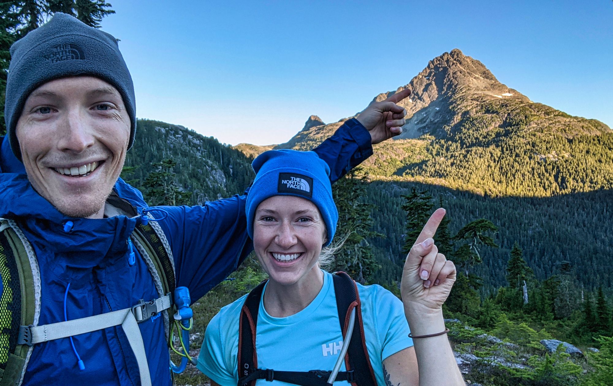
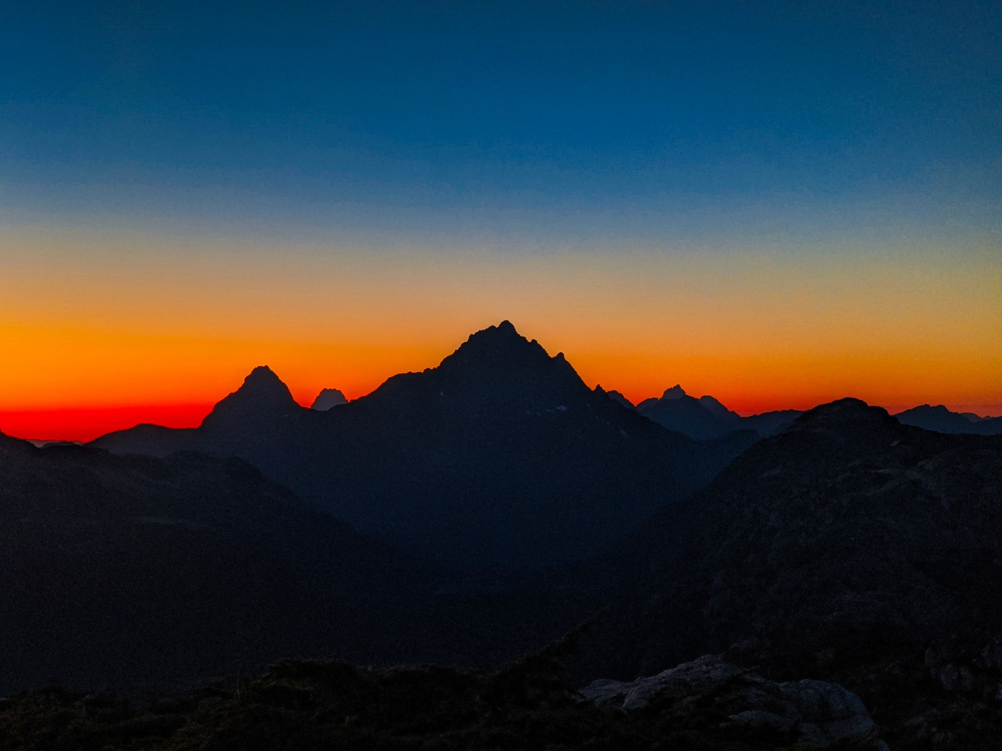
The trail, which had wound tightly through the forest on the lower slopes of the ridge, straightened out as the trees became sparse amidst the higher rocky terrain. About an hour into the morning's trek, we caught our first glimpse of our destination, the Golden Hinde. Mt McBride and Marble Peak were also visible scraping the sky to the north.
The wind howled over the ridgeline, keeping us cool as we hiked. We were amazed to see so many tarns full of water across the ridgeline. It now made sense why there were so few hikers at Arnica, with plentiful water available in the higher alpine.
We took a short stop at a high point on Phillips Ridge, just before we were to reach the first steep ascent of the day. After a quick snack and a look around at the view, we were chilled by the wind and decided to carry on.
Moving on, the ground became more and more rocky. The ridge, which had been climbing relatively smoothly in the morning, now began to climb and fall rapidly as we plodded on. We followed the trail as it hooked north around the high point, then climbed its flank, and a knife ridge connected us on to the next section of Phillips Ridge. The terrain got a lot looser, and we found ourselves picking our way carefully through fields of small rocks.
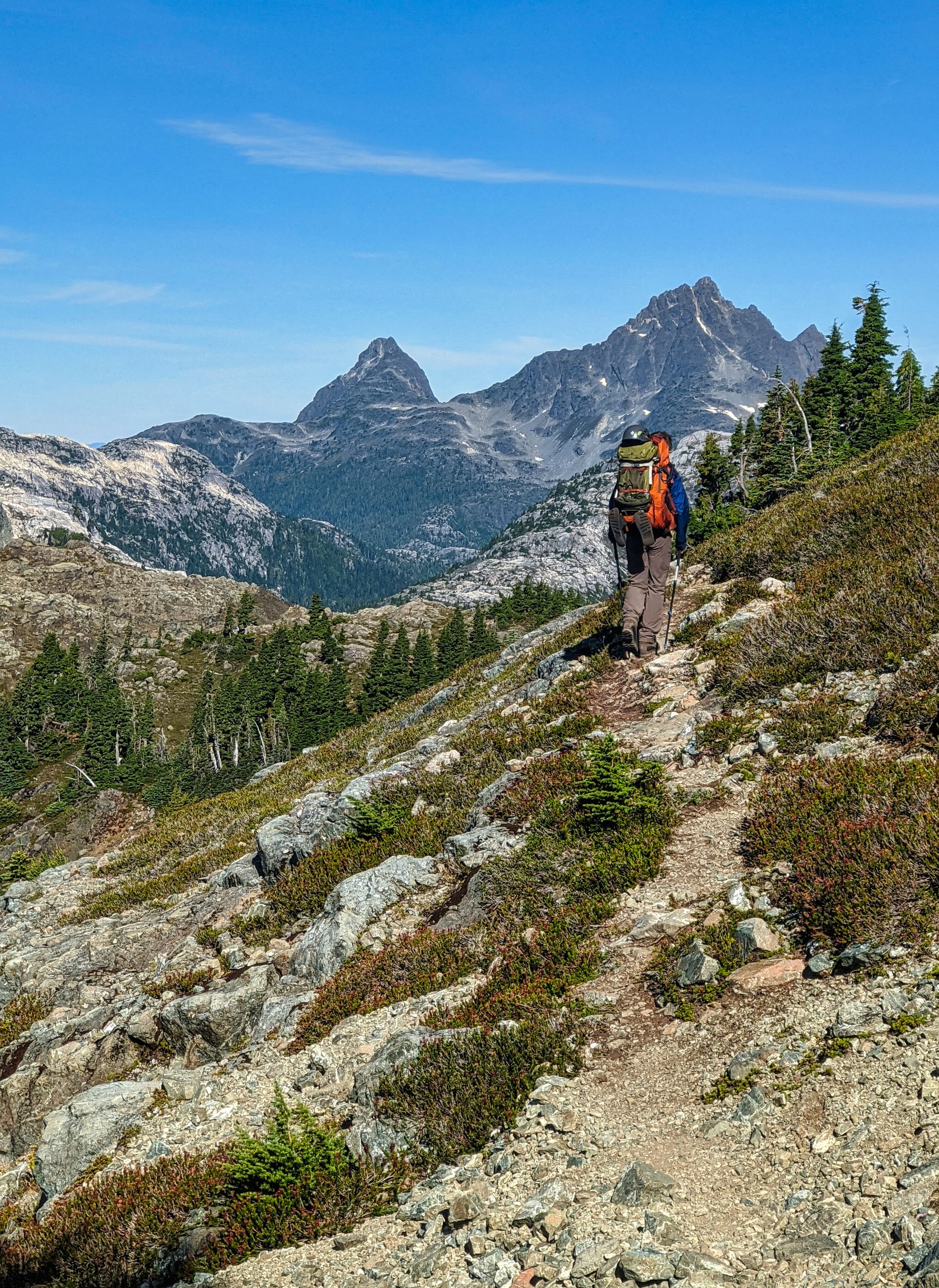
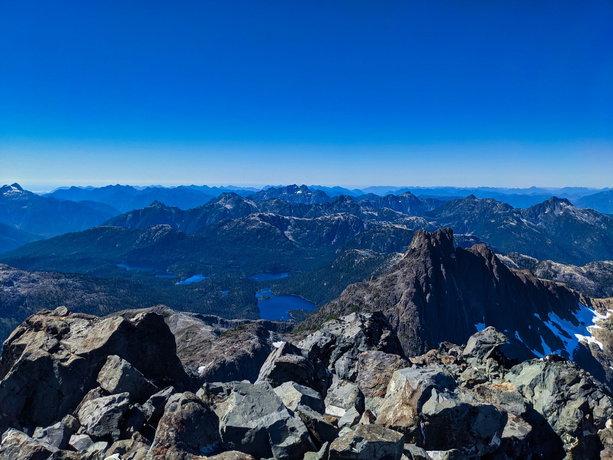
Eventually the rocks cleared and we continued our ascent towards the high point on Phillips Ridge, where the ridgeline turns north towards the Hinde. Climbing to 1730m, this was the highest we would get today, a measly 470m below the summit of the Hinde.
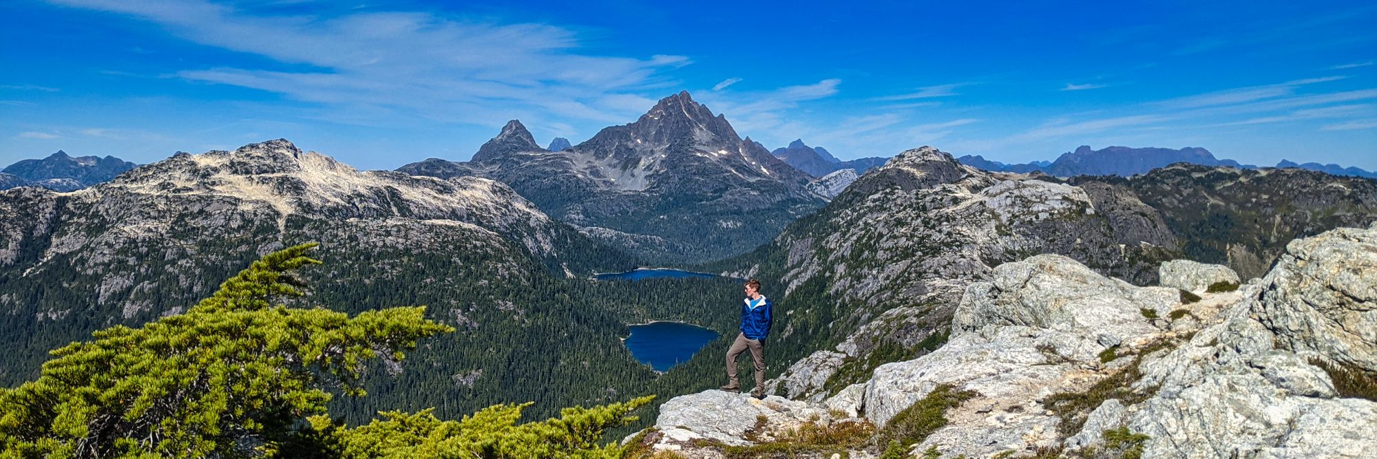
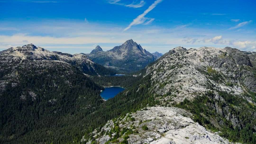
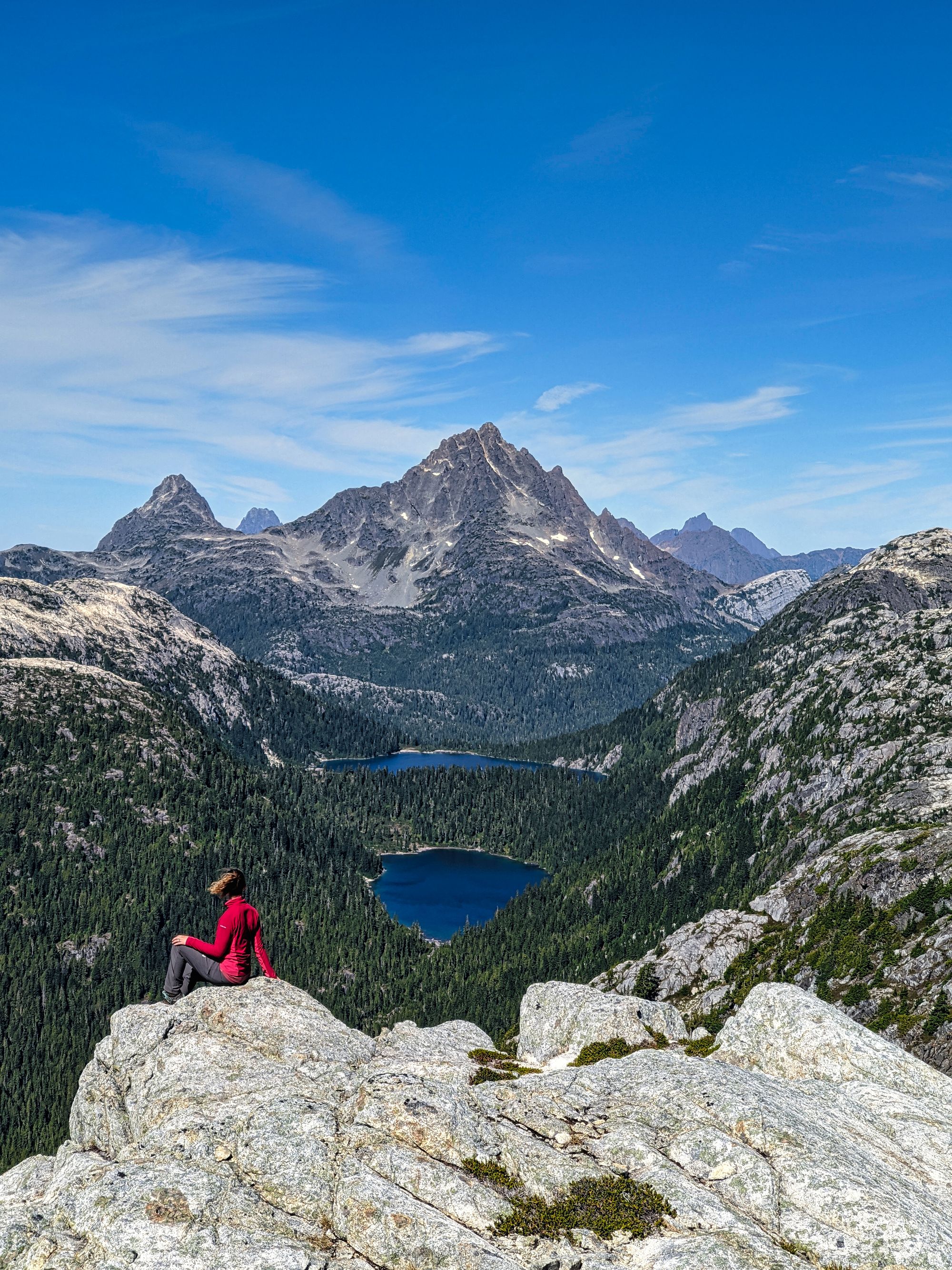
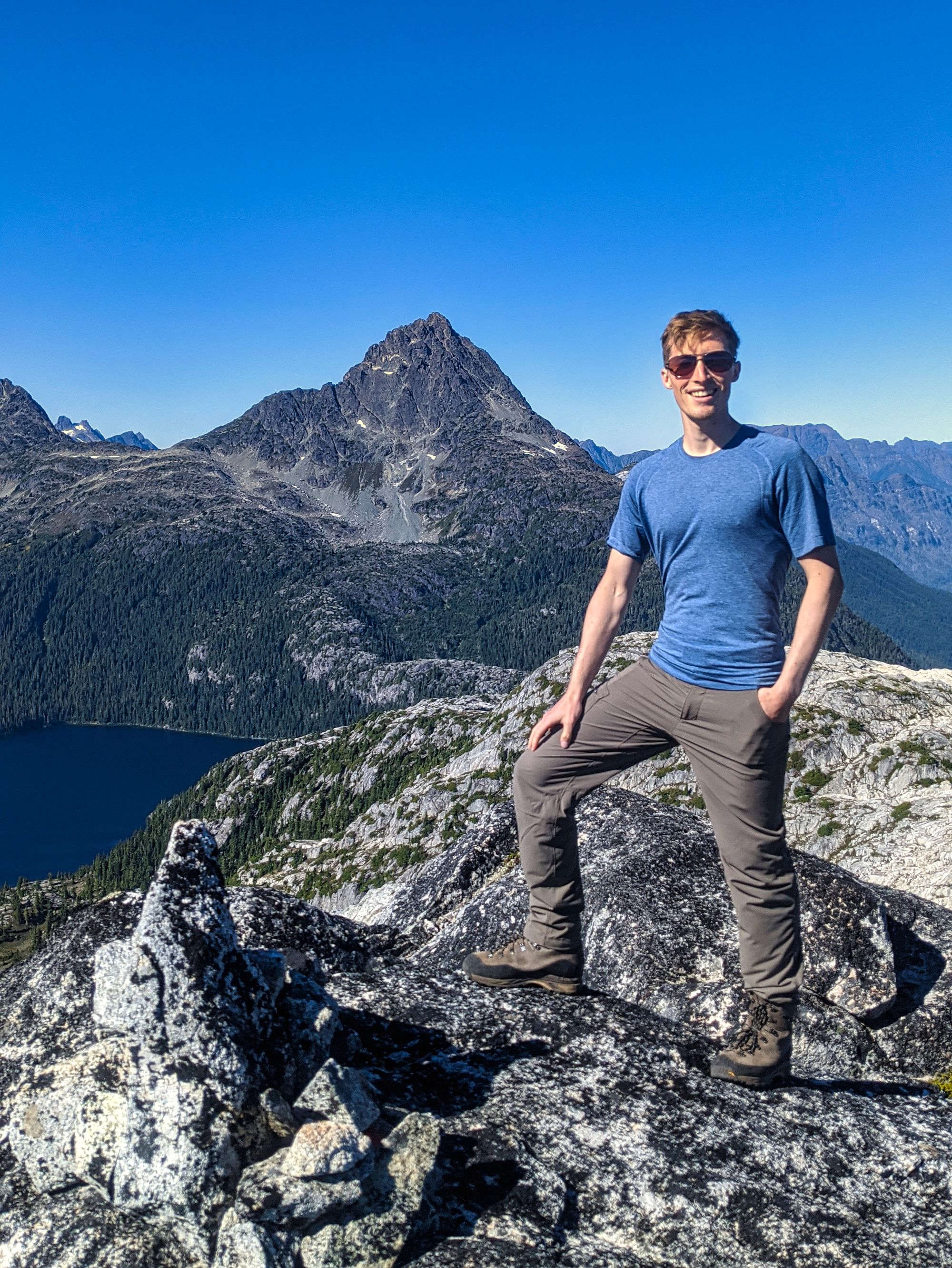
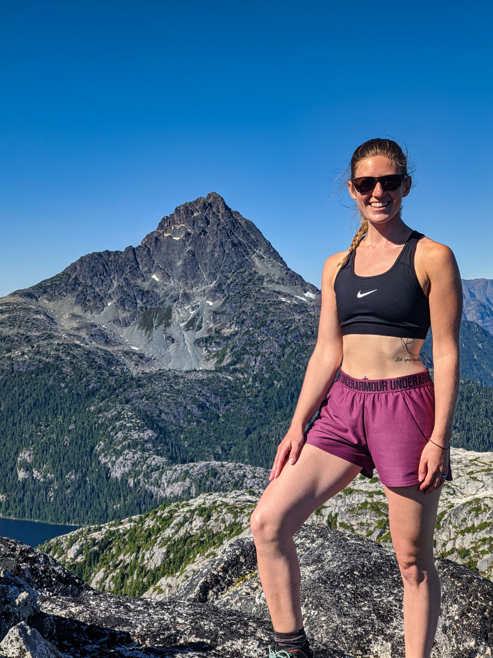
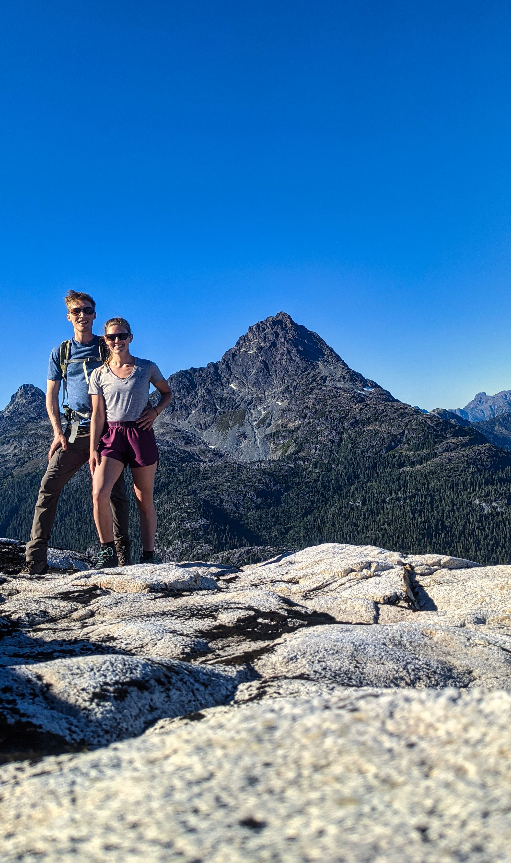
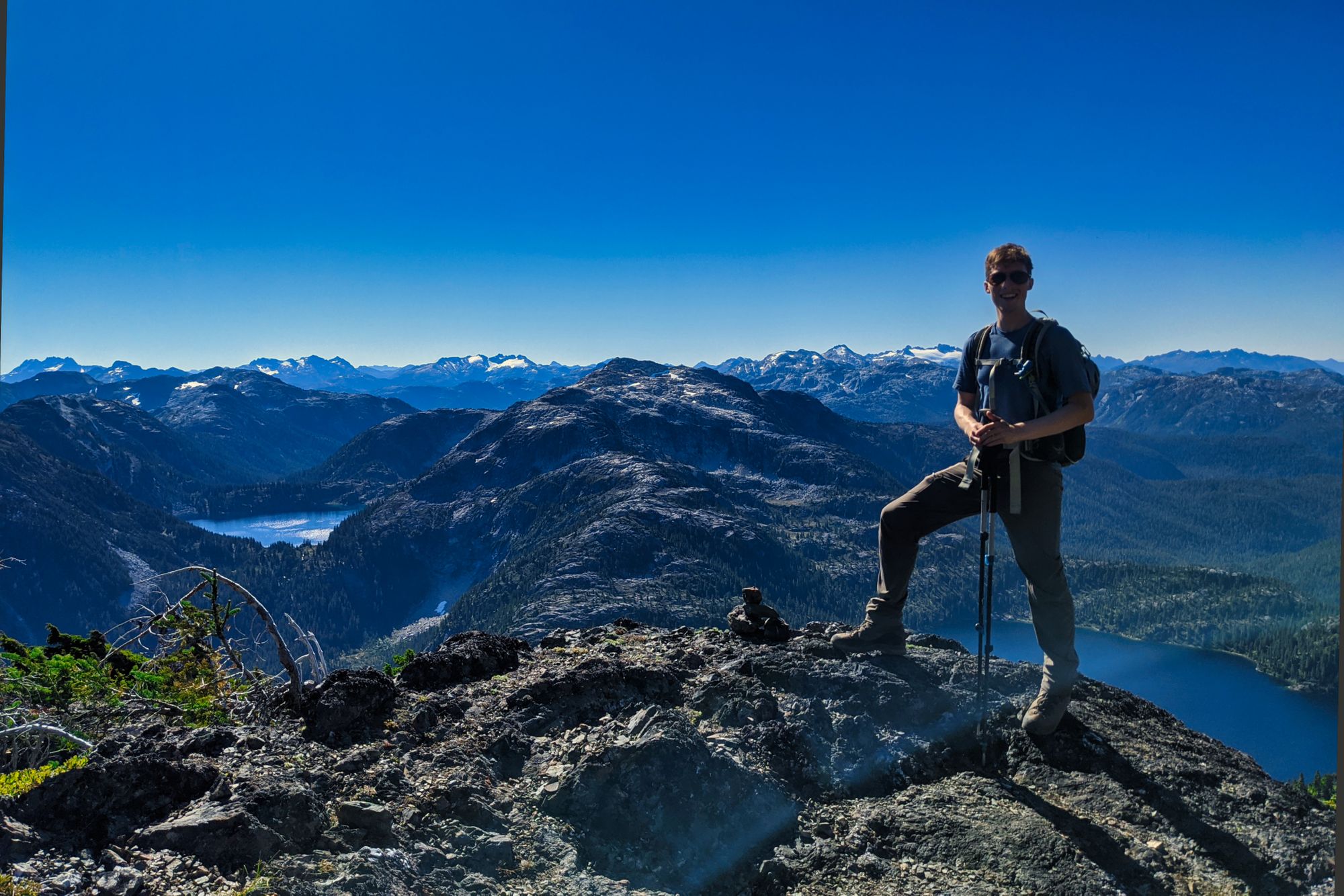
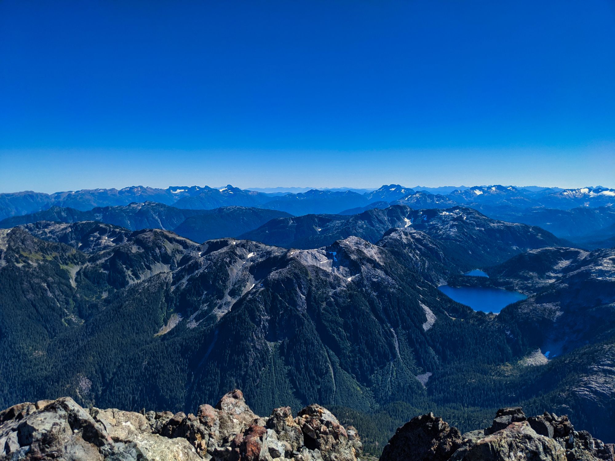
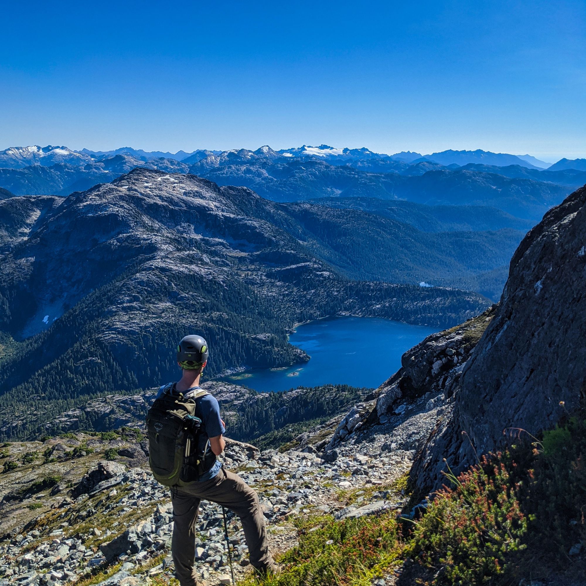
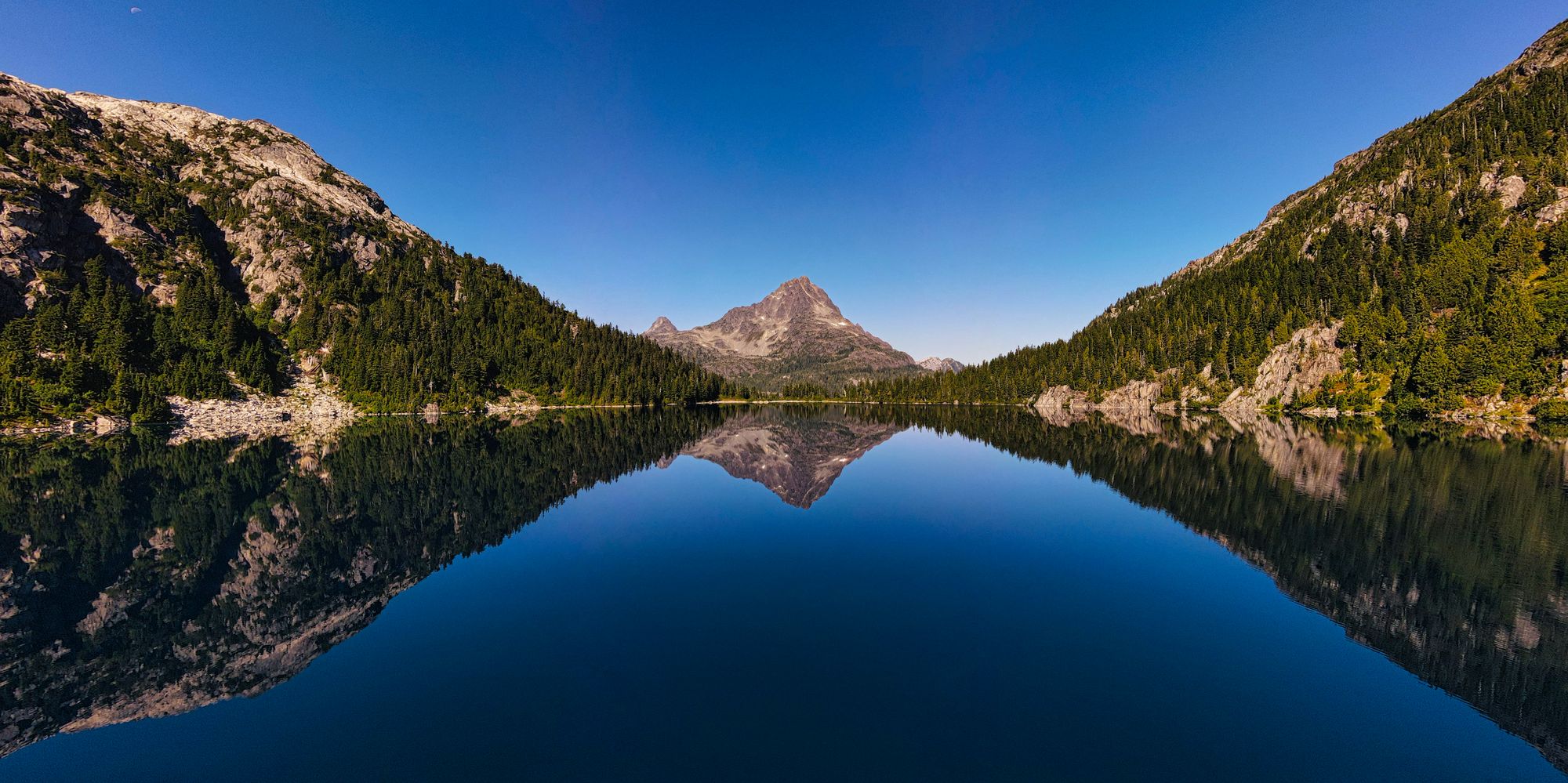
After a short lunch break, we turned north and headed towards our objective. The Hinde now absolutely dominated the skyline, sitting directly between the bulk of the two ridgelines that creased the landscape. About 45 minutes later we reached the popular viewpoint showcasing the Golden Hinde and lakes below. Any hiker who's been through the area has likely taken a photo here, as both Carter and Schjelderup Lakes are aligned with the mountain's summit. Of course, we stopped for a photo.

The day dragged on from that point as the terrain got more and more hilly. Up and over the ridgeline we went, following the trail (or one of them at least, some areas had multiple trails) down through gorges and over the high points in between.
Eventually, we reached it... The terrible, soul-sucking "dirt chute". It was our path down from Phillips Ridge to Carter Lake, and with no way to avoid it, we plunged downwards.
It's hard to describe the dirt chute to someone who hasn't hiked this trail. As you leave behind the open air and gorgeous views of the ridgeline, the dirt chute surrounds you with thick foliage - which due to dead fall must be navigated around, over, or in some cases under. All the altitude that you'd gained during the day is lost in an instant, as you crash down into the valley below Carter Lake. Pushing through branches and slogging through muck, this section is a completely different trail from the rest of the entire hike. Following the steep descent, the still-wooded trail turns and quickly ascends to Carter Lake, mocking the waste of your hard-earned altitude.
But the gleaming blue of Carter Lake breathes fresh life into every climber when they finally see it. The sun was shining and we were re-invigorated, ready to crush the trail!
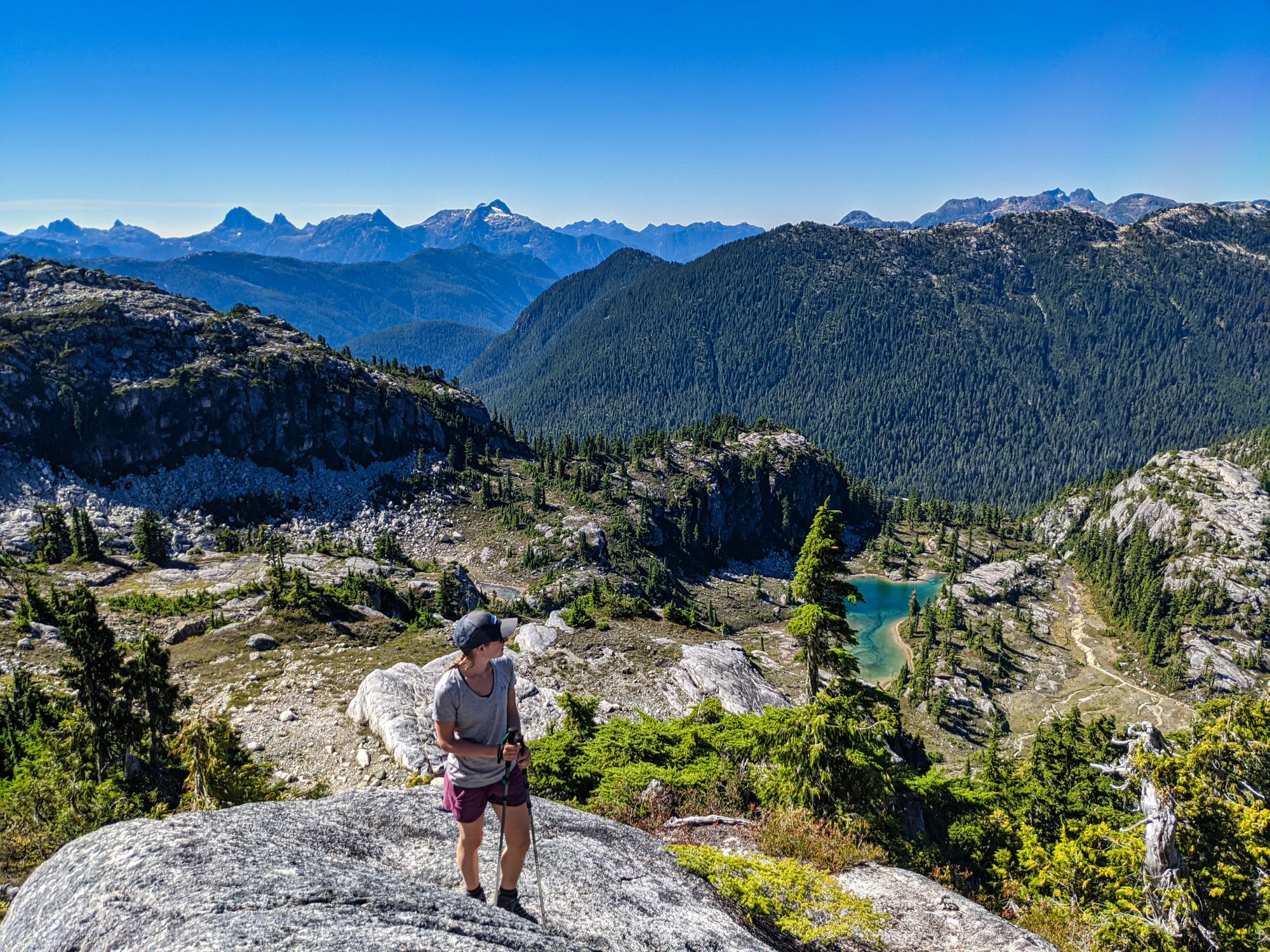
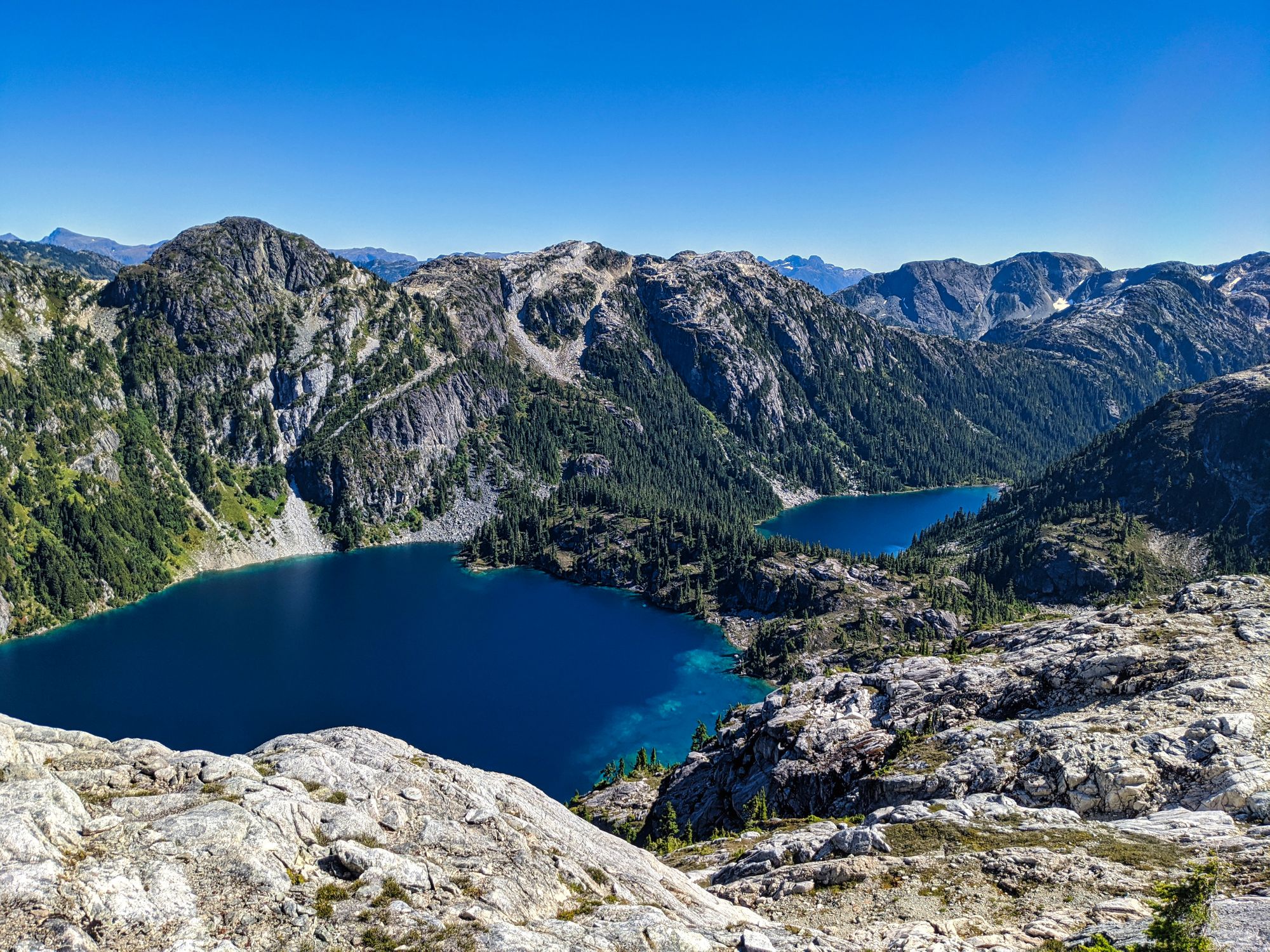
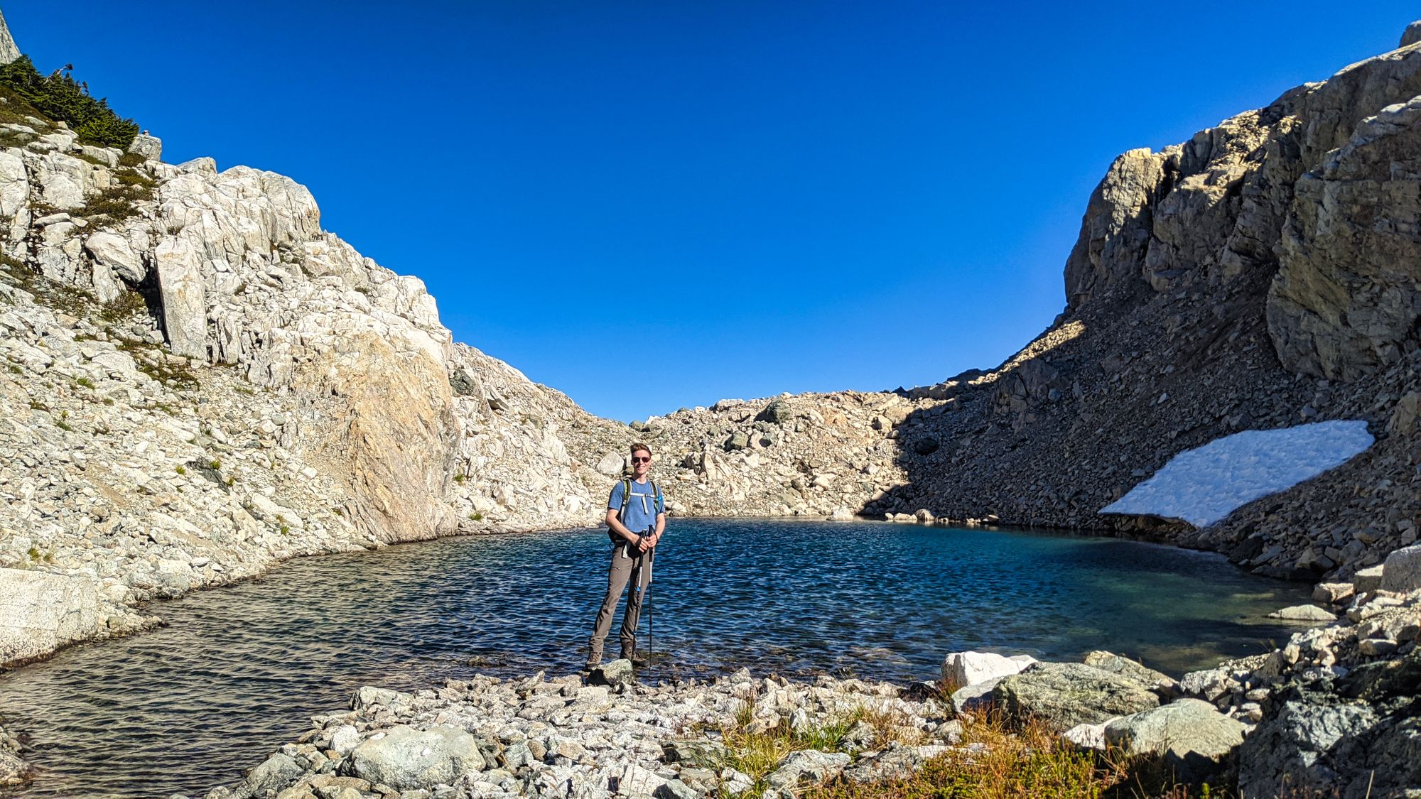
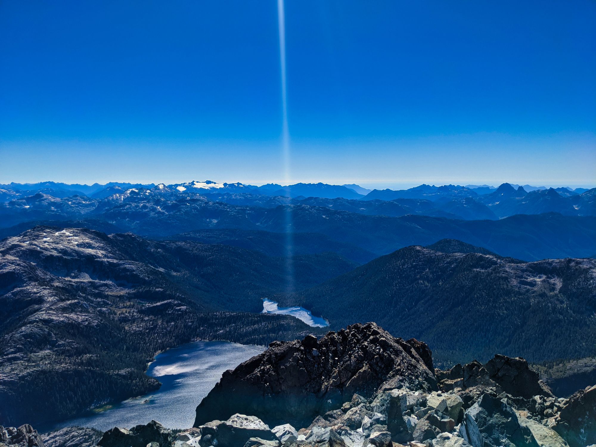
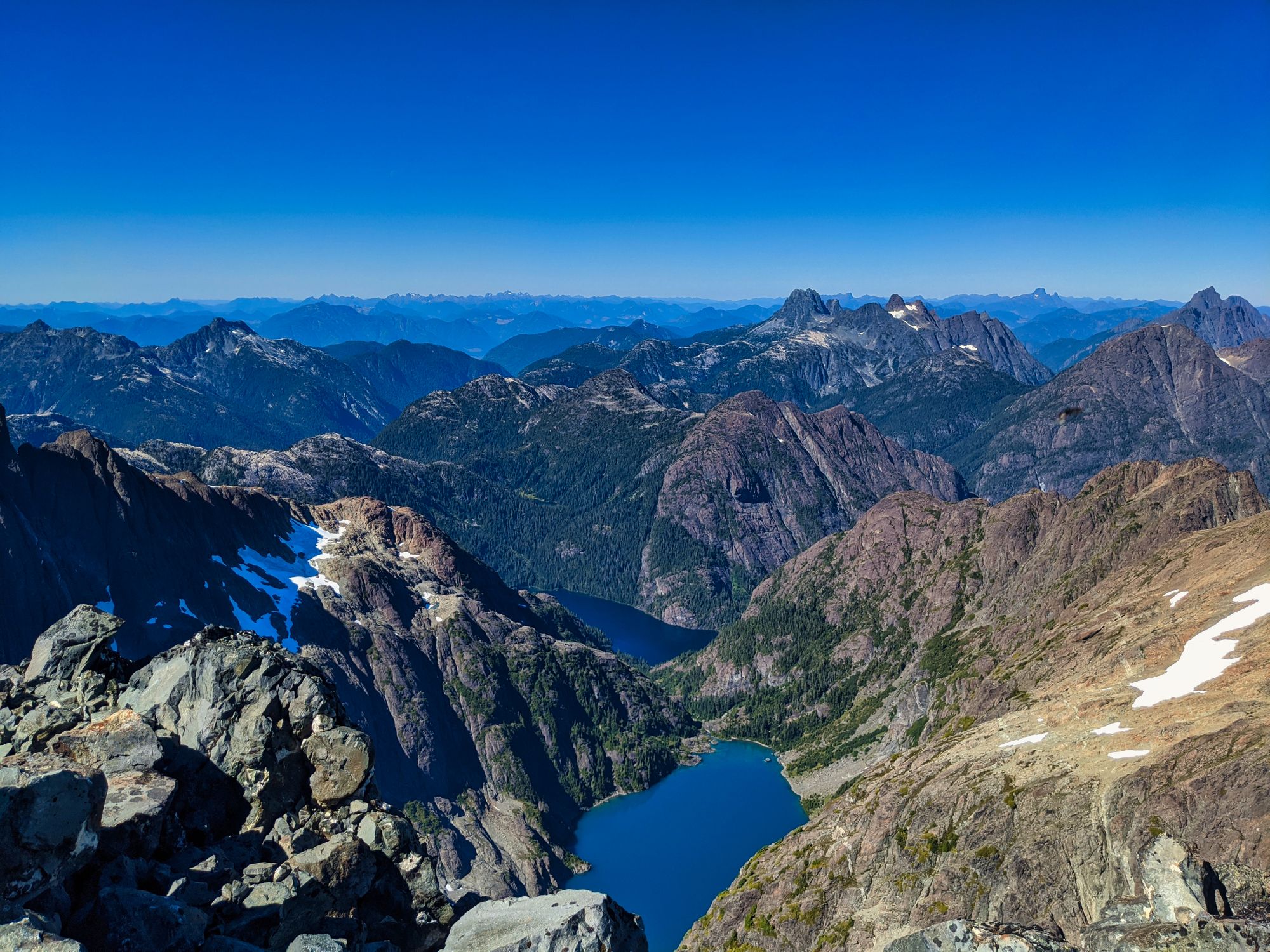
We picked our way around the lake, an easy and well-trodden trail working around the west side. Following the shoreline and hills directly above it, we made it around the lake in what felt like just a few minutes. After a short break at Carter, we carried on towards Schjelderup Lake. The trail first navigated us past a small glacial lake nestled below Mt Burman. This unnamed lake is a gorgeous spot with its colored waters, but sadly the view escaped our cameras as the setting sun brightly shimmering across the water.
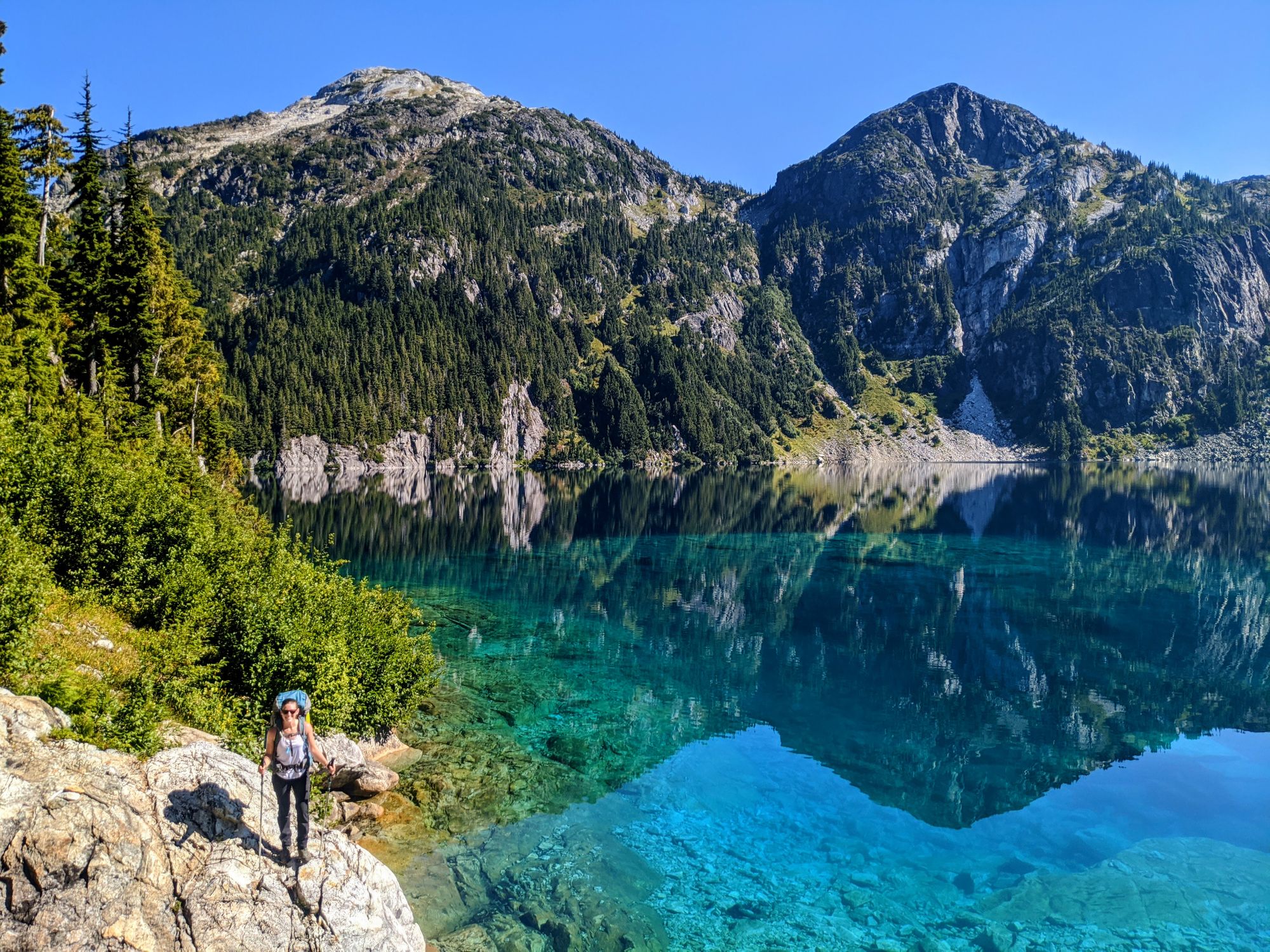
Less than five minutes of travel gave Katie her first view of Schjelderup Lake. Standing on the cliffs above the deep blue waters, she finally looked up from her feet and was astounded. But time was not in our favor, so we took a couple photos and carried on.
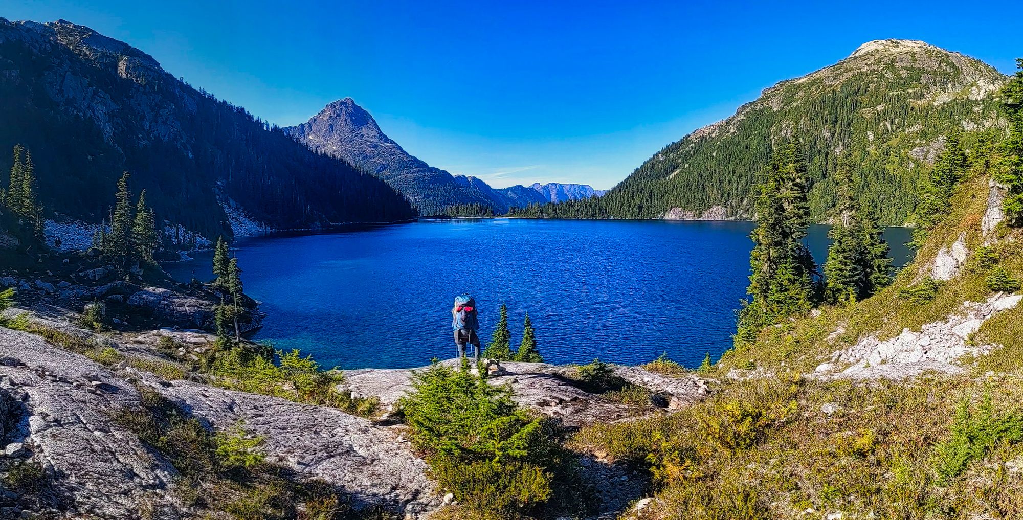
The route around Schjelderup navigates several boulder fields, where rock slides from the ridgeline above have littered the shoreline. We climbed over and around the huge stones, attempting to follow the barely-marked trail. But it's impossible to get lost here, just keep the lake on your right. Eventually each slide zone was replaced by forested headlands, where we climbed up and over the high ground to continue on into the next rock field.
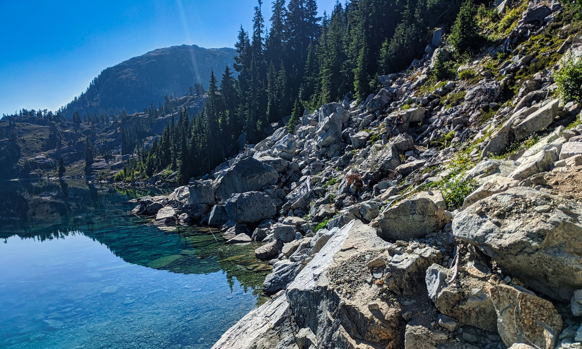
After a half hour we made it around the lake to find the camping area packed. Five tents were set up, with more people visible coming down from Burman Ridge to our left. We managed to find a quiet spot away from the others, pitching our tent near the drop-off at the north end of the lake, next to the creek where water flowed downwards into the Wolf River Valley.
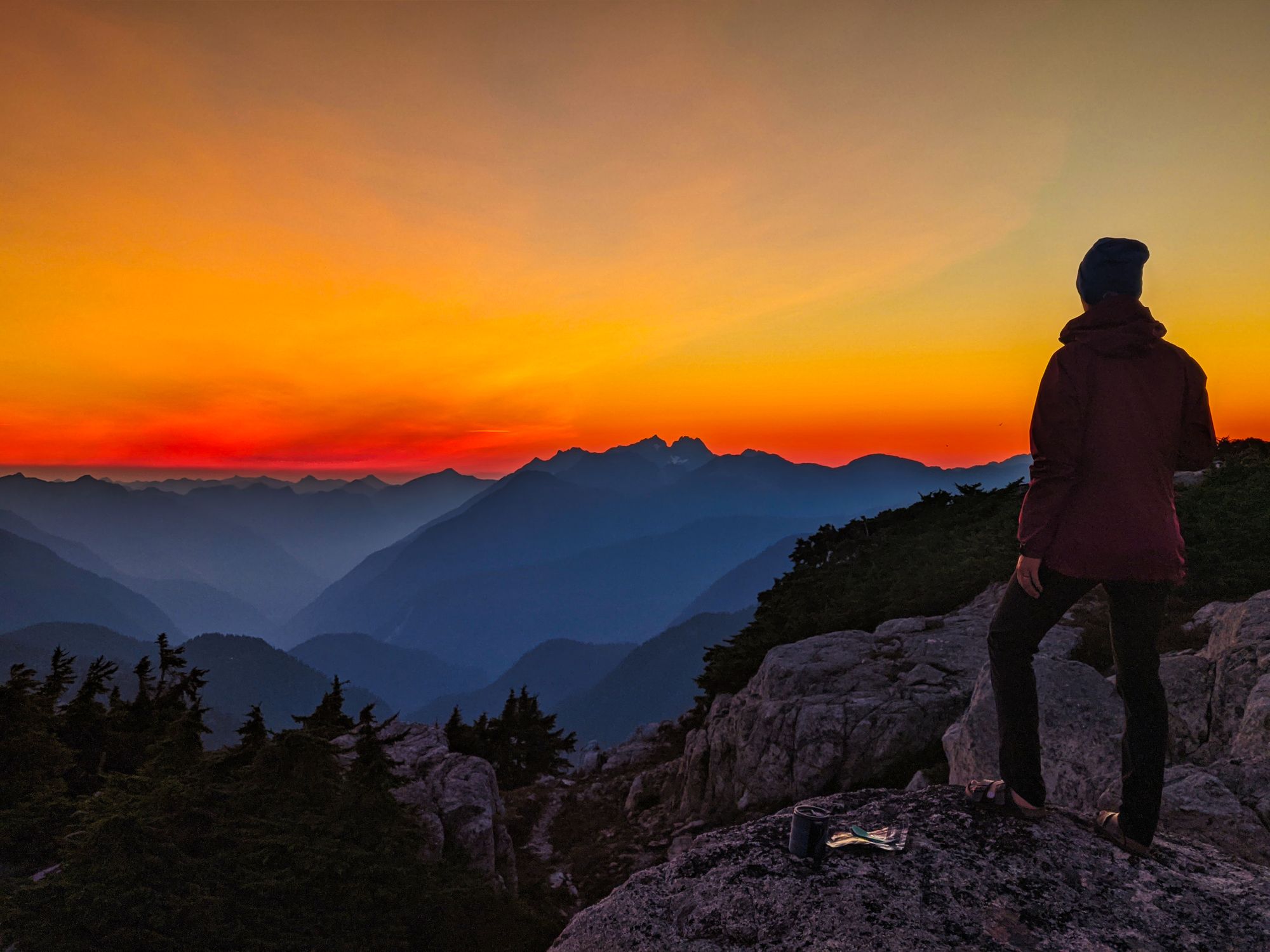
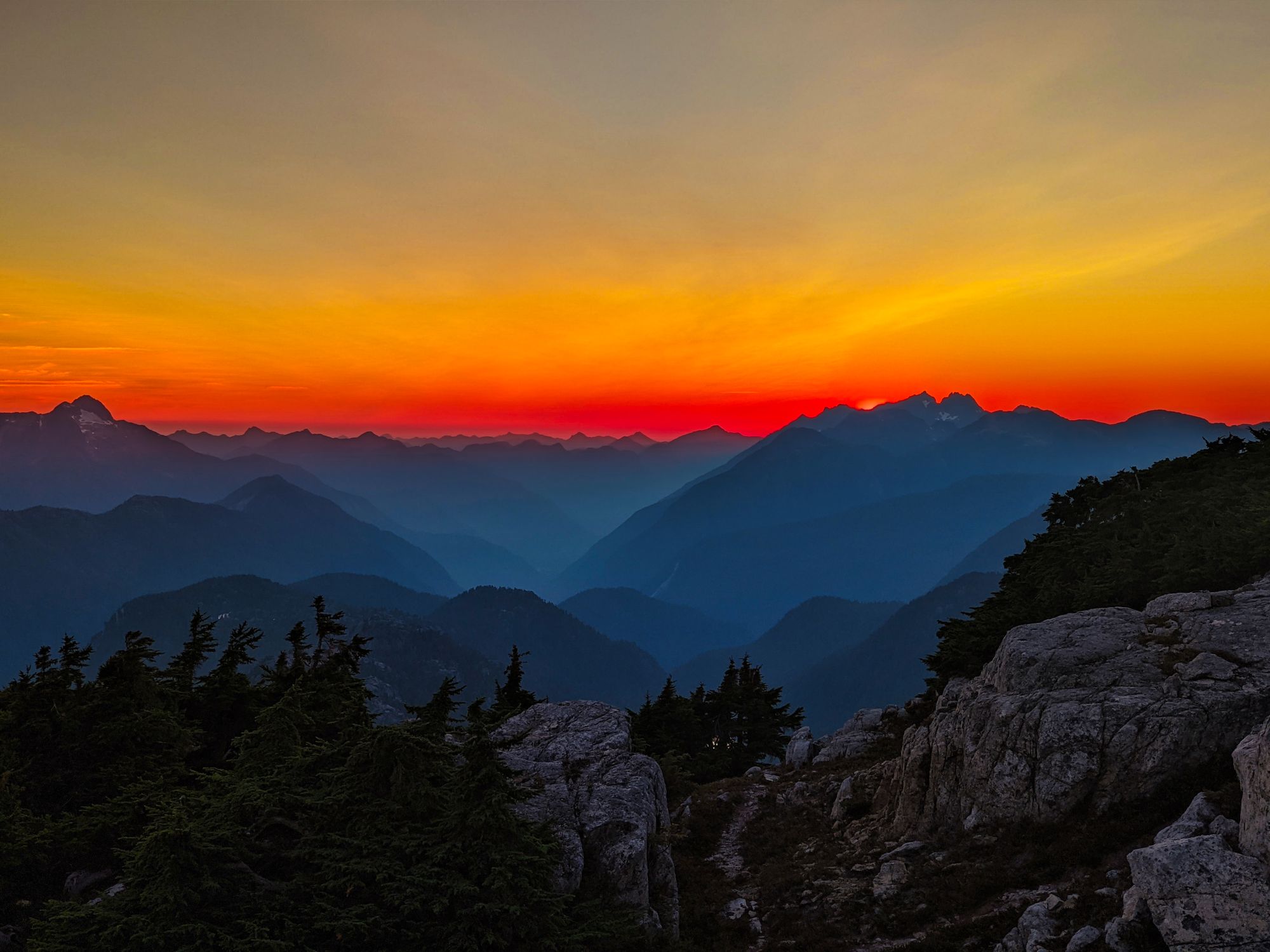
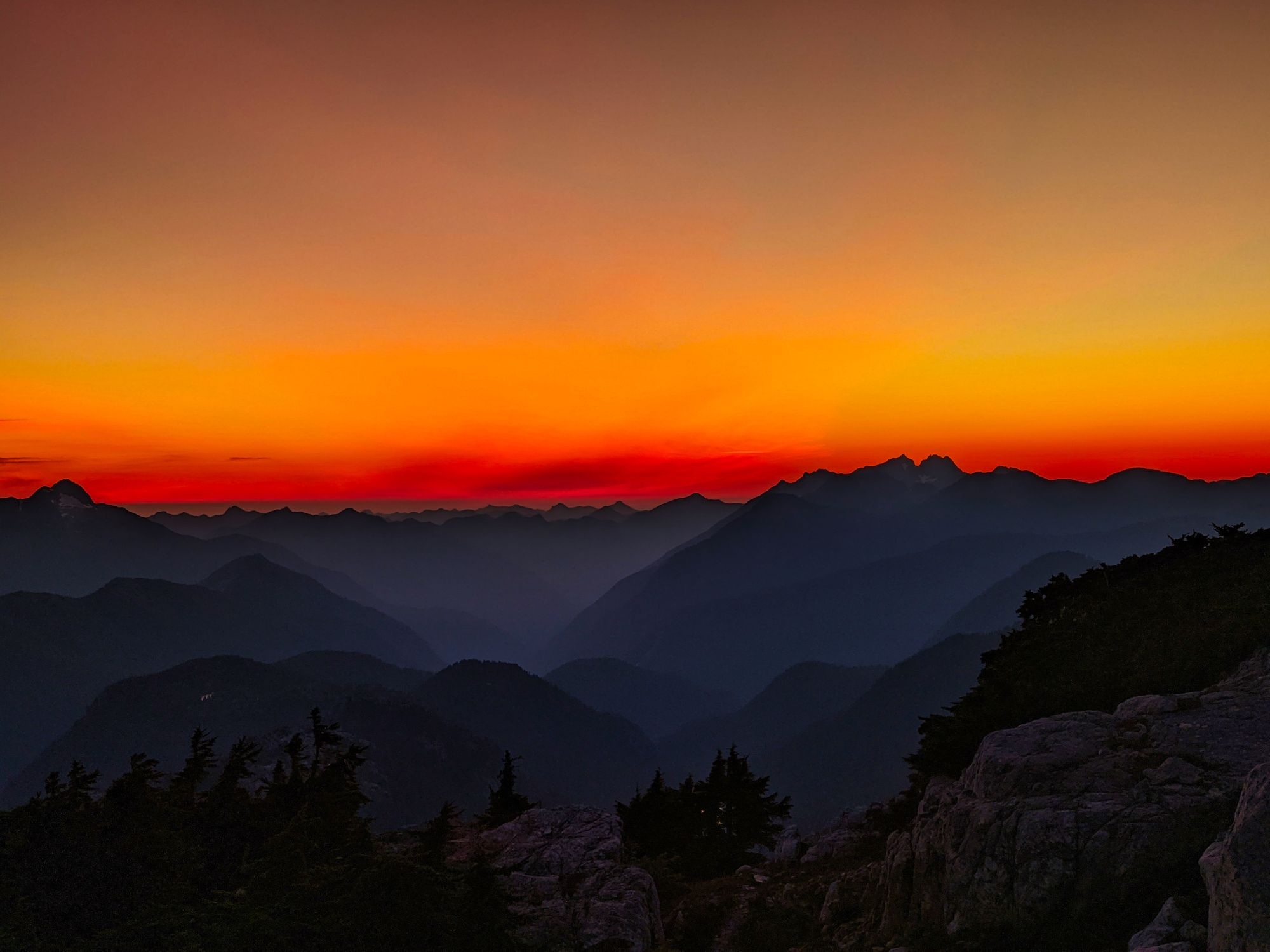
After a quick "swim" (the log jam at the north end of the lake makes swimming incredibly difficult) in the lingering sunlight to wash off the sweat of the day, we settled down for dinner and watched the sun go down. The sunset was fantastic, the sky to both north and south shaded in orange, pink, and red hues. Finally satisfied, we headed to bed as we crashed from the exhaustion of a good long day.
Day 3: Schjelderup Lake to Mt Burman, 6 km (return)
On day 3 we rose late. After completing two long travel days, each over 9 hours, we were both looking for a rest. So in the morning we woke up slowly, read books, and after a very late breakfast we prepared for a day hike to Mt Burman.
Stepping off slightly after noon, we moved into the trees to the west of our camp and quickly found one of the trails leading up to Burman Ridge. The multiple trails leading from Schjelderup Lake connected within the first couple hundred meters and then drove upwards through the trees. Our time in the trees didn't last long though, as we soon found ourselves opening into yet another alpine meadow.
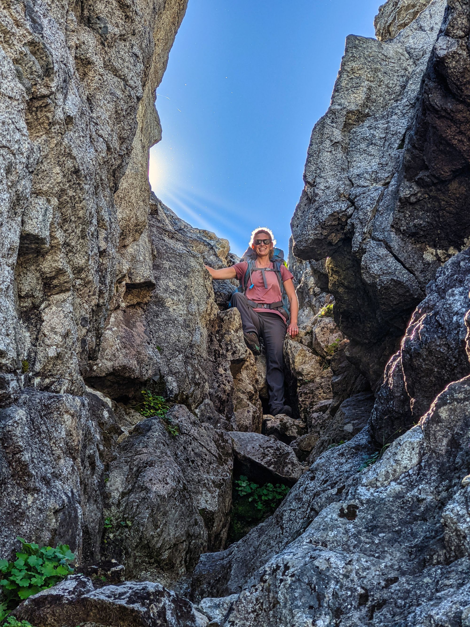
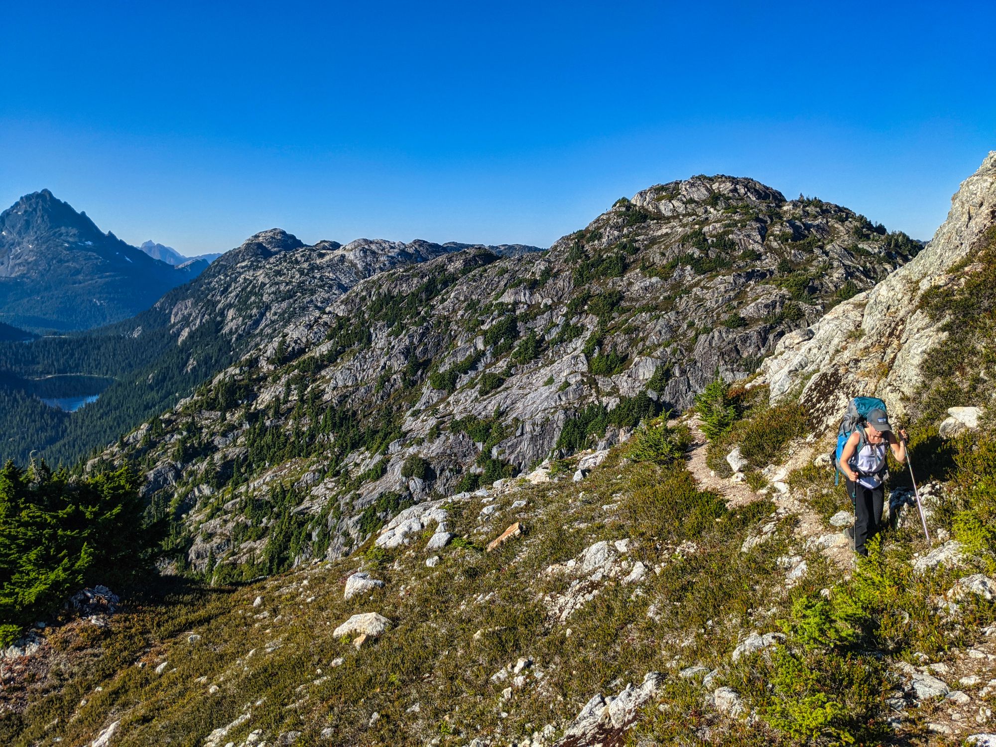
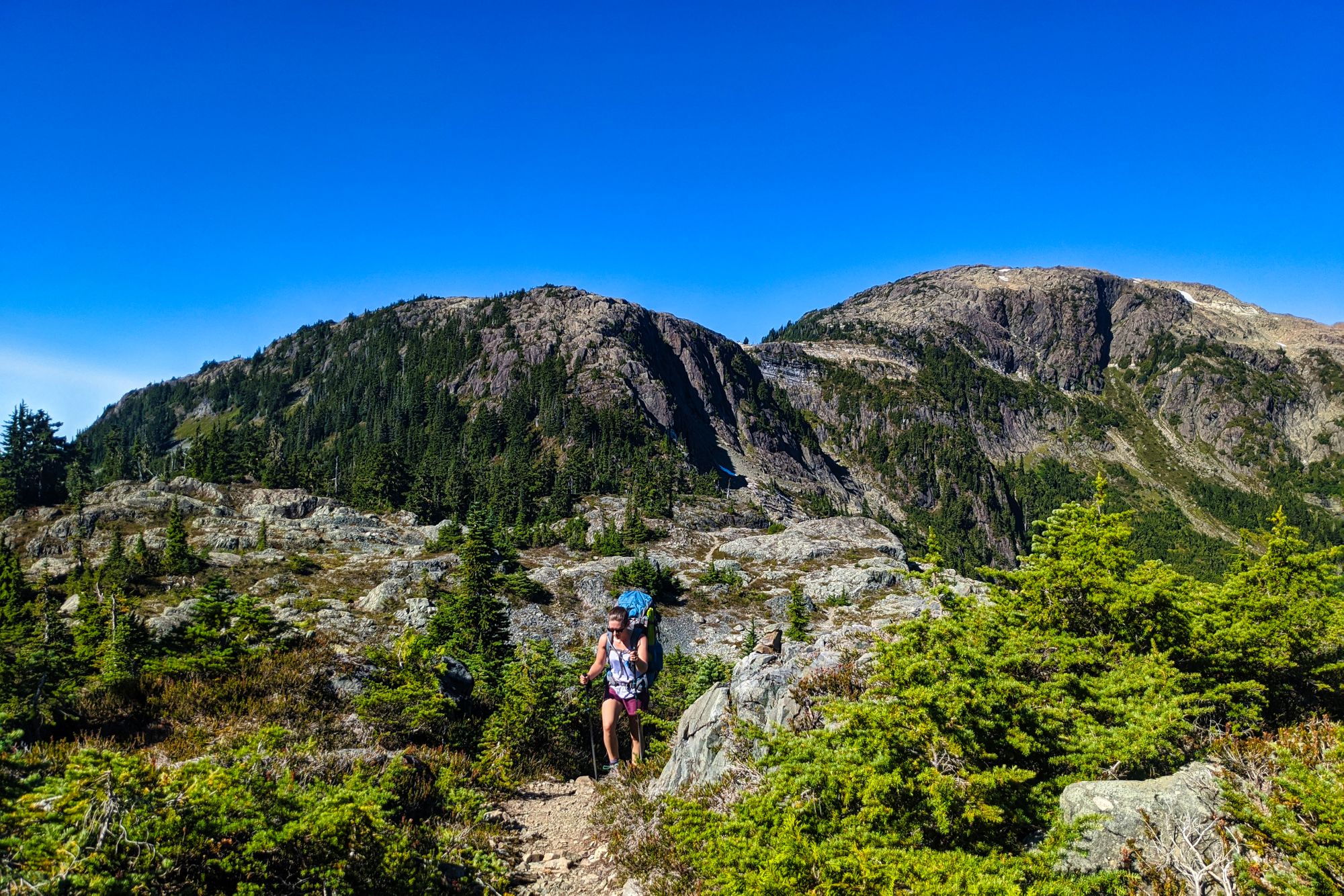
Traveling through the low bushes and across open rock, we quickly made our way up on to Burman Ridge where we turned off of the trail. The well-cairned path led northward off towards the Golden Hinde, but we needed to head south. As we began scouting the ridgeline to the south, we soon found a lightly traveled trail, complete with some sporadic cairns to lead our way. Following this path along the west edge of the ridge, we soon found ourselves climbing up a low 4th-class gully that brought us onto the ridgetop. The gully was relatively easy to climb, as many small trees and shrubs made for extra handholds as we scampered up the slope.
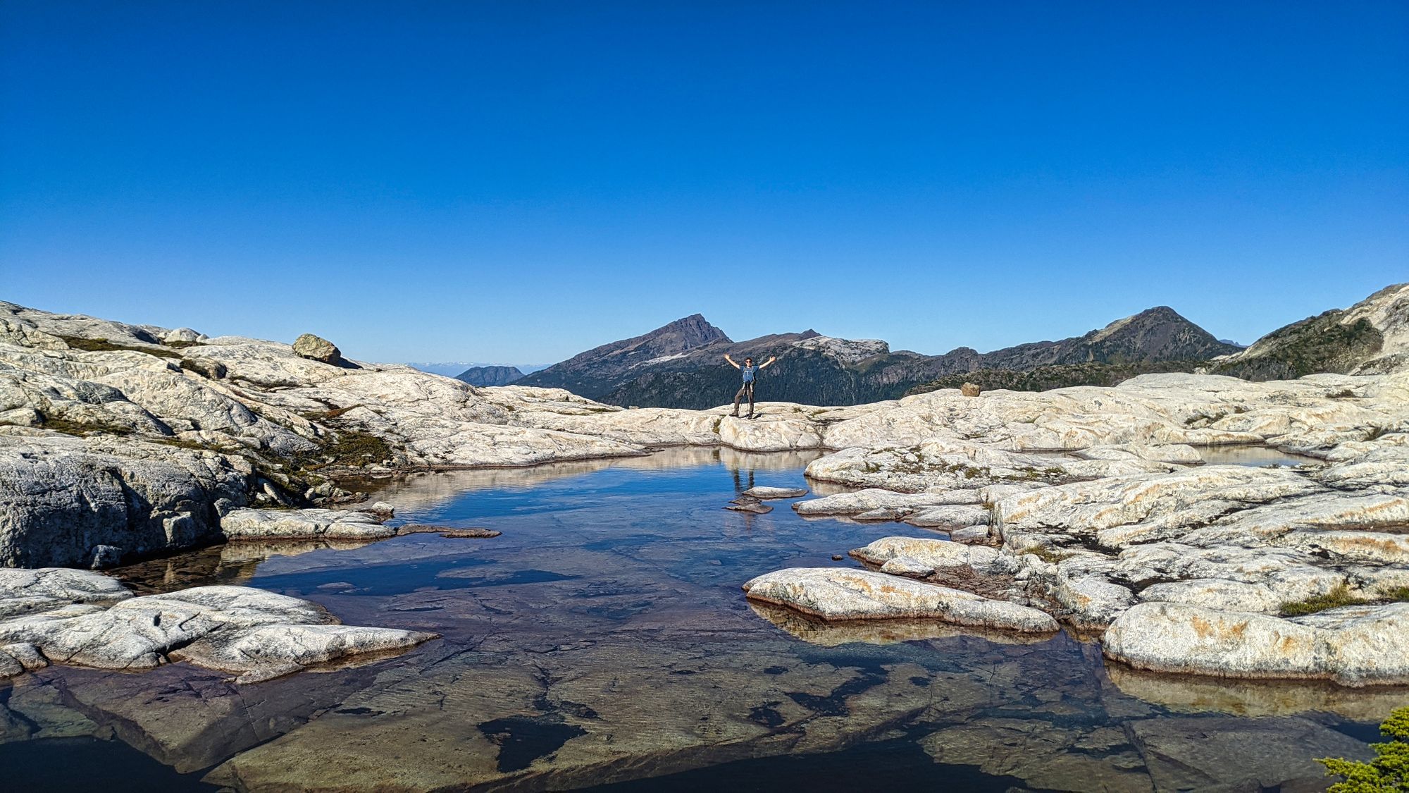
Fields of blueberries littered the lower slopes of the ridgeline, making for a snacky climb. Hands stained from the fresh sweet fruit, we clawed our way upwards towards to rocky ridge above us. Upon reaching the ridgetop, the traverse was very straightforward. Following high points and lightly cairned ascents, we traveled along while stopping often to marvel at the views. Multiple tarns littered the ridgetop, providing easy camping areas. We seemed to be super lucky with seasonal water availability in the alpine this year, hopefully it will be the same next year!
As we approached the summit of Mt Burman, we found that the slopes got steeper, rockier, and far, far looser. We picked our route carefully, following faint tracks from those who had hiked this route before us, and some cairns that were left behind.
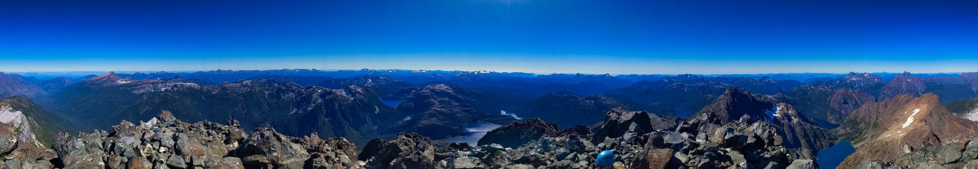
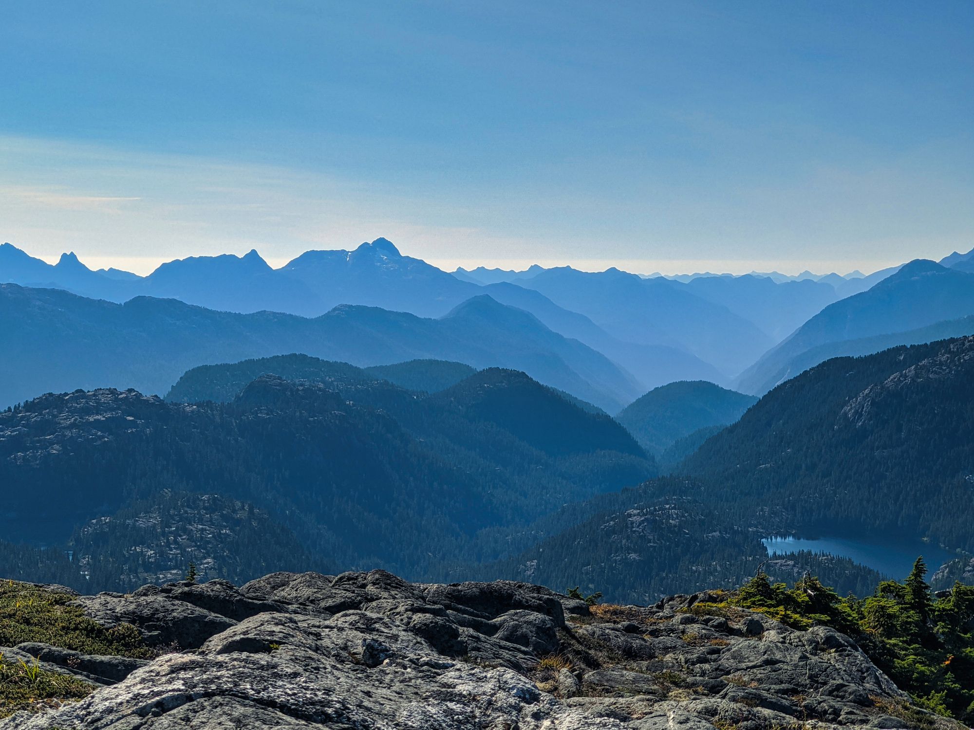
Slowly making our way upwards we eventually reached the summit! A final quick scramble up an easy rock face was the last piece of the ascent, and the waiting view was breathtaking. A 360 degree vista of island peaks was arrayed before us, as the clear blue day gave us incredible visibility.
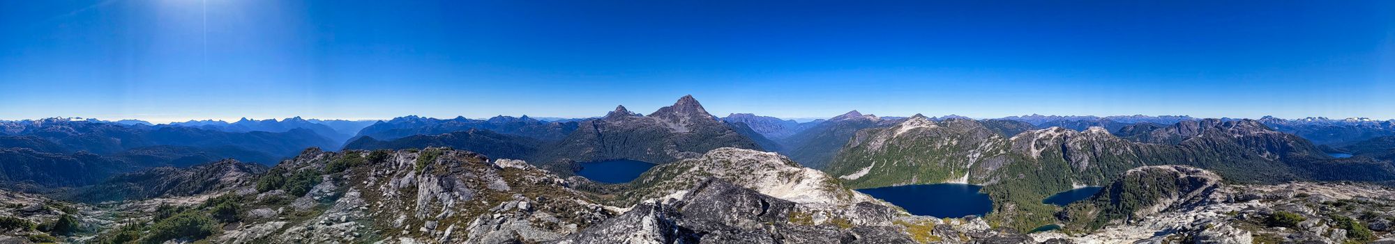
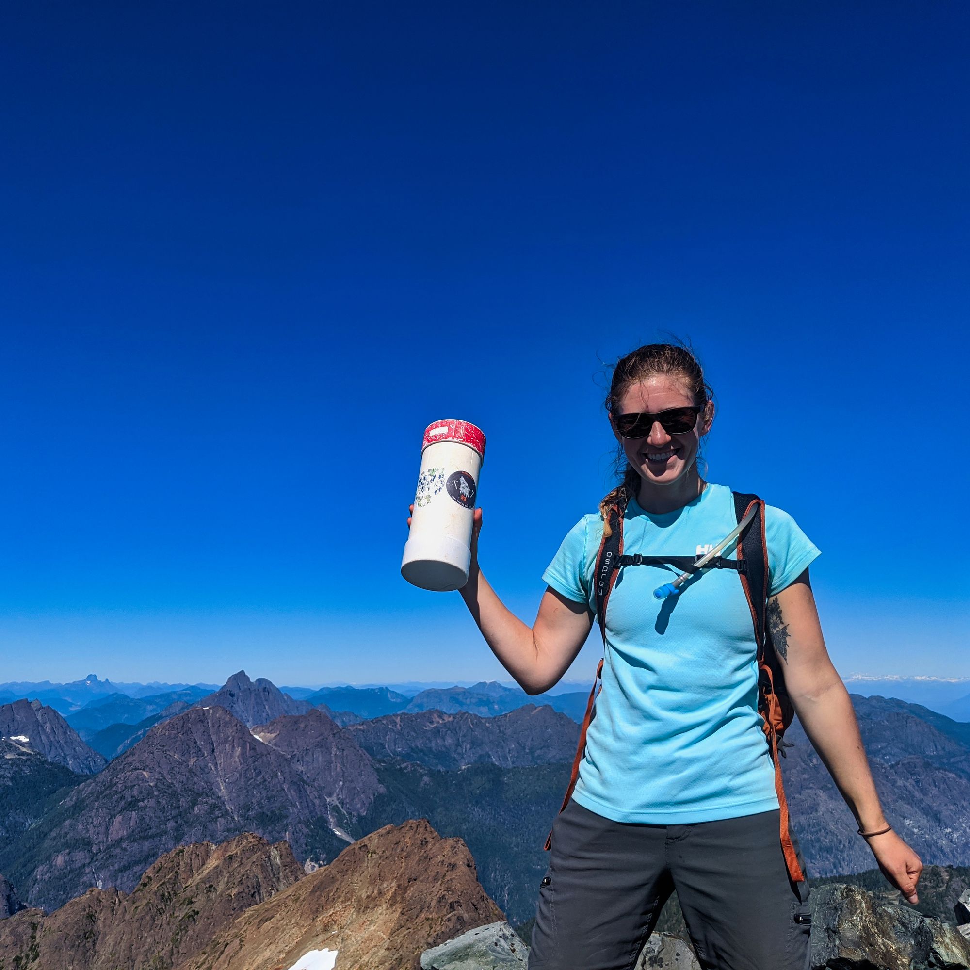
An hour at the summit passed in a flash. We ate lunch and took tons of photos, and took time to read the register. We were the 6th group up Mt Burman in 2020, with only one additional group who had made the ascent in 2019.
With the register signed and our bellies full, we turned to begin our descent. Now familiar with the route, we made quick time. The top of the gully that was our route down off of the ridge surprised us when we arrived, as it still felt like we had just left the summit. Navigating the gully descent and eating more blueberries, we finally linked back up with the Golden Hinde trail and headed for camp.
We got back to Schjelderup Lake to find what had been a bustling camp 24 hours earlier now deserted. We relaxed in the calm by the lake, soaking our tired feet in the frigid alpine water. After dinner we prepared for the following day's grind, set our alarms, and went to bed.
At 2h20 up and 2 hours flat back down, we can't recommend this overshadowed summit enough!
Day 4: Schjelderup Lake to Golden Hinde, 13 km (return)
We rose early knowing we had a long day...
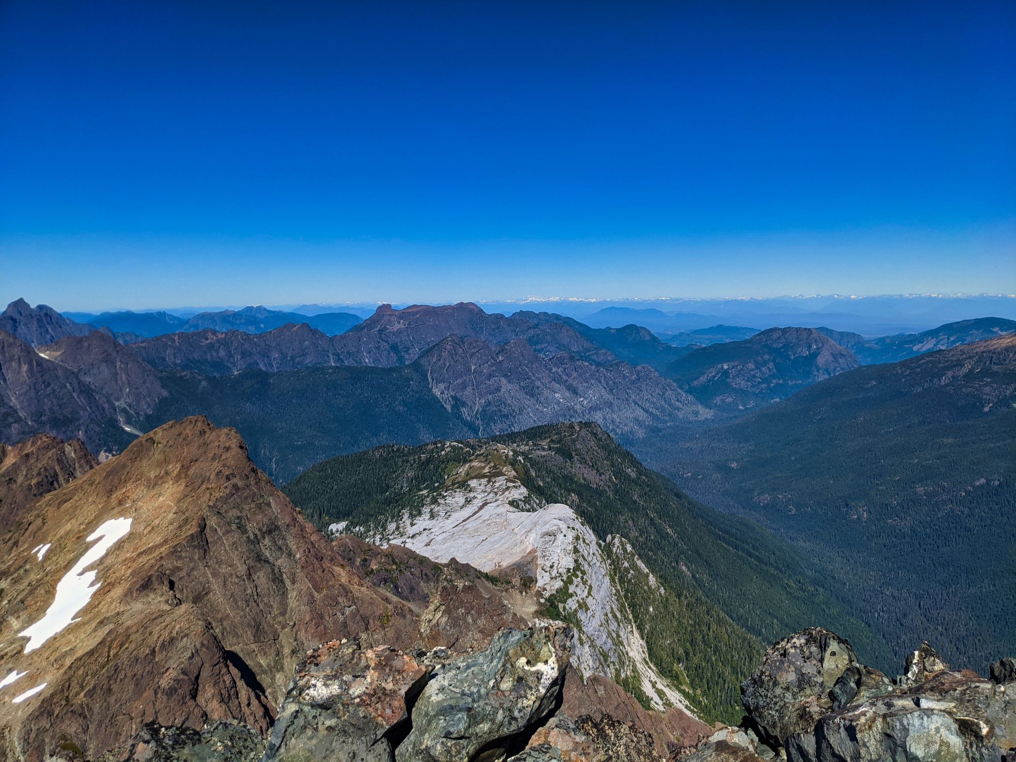
A warm wind whisked us on our way up Burman Ridge. We hiked in the early morning shadows until the sun peaked around the top of Phillips Ridge and warmed us even more. We followed our footsteps from the day before up to Burman Ridge, but then followed the trail on the right and continued our approach to the Hinde.
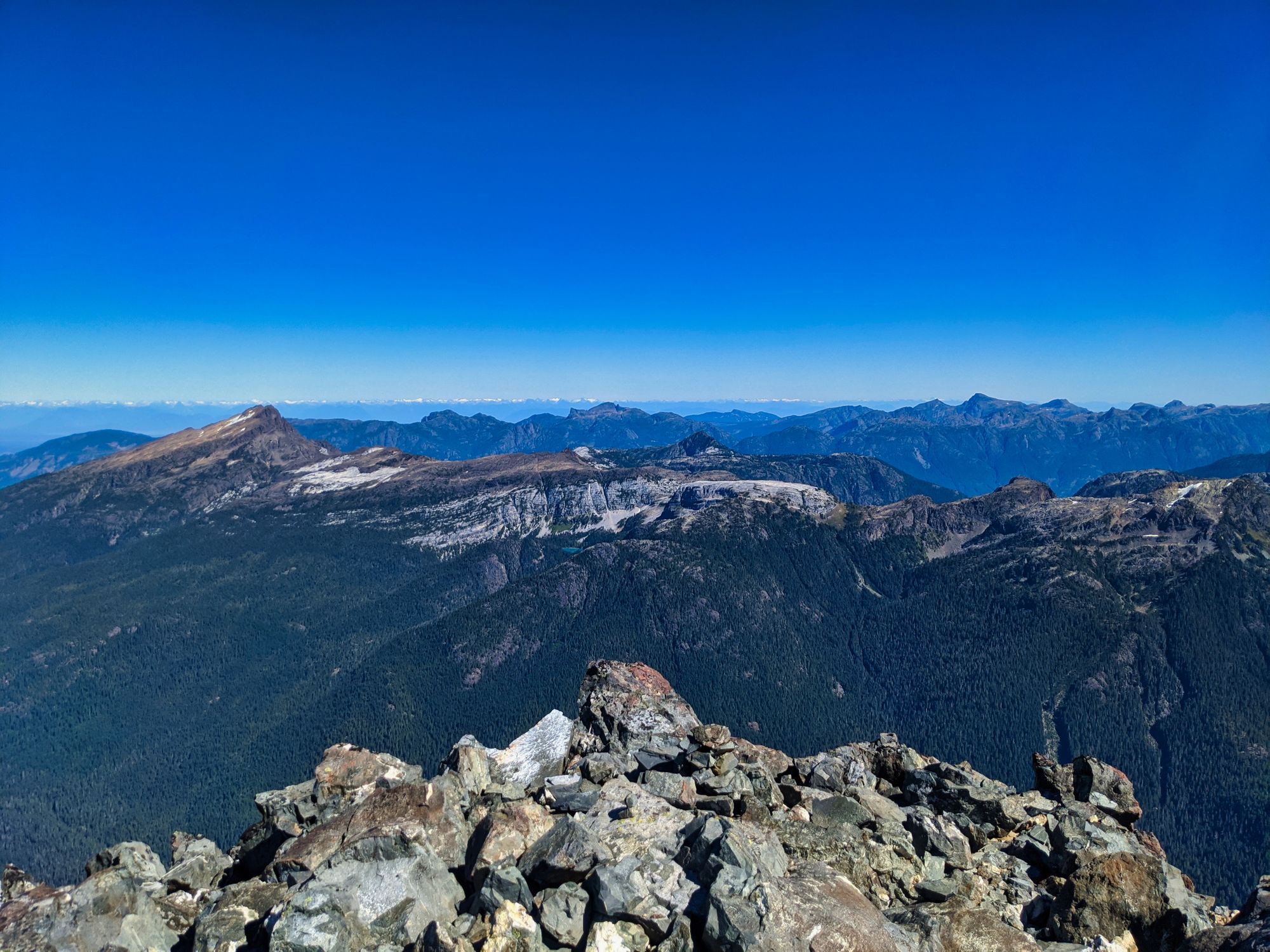
The traverse along Burman Ridge started as a long smooth descent, aiming towards a low point where we would officially start our ascent to the Hinde! As we snaked our way down the ridgeline, the Hinde grew in magnificence ahead of us. The mountain absolutely dominating the skyline as we drew nearer, and it seemed to start leaning over us as we neared the east end of Burman Lake.
The descent became more steep as we closed in to Burman Lake and the BC Hydro chasm. This infuriating low point was blasted out by BC Hydro in the 1960's in an attempt to divert the outflow from Burman Lake to the Wolf River Valley. This would have allowed them to add more water to Buttle Lake, creating a larger catchment area for the dam at Upper Campbell Lake. While some thick cables can still be seen as evidence of this ill-thought out project, BC Parks stopped it before more of the area was destroyed. Nevertheless, the construction ripped out a deep crack which must be navigated in order to start the ascent.
At the bottom of the chasm, we reached our lowest point of the day - just slightly below 1200 meters. From here, we had nearly a kilometre of elevation to climb to the summit!
We continued along Burman ridge, now ascending quickly. The ridge lifted us up above Burman Lake, and soon deposited us into the south bowl of the Golden Hinde, shortly before 10:30am.
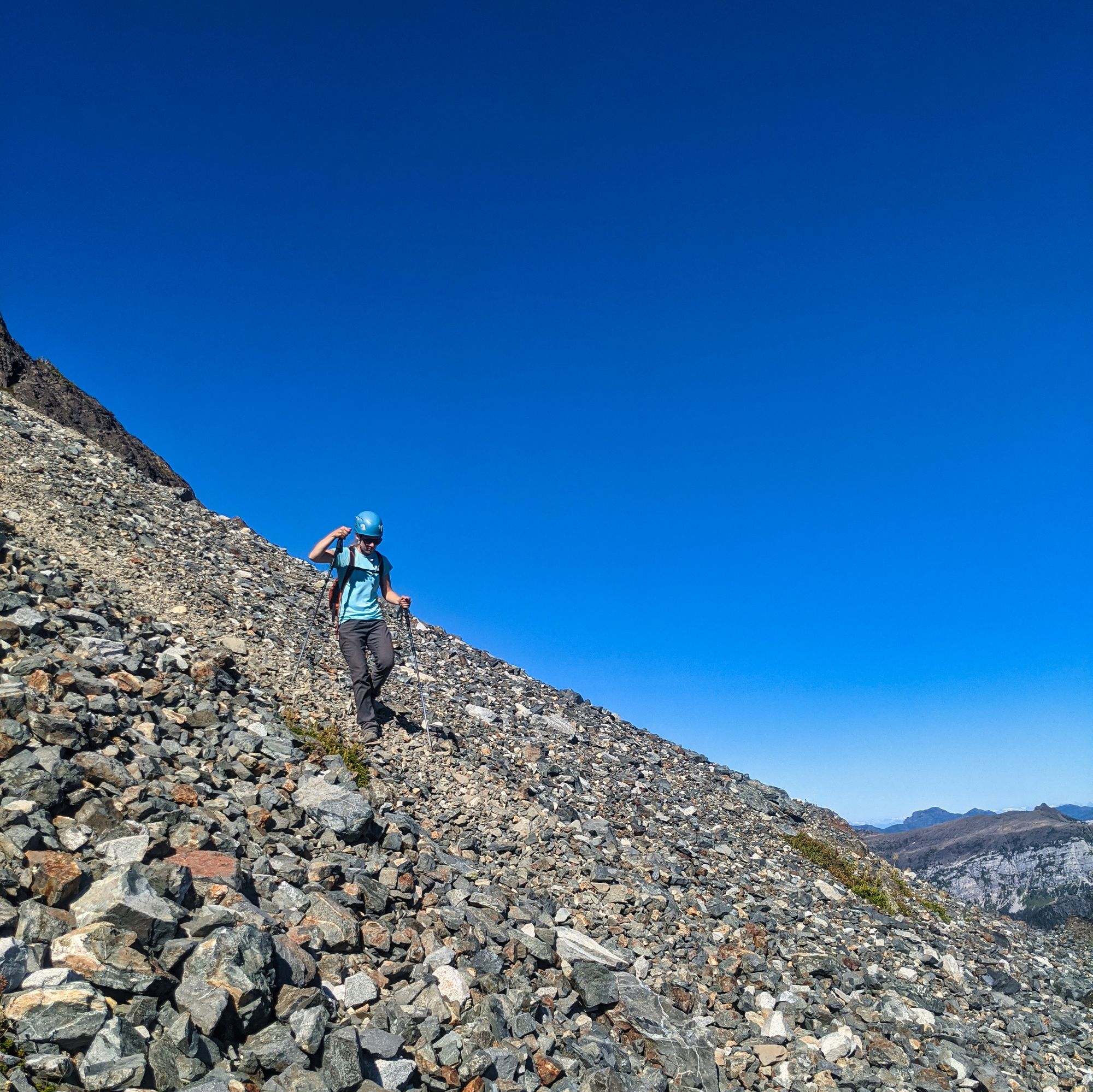
The bowl was huge and strewn with loose rock - anything and everything from pebbles underfoot to massive boulders that would dwarf a car! We found a spot in the shade of one of the bigger rocks for a break, to have a snack and reapply sunscreen.
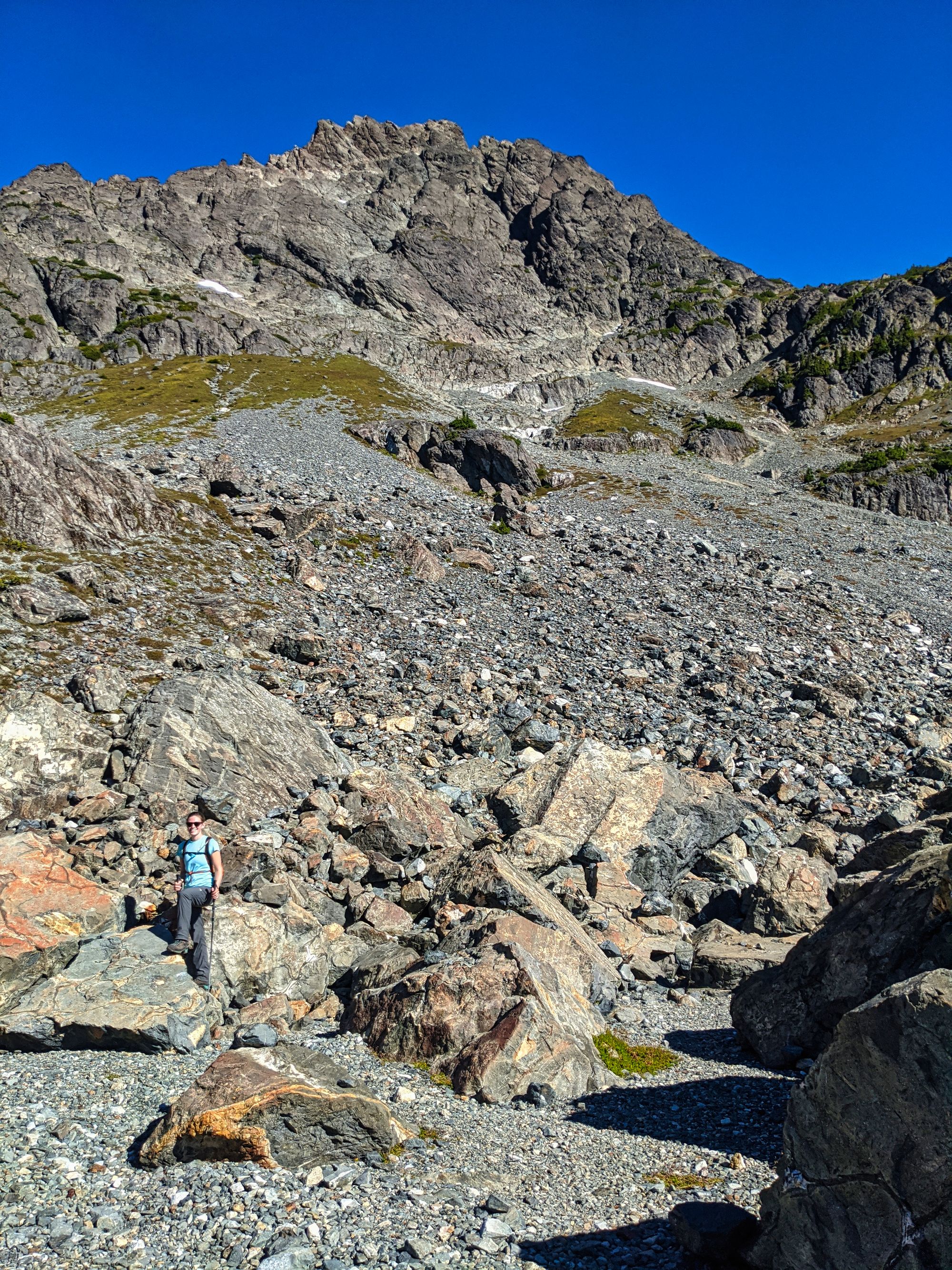
We pushed on to escape the bugs that were buzzing around the bowl, and travelled around the northwest side of the boulder field. We traversed the scree that covered the slopes of the bowl, heading slowly upwards and to the hiker's right. Snaking our way up the scree, we searched for the best path. The rocks shifted beneath us as we climbed, sapping energy as we dug our boots deep into the loose ground for grip. Trending further to the right side of the terrain, we quickly found tracks from the busy long weekend prior. Picking our way across loose stones and through a dry river bed, we eventually reached the gully that gave us access to the southeast ridge of the mountain.
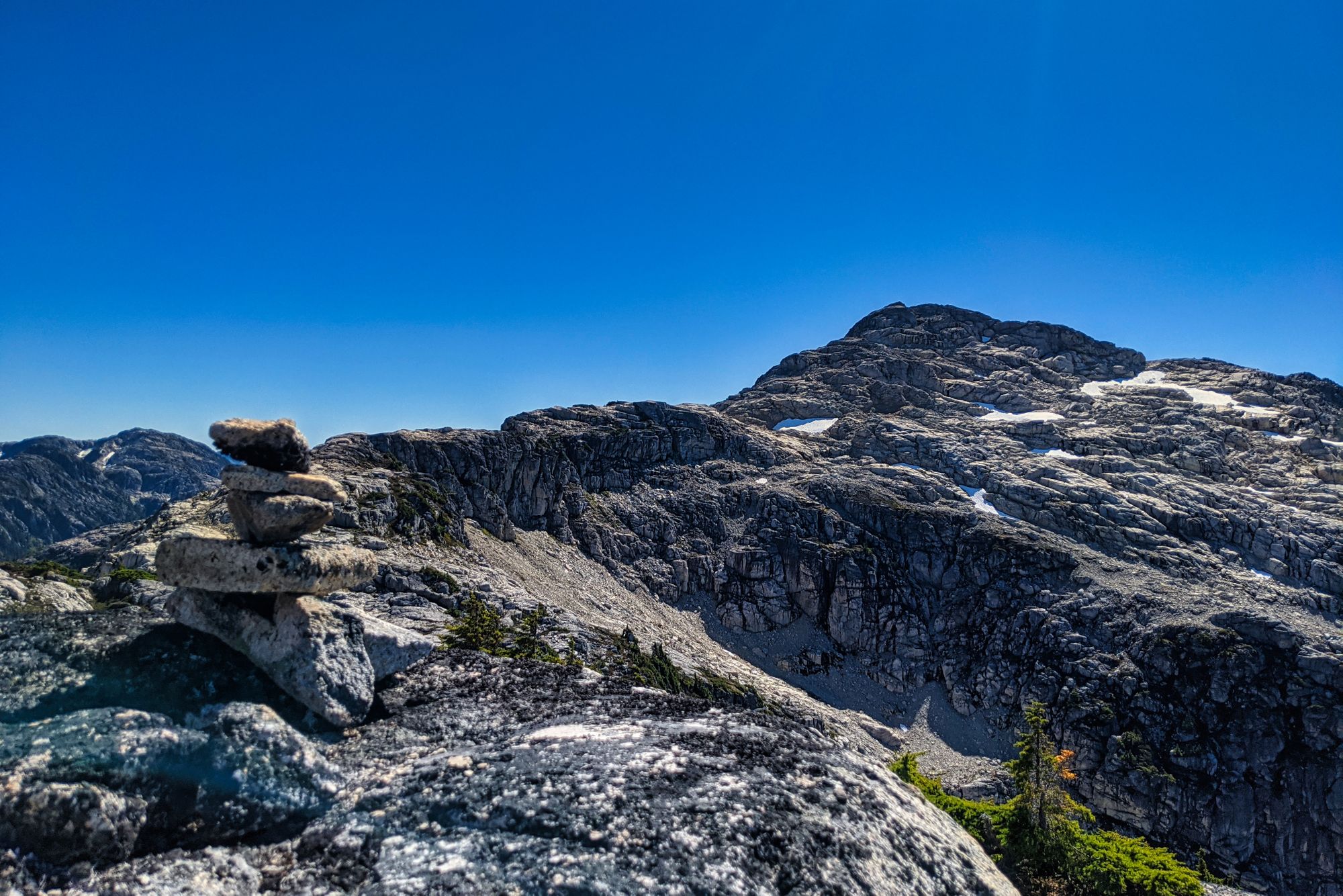
The gully ascent provided firmer ground than the scree fields, and we quickly found ourselves in a high alpine meadow. Marking the spot in our GPS (as we read that it can be difficult to find the top of the gullies later on) we carried on. The meadows quickly faded as we crossed the southeast ridge of the Hinde, replaced by another scree field that was fed by the southeast gullies: our way up. We climbed upwards, finding the base of the gully at the top of the debris cone.
As we entered the gully, our path became steeper. Putting away our poles and unpacking our helmets, we were ready for the climb!
Class 4 scrambling took us up the side of the mountain. The gully started at 1950m, leaving only 250m to go vertically to the summit. We followed the main gully for about 100m before we were cut off by a melting snow pack that blocked our climb. With no ice gear and a slope north of 45 degrees, we weren't prepared for this snow ascent. But to the right of our gully, we found another route leading into a smaller gully that allowed us to bypass the snow and continue on our way!
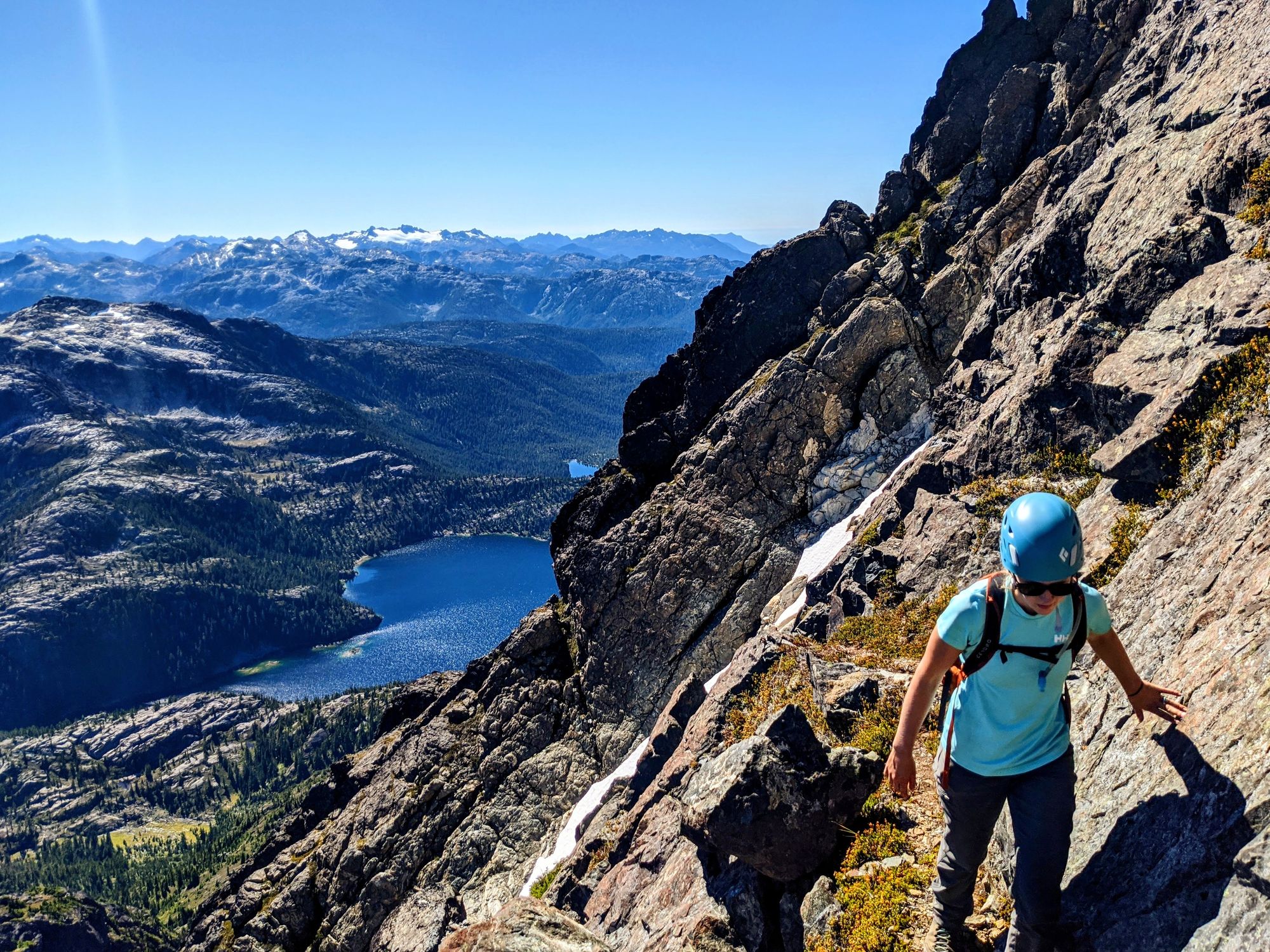
Our detour traversed right across the face of the mountain, perilously exposed on a small shelf of rock. After a 50m traverse, we entered yet another gully that took us further up the mountain. Unbeknownst to us, it angled back towards the main gully, and at the top of this climb we were able to take a quick 10m traverse back to re-enter the main gully.
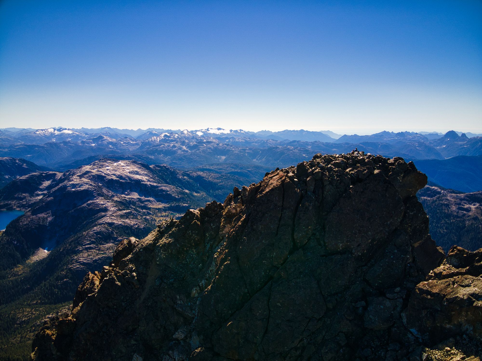
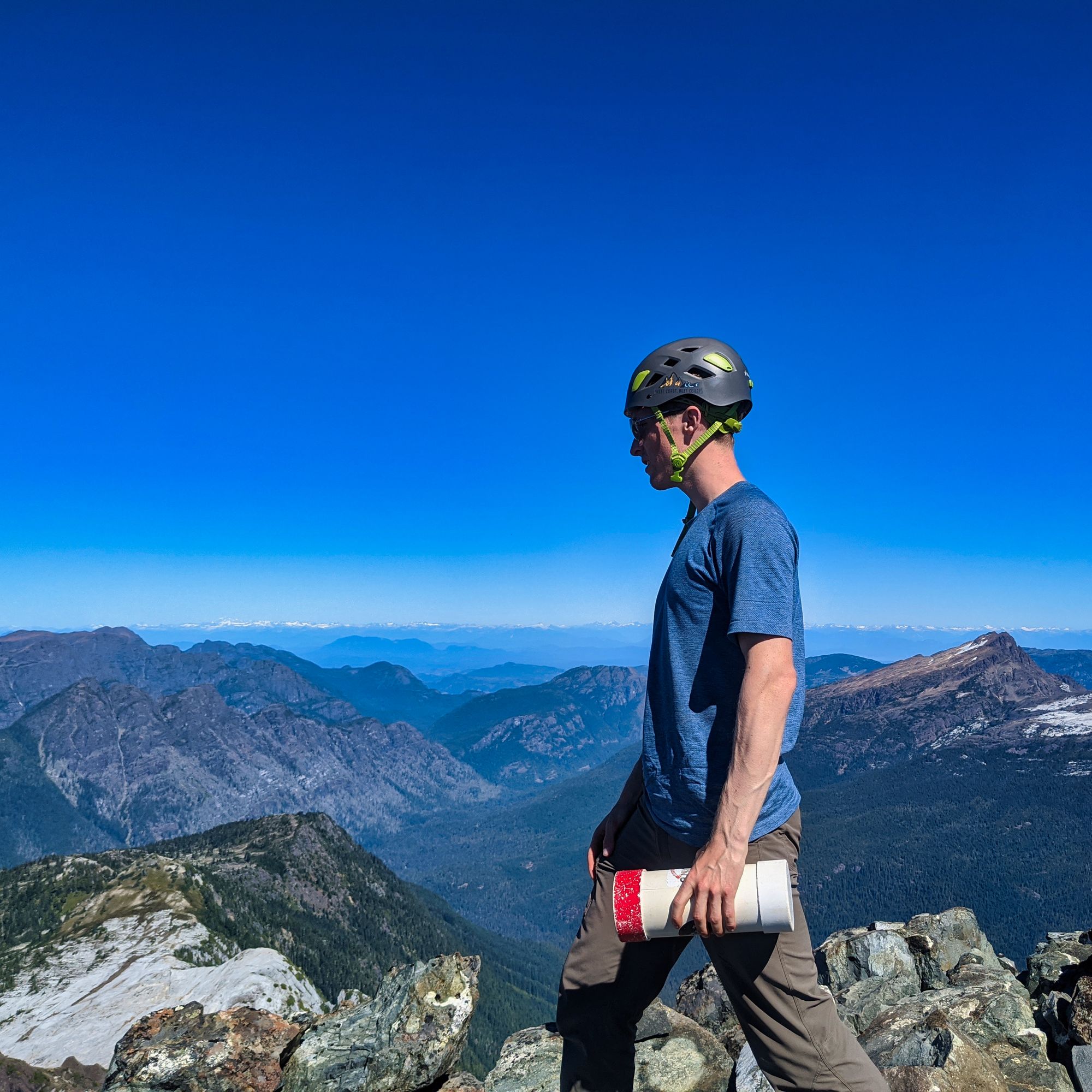
Back in the scree of the main gully, we resumed the normal route up the Hinde. The main gully fed up and into a smaller gully that took us into the "amphitheater", where the summit burst back into view! Ascending the right face of the amphitheater, we cleared the upper edge to be shown an easy Class 2 climb up to the summit itself. Minutes later, we were there!
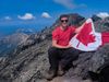
We stayed on the summit for the remainder of the hour, reading the register and taking in the awesome view. Words can't explain, so look at our photos:
At 2pm, we hit our "bug out" time and geared up for the descent down. Each taking a single pole in hand, the scree was far kinder on the descent. Wasting a half hour after missing our detour gully, we had to up-climb back to the shorter traverse to bypass the snow field. Thanks to our GPS mapping from the ascent, we eventually found the correct traverse and continued our descent.
The down climbing seemed to go quickly after that, and we soon found ourselves popping out of the bottom of the gully system. Getting out our second poles, we descended the scree fields easily and were quickly back into the meadows. It took us a few minutes to locate the gully leading down off the southeast ridge (remember the one we said would be tricky to find?), but soon we were back in the south bowl and cruising down the scree.
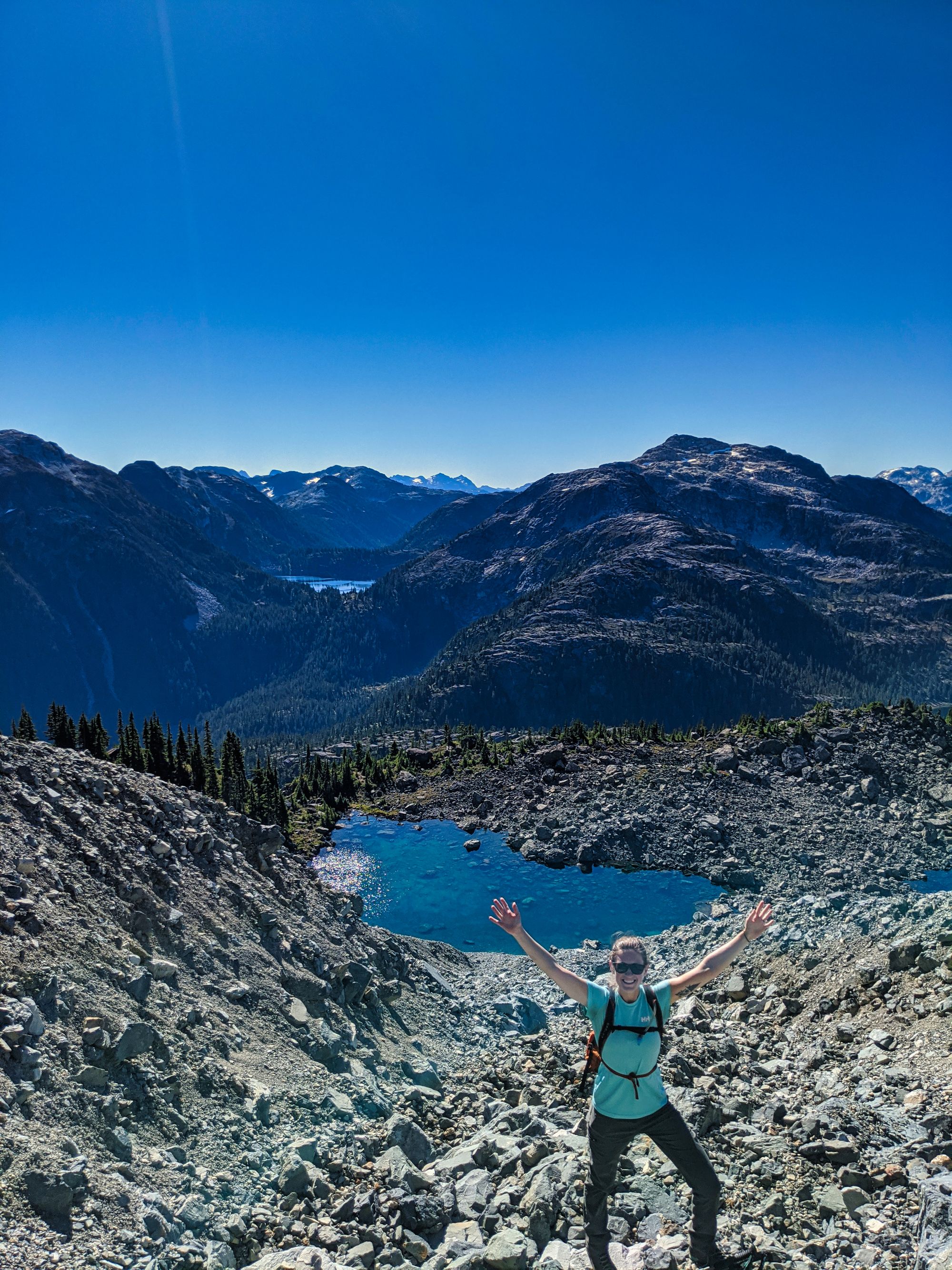
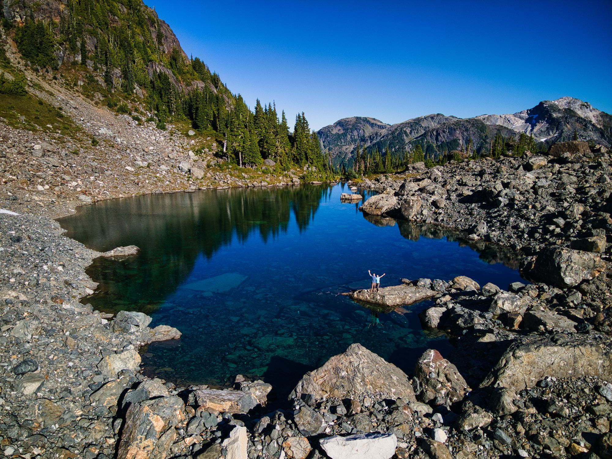
We got back to the bowl at 4:15pm following our summit, and Ryan took a much-needed dip in the clear meltwater pond. We haven't mentioned yet, but it was easily 30 degrees C this day, and we had no shade for the better part of it. Partway along our descent, before getting back to the tricky-to-find gully, Katie completely ran out of water, and Ryan was not far behind. In hindsight, we should have re-filled our water in the bowl before continuing to the summit that morning.
We departed the bowl at 5:30pm after refilling our water. We descended easily, the smooth ridgeline no comparison to the slopes we had down-climbed hours earlier.
Passing through the chasm, our descent ended and tired legs slowed our pace as we began the climb back up several hundred meters to our descent point on Burman Ridge. Stopping only briefly to chat with another group of hikers on the trail we raced home, supper weight heavily on our minds. The sun, falling low in the sky to our right, beat down on us as we climbed, feeling hotter than it did all day. We eventually made it to the descent point near Schjelderup Lake, and dropped into the merciful shadows behind the ridge.
Almost precisely 12 hours after we left, we made it back to camp. Hungry, thirsty, and utterly exhausted, we made a quick supper and crashed into bed. What a day.
For both of us, this was our first Alpine Club of Canada Island Qualifier (IQ) for the books! What an amazing day, we learned tons and pushed our personal boundaries. We can't wait to be back in the Alpine!
Day 5: Schjelderup Lake to Camp on Phillips Ridge, 6.8 km
We had a lazy morning following the previous day's summit, and departed camp at 11:40am under the sweltering sun. We took our time weaving around the shoreline of Schjelderup lake, taking care crossing the rockfall sections.
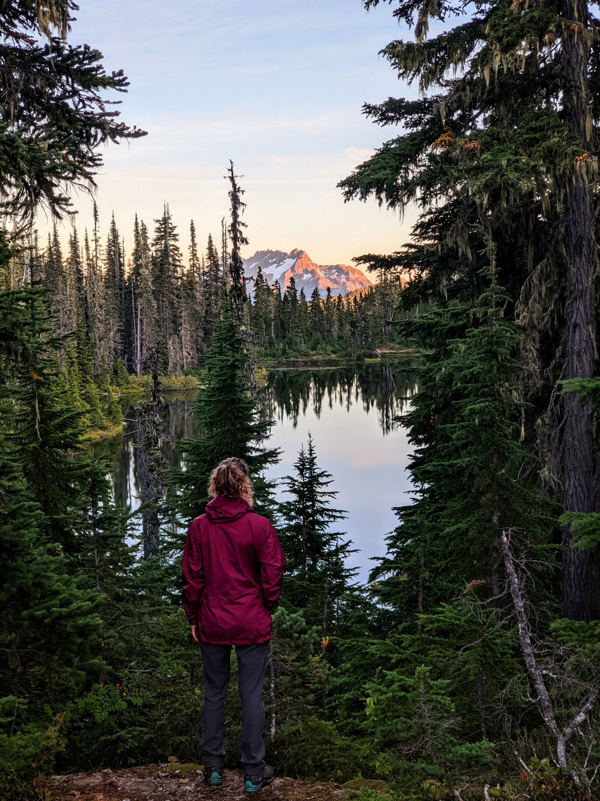
On the south end of the lake, we took out the drone for some photos. The wind was finally calm, lending stillness to the lake which afforded us a perfect reflection of the Hinde in its green-blue waters.
We quickly found ourselves back at Carter Lake, and snapped a few more photos as we skirted the shore. A quick lunch break in the shade at the south end of the lake had us fueled up and ready for our next section of climbing - we had to face the dirt chute again to regain Phillips Ridge. Aside from sadness, the dirt chute brought us one other thing: shade. We entered the darkness just after 2pm.
The shade was somewhat pleasant, though it was no match for the hot sticky air that stifled us as we climbed. The trees completely blocked the pleasant breezes of the lakeside, and we sweat hard as we fought for every step up the dirt chute. Eventually the thickness of the air lessened as we neared the open ridge. Finally we escaped the dirt chute and regained the top of Phillips Ridge at 3:30pm!
Shade on the ridgeline was scarce and the hot afternoon sun beat down on us as we ascended its spine. The cool breeze was a very welcome change, though. Up and over high points, we climbed and descended.
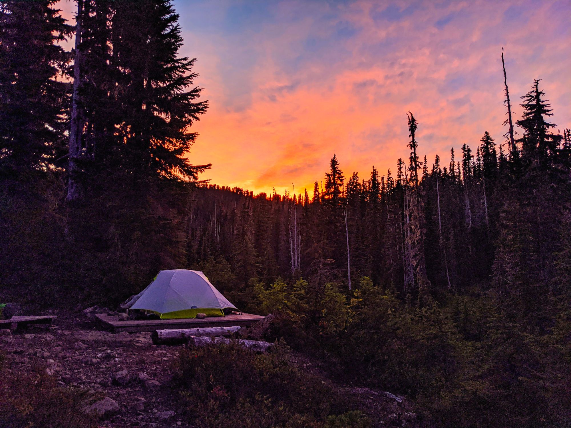
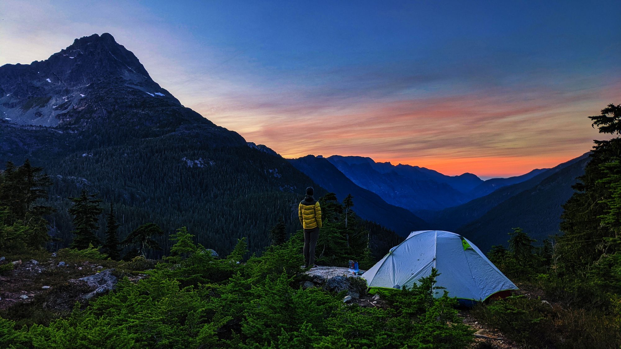
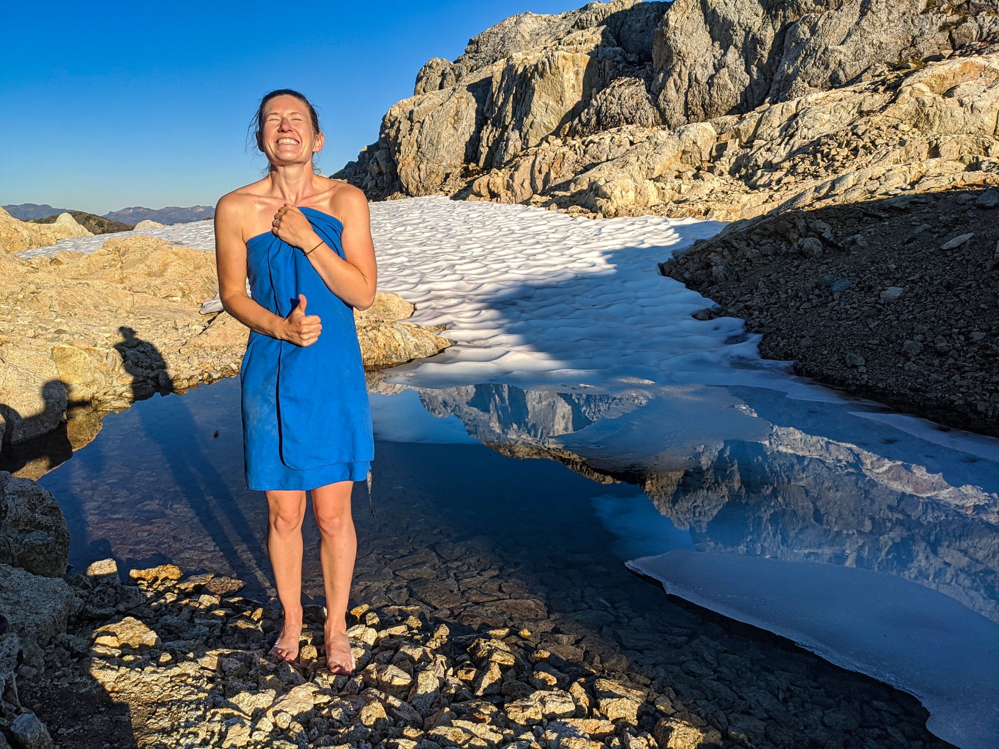
We stopped to refill our dwindling water in a small stream below a larger snow field, as the inescapable heat had us drinking constantly. Shortly thereafter, we found a nice spot high on Phillips Ridge to pitch our camp. With the tent tucked into a small sheltered nook, stunted trees and juniper bushes gave us slight shelter from the sun and wind (if there was any). In the evening sun, we had to reacquaint ourselves with bug spray, as the air was calm but the mosquitoes were not.
We were lucky to be just around the corner from a melting snowfield complete with icy pond. The freezing pool provided us with what water we needed for dinner, and for a frigid sponge bath to rinse the sweat off.
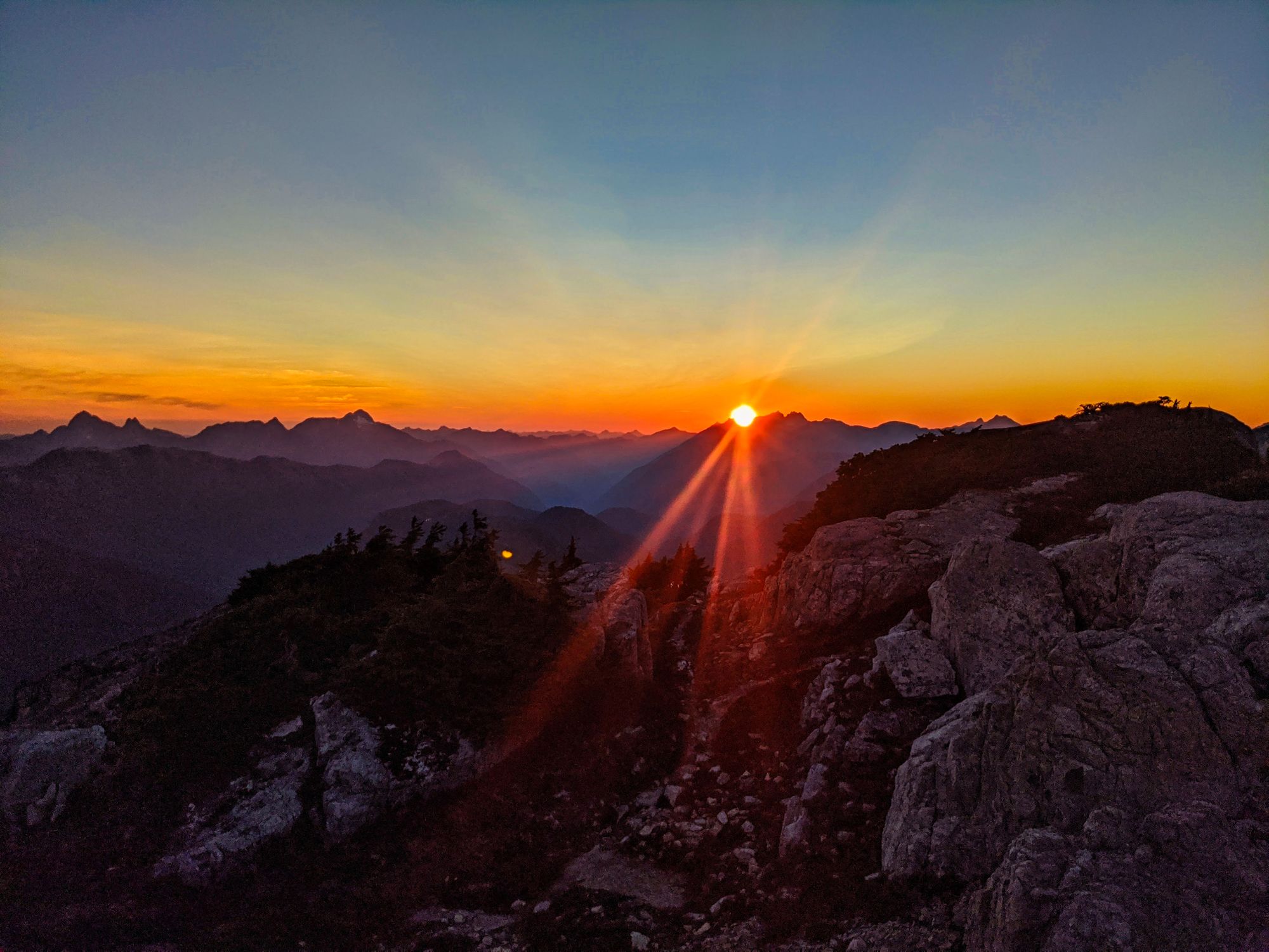
We cooked up a late dinner and ate as we watched the sun go down from a high point. Unbeknownst to us at the time, the Island was beginning to be blanketed in smoke from the wildfires blazing in Washington and Oregon. Although devastating, the smoke lent itself to one of the most beautiful, burning sunsets we have ever seen.
Day 6: Phillips Ridge to Trailhead, 14.6 km
We hit the trail at 9:30 a.m. and followed its meandering path up and down the knolls of the ridge. 25 minutes later we paused for a quick breath and a photo at the highest point on the ridge; also known as "Peak 1732" for its elevation, it is about 10m taller than Mt Phillips, which we hiked last year. Along our way we passed a few tiny glaciers on the north-facing sides of the ridge, many meters below our path.
Eventually the ridge turned eastward, bringing us some relief as we knew that our path was all downhill from there. The wind that had wailed across the ridge just days before was today but a whisper. The mosquitoes took full advantage and swarmed every time we took a pause. Shade became sparse as the sun rose higher.
We stopped for a snack just before 11. Shortly thereafter we zipped down the slightly shitty descent that had been our toughest climb on day two. The miles passed by in a flash as our chit-chat distracted us while we descended the ridge. In no time we were off the ridge and found ourselves walking through sub-alpine meadows as we neared Arnica Lake. We arrived at 12:30pm, the lake bringing a taste of victory - and of lunch.
We had a quick dip in the lake to refresh and wash off sweat before eating our tasty tuna lunch. Setting off from the north side of the lake at 1:15pm, we hoped to be back to the car by 3:30.
We followed the trail around and beyond the lake, down through meadows and on to the switchbacks. We scampered down the hillside at lightning speed, making it back to the parking lot only minutes after 3:00pm. Man, did it feel good to get those boots off!!!