Mount Albert Edward & the Castlecrag Loop
The last 3 days of our 9-day Strathcona adventure brought us to 3 summits: Mt Albert Edward, Mt Frink, and Castlecrag Mountain in a single-day loop.
Route Outline
| Difficulty | Moderate |
|---|---|
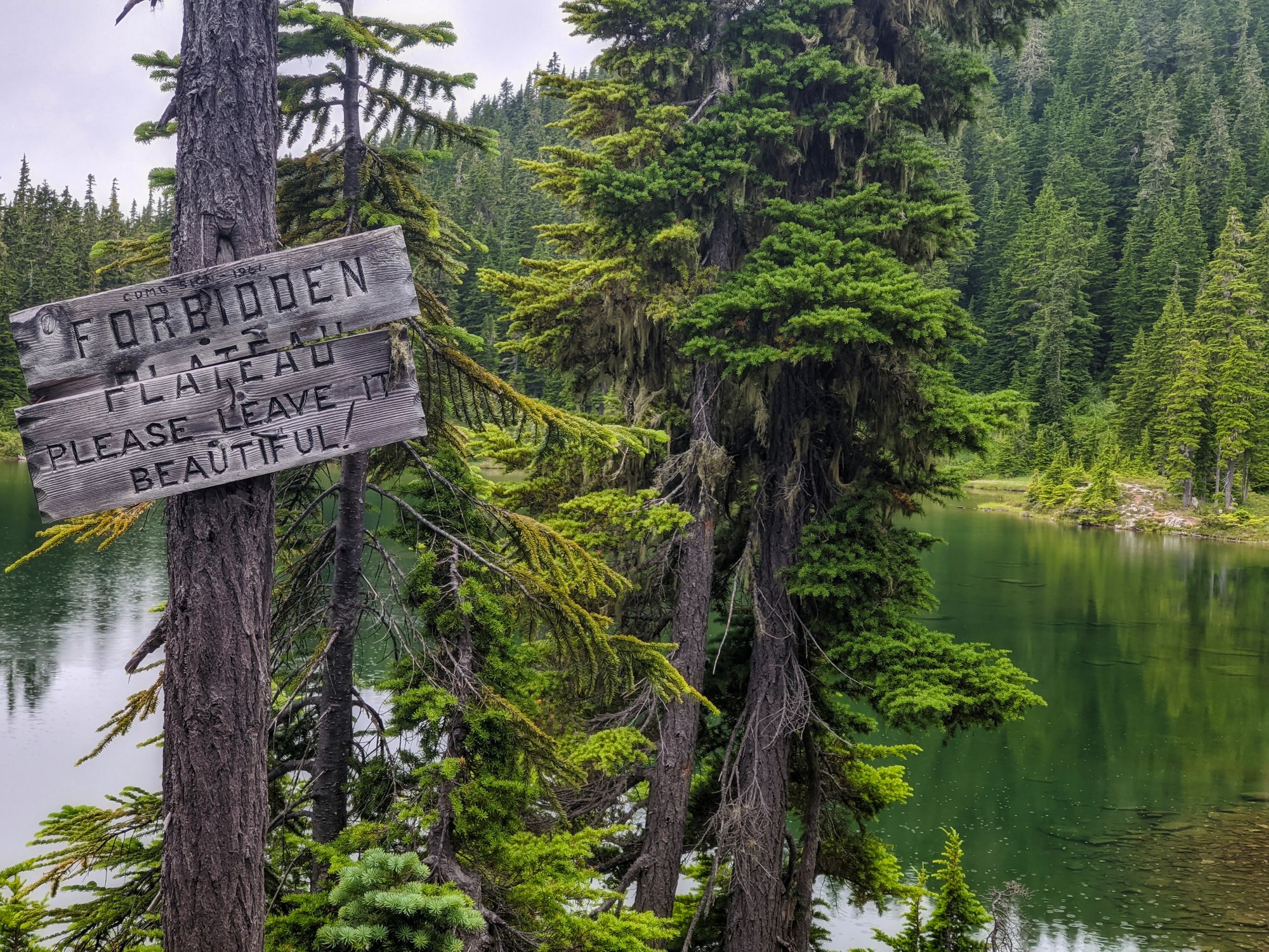
| Synopsis | The Forbidden Plateau area is a popular location for day hikes and overnights due to its accessibility from Mount Washington. As the sixth-highest peak on the island but requiring no technical skills to summit, Mount Albert Edward is a significant draw for a lot of this hiking traffic. With its iconic triangular profile, it is a landmark for the area. The Castlecrag Loop is another excellent hike, but far less busy due to the increased distance and requirement for route-finding. This loop is easily done in conjunction with an early morning or late evening summit attempt on Albert Edward, depending on your direction of travel. |
| Getting There | From Victoria, follow Highway 19 north for around 200 kilometres until you reach the Comox Valley. After passing by Courtenay, the left turn onto Strathcona Parkway is quick to follow. Continue for 17km, then turn left on Nordic Drive. A further 2.5 kilometres takes you to the Raven Lodge, which serves as a trailhead for the Forbidden Plateau area. Ample parking is available. |
| Facilities | Outhouses at all campgrounds. |
| Fees | $10 per person, per night. |
July 31 - August 2, 2020
Trip Report
Day One
Trailhead to Circlet Lake, ~9km
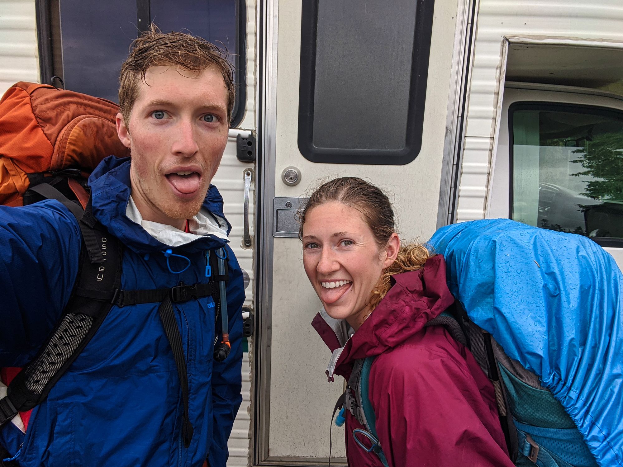
We camped in #GloriaRV in the parking lot at the Raven Lodge on Mt Washington the night before, in anticipation of getting an early start on Friday morning so we could get ahead of the long weekend traffic rush.
We departed the parking lot before 8am amidst quickly arriving groups of hikers. The wide, flat trail lanced through the trees, allowing us to walk side by side as we cruised through the lovely sub alpine meadows. Wooden boardwalks carried us along great lengths of the trail, sometimes giving way to some earthy sections which were just as wide and easy to walk on. The trail continued in this fashion for about 45 minutes, and made for easy and fast hiking along this first stretch. It took us less than an hour to reach Lake Helen Mackenzie, at the 3 kilometre mark.
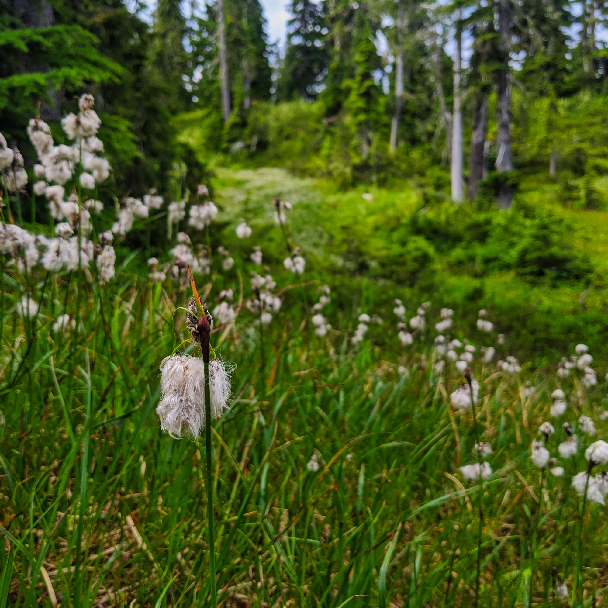
We turned westward at the fork, following around the northern shore of the lake. The boardwalks began to show signs of damage and the trail quickly got rougher, with roots to step over and patches of thick mud to pick our way through. Our pace slowed, as we had to navigate over and around obstacles on this far more technical section of terrain. As we passed the south end of Lake Helen Mackenzie, the trail steepened into switchbacks. We rose swiftly, and the lake soon became visible behind us. The forested slopes edging the lake soon cleared, opening again into lovely sub alpine meadows, dotted with flowers.
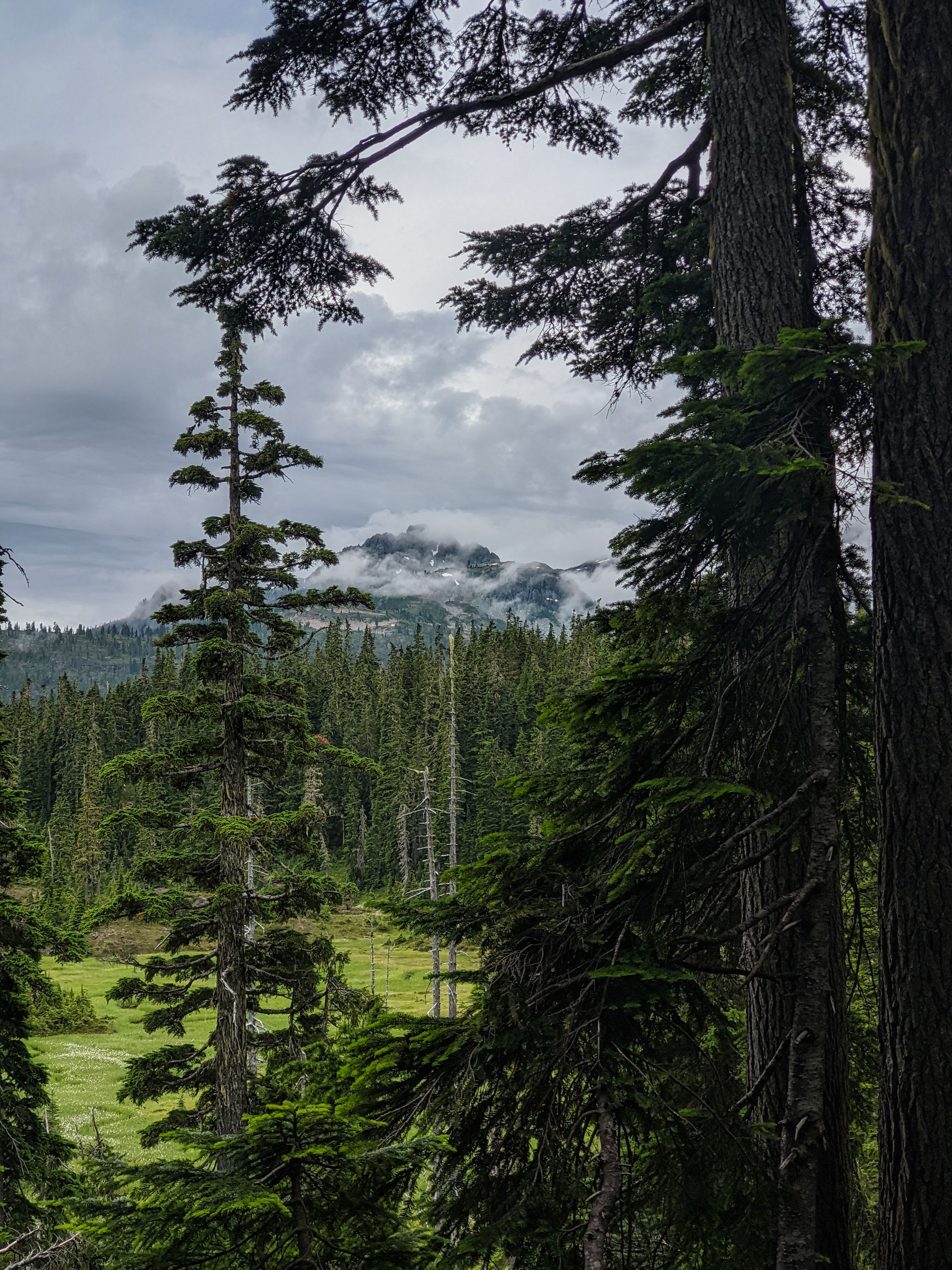
Once we had cleared the saddle between Mount Allan Brooks and Mount Elmo, the trail surface returned to hard-packed, smooth, and relatively flat. Views of snow-capped mountains started to peak out of the trees to the southwest, as we passed the Ranger Cabin at 9:35am. Ten minutes later, we reached a fork where we took the right to Circlet Lake. From there, the trail quickly climbed and we hoped for good views of Mount Albert Edward ahead. Along the trail we came across a sign for Hairtrigger Lake, and decided to take a short detour to check it out. Less than 100m down the trail, we reached the Lake. The waters of Hairtrigger broke the tree line enough to provide gorgeous views of Mt Frink and Albert Edward.
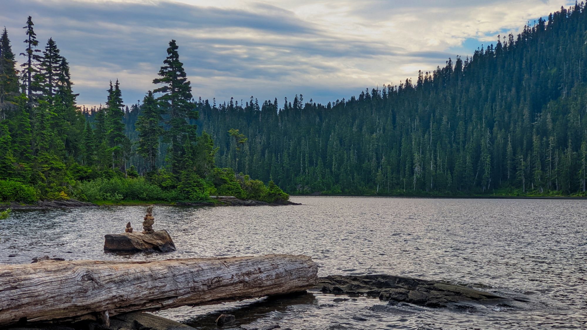
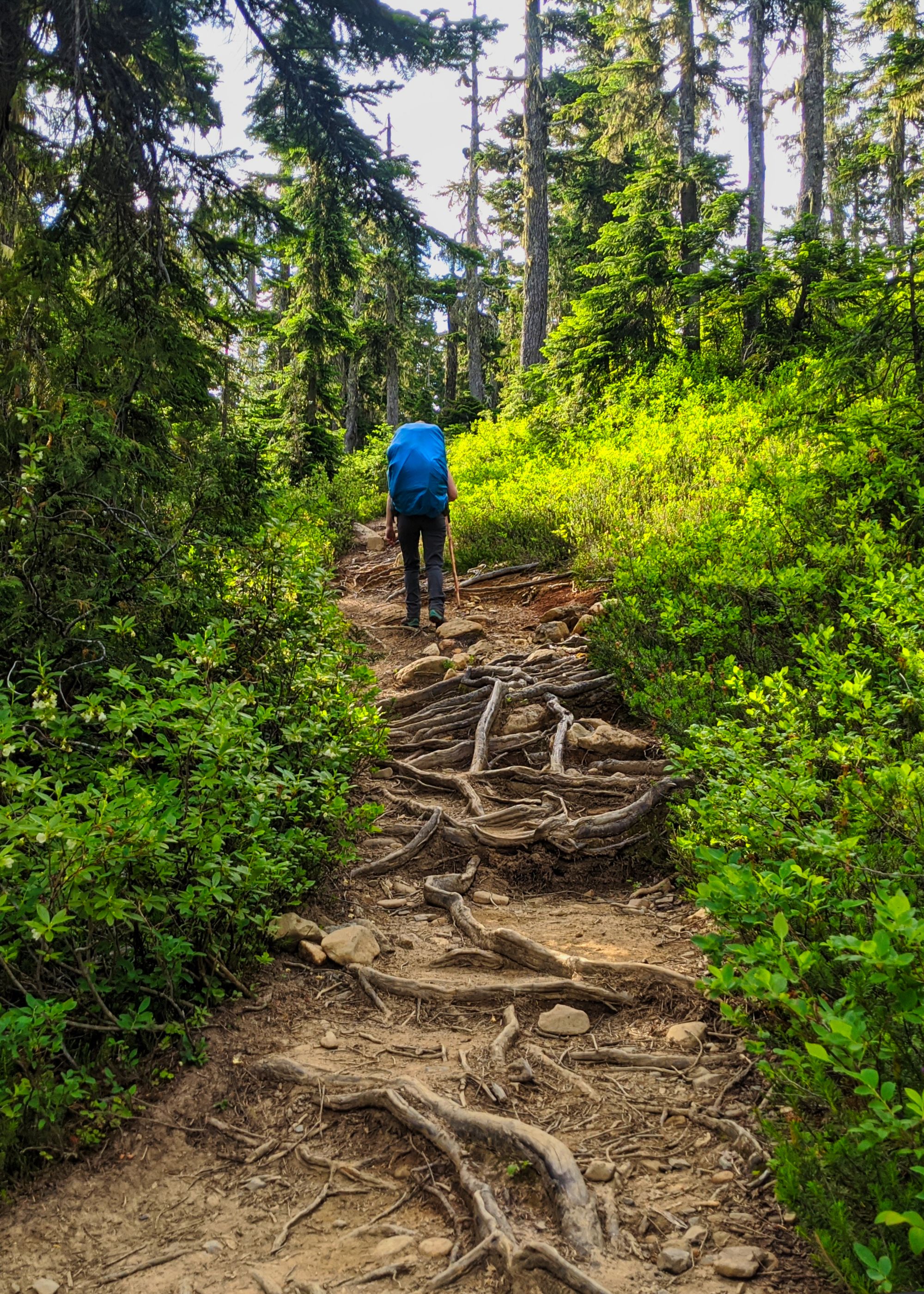
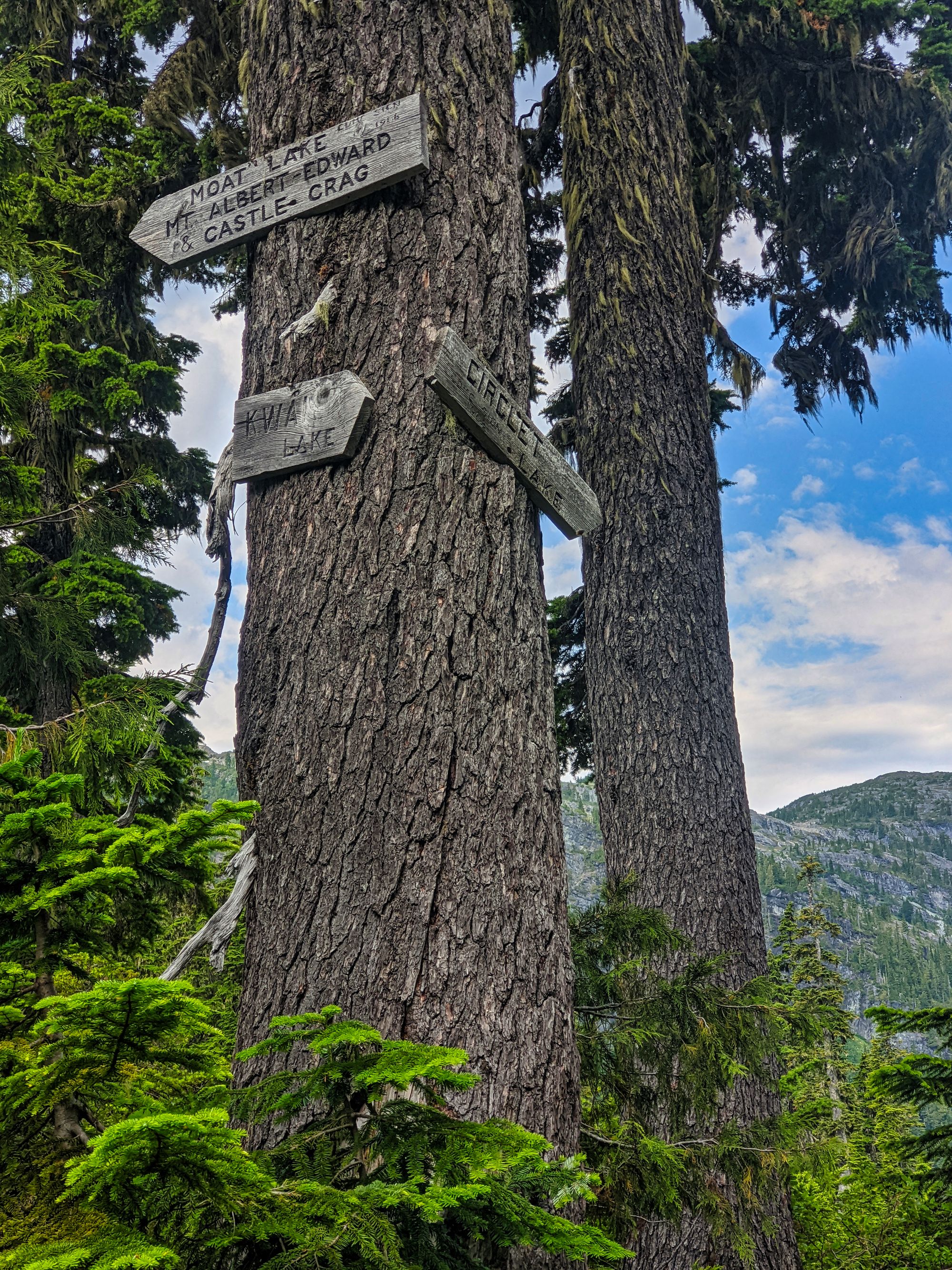
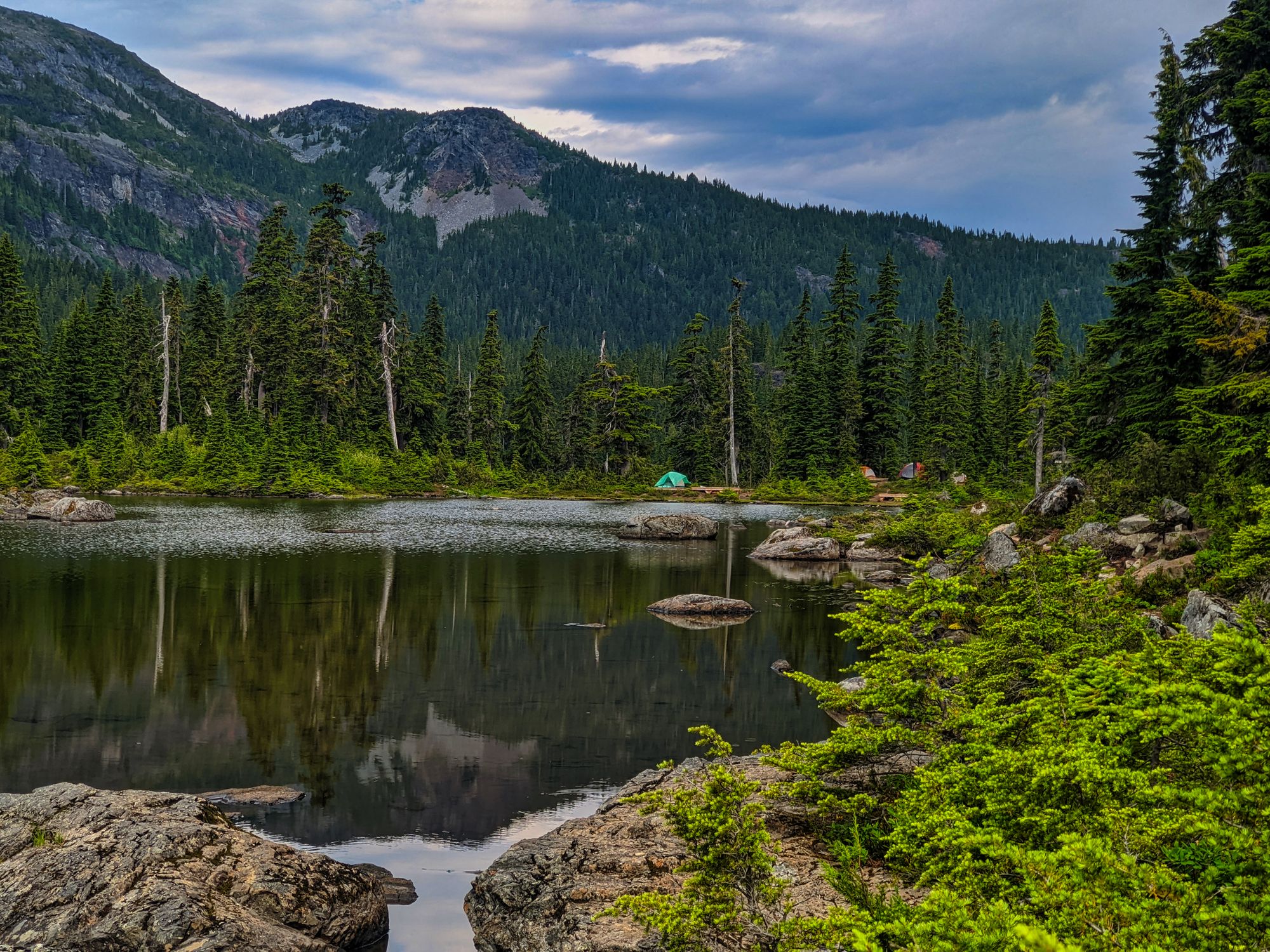
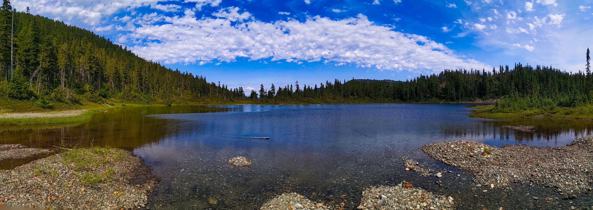
We headed back to the main trail and carried on towards Circlet. As we progressed further towards our destination, we found the trail getting rougher and rougher (for Forbidden Plateau standards, at least) as we moved further from Mount Washington. It ranged from dry, flat, and dusty at high points to literally walking down a creekbed at low points. The flat, wide boardwalks and trails of the Centennial Circuit were long behind us! As we crested a small hill, we saw an old wooden signpost up in a tree marking Circlet Lake in one direction and Mt Albert Edward in another. Just past this sign was a small body of water; it was only 10:40am, could we be at Circlet Lake already? This lake looked a little small and uninviting... But upon inspection of a posted map just ahead, we determined that we were in fact on the shores of Duck Pond, and Circlet Lake was another couple hundred metres ahead. No ducks were anywhere in sight, but there were a number of tent pads - about half of them occupied. According to the next map we found, the camping along Duck Pond is marked as overflow camping, only to be used when all the sites on Circlet are full. Not believing that all the sites could be occupied already, we continued past the pond to the much larger and more inviting Circlet Lake. There we found multiple unoccupied tent pads, and snagged ourselves the pad closest to one of two docks along the lakeside. About the time we finally decided on this site, the clouds that had been lingering over us all morning also made a decision: to give us a good shower. We hastily put up the tent and tarp, and by the time we were done so was the rain. For the next couple of hours, we slowly set up the rest of our camp, purified our water supply for the next few days, and played a game of crib.
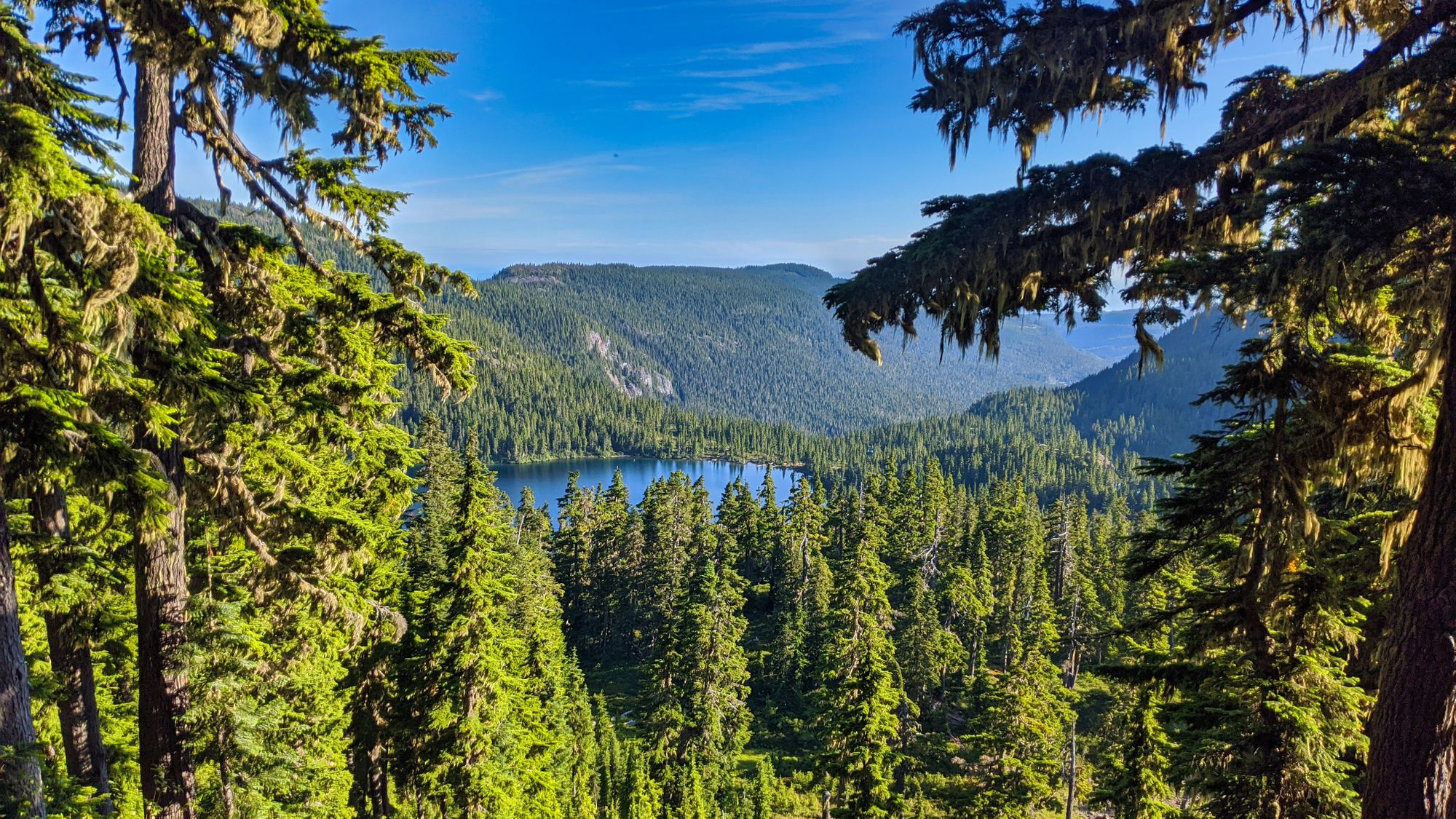
At a friend's suggestion (thanks Kevin!!!) we spent the afternoon looking for Amphitheatre Lake, supposedly only 1.5 km away. With no GPS tracks and little-to-no information on the trail sign, we decided to "WAG" it. The track, while slightly booted in, was hard to follow at times as it twisted around Circlet Lake and up the mountainside. We pushed through brush, crossed a couple of creeks, and stepped under deadfall - this unmaintained trail was very different from that leading to Circlet. Nevertheless we persevered, picking our way along through sub-alpine meadows and around small ponds, the bustle of the campsite at Circlet Lake soon forgotten.
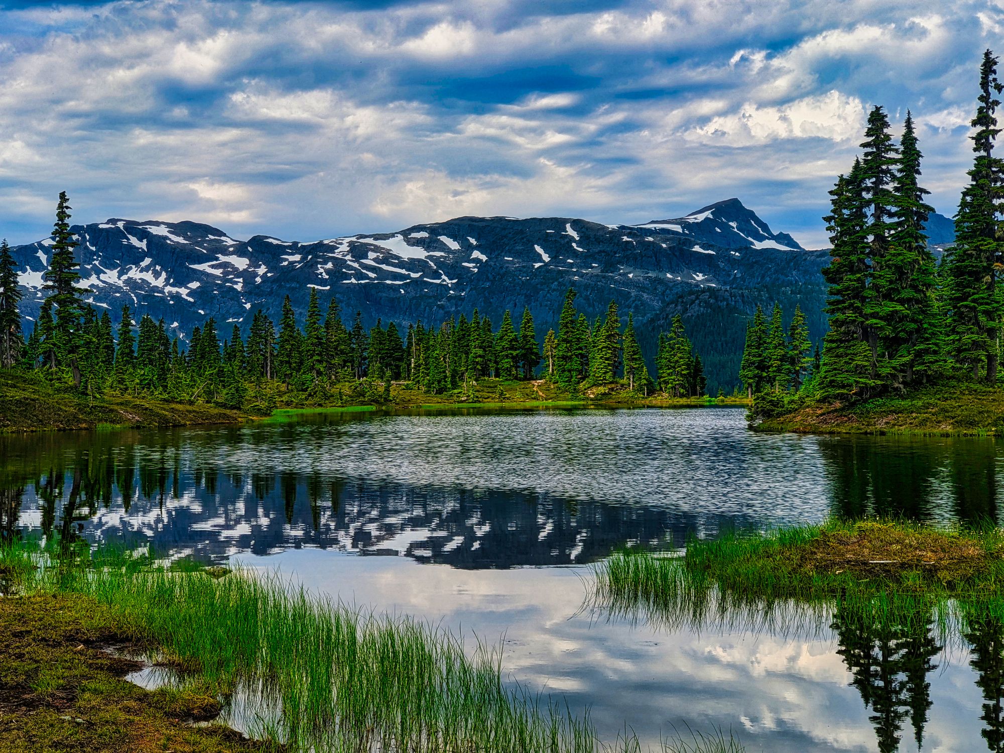
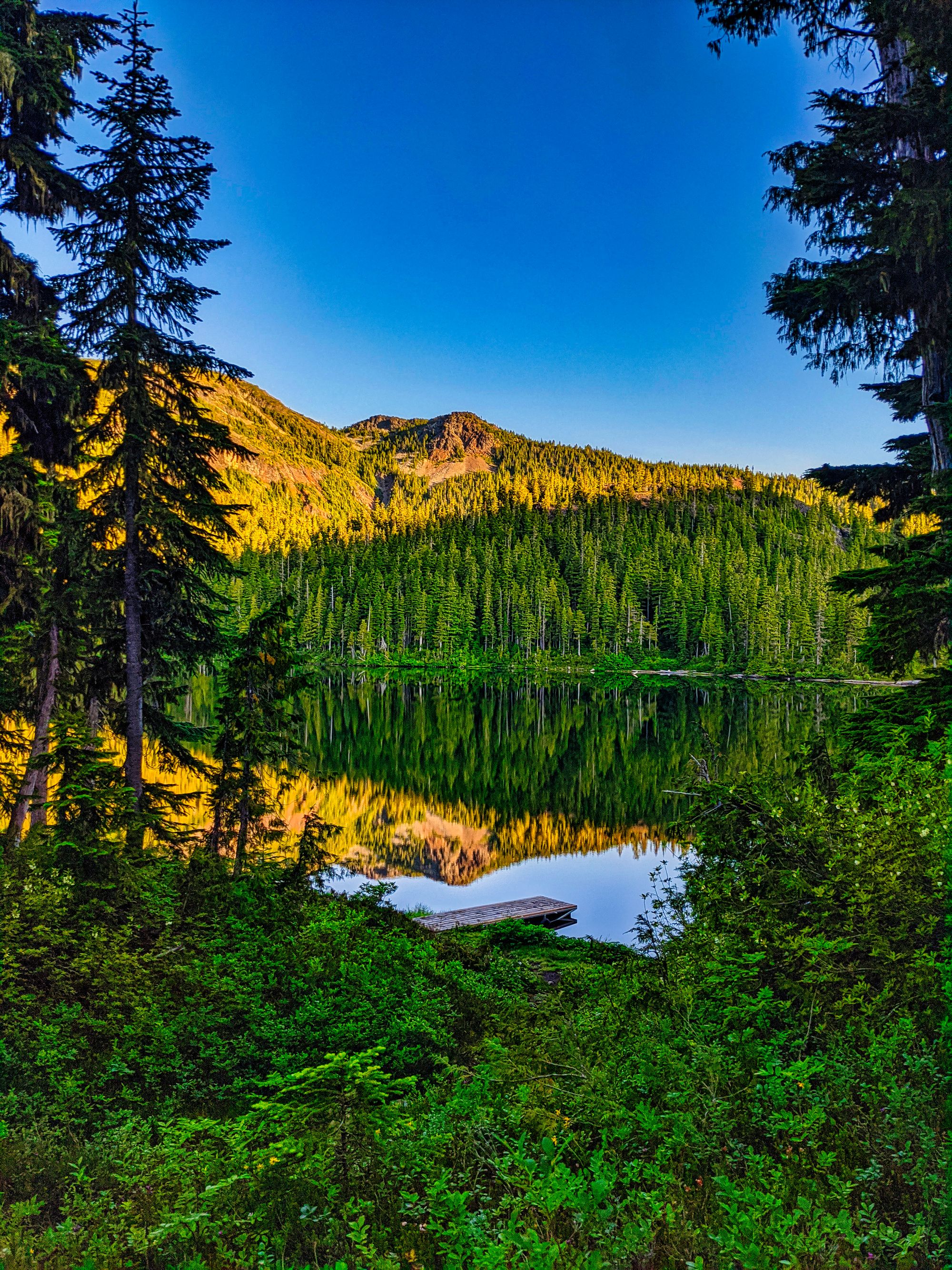
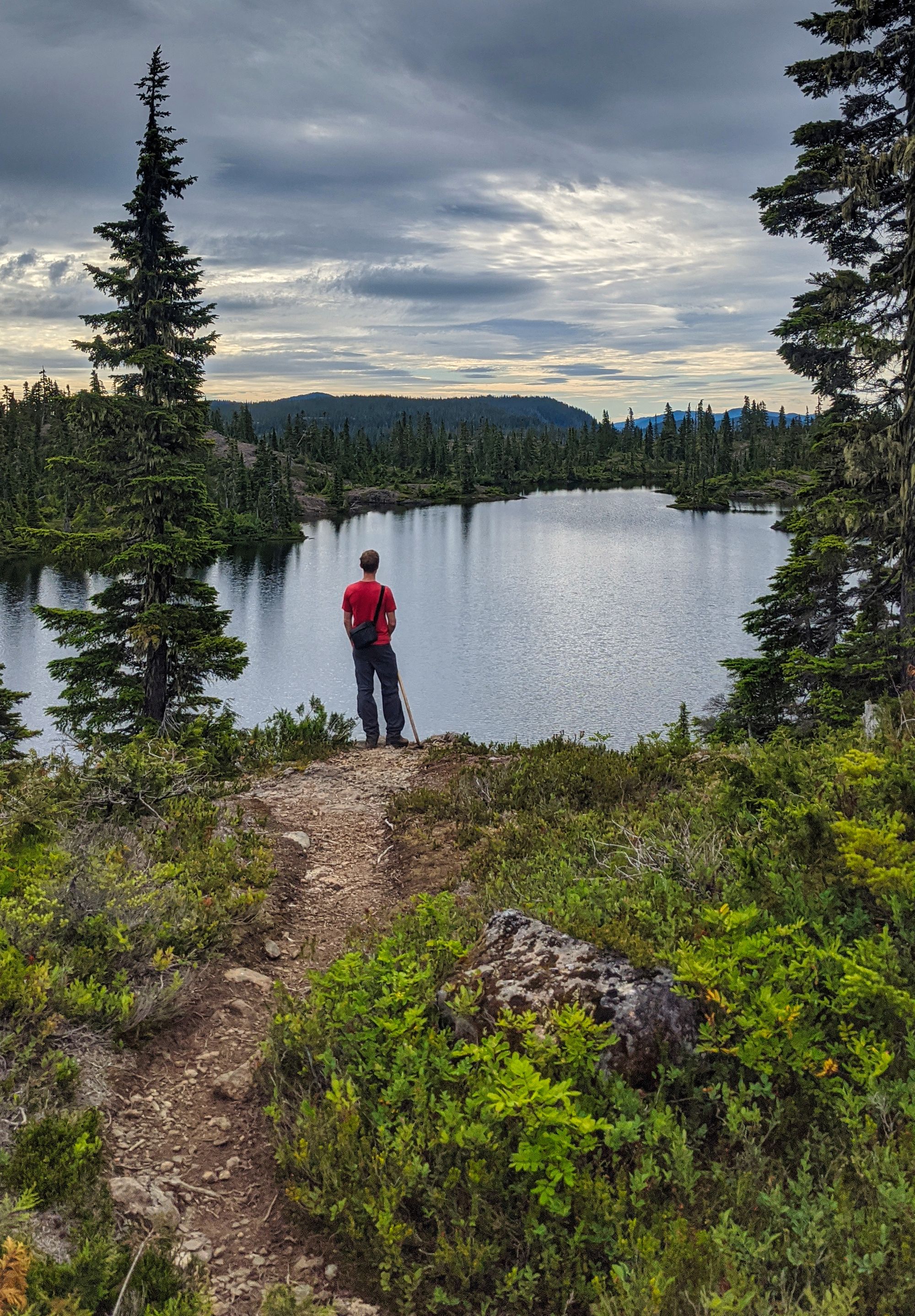
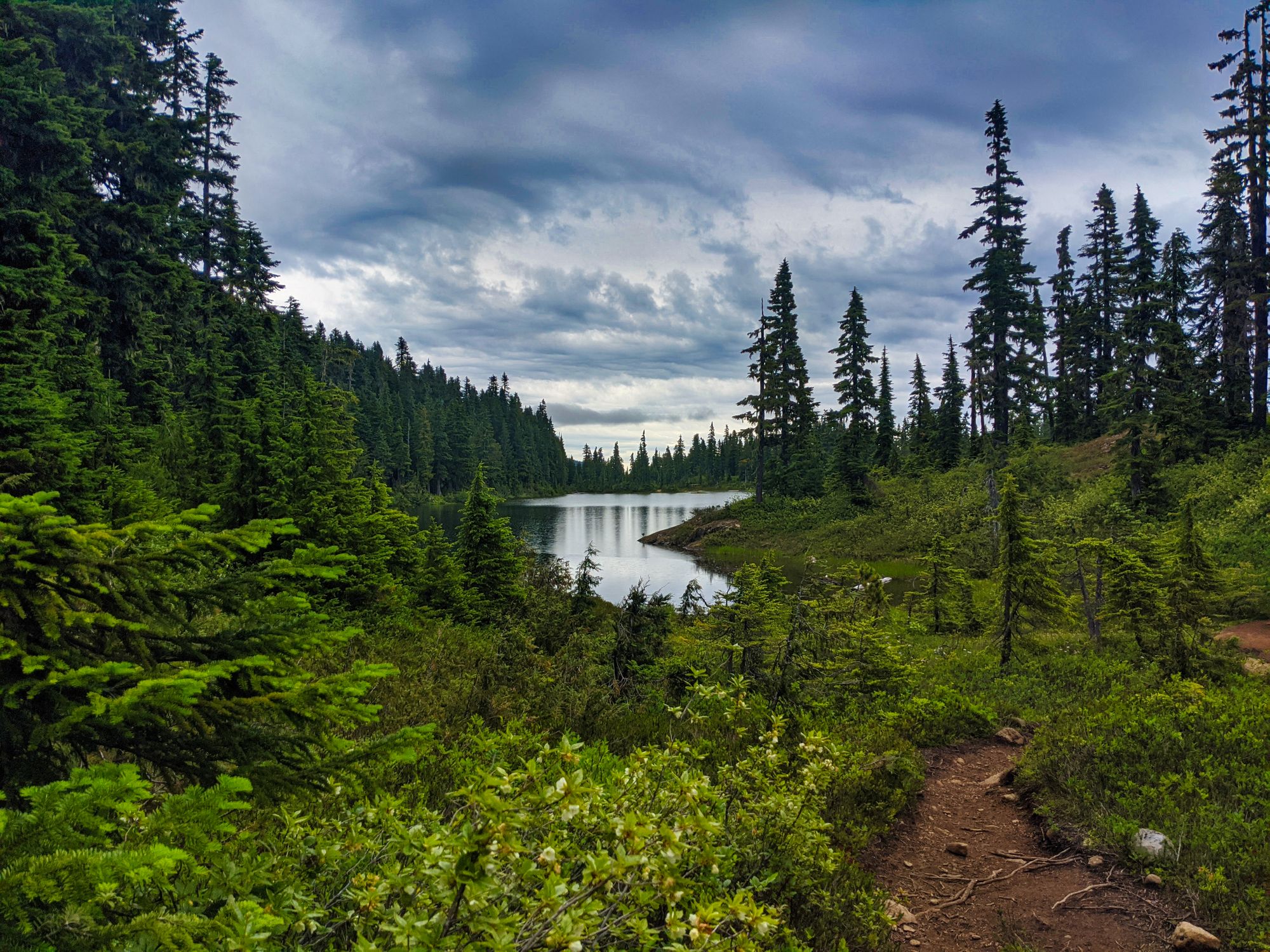
The trail started to break out into separate tracks as we reached a flat point to the northwest of Circlet Lake. We carried on as best we could, knowing that the lake should be to our right side. We soon reached a cairn in the middle of the trail, and turned to take the path to the right. Our decision was rewarded, as we soon got our first glimpse of Amphitheatre Lake through the trees. As we drew near to the lake the terrain opened up, with flat meadows surrounding the lake on most sides and only a few stunted trees along its shoreline. The trail petered out there, and we found ourselves a nice place on a gravel bar next to the lake. Lucky for us, it looked like we would have the place to ourselves!
The lake itself had rusty-coloured rocks where the water was shallow, with more blues showing in the water as the lake deepened. We relaxed, swam, and took time to enjoy our books until the sun became obscured by clouds and we began to grow cold from the wind. We retraced our steps to Circlet Lake, getting back to the campsite in roughly 35 minutes, a mere 5 minutes faster than our ascent. We were unsurprised to find the camping area at Circlet Lake had quickly filled up. Nearly (if not all) of the pads next to Circlet were filled, with the pads up at the Duck Pond getting near capacity as well. We knew that we would have to make an early start of it in order to have Mt Albert Edward to ourselves, so we ate dinner and went to bed early.
Day 2
The Castlecrag Loop, ~20km
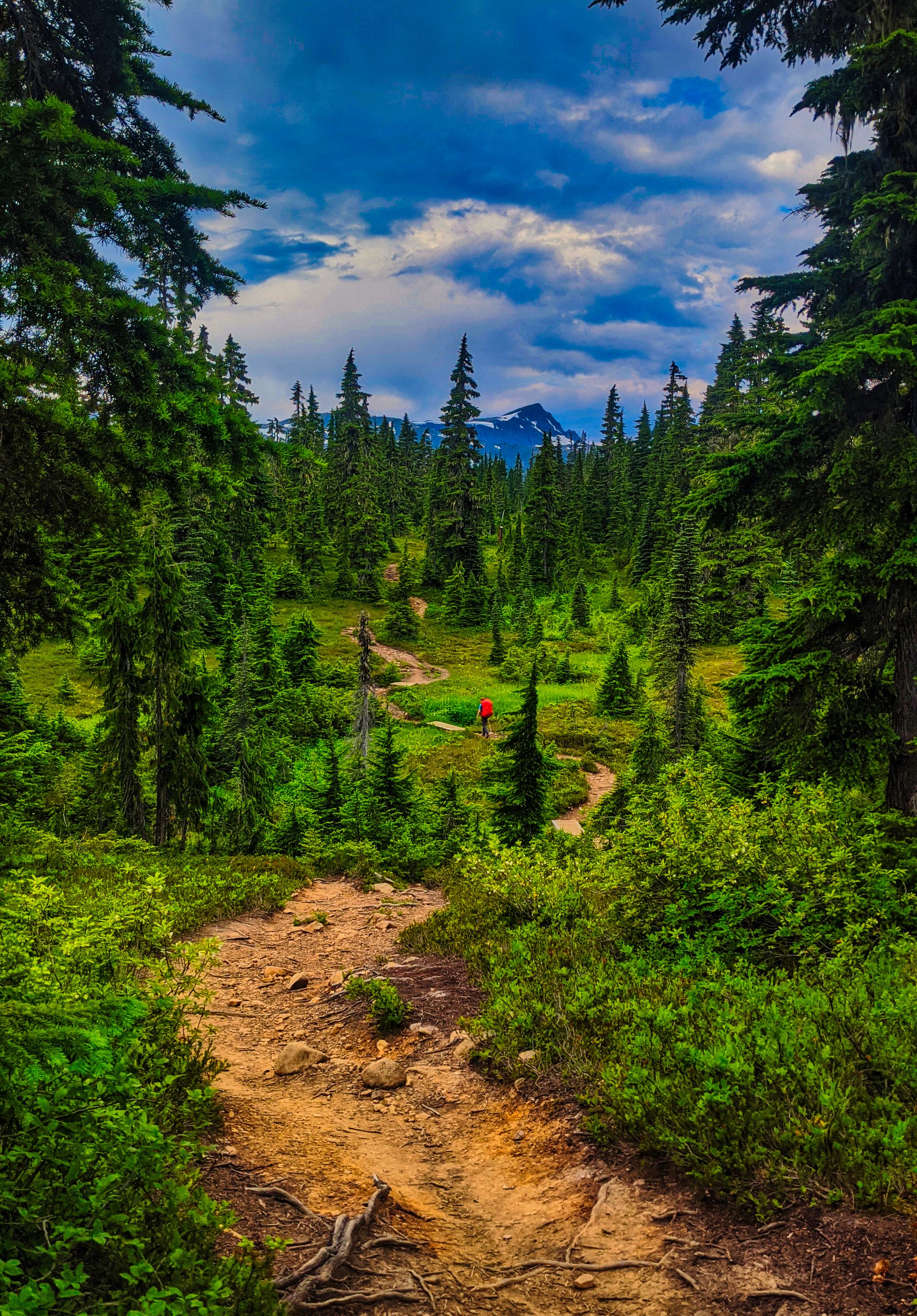
We rose early anticipating a 17km+ hike up and down three unique summits. The air around us was cold as we rose, the sun still too low to start warming the bowl that surrounded Circlet Lake. We ate quickly and got going for 7:45am. The trail was damp to start, following a creek bed up and away from Circlet Lake. We soon began to climb in earnest, following an almost direct path crashing up over the high terrain. The trail became dusty and rocky, but dry stone gave us confident grip as we climbed. Views of Circlet Lake began to open up behind us as the sun rose in the sky.
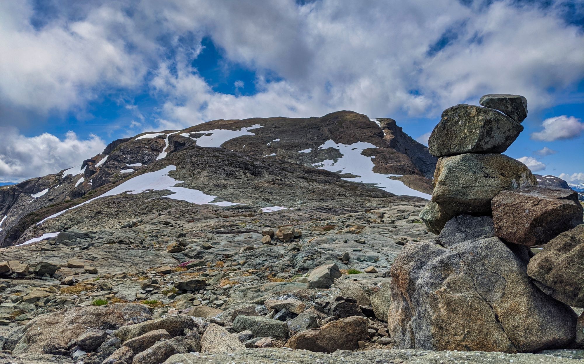
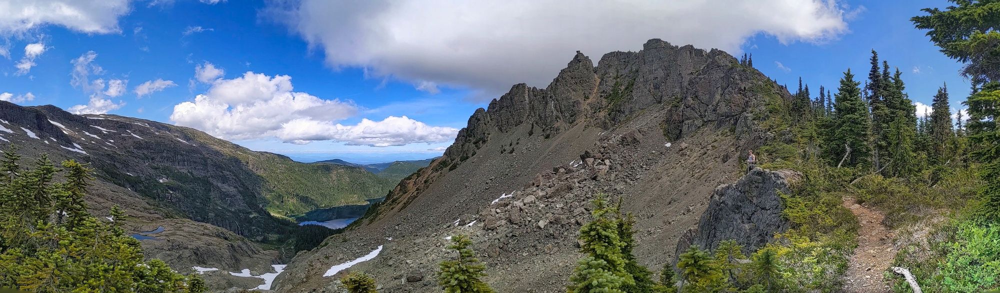
Continuing upwards we started to follow a dry creek bed climbing up the ridgeline, but we quickly spotted a cairn where the path cut off to our right. While the trail seemed to naturally follow straight up the dry gully, this erroneous route leads into a far steeper climb and then a bushwhack to regain the trail; luckily we took the right. Once we had cleared the gully area, we reached a spur below the ridgeline that jutted out between Circlet and Moat Lakes. This nearly alpine terrain had thinned the trees, opening up panoramic views of Castlecrag Mountain, Mt Frink, Mt Washington and towards the Comox Valley below. We hooked up with the well-trodden and well-cairned trail that headed up towards the higher ridgeline and Mt Albert Edward.
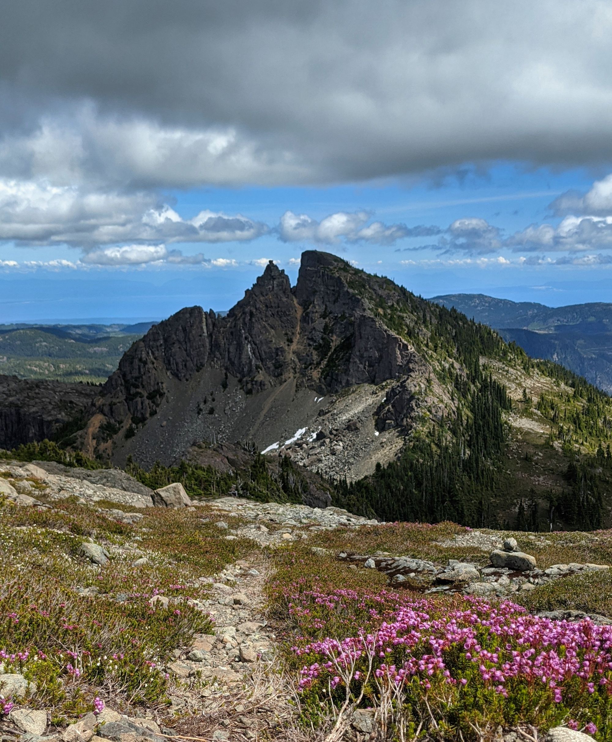
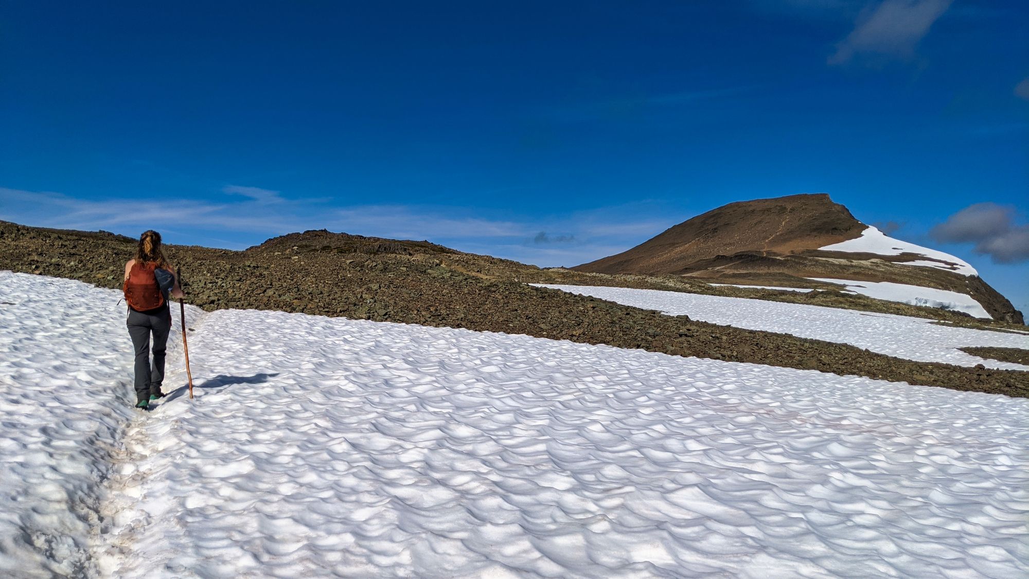
We walked the flat shoulder of the ridgeline for several minutes, marveling at the views around us. Castlecrag was the highlight of the skyline, its bony ridges scraping the sky, drawing far more attention than its higher but more sedate neighbour Mt Frink. Reaching the end of the ridge spur, another steep climb took us across loose rocks and over large boulders, the path far more interesting than the climbs before. Still no technical skills were necessary to ascend the rocky slope. Ascending through 1600m we turned the corner and got our first glimpse of the triangular spire of Mt Albert Edward, and Mt Regan beside it. Our path ahead was now clear; we could easily see the smooth curl of the ridgeline as it approached Mt Frink and then turned westward to ascend to the pinnacle of Albert Edward. Snowfields became more common as we climbed higher on the ridgeline, occasionally with a seasonal alpine pond at their low end.
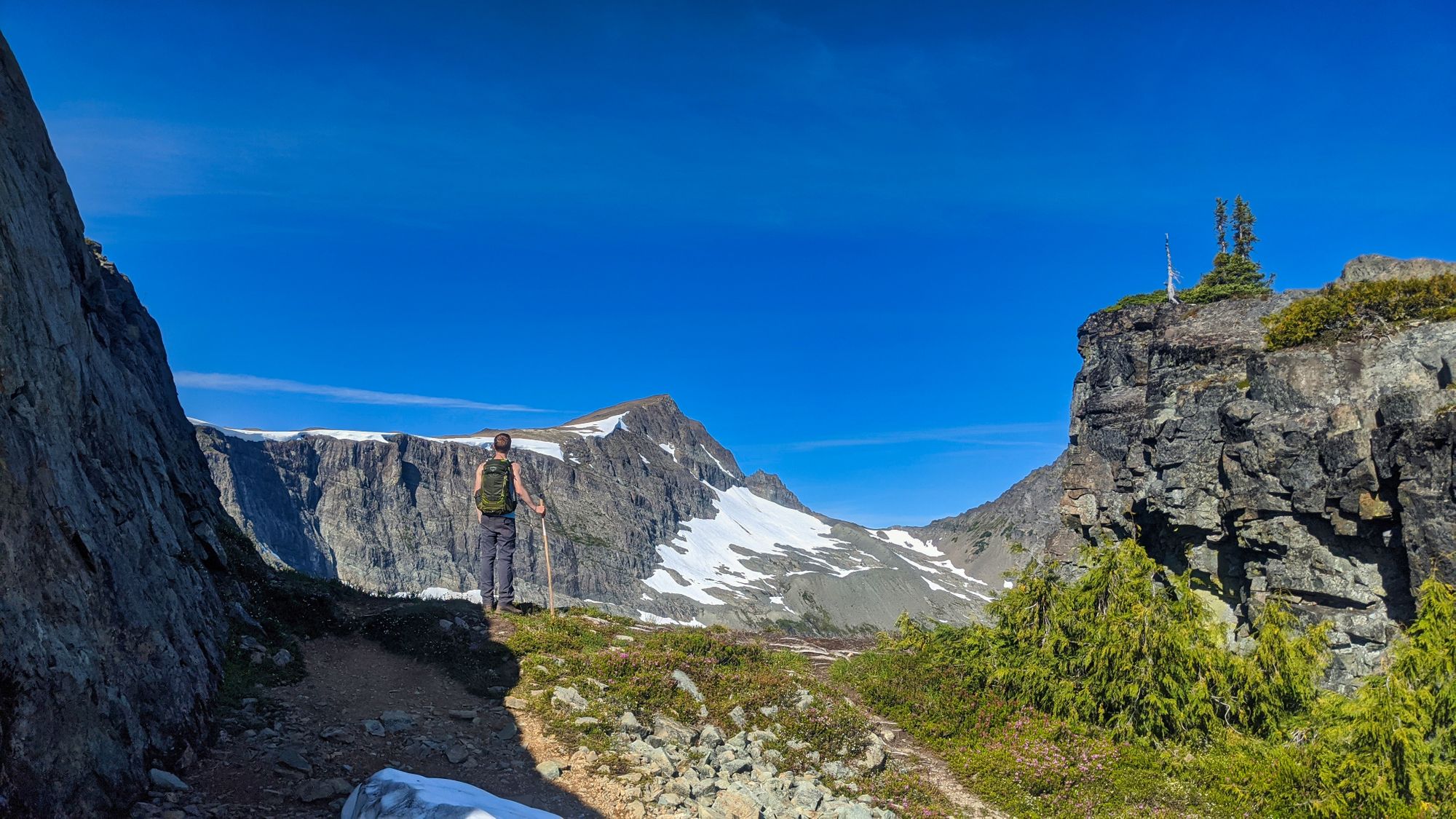
As we reached the point to ascend onto the final ridge of Mt Albert Edward we passed through a choke point where the ridge narrows, which can be very dangerous in winter. The tight, north-facing gully can collect a cornice of windswept snow which can be extremely large and give the impression of a shortcut. Great care must be taken around this area when snow remains as you could be balanced on a teetering snowpack above a several-hundred-foot drop.
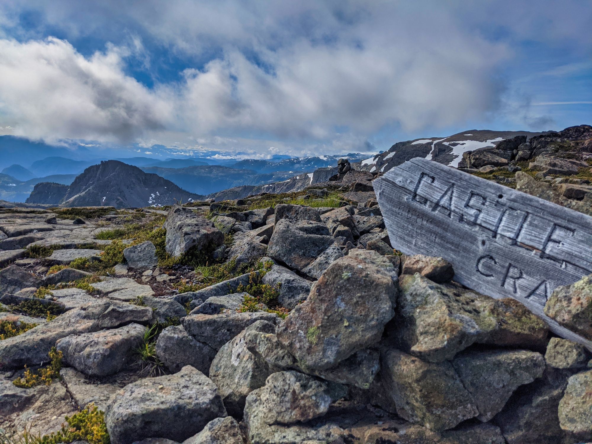
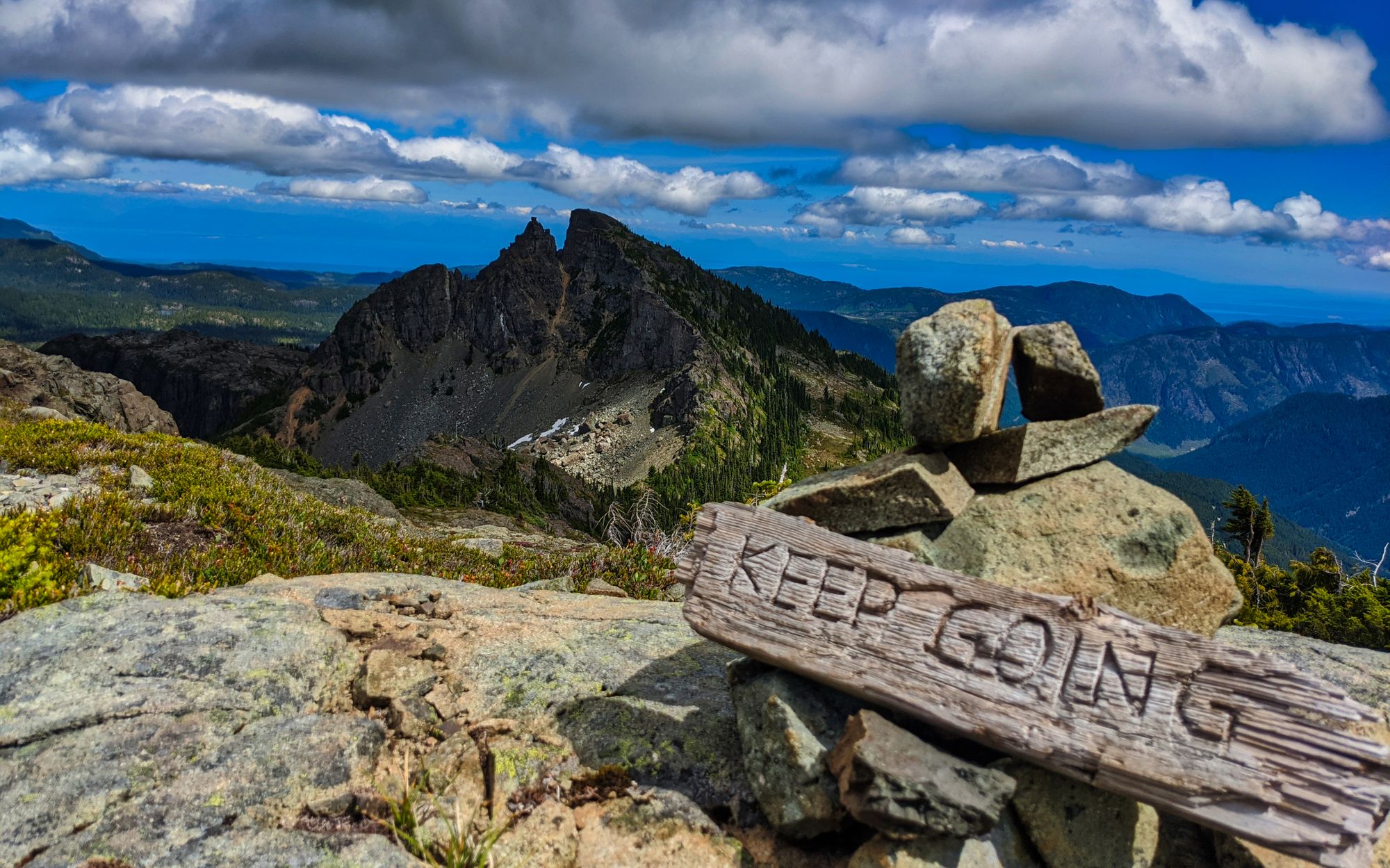
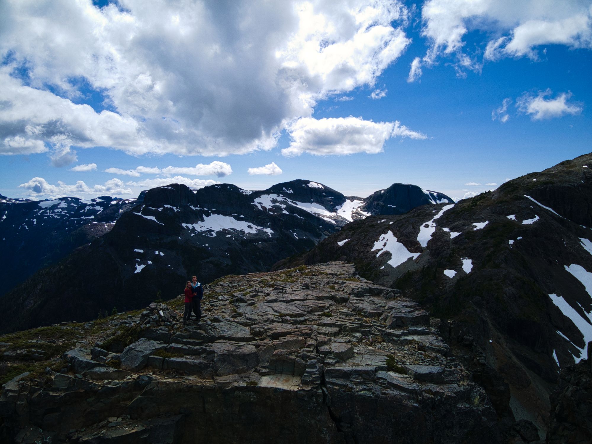
Passing 1850m we rounded the corner to find a neat old wooden sign pointing out Castlecrag Mountain to the left. The views towards Castlecrag and Frink were much clearer, and the new angle revealed the far more sedate approach to Castlecrag, the back of the mountain smoothly climbing up to its recognizable spires that can be seen from the east. With only 300m of elevation to go, the ridgeline began to obscure Albert Edward, though Mt Regan could still be easily seen to the right.
Soft cumulus clouds appeared over the mountains and we started to race them to the summit. It grew colder as the clouds pushed up and over us, shading us from the quickly warming sun. We crested a small rise and the south face of Albert Edward was revealed in the crisp morning air. We could see the trail ahead of us crossing snow fields and winding its way up to the summit, around a kilometre ahead and 200m above.
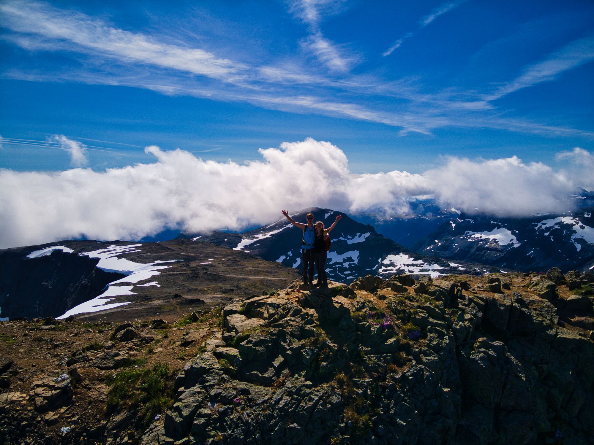
We reached the summit around 10:30am, with only one other hiker having gotten there before us. We enjoyed 15 minutes or more with the summit nearly to ourselves before we were joined by other hikers that we had passed along the trail. After eating a snack and taking advantage of cell service to do a check in, we were ready to carry on with the Castlecrag Loop.
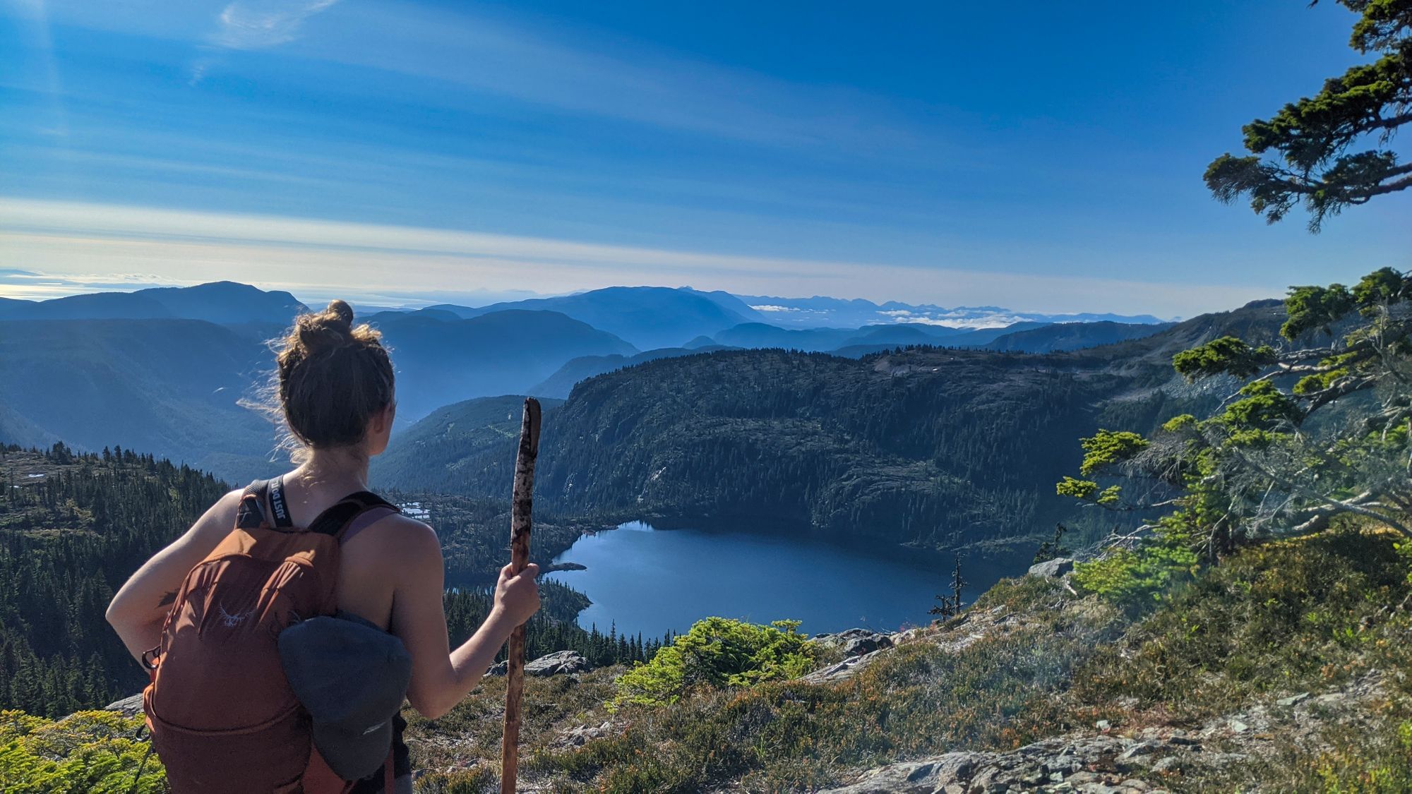
We began our descent as the summit got busier. Passing many groups on the way down, we could see why the trail was so well trodden. We followed the trail down the slope of Albert Edward, inching closer to the saddle connecting to Mount Frink. As we drew near we cut the corner rather than continue down to the Castlecrag sign we had seen earlier, hoping to shave off any distance we could from the day. Crossing some sedate snowfields, we soon found a set of cairns marking a route along the eastern side of the saddle where travel was relatively easy. We relaxed into a leisurely pace as we followed the cairns towards Mt Frink.
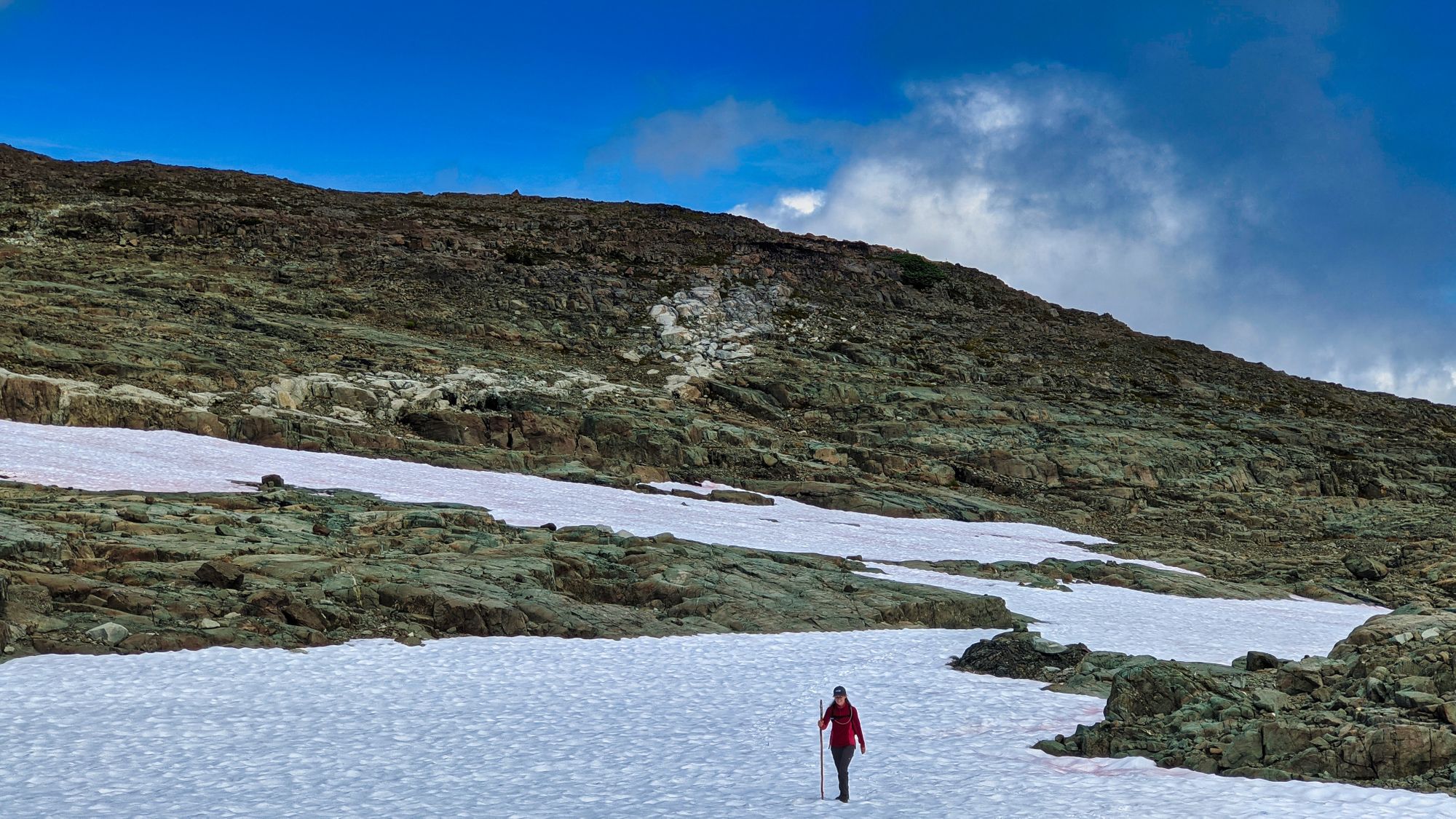
Although the route led us on a straight and easy path across the saddle, care had to be taken as the snow melt had revealed several trenches which had to be descended and re-ascended. There was a more direct-looking route up to Frink's summit via a large snow field, however it looked quite steep so we opted to follow the marked route along the rocks.
We began our slow trod up the north slope of the mountain, the cairns quickly disappearing among the loose scree scattered on the hillside. After a few minutes of walking up some grippy stone, we spotted another cairn which seemed to lead us right. Making our way over, we found a defined path winding upwards through loose rock. At the top was a small meadowed area. We continued our ascent to the right from this slight shoulder and quickly found ourselves at our second summit of the day! With 11 kilometres down, we estimated a further 6-7 to go (we were wrong, but oh well)! We were not surprised to find no register at the summit, though we did find a small geocache with a single, rain-sodden piece of paper inside. With nothing to sign, we stopped for lunch and then carried on our way towards Castlecrag a little after 1:30pm.
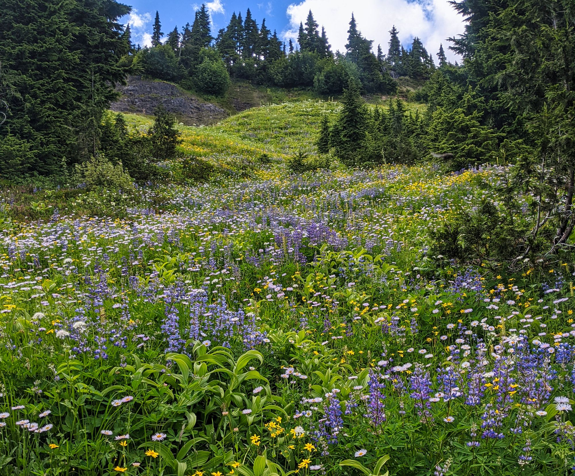
We followed the ridgeline eastward from Mt Frink to the end of the first shoulder, where the trail plunged down to our right. Descending quickly, we had to pick our way through a mix of rock and scree to descend the flank of the ridge down towards Castlecrag. But as the grade became more gradual, the rock was soon replaced by a series of magnificent alpine meadows!
As we walked, Castlecrag's steep peak and sharp lower spire were shown off in dramatic light thanks to the clouds overhead. The view of Castlecrag was fantastic as we descended the ridge, especially as we were still significantly higher than Castlecrag's summit. We had to descend the ridge down towards a saddle between Mount Frink and Castlecrag, before we could start the ascent to Castlecrag's summit further around that mountain.
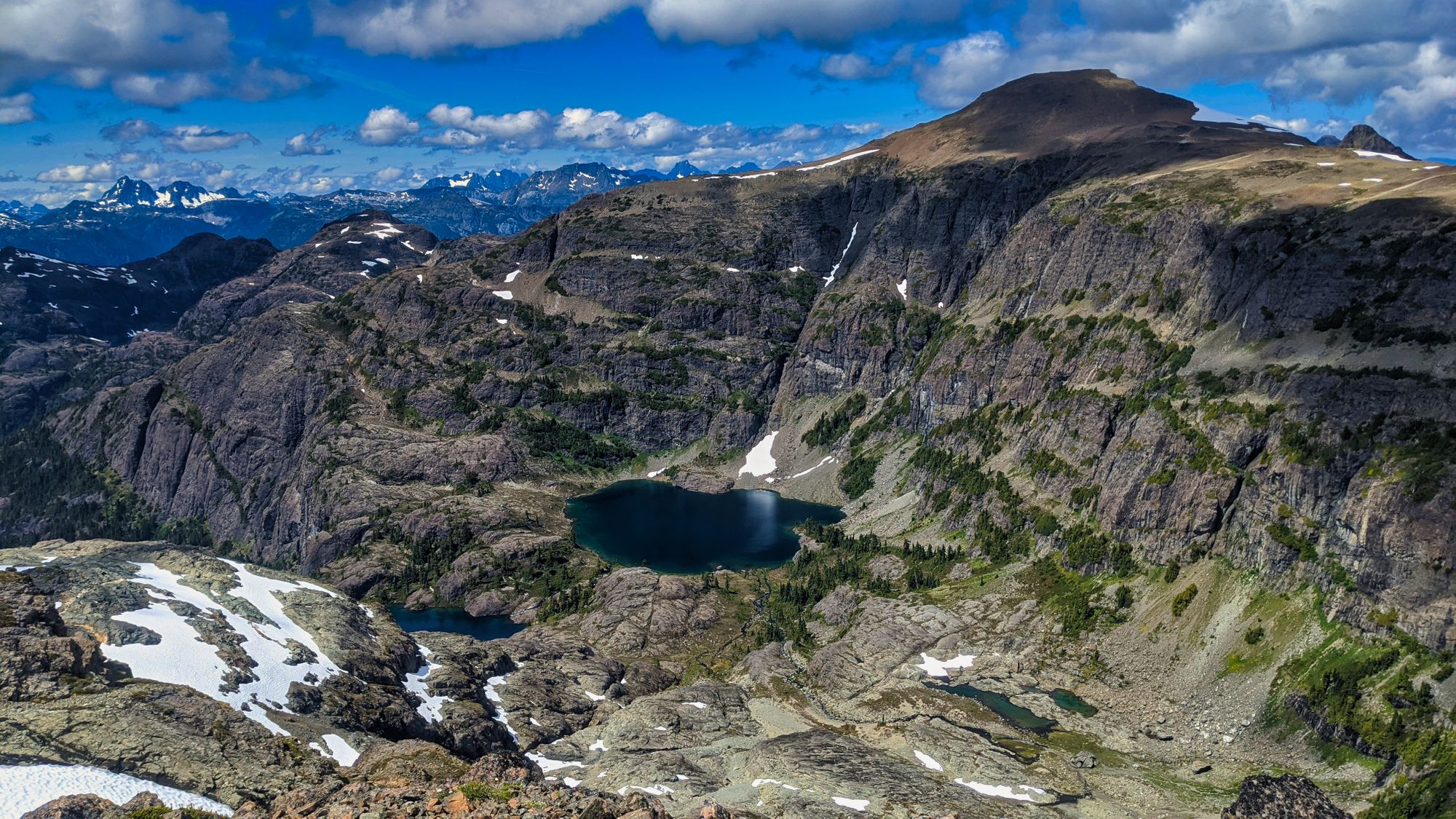
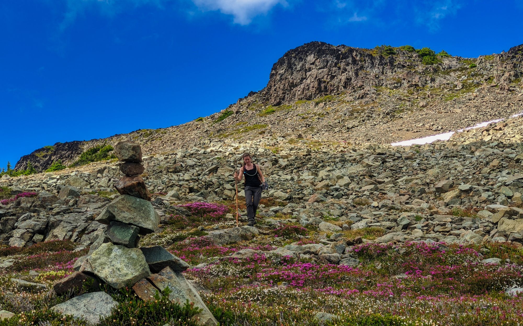
Now starting to traverse along the cliff wall below the Mt Frink ridgeline, the trail cut above more meadows dotted with pink, purple, and yellow flowers. Maintaining our altitude as we traversed above the beautiful gardens, we soon made a short climb and crested the saddle between Frink and Castlecrag. Well clear of the sub-alpine trees, we were treated to a beautiful view of Moat Lake and the Albert Edward ridgeline, with vistas reaching all the way out to the Juan de Fuca Straight.
The trail continued at a gentle grade above even more meadows until it abruptly came to a large cairn with yellow flagging tape which pointed us left - and up. From here the trail scampered up the mountainside, with dry loose rock beneath our feet. There were no switchbacks to ease the ascent, though it was over quickly and the meadows swiftly disappeared below us.
We reached the Castlecrag summit at 3:00pm and had it all to ourselves, save for the swarm of hungry mosquitoes. They were the worst we had seen on this hike so far. At 12.2km into our day, we were starting to get a little tired. We had a snack, took some photos, and started our descent at 3:30pm.
We descended quickly along the same steep path that had taken us to the summit. Once at the bottom we turned left at the cairn and continued along the trail that now forged through meadows along the lower slopes of Castlecrag. The route was well-marked with tall cairns placed at every high point.
We marveled at the valley below and the lakes and peaks on the far side. Eventually the trail opened up into a huge rock slide area. Here we took our time, slowly picking our way across the wide boulder field. As we navigated through, it seemed that the trail was cairned and flagged for one-way travel in the opposite direction. Once past these gigantic obstacles, the trail climbed away into the sub-alpine forest, continuing its traverse along the slopes below Castlecrag. The traverse was littered with boulder fields: some gigantic, some small, some recent, and some very old.
Finally across all the boulders, the trail cut between gorgeous flowered meadows. Castlecrag began to disappear in the distance behind us. As the trail crossed meadow after meadow, the terrain became gentler and more easy-walking.
We were relieved to finally make the top of the ridge. We started to see the horizon peaking out through the trees and felt the wind breezing over us. With only a few kilometres left in our day and eager for supper, we pressed on hard.
Moving through the meadows, the trees on either side of us obscured our views. As we drew closer to home the ridgeline slowly brought us down on a gently curving path that revealed the sparkling waters of Moat Lake on the left and the towering cliffs of Cruikshank Canyon to our right. The trail curled towards Moat Lake, taking us through the low saddle at its far far end and then up to our camp at Circlet.
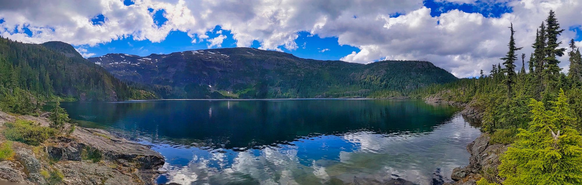
Passing around Moat Lake, we noticed a set of 3 A-frame cabins on the peninsula, with a couple of shored boats alongside. We later discovered that the peninsula was grandfathered-in as private land despite the Park status of the surrounding area, and is owned by the Wood family.
We motored along the trail after Moat Lake, our tired feet carrying us into camp just after 6:00pm. Clocking in just shy of 20km, taking off our boots never felt so good!
Day 3
Circlet Lake to Cruickshank Canyon and Back to Trailhead, ~14km
We said our goodbyes to Circlet Lake at 8:20am on the cloudy cool morning of August 2nd. From the duck pond we turned left to follow the same trail that had brought us into the camp two days earlier.
As we passed through the meadows on our way to Kwai Lake, we looked back to see yesterday's summits enveloped in cloud. We had sure gotten lucky with the weather for this trip!
At a signpost indicating Kwai Lake straight ahead and Mariwood Lake to the right, we took the right-hand turn to head down the trail to Cruikshank Canyon. We stowed our bags in the trees knowing that we would have to come back this way to exit the park. We nearly hopped and skipped down the trail feeling so light without the burden of our large packs.

We first passed by Mariwood Lake and then came to a fork in the trail with another signpost. Had we taken the left we would have gone to Panther Lake, but we opted for the right-hand path leading first to Lake Beautiful and then to Cruikshank Canyon. As we passed by Lake Beautiful we crossed a stepping stone bridge over a small stream. The trail quickly opened up into more meadowed terrain. We had a spooky cloud-covered view of the mountains in the distance ahead of us.
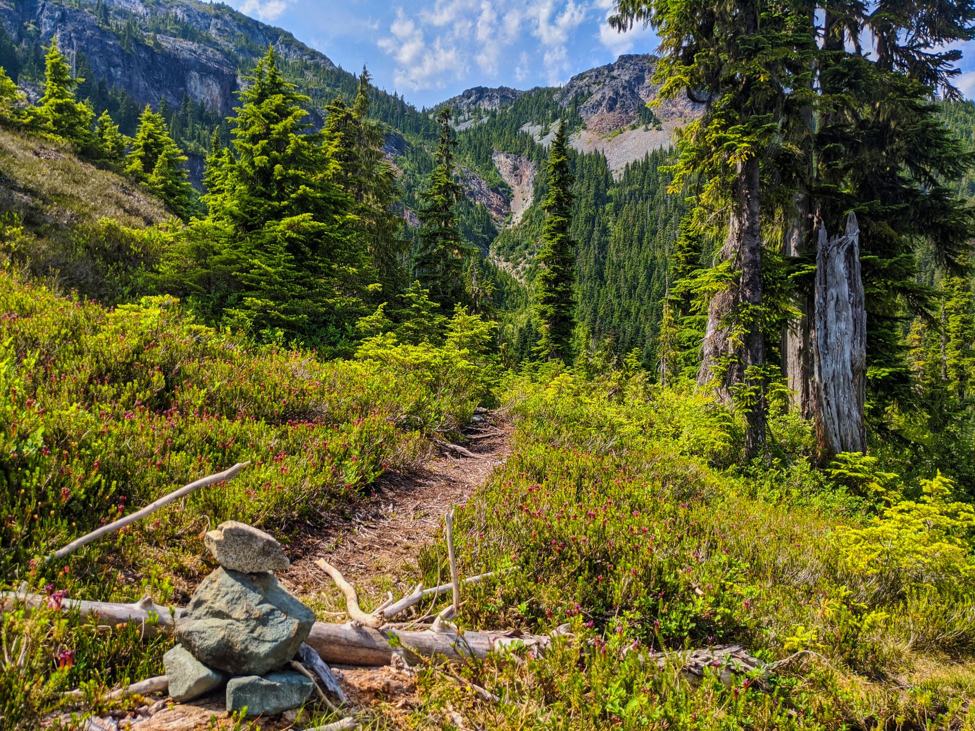
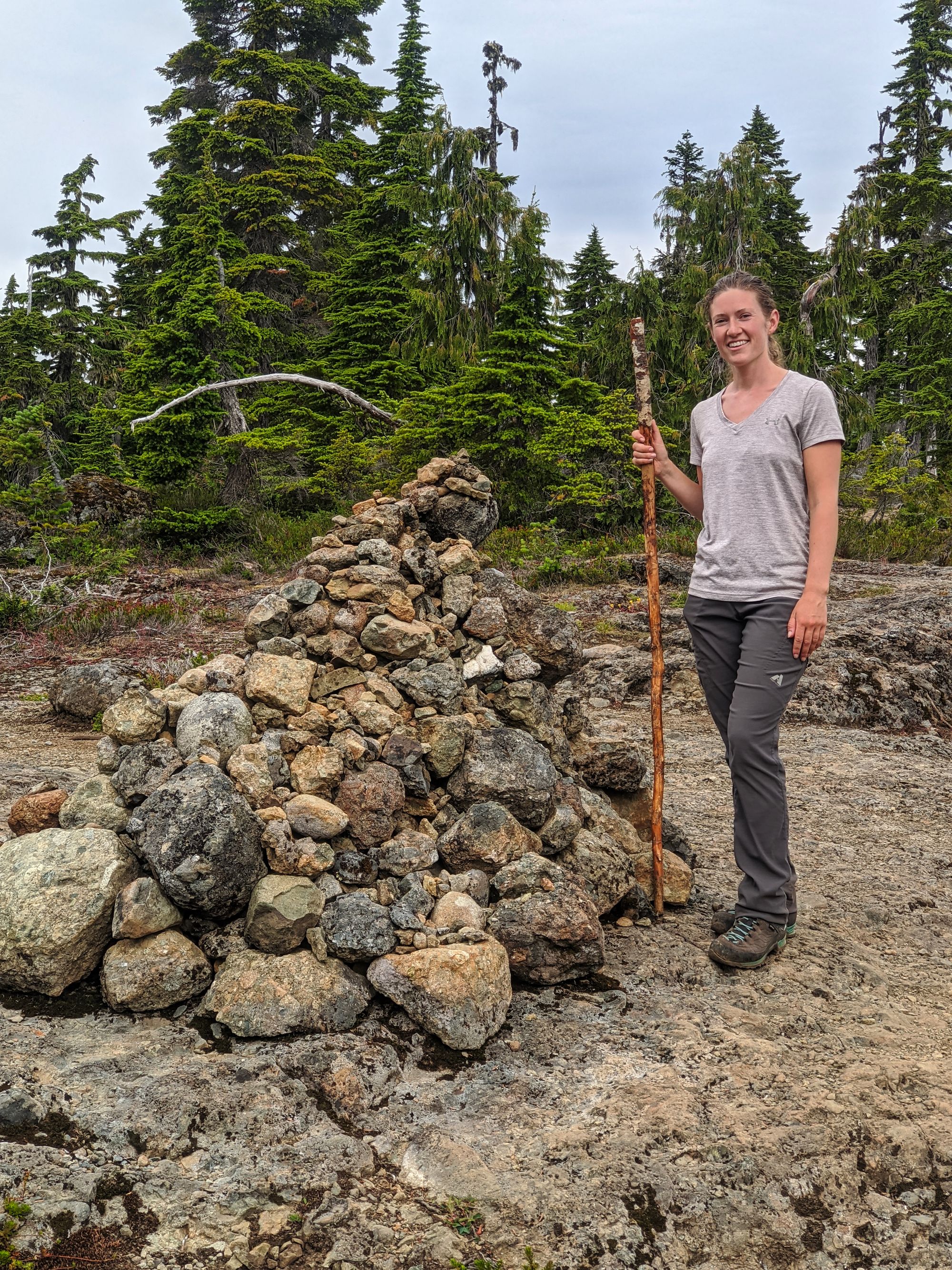
The path wove through boggy meadows, slowly climbing up towards the canyon. Traveling through the shrubs we were amazed when we came upon a huge cairn; made of small stones, it was about 3/4 the height of a person but twice as wide. Continuing along the trail, more small cairns appeared on the side of the trail marking our path.
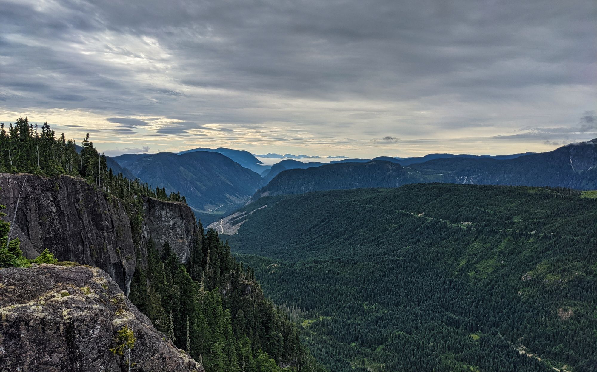
Eventually the trees ahead started to drop away: we were there. The canyon was stunning as it dropped away, especially towards the Comox Valley to our left. To our right the view was not as impressive, with a logging road and multiple cutblocks; the mountains above were completely obscured by clouds now.
It was interesting to have a new perspective on the canyon that we saw as we climbed down from Castlecrag Mountain yesterday. The damp air pushing down from the mountains and the cool breeze through the canyon gave us a bit of a chill. The clouds continued to build and descend the slopes of the mountains, though blue skies and patchy clouds could be seen towards Comox.
We turned to retrace our steps from the canyon to our packs. We put down a good pace trying to regain our warmth. We picked up our packs from their hiding place and carried on. We reached Kwai Lake in a hurry, at 10:50am. A light rainfall began and we put on our pack covers for the rest of the journey, another 7.5 km to the parking lot.
As we circled around Kwai Lake we noticed a sign that indicated there was no swimming allowed in the lake. Other observations included that the campsites all had little trails and were further away from the lake than those at Circlet. There were also no wooden tent pads, but rather crushed gravel sites.
We spotted our first larger wildlife near Kwai Lake: a solitary deer picking away at the grass and shrubs in the meadow. (Of course we didn't manage to get a picture, so you'll have to take our word for it!)
We passed on from Kwai Lake and descended smoothly under the lightly sprinkling rain. The trail, which was mostly made of larger rocks and some small gravel, resembled a creek bed and would likely be wet and slippery in damper weather. Soon after this short descent the trail leveled out and we came upon the Forbidden Plateau turn-off sign. That trail carves a path to Mackenzie Lake, Mt Becher, and eventually the Forbidden Plateau parking lot. Our destination, the parking lot at Mt Washington, was straight ahead.
Soon we were walking on a smooth trail with well-kept sections of boardwalk making for quick and easy walking. At the far side of Murray Meadows, the trail climbed again into the trees. A viewpoint partway up the hill and gaps through the trees provided peaceful views of the meadows below and the boardwalk that snaked its way through them.
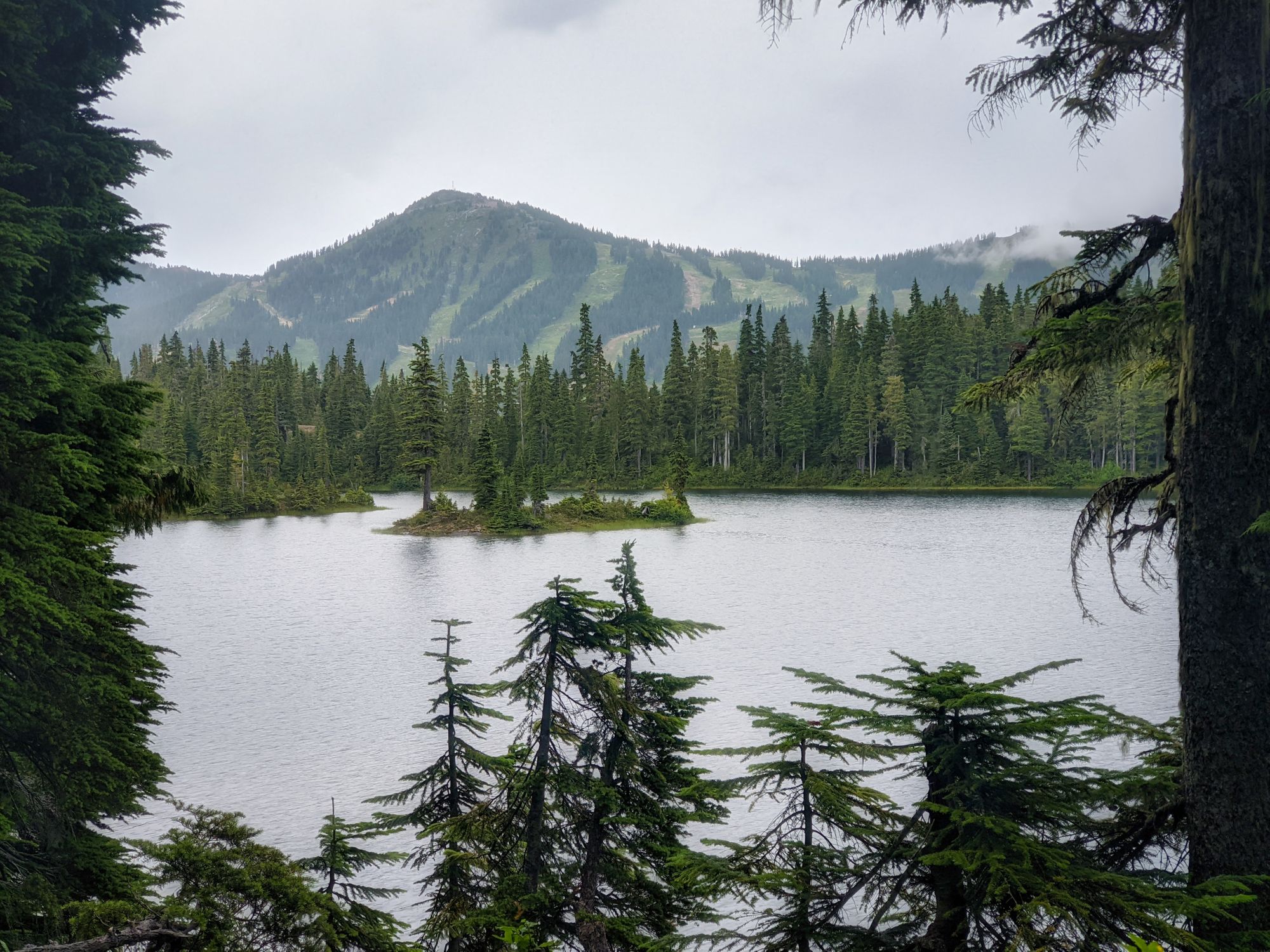
The trail looped around the high ground as we passed Croteau Lake. As we rounded the lake we saw a cabin on the other side with what appeared to be a kayak in the water. This is the group cabin rental area.
The rain became a steady shower and we no longer had tight tree cover to keep us semi-dry. The cloud was so low that even the nearby Mount Elma was partially obscured. As we carried on the rain came down harder, dampening the trail as it led us to Credo and then Lady Lake.
As the trail wound around Lady Lake, we found a tree sheltered patch of trail to put on our rain jackets. We cruised on past Battleship Lake, the heavier rain now making the boardwalks and roots along the trail slick and slippery.
As we passed the wooden map sign at the close end of Battleship Lake, we began to pass many day hikers as we were now only 3km from the parking lot. The long expanse of Battleship Lake stretched out to the right in front of us. We could just start to see the peak of Mt Washington, still slightly obscured by the trees and the low cloud.
We enjoyed a small reprieve from the rain as the trail alongside Battleship Lake wound its way through the trees. Finally we could see the opposite end of the lake with a wooden dock and rocky outcropping that were full of people. As we passed by the dock at the end of the lake, a sign post told us we had another 2.2km to the parking lot - the entire length of Battleship Lake is over 1km.
Ski cabins poked in and out of view through the trees as we drew closer to the parking lot. The last kilometre, having mostly flat boardwalk, seemed to drag on as our feet and bellies were aching to get back to the parking lot for a soft seat and lunch. Passing by many, many day hikers, we finally reached our cozy RV just before 1:00pm.
What a trip!!!
This trip marked the last of our 9 days in the Strathcona Park wilderness. We hope you enjoyed reading about our longest backpacking adventure to date!