Cream Lake via Bedwell Lakes Trail
A popular day and overnight hike, the Bedwell Lakes Trail provides access to multiple lakes with both designated and wilderness camping. This trail also provides access to a number of technical summit routes.
Route Outline
| Difficulty | Easy |
|---|---|
| Synopsis | Bedwell Lakes are an extremely popular point for frontcountry camping or to use as a base camp for alpine excursions to nearby Mt Tom Taylor, Big Interior Mtn, or Mt Septimus. An easy 15km round-trip also entices many day hikers to Bedwell or the nearer Baby Bedwell Lakes. Cream Lake is a further 5km from Bedwell Lake, a turquoise gem nestled at the base of Mt Septimus. Backcountry hikers will enjoy the more peaceful setting at Cream as most hikers opt to camp at Bedwell. |
| Getting There | From Campbell River take Highway 28 towards Gold River. Carry on into Strathcona Park for about 50km, and then continue straight onto Westmin Rd (don't take the bridge towards Gold River). Follow Westmin for approx 35km to the south end of Buttle Lake, and then turn left onto Jim Mitchell Lake Rd. This gravel road is maintained and well used by the local Westmin Mine, so be cautious of larger machinery. Follow Jim Mitchell for 7km to the well-marked Bedwell Lake trailhead! |
| Facilities | Outhouses at the trailhead, plus at Bedwell and Baby Bedwell Lakes. No facilities at Cream Lake. |
| Fees | $10 per adult, $5 per child (per night). |
July 28-30, 2020
Trip Report
We drove out to the Bedwell Lakes trailhead on the evening of July 27 following our hike down from King's Peak, and spent the night in #GloriaRV. The parking lot was packed, with many additional vehicles parked on the sides of the adjacent road. We hoped that at least a few of them would be on their way out as we headed in the next day.
Day 1
Trailhead to Cream Lake
We had planned to wake up early and get going but we felt lazy after our recent King's Peak trip and had a slow morning. As vehicle after vehicle poured into the already overflowing parking lot that Tuesday morning, we gained some motivation and finally pushed off just before 10:30am.
The trail started with descending switchbacks. Yes, descending. They didn't last long though, and the trail quickly flattened out as we approached the first bridge after a few minutes. A metal suspension bridge carried us over a dried up creek bed, and then a second bridge (wooden this time) crossed a flowing creek with a deep turquoise pool below. We lingered for a few minutes marveling at the water carving its way through the rock, but voices behind us prompted us to get back in gear. We hit the trail, and started to climb!
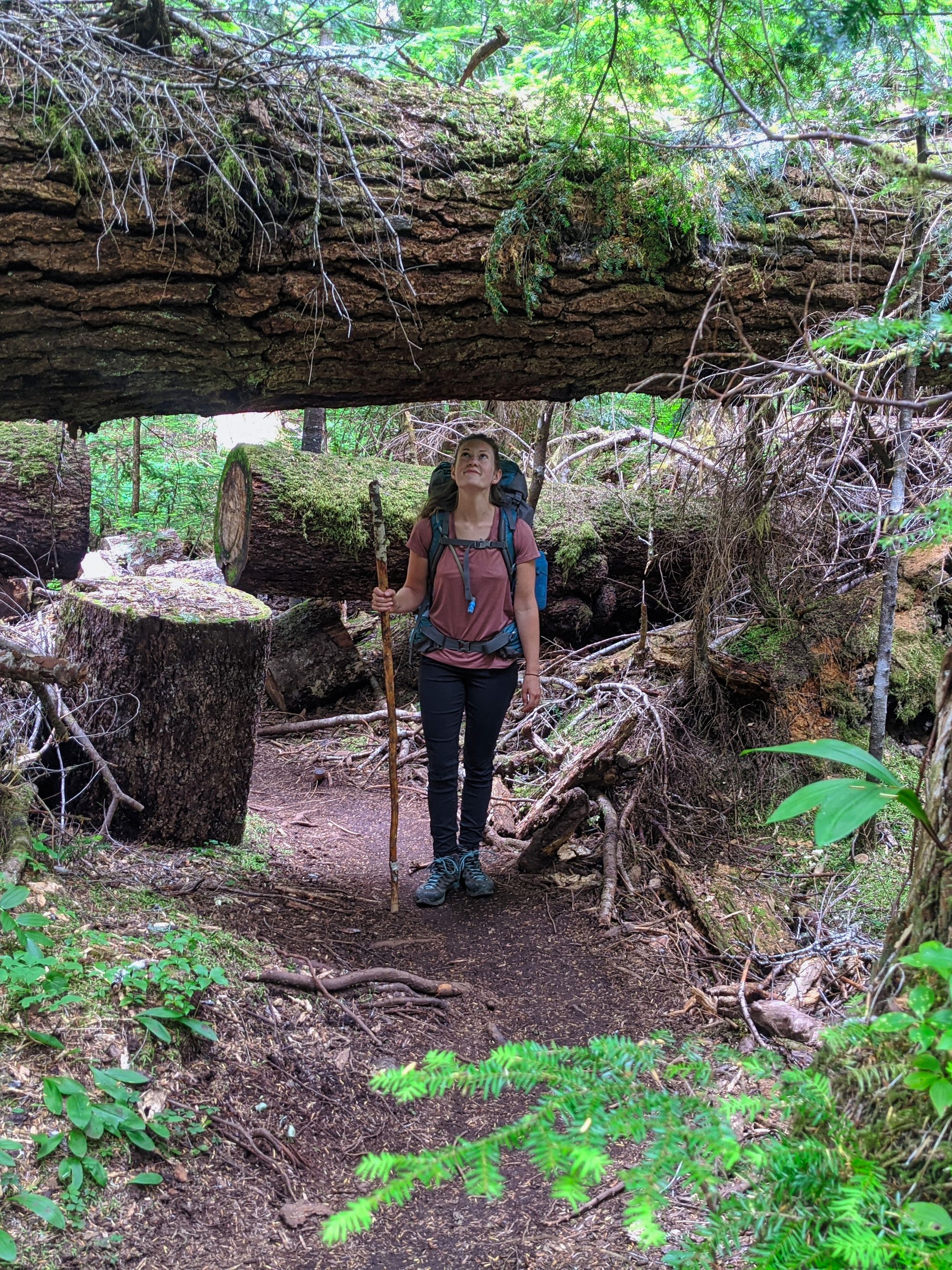
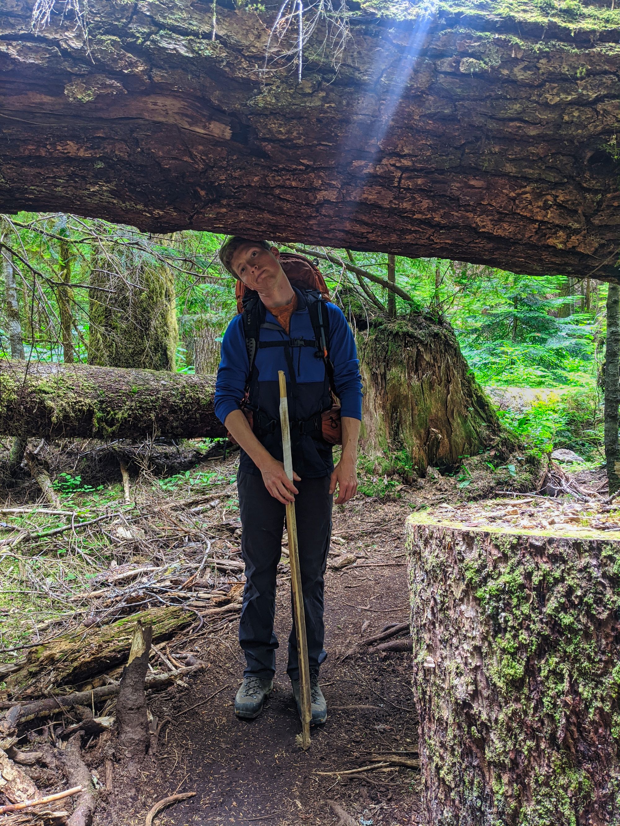
Switchback after switchback of built-up, well maintained stairs carried us up the trail. Eventually the relatively smooth, wooden-panel-reinforced trail gave way to rougher terrain. Larger rocks and snarled roots dominated the path under our feet, as most smaller dirt was washed away by the rainy season. Despite this, regular maintenance has kept the trail in good shape, even with the huge amounts of hiking traffic moving up and down the trail. We continued upwards towards Baby Bedwell Lake, passing bridge after bridge in quick succession. Some had water flowing sluggishly, but most creeks were dry due to the heat in the mid summer season.
Older metal stepladders became more and more common on steeper sections as we wound our way upwards, interspersed with well maintained boardwalks in flatter areas of trail. But all of a sudden, we finally crested a high point and the trail leveled out. Looking back, we could just see the South end of Buttle Lake nestled at the bottom of the mountains in the distance. As we stretched our legs in the flatter terrain, we put down a good pace over flat packed earth and boardwalks. But based on the multitude of dried up pools to the left and right, it's clear that we would have been wading through mud in an earlier season whenever we hit stretches without boardwalks.
The trail meandered slightly downhill to take us to Baby Bedwell Lake, the first campsite on the trail. The 4.4km hike there took us about an hour and a half. We took a quick look at the posted map and opted to save exploration of this smaller lake for our way out, pressing on the further 1.9km to Bedwell Lake.
Four consecutive metal staircases brought us quickly above Baby Bedwell, where we could see a few empty tent pads receding behind us. We were very shortly treated to a glimpse of Bedwell Lake through the trees ahead. Here we ducked off the trail to the right to find a viewpoint which afforded us panoramic views of both Bedwell and Baby Bedwell lakes. From here we could see lots of tents set up on the far side of Bedwell Lake.
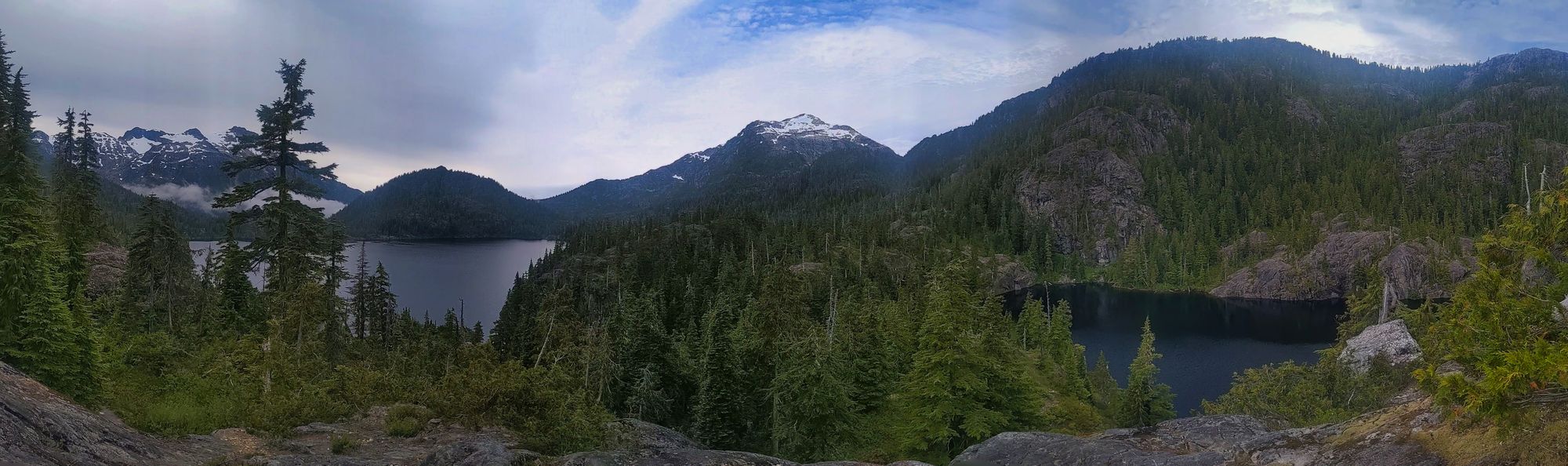
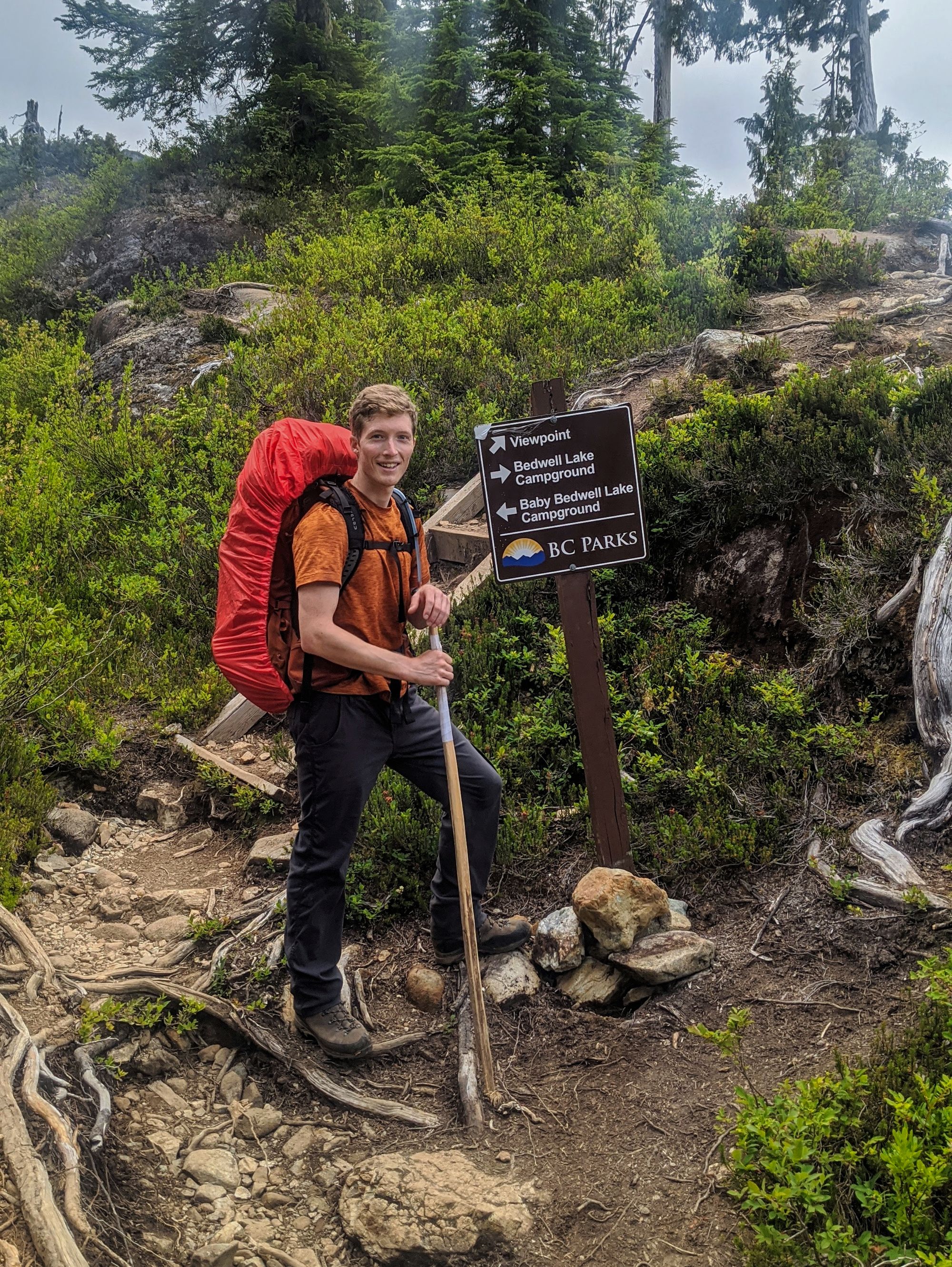
From the sign post (see photo below), the trail turns sharply down to the right. We continued down several metal and wooden staircases to the lake's edge, then followed the shoreline around to the camping area.
The shoreline trail carried us up 4 consecutive metal staircases/ladders, providing a great view of Mt Tom Taylor. It continued to meander up and down, following the terrain as we rounded the lake. We reached the Bedwell Lake campsite at 1:00pm, whence we found a trail to the water.
We ate lunch at the lakeside on a comfortable rocky area all to ourselves. Mt Tom Taylor was barely visible above the trees that jutted out into the lake from where we sat. We spent an hour and a half there, enjoying the scenery, relaxing, and reading our books. We hit the trail again at 2:30pm, with our destination of Cream Lake a further 4.8km down the trail.
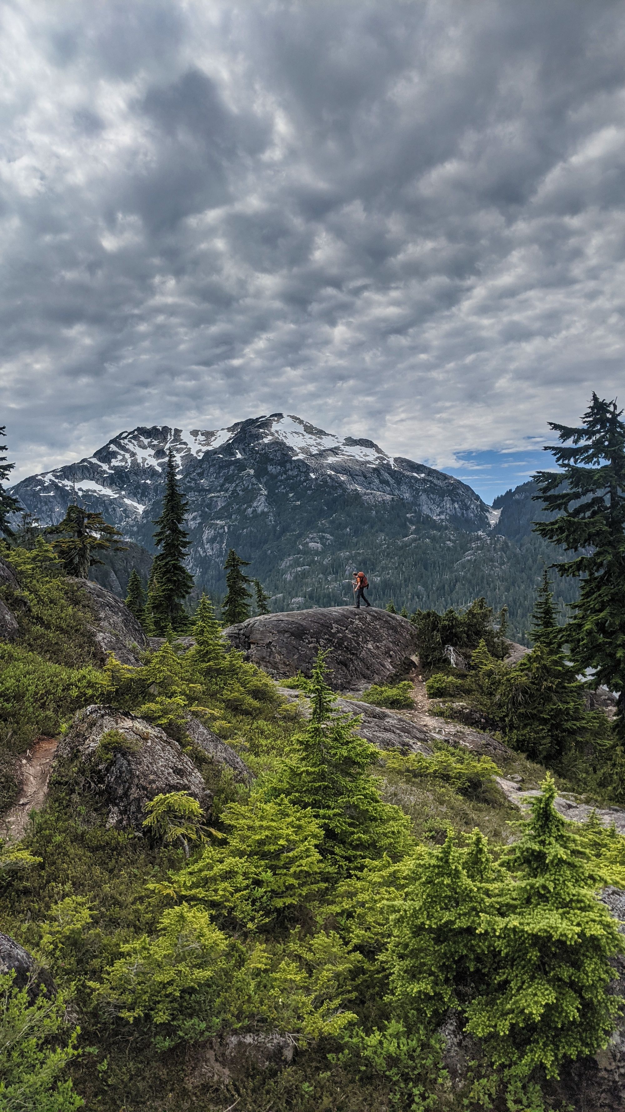
The now rough, rocky trail took us up to a great viewpoint of Tom Taylor with Bedwell Lake below and to the right. The trail was relatively easy to keep in our sights and where it was not, it was well-marked with blue flagging tape and a few cairns.
As the trail continued upwards it slowly hoved in towards a narrow creek bed. The trail followed the water and we crossed and re-crossed the creek as the track wove upwards through the idyllic sub-alpine valley.
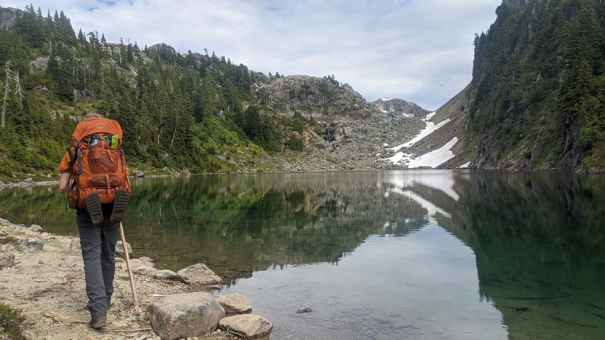
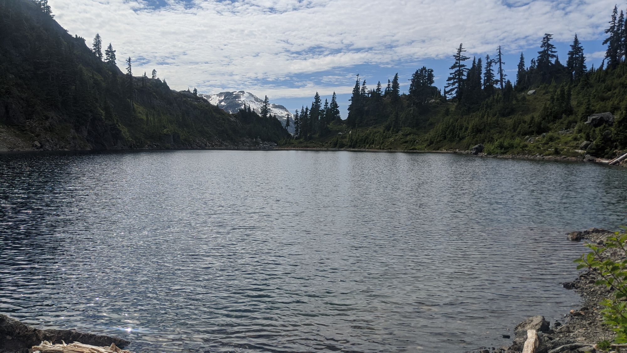
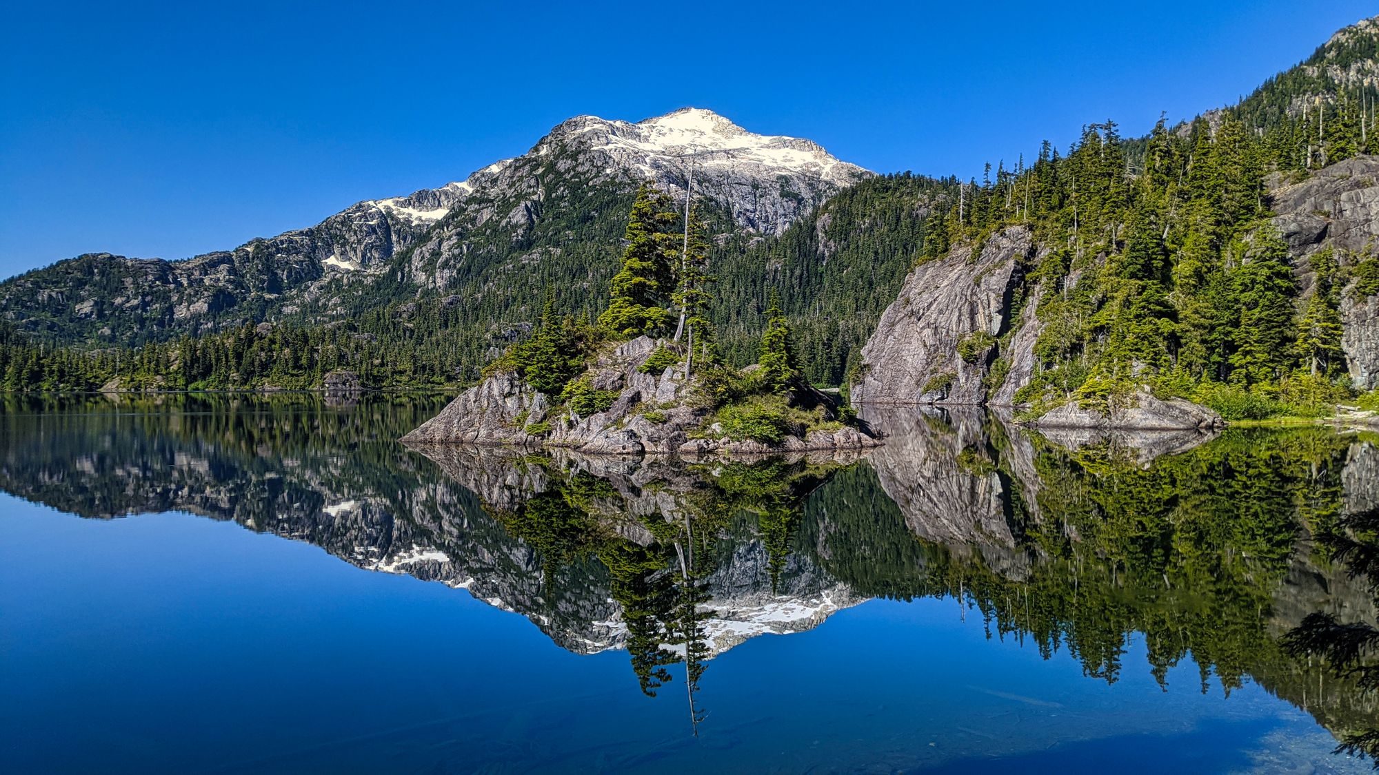
An hour after Bedwell Lake, we climbed out of the valley and found ourselves at a larger creek with small rushing waterfalls pouring out of a wide, rocky gully above us. Carefully picking our way up and over huge boulders, we discovered the source of the creek - pristine Little Jim Lake, nestled in a small alpine bowl.
From the outflow of Little Jim, the trail cut a clear path through the shrubs above the lake. However, the water level appeared lower than normal, so we opted to follow along the shoreline where a space had been created to walk at the water's edge.
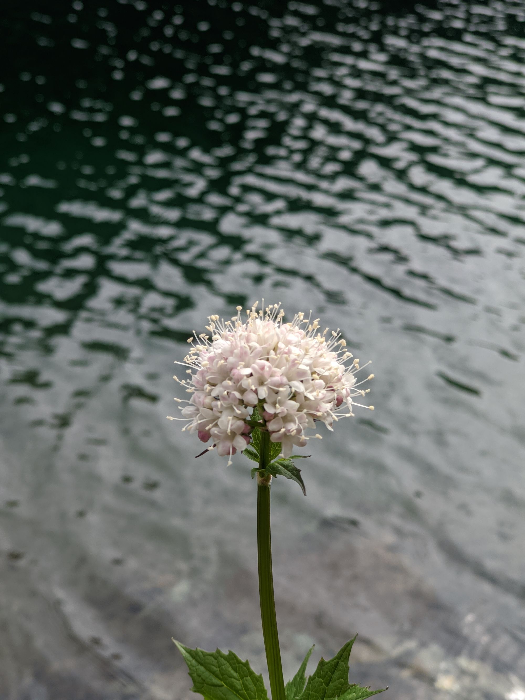
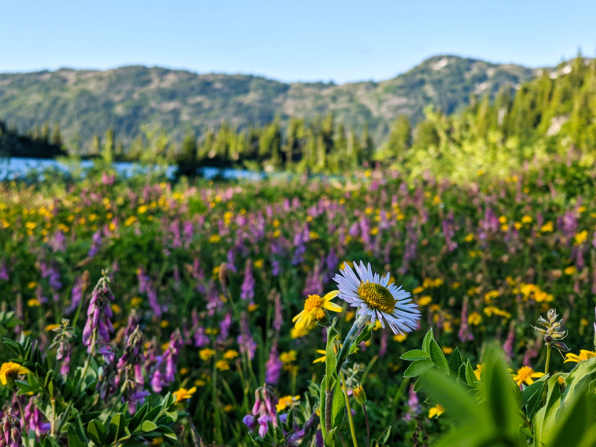
Halfway round the lake the terrain forced us higher, away from the water. Continuing on, we crossed into more of an open meadow where colourful flowers dotted the hillside, breaking up the monotony of green trees and raw grey boulders.
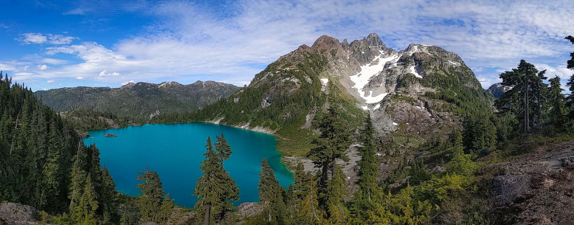
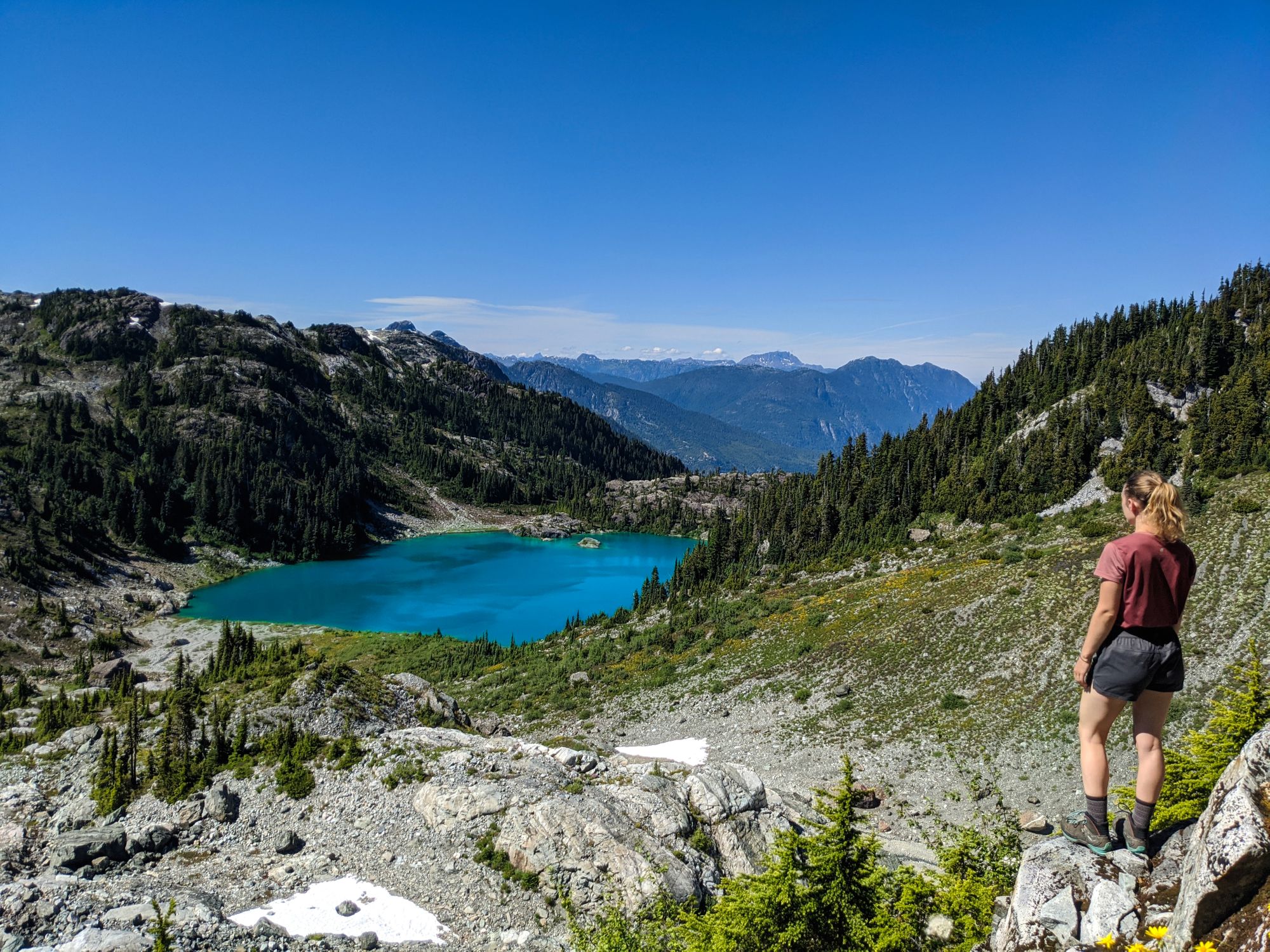
Once we reached the far side of the lake the trail ascended quickly, taking us above the risky boulders and snowfields in the lower slopes of the col below. We hiked across the loose gravel slopes, then down a short scree slope to slightly gentler terrain. The trail took us through varied terrain along a ridgeline, from gravel and small rocks to easy-walking sections, and even across a rock slide area. Clearing the ridgeline, Mounts Septimus and Rousseau popped into view.
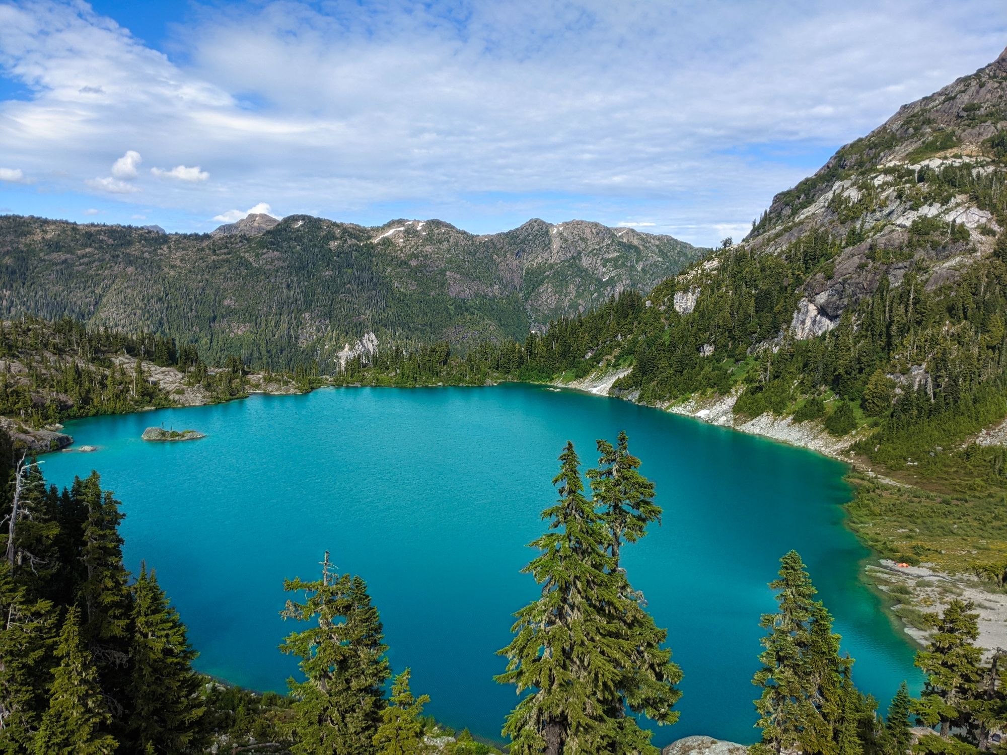
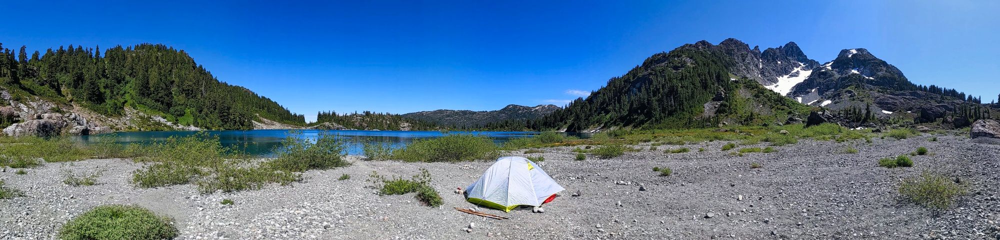
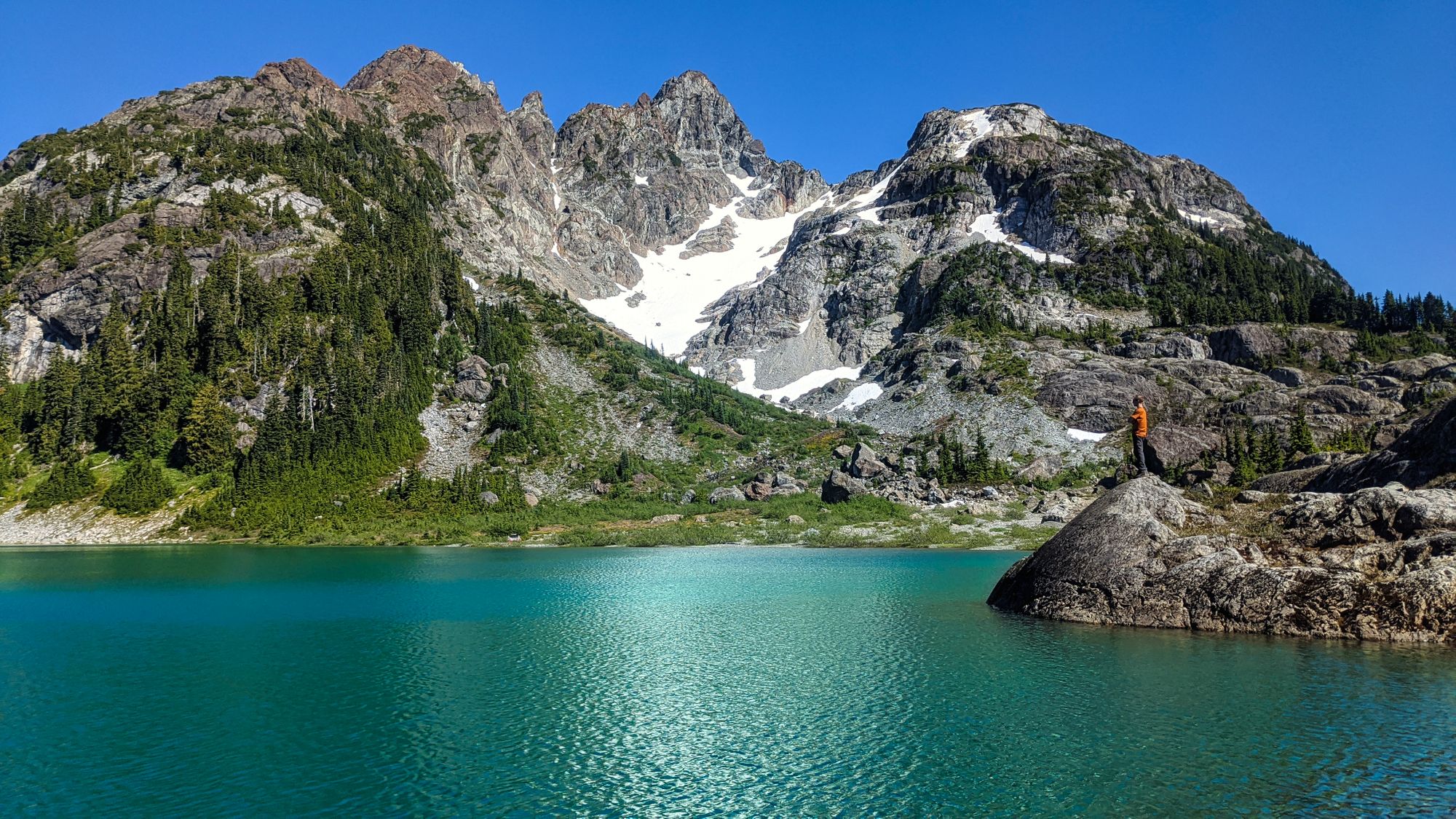
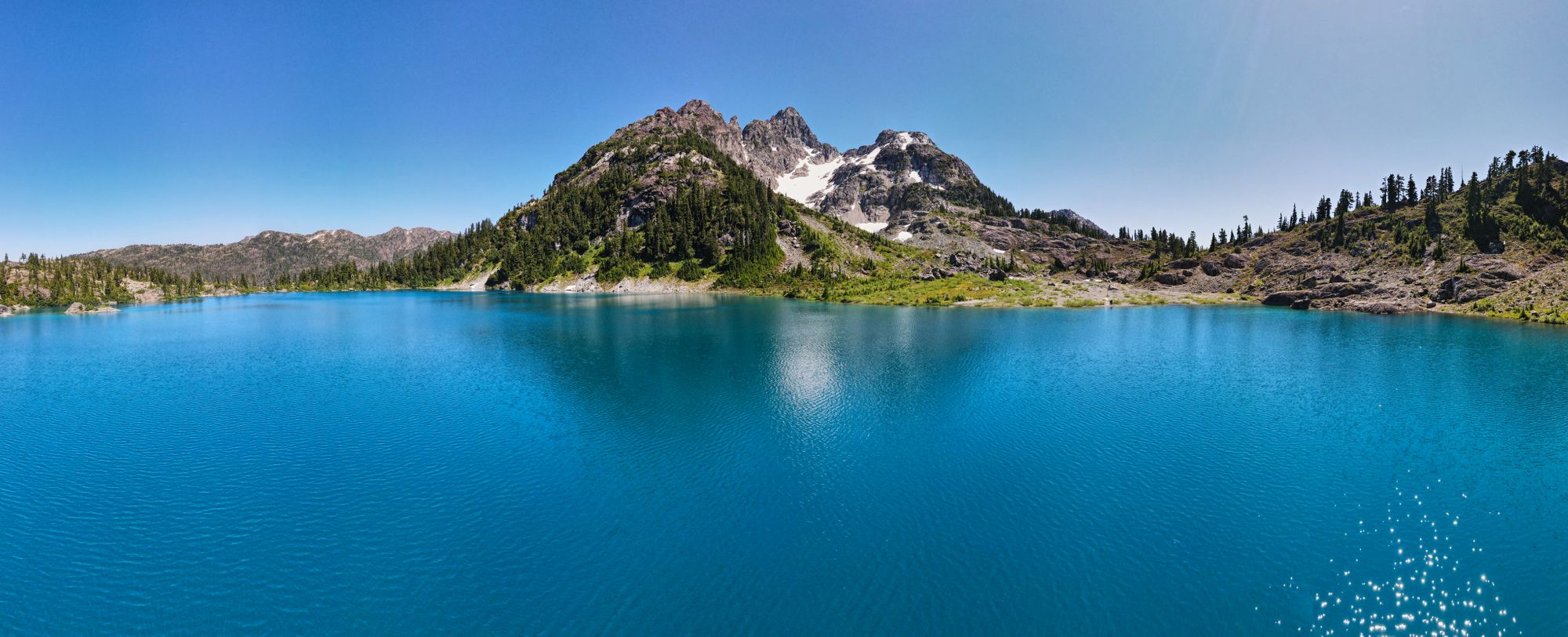
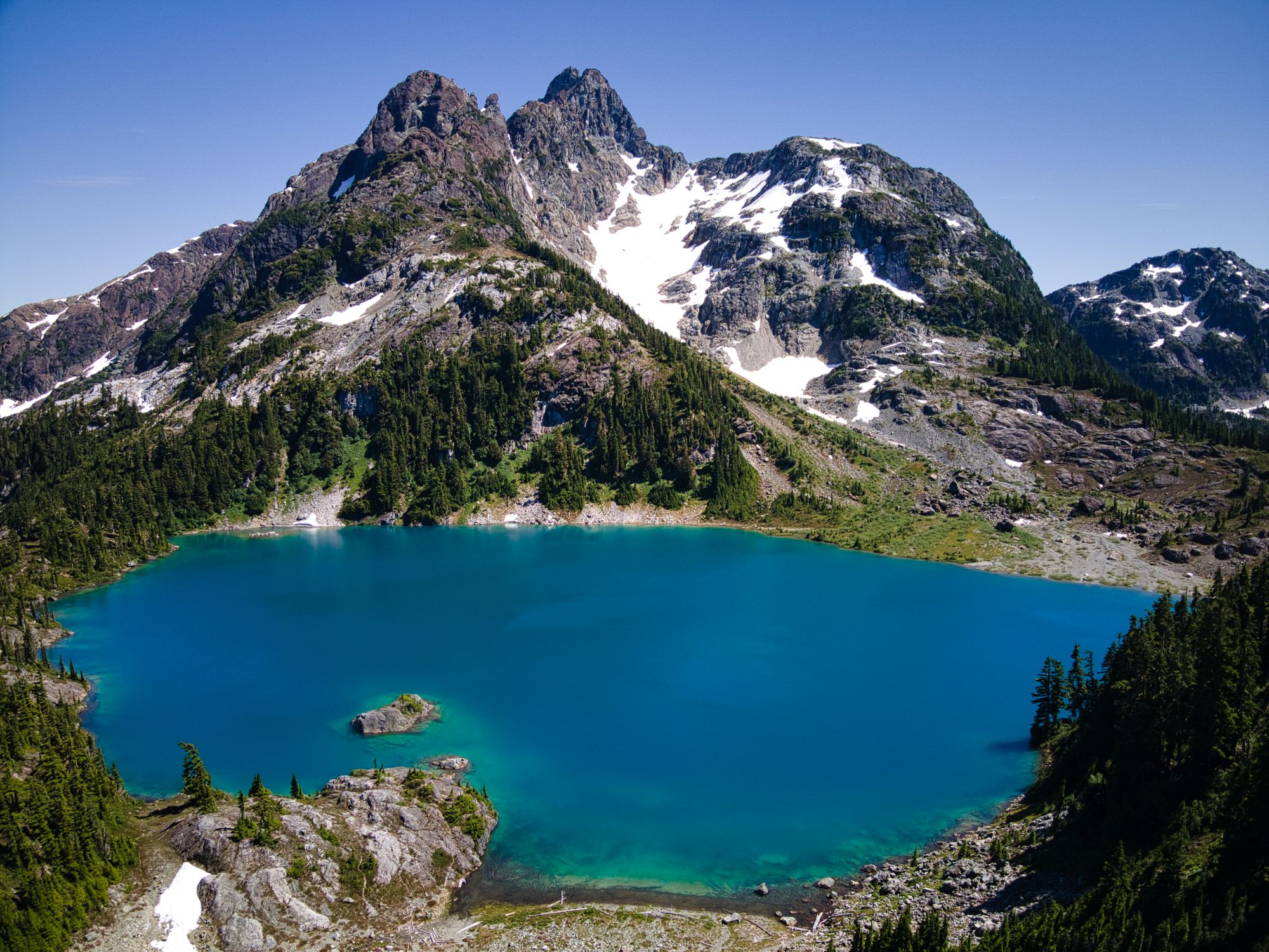
As we carried along the rocky path, we eventually got a good view of Nine Peaks. The penultimate view of Strathcona Park was unmistakable, the series of peaks still dusted with snow that concealed the glaciers underneath. Still marveling at the distant view, we were shortly treated to our first glimpse of Cream Lake -- a gleaming sapphire cut out of the mountains. A nearly 10-minute descent brought us to the gravelly shore of the lake at the base of Mt Septimus, marking the end of our 6.5 hour hike day.
We set up our camp on the lake shore, the wide meadow providing plenty of space for us and two other groups. With set-up complete, we enjoyed a frigid swim ("enjoyed" might not be the right word...) followed quickly by a hot dinner and whiskey! We settled down for the evening, watching the lake shift from bright to dark blue as the sun sank slowly behind the mountains beside us.
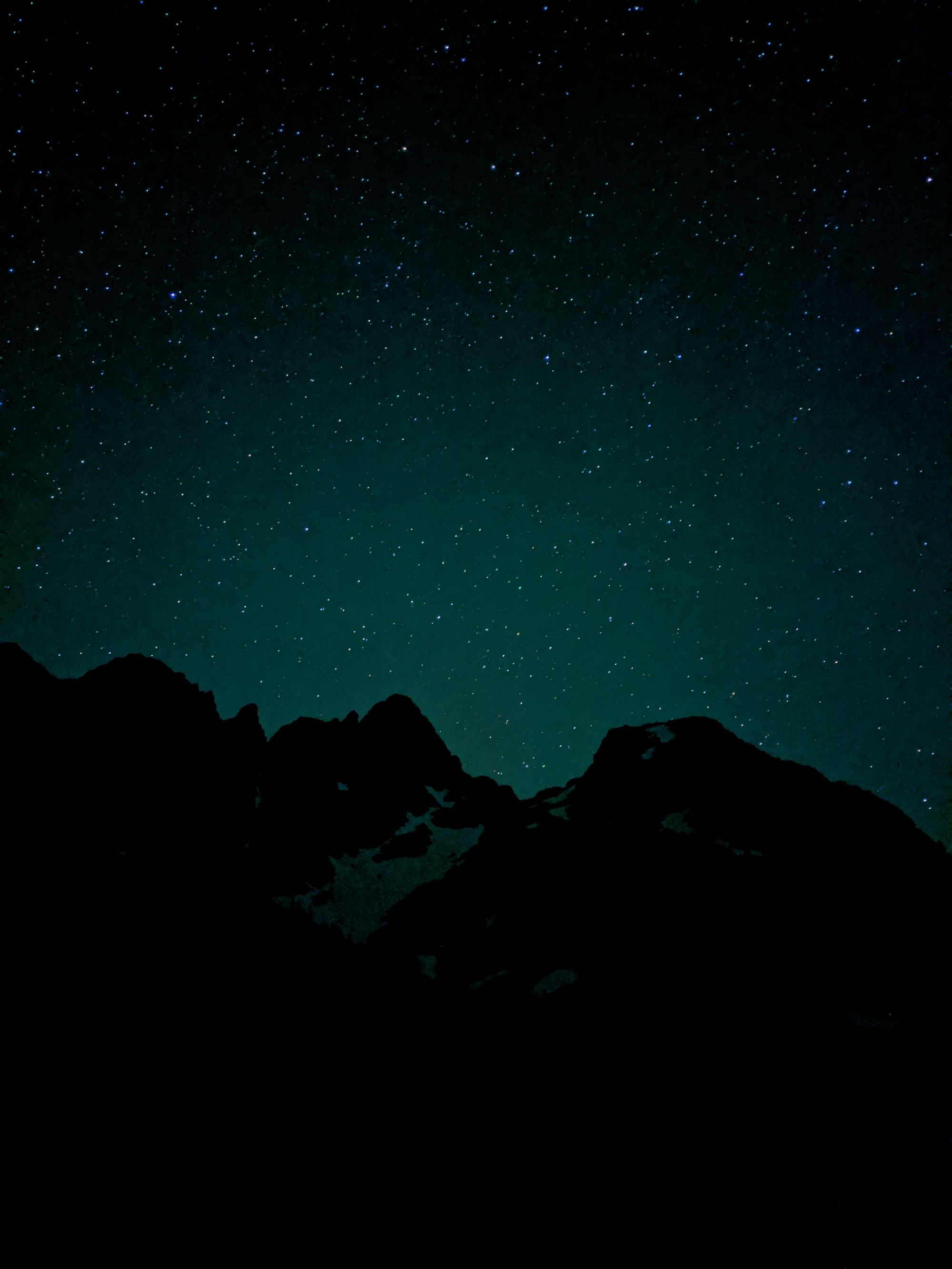
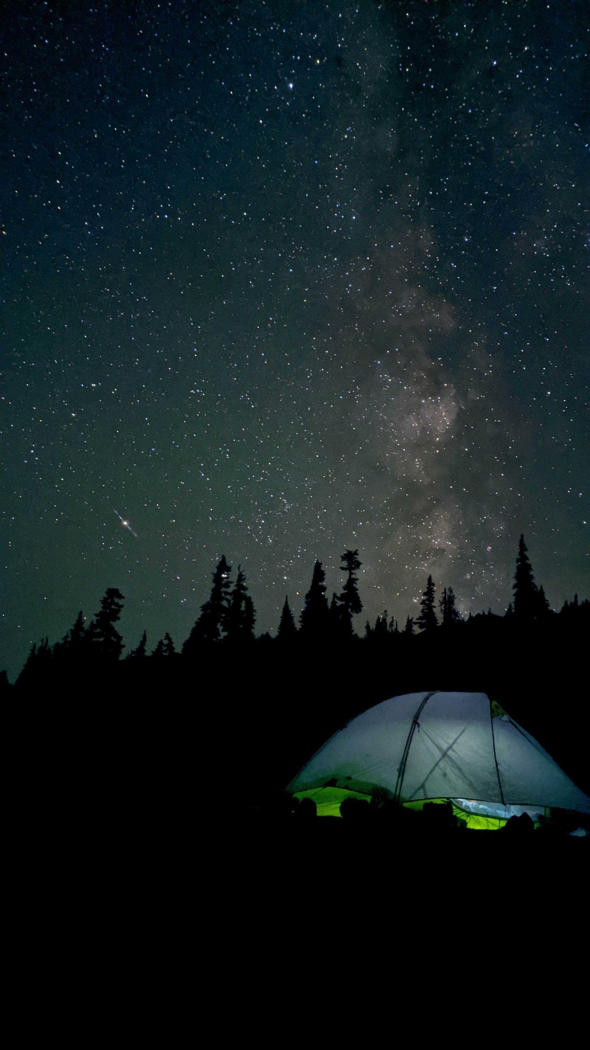
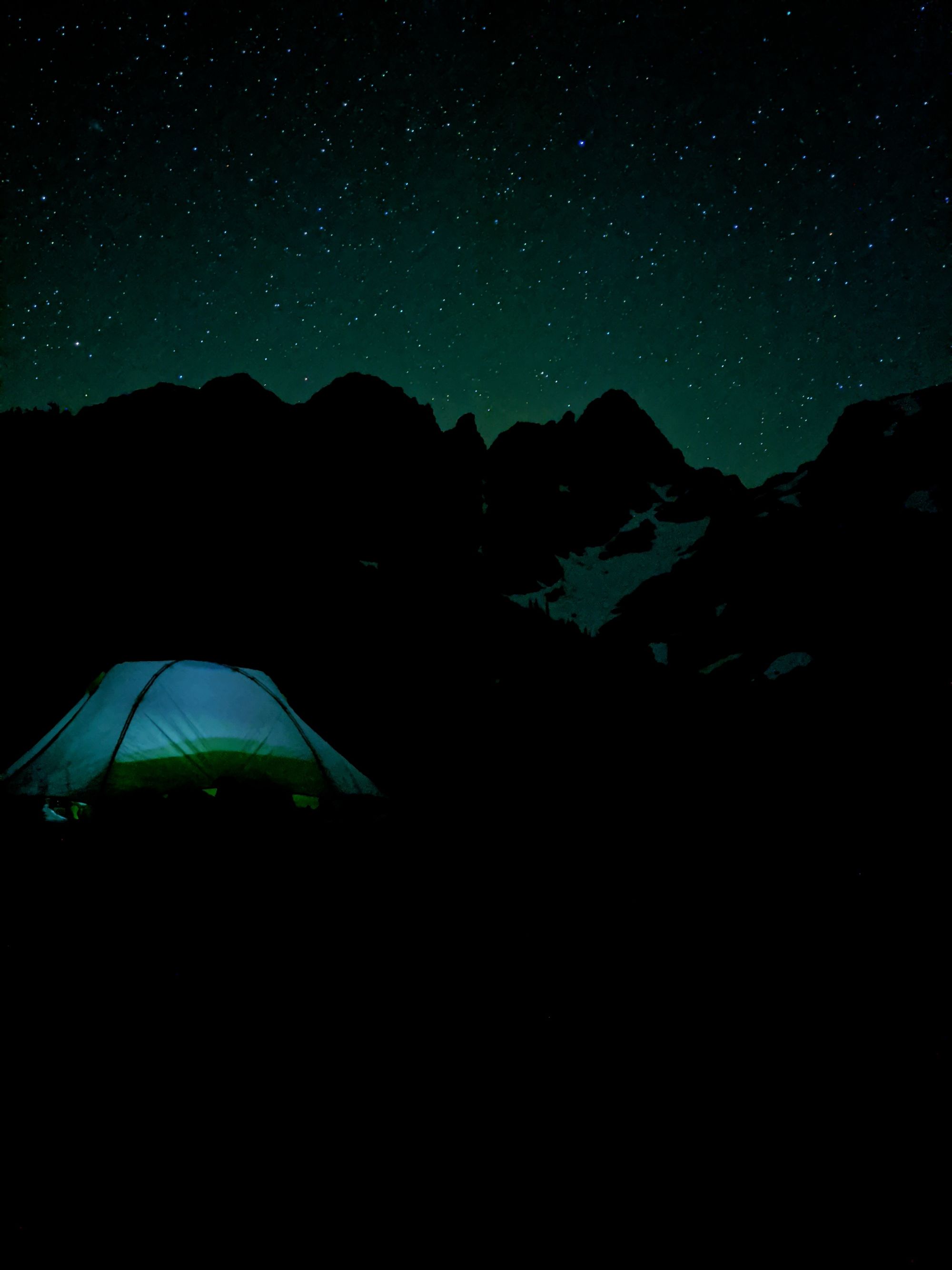
Going to bed did not mark the end of our day, however. Inspired by the clear sky and remote location, we thought the towering Mt Septimus would provide an optimal backdrop for some astro-photography. We were rudely awakened by our alarms at 2:00am and had a short debate over whether the experience would be worth it since we didn't have Katie's camera, just our phones. We are so glad we got out of the tent!
Day 2
Exploring the Cream Lake area
Following our night of astro-photography we were dead tired, and not even the brightness of the rising sun could wake us. At some point in the morning we eventually got up, motivated mostly by hunger.
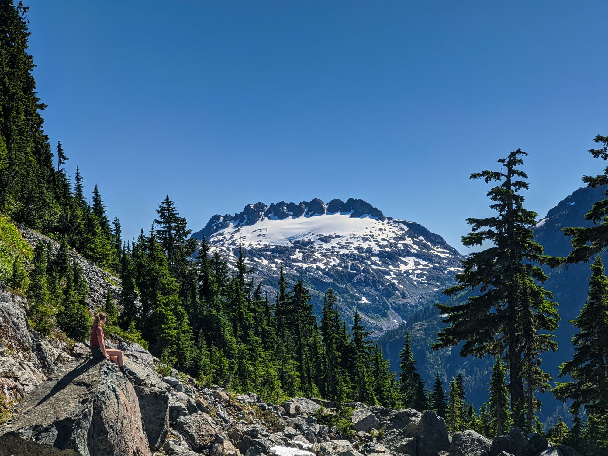
We spent the majority of the day lounging by the lakeside until we finally finished our books. On rested legs we explored the slope of Mt Septimus above us, following a loosely-defined trail marked sporadically by flagging tape. With no ropes or other equipment, we went only as far as we felt comfortable, calling it when the route became a Class 4 scramble. We had gained enough elevation by that point to get a stunning perspective of Cream Lake below. On our way down we also discovered a great view of Nine Peaks in the distance (below, right).
From our campsite, we could see what looked like a trail carved around Cream Lake, on the side opposite to the mountain. Though it appeared promising from our vantage, we opted not to attempt it as the day had gotten away from us and it looked like there may have been a section of hefty bushwacking. Ever resourceful (read: lazy), we flew our drone across the lake instead.
Despite having a rather lazy day, it was not devoid of excitement. On the shores of dreamy Cream Lake, Ryan got down on one knee and asked Katie to marry him! Of course, she said "yes!"
Another quick dip in the lake left us refreshed before we turned in for the night.
Day 3
Cream Lake out to Trailhead
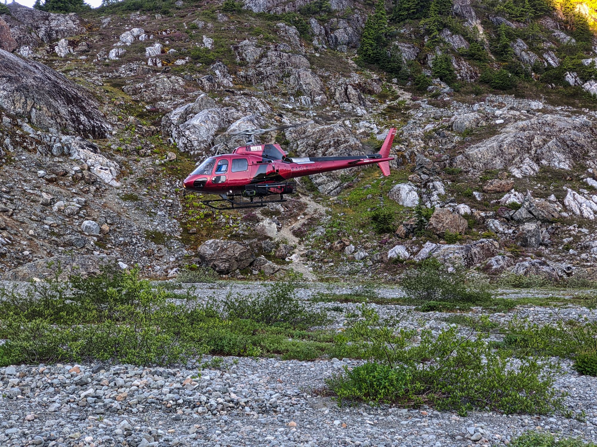
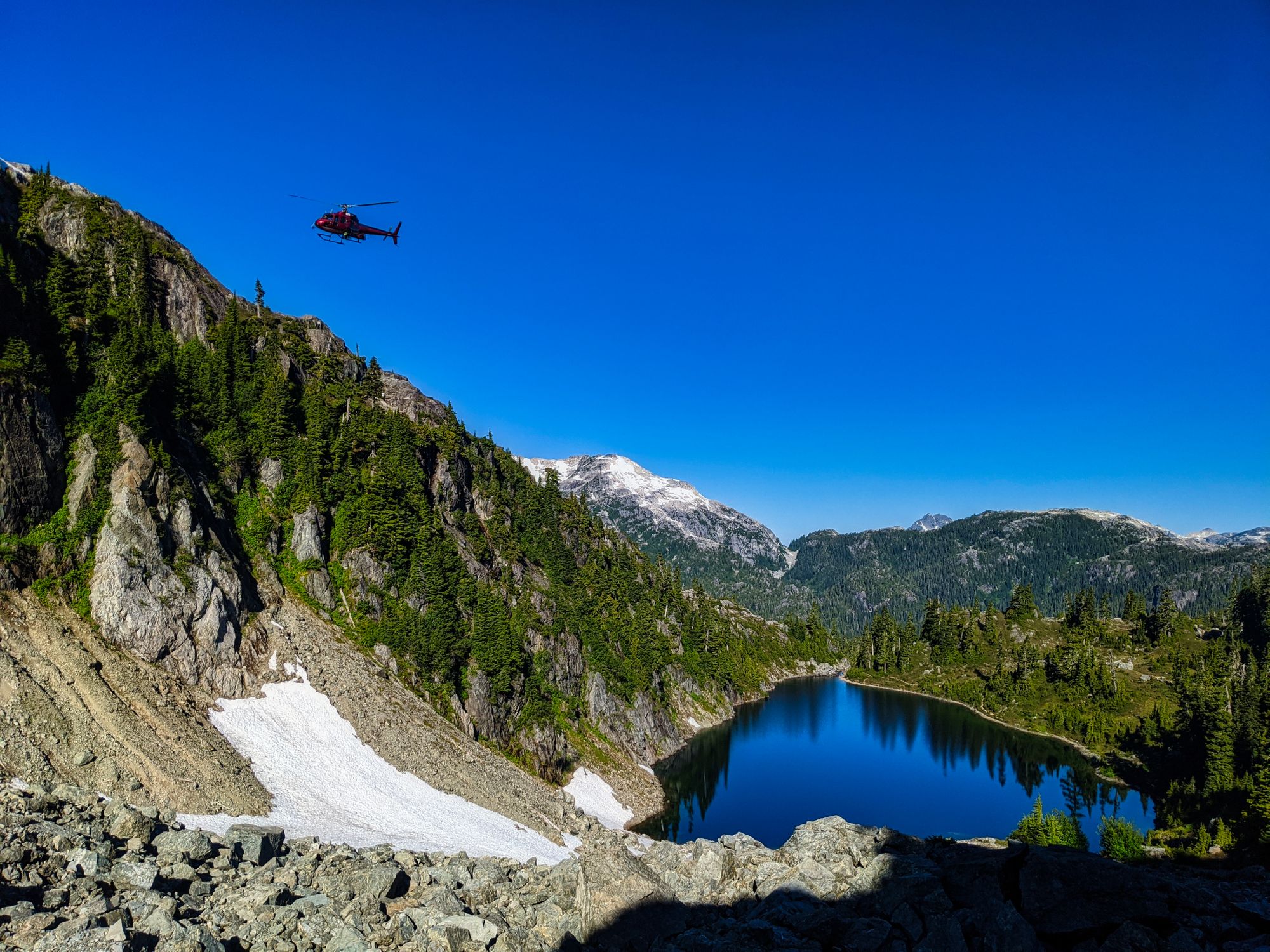
With a long hike out ahead of us, we awoke to the gentle glow of the sun illuminating Cream Lake from underneath the ridge, at around 6am. We ate breakfast and were about halfway through our pack-up when we were surprised to hear the sound of an approaching helicopter. Sitting inside the tent drinking our tea, we watched it circle the large gravel/meadow area, then come around again to shoot an approach to a flat spot not far from our tent. 49 North Helicopters and Campbell River SAR were searching for two hikers that hadn't checked in from their trip to Mt Septimus.
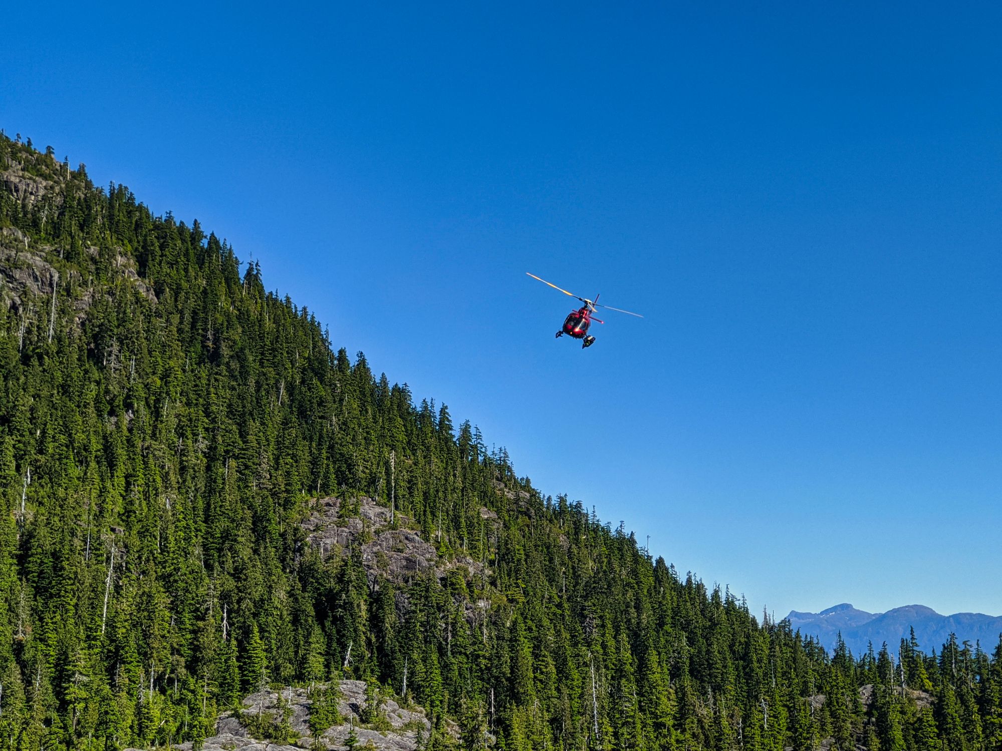
We departed Cream Lake at 8:00am, warming quickly as we climbed back up to the ridgeline. The searching helicopter continued to be heard as we hiked, and we saw it throughout the morning as it traced the trail and surrounding areas. We careened down the winding trail back to Bedwell Lake and made it there by 9:40am, just in time to watch the helicopter depart from a gravel beach beside the lake.
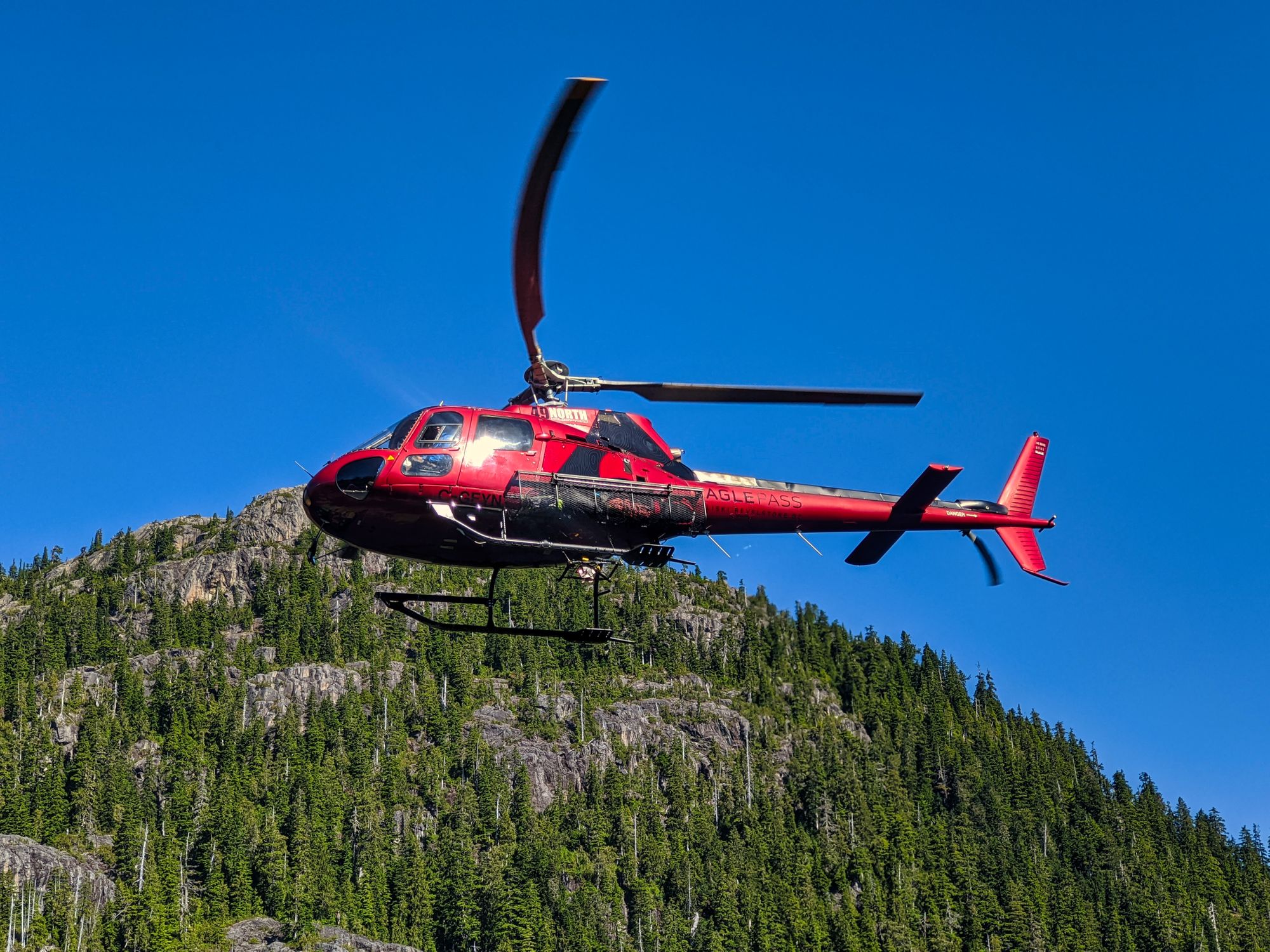
After a short break at Bedwell, we continued another 45 minutes down the trail to the high point above Baby Bedwell Lake, where we saw the helicopter for the last time. Recognizing us from earlier, the pilot flew a showy descending turn over the small lake and then adjacent to the trail where one of the crew stuck a hand out the window and gave us a wave.
Following all that excitement, the remainder of our hike out was uneventful. We axed our plans to explore Baby Bedwell Lake as it was packed with campers. We opted instead to carry straight on back to the parking lot. When we departed, the parking lot was even more full than it had been at our arrival.
With 2 out of 3 hikes and 6/9 days of our trip complete, we were getting in the groove. We were thankful for our peaceful day at Cream Lake, knowing that our next hike - over the long weekend - would be much busier. We tossed our packs in the RV and headed for Comox. Mt Albert Edward and the Castlecrag Loop were up next!