Sunshine Coast Trail - Everything we wish we knew before hiking
A comprehensive "FAQ" of questions we were asking before we hiked, and everything we wish we'd known ahead of time!
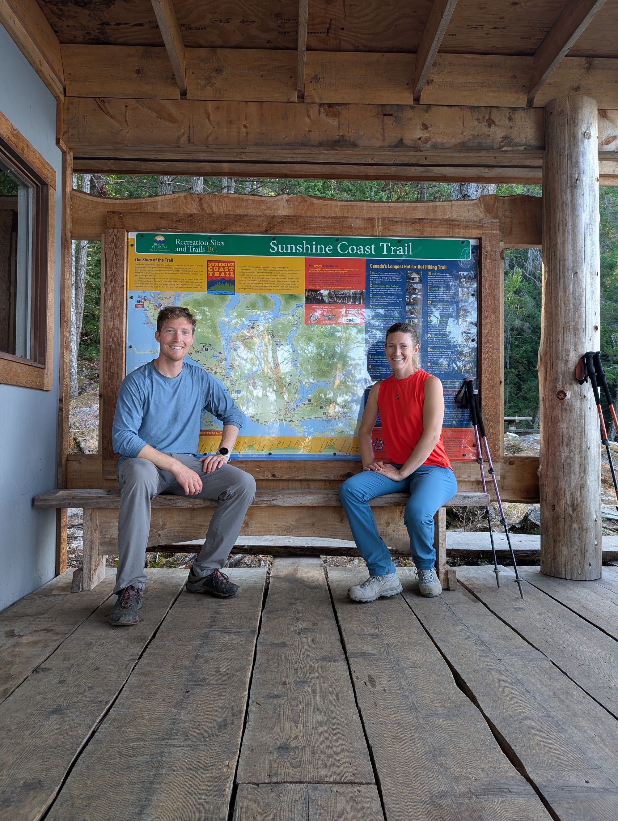
The Sunshine Coast Trail is Canada's longest hut-to-hut hiking trail, at an advertised distance of 178km. We say "advertised" because over the years there have been multiple trail reroutes due to fires, natural erosion, and active logging operations, making the overall distance some amount longer.
The SCT runs all the way along the northern section of the Sunshine Coast, which will either require ferries or a plane charter to access.
Getting to the Sunshine Coast via ferries...
From Vancouver:
Access from Vancouver will require two ferry crossings. First, find your way to Horseshoe Bay ferry terminal and cross over to Langdale. From there, you will need to find a way north to Earls Cove to cross over to Saltery Bay.......
Talk about bus options across Sechelt.....
The Southern end of the SCT is only a few minutes on foot from the ferry terminal.
From Vancouver Island:
Travel to Comox. Take a ferry from the Little River terminal, which will drop you off in the middle of Powell River.
Getting to the Sunshine Coast via air travel:
Two airlines fly into Powell River:
1) Pacific Coastal Airlines.
The easiest for people coming from afar will likely be connecting a flight with Pacific Coastal Airlines, a smaller operator that will connect from larger airports such as Victoria or Vancouver.
2) Harbour Air
For locals, Harbour Air is a great option for getting to the SCT. They are a floatplane operator that flies out of multiple harbours across Vancouver Island, the Gulf Islands, and the Lower Mainland. They will drop you off right at the Shinglemill Pub, which makes dropping off any resupplies a breeze!
Note that any flights will not allow dangerous goods onboard, such as bear spray or camp fuel. Leave time to purchase these locally, or alternatively the Sunshine Coast Shuttle can pick them up for you for a fee.
Getting around the Sunshine Coast:
There are a few main options for traveling the around the Sunshine Coast once you get there:
1) Drive. Note that the road from Lund to Sarah Point is a very steep gravel road. Only high clearance 4x4s will make it, especially in wet conditions. Most vehicles won't make it, so consider an alternate route.
2) Hitchhike. Nothing's guaranteed here, but the locals seemed very friendly to hitchhikers! It likely won't get you past Lund, but the roads from Saltery Bay to Lund are heavily trafficked.
3) Bus. The buses from Saltery Bay are sparse, so check current schedules and plan ahead. At time of writing, to get from Saltery Bay northbound you take the 12 until Powell River and connect onto the 14 to Lund. The 12 leaves Saltery Bay at 11:25 and 14:10, but does not operate on Thursdays or Sundays. The 14 (Lund) bus only operates twice daily on Mondays, Tuesdays, and Fridays.
Southbound is the opposite, so again plan ahead to get the right bus.
4) Taxi. Several taxi companies operate on the Sunshine Coast. Although more expensive than the bus, they will be cheaper than a Sunshine Coast Shuttle ride to connect between Saltery Bay and Lund.
5) Sunshine Coast Shuttle. The shuttle will get you anywhere on the Sunshine Coast, but it ain't cheap. With their 4x4s they are a great option to drive to Sarah Point. The shuttle also offers other services such as resupplies to austere locations, purchasing fuel or other supplies ahead for you, and last-minute pick-ups. They are also dog friendly!
Our ride from Saltery Bay to Sarah Point cost $375, but you can get cheaper rates by combining with other parties. We were offered a rate of $105 per person if we joined another pair leaving later the same day as our shuttle ride.
Don't expect accurate quotes from their website, it was super out of date when we checked it. Call or email for updated quotes.
Their website is: sunshinecoastshuttle.ca but has appeared to be offline for the last few weeks.
6) Lund Water Taxi. The water taxi is the other main option for access to Sarah Point, commonly used by SCT hikers. They don't list prices on their website, call for an updated quote. They are also dog friendly!
Their website is: lundwatertaxi.com
Yes! There are many access points, mostly by logging road, which make day hikes, single-overnights, and other shorter totally doable. Some common trip plans are:
1) Powell River to Lang Bay. We met several people who hiked the first 3 days of this itinerary. With easy access, great huts, and arguably the best views of the SCT on this leg, it is a competitive option for a smaller point-to-point overnight trip. We'd recommend the following relaxed(ish) hut-based itinerary:
- day 1: Powell River to Inland Lake. Day 1 transits along Powell Lake until Haywire Bay, and then plunges inland towards Inland Lake. Overnight is at a rec site. This day could be easily skipped to shorten the trip by getting a ride to Inland Lake.
- day 2: Inland Lake to Confederation Lake Hut. This short day leaves lots of time to explore other areas on Inland Lake or to use the boat at Confederation Lake. Overnight is at Confederation Lake Hut.
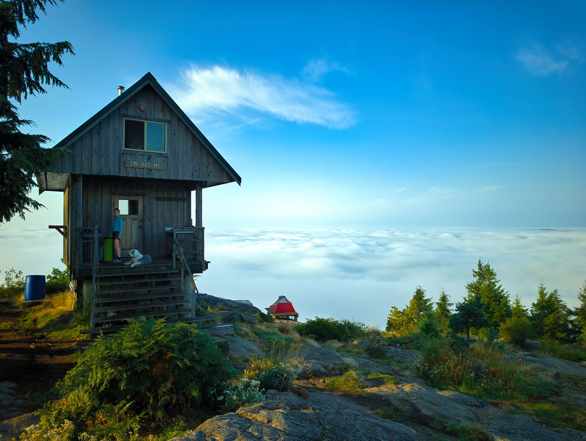
- day 3: Confederation Lake to Tin Hat Mountain Hut. Day 3 has a large descent down to Fiddlehead Landing and then a big climb up to Tin Hat. Get ready to carry water - there's none at the top of Tin Hat Mountain. Beautiful sunsets and sunrises from this high point. Overnight at Tin Hat Hut.
- day 4: Tin Hat to Elk Lake Hut. Loop around Lewis Lake and then head to Elk Lake. This trail spends a lot of time following abandoned logging roads, so there's lots of old logging gear to see being slowly swallowed by the forests. Enjoy the dock at Elk Lake for an afternoon swim! Overnight at Elk Lake Hut... Get ready for roommates, there's mice.
- day 5: Elk Lake to Walt Hill Hut. A relatively short day takes you past Coyote Lake and up to Walt Hill. Water at Walt Hill can be seasonal so plan ahead. See if you can find Walt Hilton on the way around the longer route to the Walt Hill Hut! Enjoy a good sunset, followed by absolutely incredible sunrise from Walt Hill looking over the Lois Lake in the distance. Overnight at Walt Hill Hut.
- day 6: Walt Hill to Lang Bay. Final day! Descend down as the trail winds it's way around logging areas, to finally arrive at the Lois Lake dam at the bottom. A short walk will have you back out at pavement in no time to find a ride home!
2) Lang Bay to Saltery Bay. This route shares its ease of access with the route prior. Ascending up and over Mount Troubridge, it will give your legs a workout!
- day 1: Lois Lake to Troubridge. Head out from the Lois Lake dam or one of the rec sites. Head uphill for the long climb to the Mount Troubridge Hut. Elephant Lake makes a nice rest spot before the trail really gets steep. Overnight at either the Mount Troubridge Hut or Mount Troubridge Emergency Shelter. The hut is larger and has water access, but the emergency shelter is at the summit and has great views nearby! Recent renovations made the emergency shelter very liveable and added a toilet and bear cache, so we wouldn't hesitate to visit. Bring water from the main hut (Jocelyn Pond).
- day 2: Troubridge to Fairview Bay. Yesterday was all up, today is all down. Descend hard from Troubridge and take a well deserved swim at Rainy Day Lake before continuing on to Fairview Bay. The ocean is great for an evening swim as well! Good water source, but be prepared in dry late summer seasons to carry water from Rainy Day Lake. Overnight at Fairview Bay Hut, enjoy the sunrise.
- day 3: A quick 6km hike out will take you to Saltery Bay and your way home. Enjoy the pretty coastal Arbutus along the route!
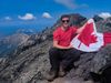
3) Tin Hat overnight loop. Tin Hat mountain is one of the best viewpoints along the trail, and due to easy access is definitely the most popular. It is also a great spot for a short overnight loop, as staying overnight will allow you to see the fantastic sunset and sunrise from this peak!
- day 1: Tin Hat. Access the parking area from a spur road off of Eldred River Road, leading up the south side of Tin Hat Mountain. A short (30 min - 1h) hike will take you to the top. Bring water, as there's none on top of Tin Hat. Overnight at Tin Hat Hut.
- day 2: after sunrise, enjoy a lovely hike down and around Lewis Lake. The SCT crosses Eldred River Road to the south side of Lewis Lake, at which point you can climb back up to your car.
4) Fairview Bay and Rainy Day Lake loop. These areas make a nice easy weekend loop, and are a good option for doing short hikes with additional day hikes from the cabins.
- day 1: Saltery Bay to Fairview Bay Hut. Enjoy the short 6km coastal hike, before dropping your bags at the hut and deciding what to do for the afternoon. Would also be a good option to access after a travel day or work day if you don't have a full first day to hike. Overnight at Fairview Bay Hut.
- day 2: Fairview Bay to Rainy Day Lake Hut. Today is only about 3km, but allows day hiking access up onto the lower slopes of Mount Troubridge after bags are stored at Rainy Day Lake Hut. Enjoy a swim from the dock at the lake at the end of the day! Overnight at Rainy Day Lake Hut.
- day 3: a short day out. Take the alternate trail direct to Saltery Bay for an easy hike down to the car.
5) Sarah Point to Powell River. This is the most logistically complicated due to the difficult access to Sarah Point. This will likely be the quietest section of the SCT in all seasons.
- day 1: Sarah Point to Manzanita Bluffs Hut. After a lift from Sunshine Coast Shuttle or the Lund Water Taxi, start southbound from the northern trailhead of the SCT. Ensure you stop at Wednesday Lake for a swim, before carrying on to Manzanita Bluffs Hut. There's no water at the hut, so fill up ahead. Overnight at Manzanita Bluffs Hut and enjoy the amazing sunset!
- day 2: Manzanita to Sliammon Lakes. A big day. Head out early from Manzanita to leave lots of time! Work your way down and across the high bluffs of the Malaspina peninsula, and then across the low grounds near Plummer and Toquenatch. Try to hold off your lunch break til Gibraltar Lookout for the amazing views, and then continue on. Pass by Rieveley Pond Hut and continue on towards Appleton Canyon. Check out the waterfalls in the canyon, then carry on to camp either at Sliammon Lake (Kokanee Creek Rec Site) or Little Sliammon (Shangri-La Rec Site) and enjoy the swimming!
- day 3: Sliammon Lakes to Powell River. Continue on through the forests towards Scout Mountain, and then to the Shingle Mill. This short day should have you at the pub for lunch!
We took 10 days, which seems to be pretty common based on what we've read on the SCT Official Facebook Group and in hut logbooks along the way.
YES...
but so worth it!
We would definitely recommend carrying some sort of shelter. Huts can be full, or for whatever reason you could not make it to a destination (or just find a nicer place to stop). Having a self-sufficient shelter gives you a lot of flexibility.
The huts are all first-come first-served, with no bookings required (or available). Priority for bunk spaces is to be given to thru-hikers.
No. Less than 10km of the SCT was actually along the ocean, and those sections were only at the extreme North and South ends of the trail. Be prepared for a lot of woodland and bluff hiking!
It is totally FREE to hike the Sunshine Coast Trail. The Trail volunteers suggest a donation of $10/person/night. Some Rec sites are operated by BC parks, which cost $5/person/night.
Yes! The Shinglemill Pub in Powell River and Lang Bay Store in Lang Bay both allow hikers to leave resupply packages. The Shinglemill Pub is conveniently located directly on the trail route. Note that if you choose to resupply at the Lang Bay Store, it will add approximately 5km to your hike.
Additionally, the Sunshine Coast Shuttle will drop off your resupplies wherever you like for a fee. More information is on their website here.
Yes, "well-behaved" on-leash dogs are allowed on all sections of the trail. Dogs are not allowed in any of the huts. Dogs are allowed on both the Sunshine Coast Shuttle and Lund Water Taxi.
As of time of writing (September 2025) every hut has a composting toilet and bear cache. Campgrounds along the trail all have some kind of outhouse (some old-style pit toilets and some of the newer composting ones), but bear caches were hit-and-miss at campgrounds.
On the issue of water: a lot of the streams along the SCT are seasonal, meaning that after a dry spell/towards the end of the summer a lot of them are dry. For huts, campsites, points of interest, and water sources along the trail, check out the "SCT Trail Odometer" section below - water sources highlighted in blue.
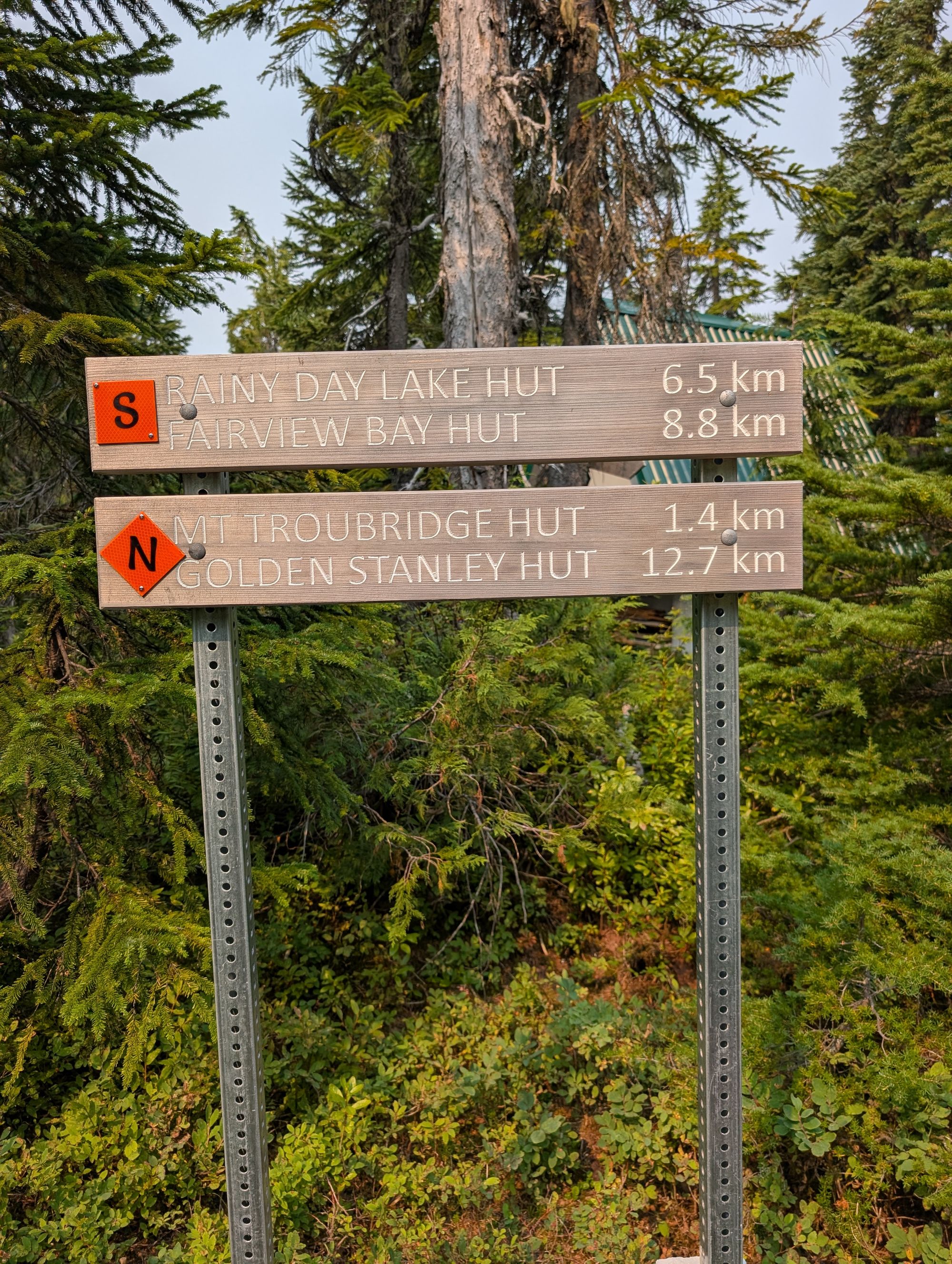
Navigation along the trail is quite straightforward. Orange reflective markers are frequently placed on trees; square markers for southbound and diamond markers for northbound. There are also KM markers placed at each 1km interval (mostly - there were a couple sections with gaps when we hiked), however they are not all exactly 1km apart! Older signs with locations and distances listed give a good estimate, however have become inaccurate over time due to reroutes/detours. The newer signs featuring N and S orange blazes have more accurate (as of September 2025) distances listed.
We hiked from the end of August into early September and found the conditions to be pretty ideal - good weather (minimal rain), no heat wave, zero bugs, and not very busy with other hikers. The trade-off hiking that late in the season is a lack of seasonal water sources... which just means you need to plan a little more carefully, and do some demanding water slogs uphill.
The trail is a lot busier in mid summer (June to August), and we've heard lots of complaints about mosquitos and other bugs at that time of year. Keep in mind that if you hike any earlier in the season than May, you're most likely going to have to contend with snow along the higher elevation portions of the trail.
We found a hard copy of this odometer on our final night at Fairview Bay Hut. We wish we had all this information sooner for trip planning! Distances are approximate as we don't know when it was written and it doesn't factor for newer detours.
Lands End (Sarah Bay to Wednesday Lake)
0.0 - Sarah Bay Hut - North Trailhead of SCT. Fully enclosed hut. Seasonal water available by following signed trail to creeks.
0.6 - Sarah Point - Regional campsite, parks fees apply. Has outhouse and bear cache.
2.8 - Feather Cove - Regional campsite, BC Parks fees apply. Great ocean access! Has outhouses and bear caches.
5.3 - Hinder Lake - Small lake, safe water source.
8.1 - Bliss Portage footbridge - Seasonal water source.
8.2 - Bliss Portage Hut - Fully enclosed hut.
12.0 - Wednesday Lake - Large lake, great swimming access. May be last water source prior to Manzanita Bluffs Hut. Has camping areas and outhouse.
Gwendoline Hills (Wednesday Lake to Malaspina Road)
12.4 - Wednesday Creek - Trail junction with exit towards Gilpin Road. Seasonal water source.
13.7 - Doctors Chute Junction - Trail junction with exit towards Gilpin Road.
16.0 - Manzanita Bluffs Hut - Epic vista over Malaspina Peninsula. Semi-enclosed hut.
17.0 - Spire Trail - Trail junction with exit towards Lund.
17.5 - Thulin Springs - Seasonal water source.
19.0 - Krompocker Junction - Trail junction with exit towards Pryor Road and highway.
Thunder Ridge (Malaspina Road to Plummer Creek)
21.3 - Malaspina Road.
22.6 - Fern Gulley Creek Bridge - Seasonal water source. and basic camping area.
Toquenatch (Plummer Creek to Homestead)
25.2 - Plummer Creek Road.
25.8 - Plummer Creek Bridge - water source with camping area and outhouse.
26.7 - Toquenatch Falls - Pretty falls, trail across bridge leads to Southview Road.
28.2 - Trail junction with Southview Ridge Trails.
28.3 - Toquenatch Creek Bridge - Water source.
28.5 - Ancient Toquenatch Douglas Fir.
28.8 - Southview Road.
28.9 - Homestead Campsite. Reportedly closed...?
Marathon (Homestead to Appleton)
29.6 - Trinket Trail Junction.
30.3 - Chocolate Lily Junction.
31.2 - Gibraltar Lookout Junction.
31.6 - Gibraltar Lookout.
32.5 - Theodosia FSR.
33.5 - Rieveley Pond Hut. Semi-enclosed hut. Okay water source.
35.3 - Appleton Creek Rec Site detour.
35.6 - Appleton Creek Rec Site - Camping areas and outhouses available. Water source.
Appleton Canyon (Appleton to Sliammon Lakes)
36.2 - Gorge Falls - Gorgeous falls and swimming hole.
37.7 - Tomkinson Road and parking area.
Sliammon Lakes (Sliammon Lake to Scout Mountain)
39.1 - Theyeth Lake (Upper Sliammon Lake) and Bogus Mountain Vista.
39.2 - Kayach Bluffs.
40.0 - Kokanee Creek Campsite - Campsite at edge of Sliammon Lake. Great swimming! Lots of tenting areas and an outhouse. No bear cache. Water source.
41.2 - Dogleg Pond.
42.5 - Little Sliammon Lake.
43.1 - Shangri-La Campsite - Gorgeous campsite with outhouse, bear cache, covered cooking area, and dock. Two boats at the site, both looked unserviceable. Water source.
43.9 - Kwolum Springs Junction - Access Tla'amin trail networks.
Scout Mountain (Scout Mountain to Shinglemill Pub)
47.3 - Scout Mountain Junction.
47.9 - Third Bench - Great lookout towards the Shinglemill.
50.2 - Shinglemill Pub. Resupply point and great lunches that you don't have to carry! Water available.
Mowat Bay (Shingle Mill to Mowat Bay)
50.6 - Powell River Bridge.
52.6 - Mowat Bay Municipal Park - Toilets and great swimming available.
Tony's (Mowat Bay to Haywire)
53.4 - Tony's Trail (climb over bluff)
55.4 - Tony's Point - Gorgeous camping area on lakeside. Great swimming access. No toilets or bear cache. Water source.
57.0 - Lost Creek Bridge.
57.2 - Outdoor Learning Centre - Cabins available for rent, would be a great alternative to Haywire!
57.9 - Haywire Bay Campground. Water spigots, campsites, toilets, and hot showers available ($).
Lost Lake (Haywire to Lost Lake)
59.0 - Haywire Bay Bluff Junction.
62.0 - Lost Lake bench at lakeshore - water source.
Inland Lake (Lost Lake to Confederation Lake Trail Junction)
62.8 - Inland Lake - Turn right to follow south side of lake.
64.0 - Inland Lake Rec Site - Camping area with outhouses. Has a dock with great swimming areas.
66.6 - Inland Lake Totem Pole.
Confederation Lake (Junction to Confederation Lake Hut)
66.8 - Confederation Lake Trail Junction - Turn right to follow SCT. Anthony Island hut is short detour straight ahead. Anthony Island hut is a rustic cabin, but has an outhouse nearby. Be prepared for roommates (bats), the hut isn't sealed.
67.8 - Rubber Band Junction.
68.4 - Seasonal stream.
69.7 - Stealth Falls and bridge. Seasonal water source.
72.0 - Confederation Lake.
74.1 - Confederation Lake Hut. Fully winterized hut with bear cache, swimming, and leak-free rowboat. Cleanest hut that we stayed in during our trip! Water source.
Fiddlehead Landing (Confederation Lake to Fiddlehead Farm)
74.9 - Vomit Vista.
81.0 - Fiddlehead Junction. Fiddlehead Hut is 0.8km detour downhill from the junction. The only hut that we didn't see on our trip.
81.1 - Scheiber Crossing - running water source.
81.4 - Fiddlehead Farm/The Old Orchard. Camping area with outhouse and covered cooking area. Might find apples on the old orchard trees!
Tin Hat (Fiddlehead Farm to Lewis Lake)
83.0 - Shakebolt Dam Bridge - Last strong water source prior to Tin Hat.
86.0 - Bottom of switchbacks.
86.5 - Haslam Vista Bluff.
86.7 - Seasonal creek.
87.0 - Seasonal creek.
88.0 - Tin Hat Road Junction.
89.3 - Tin Hat Mountain Hut. Fully winterized hut with bear cache. No water at Tin Hat.
Lewis Lake (Lewis Lake to Spring Lake)
93.0 - Lewis Lake Main.
93.8 - Lewis Hobbit Campsite - Campsite with bear cache and outhouse. Great lake access.
95.1 - Lewis Creek bridge.
97.9 - Spring Lake Main.
March Lake (Spring Lake to Elk Lake)
106.0 - Old SCT March Creek crossing.
107.2 - March Lake (spur ATV trail to tent site).
109.1 - Elk Creek. Seasonal water source.
109.3 - Elk Lake Hut. Great lake access.
Elk Lake Loop (Elk Lake to Hotdog Creek)
110.3 - Summit pond junction. Follow "Outside Route".
110.9 - Horshoe Valley Vista.
114.0 - Junction with Elk Lake "Inside Route".
114.2 - Hotdog Creek. Seasonal water source
Walt Hill Trail (Hotdog Creek to Suicide Pass)
116.0 - Coyote Lake (dock, camping, water).
120.0 - Blackwater Springs. Seasonal water source *dry Sept 1.
120.5 - Walt Hilton (emergency shelter).
122.5 - Bridge of Doom seasonal water source.
123.0 - Walt Hill Hut. No water.
125.1 - Walt Creek. Seasonal water source.
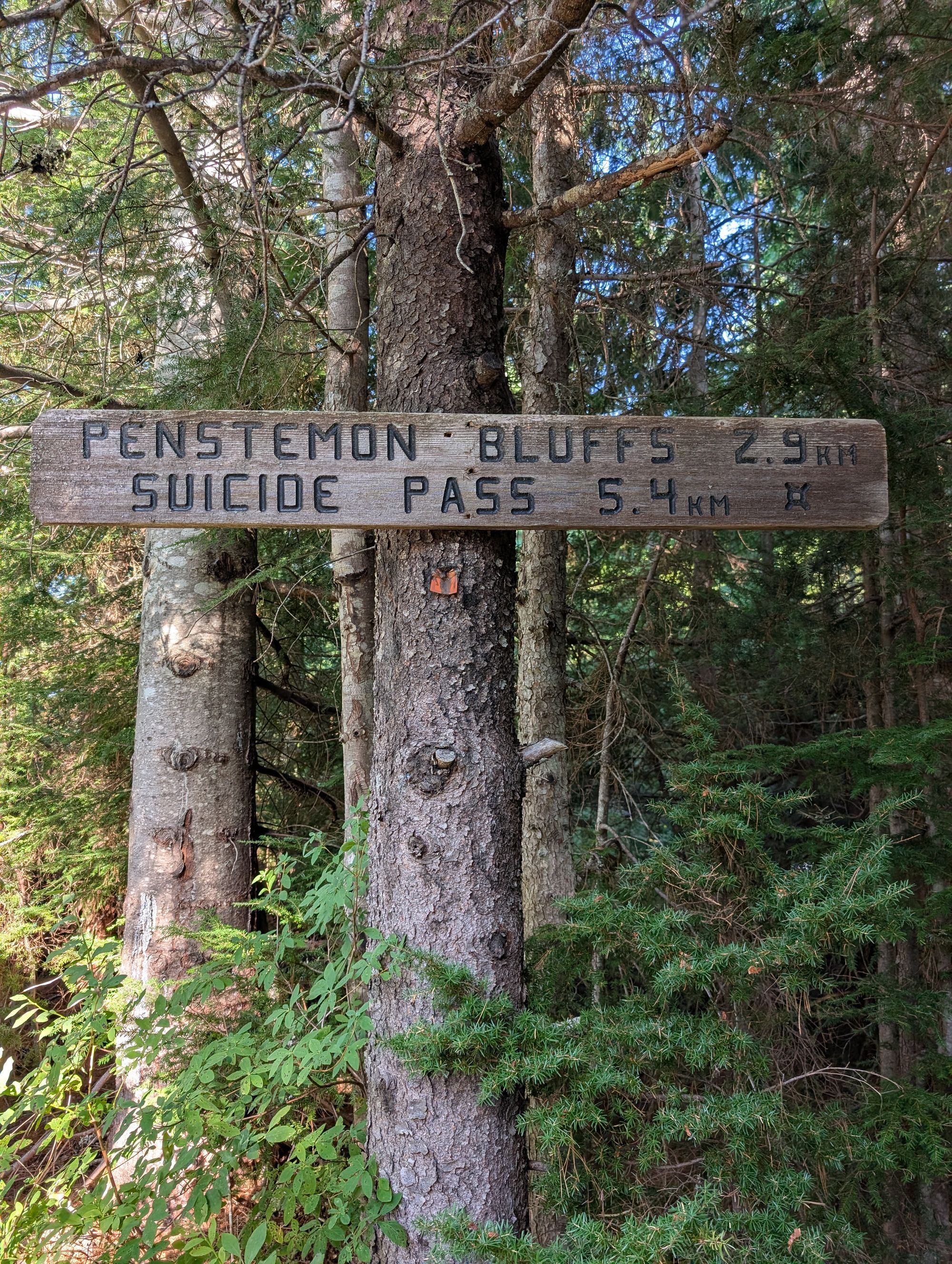
Suicide Pass
126.0 - Suicide Pass.
127.0 - Campsite; seasonal creek.
Smokey's Blue Ridge (Suicide Pass to Eagle/Lois River)
130.6 - Deer Creek emergency camp. Seasonal creek.
Eagle River (Eagle River to Lois Lake)
133.0 - Variable Retention bench, lookoff.
135.7 - Eagle (Lois) River crossing *no bridge.
Lois Lakeshore (Lois Lake to Golden Stanley)
137.1 - Lois Lake Dam.
139.7 - Br.41 Campground; canoe route staging.
141.5 - Lois Point campsite. Water access
143.9 - Squalor Beach.
Elephant Lake (Golden Stanley to Elephant Lake)
144.9 - Golden Stanley Hut. 100m to creek access.
146.3 - Buckwheat Creek.
148.0 - Stanley footbridge; water access.
153.8 - Elephant Lake. *The lakeshore had an algae bloom Sept 2025.
West Mt. Troubridge Trail (Elephant Lake to Troubridge Summit)
154.5 - New SCT route goes right.
157.5 - Junction; left for Troubirgde Hut, right for summit.
157.6 - Mt. Troubridge Hut; Jocelyn Pond (water source).
159.3 - Troubridge Summit Emergency Shelter. New sleeping quarters, outhouse, bear cache.
East Troubridge Trail (Troubridge Summit to Rainy Day Lake)
162.2 - Seasonal springs.
167.0 - Rainy Day Lake Road.
Rainy Day Lake Trail
167.2 - Rainy Day Lake trail - sharp left.
168.5 - Fairview Bay Trail junction; left for Fairview Bay, right for Rainy Day Lake.
169.0 - Rainy Day Lake Hut. Water access.
(A): Fairview Bay Trail (Rainy Day Lake to Saltery Bay via Fairview Bay)
169.5 - Trail Junction (Fairview Bay or direct Saltery Bay)
171.1 - Spur trail to Fairview Creek (water source).
171.2 - Fairview Bay Hut. Ocean swimming access.
173.0 - Ahlstrom Point.
176.0 - Pirate Cove picnic site (emergency tent site). No water source.
177.6 - Saltery Creek.
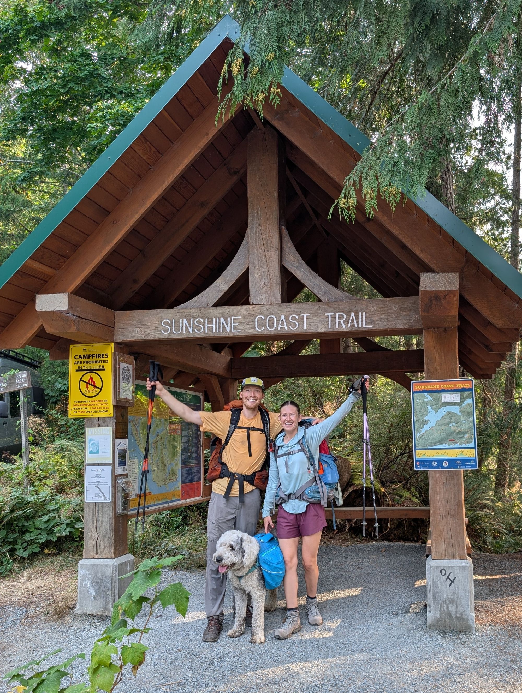
178.0 - SCT Southern Terminus trailhead parking & kiosk.
(B): Saltery Bay/Blue Grouse Ridge Trail (Rainy Day Lake to Saltery Bay bypassing Fairview Bay)
169.0 - Rainy Day Lake Hut. Water access.
169.5 - Trail Junction (Fairview Bay or direct Saltery Bay)
171.8 - Freil Falls Lookout. No water source.
178.0 - SCT Southern Terminus trailhead parking & kiosk.