SCT Day 5: Confederation Lake to Tin Hat Hut
Our fifth day was dominated by the large descent from Confederation Lake and the bigger climb up to the top of Tin Hat Mountain, carrying up water for the night. But Tin Hat didn't disappoint, the views were incredible!

Hiked September 1, 2025
Quick Overview
| Distance/ Elevation | 18km, 1300m | ||||
|---|---|---|---|---|---|
| Water Sources |
Confederation Lake Hut (KM74) Scheiber Crossing - creek (KM81) Shakebolt Dam Bridge (KM83) *last strong water source before Tin Hat Seasonal Creek (KM86) *gently/barely flowing September 1 Seasonal Creek (KM87) *no water September 1 |
||||
| Other Sections |
FAQ/General Trail Information SCT Day 4: Haywire Bay to Confederation Lake SCT Day 6: Tin Hat Mountain to Elk Lake Hut |
||||
| Facilities |
Confederation Lake Hut: Fully enclosed, winterized hut. 2 picnic tables, bear cache, extra-large tent platform, composting outhouse. Great swimming access, rowboat that doesn't leak (as of August 2025). Tin Hat Mountain Hut: Fully enclosed, winterized hut. 3 picnic tables, 2 wooden tent pads, 2 composting outhouses. A few more hidden places to pitch a tent, including one up at the summit. |
||||
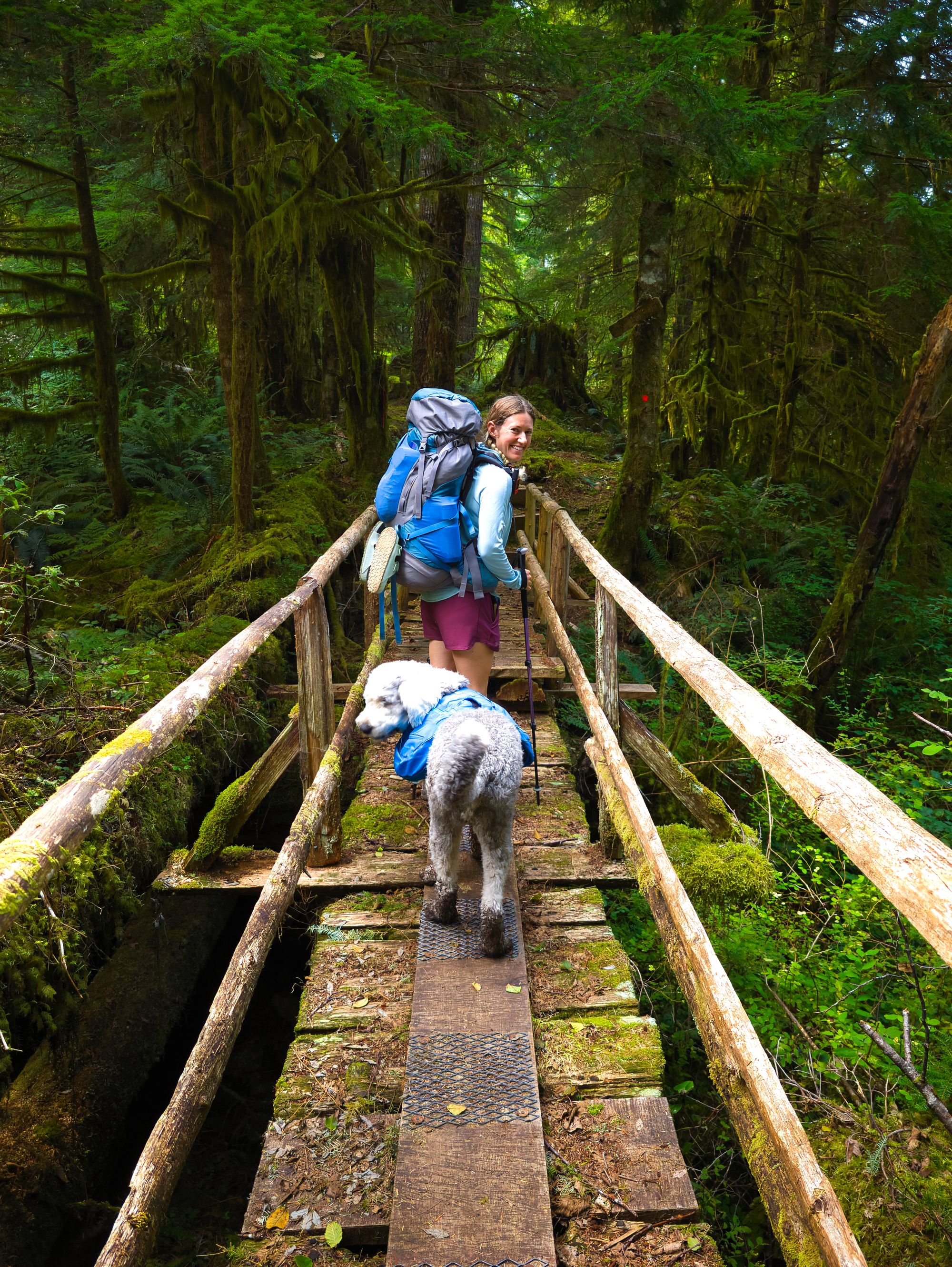
We woke up around 6AM and were on the trail just after 8. Our night in the Confederation Lake Hut had been punctuated by intermittent rain and wind, but that was nothing compared to the raucous snoring of one of our hut-mates. Definitely should have packed ear plugs!
The trail from the lake started with a quick flat(ish) stretch to Vomit Vista. It was an easy hike to the viewpoint for us going southbound, but wouldn't have been for northbound travelers coming up from Fiddlehead Landing.
Immediately after the vista, we hit the descent fast and wound our way down the ridgeline towards Powell Lake, losing over 500m of elevation in only a few kms. The trail worked its way down the ridge, but views were few and far between as trees still blanketed the area.
We stopped for a few minutes at Scheiber Crossing (Fiddlehead Creek) but opted not to take the 1.6km-return detour to the Fiddlehead Hut. Carrying on along the main trail, we saw a recently posted sign for a cougar in the area before we stopped for another break at the Old Orchard. It looks like a pretty viable spot for a quiet campsite, especially if the fruit on the trees was ripe!
Old Orchard
Lovely rustic camping area; big shelter with room for tents underneath; outhouse.
No bear cache. No water source.
As soon as we left the orchard, the trail began to climb. We moved between mossy tree wilderness and logging slash areas, but luckily stayed fairly cool due to good cloud cover.
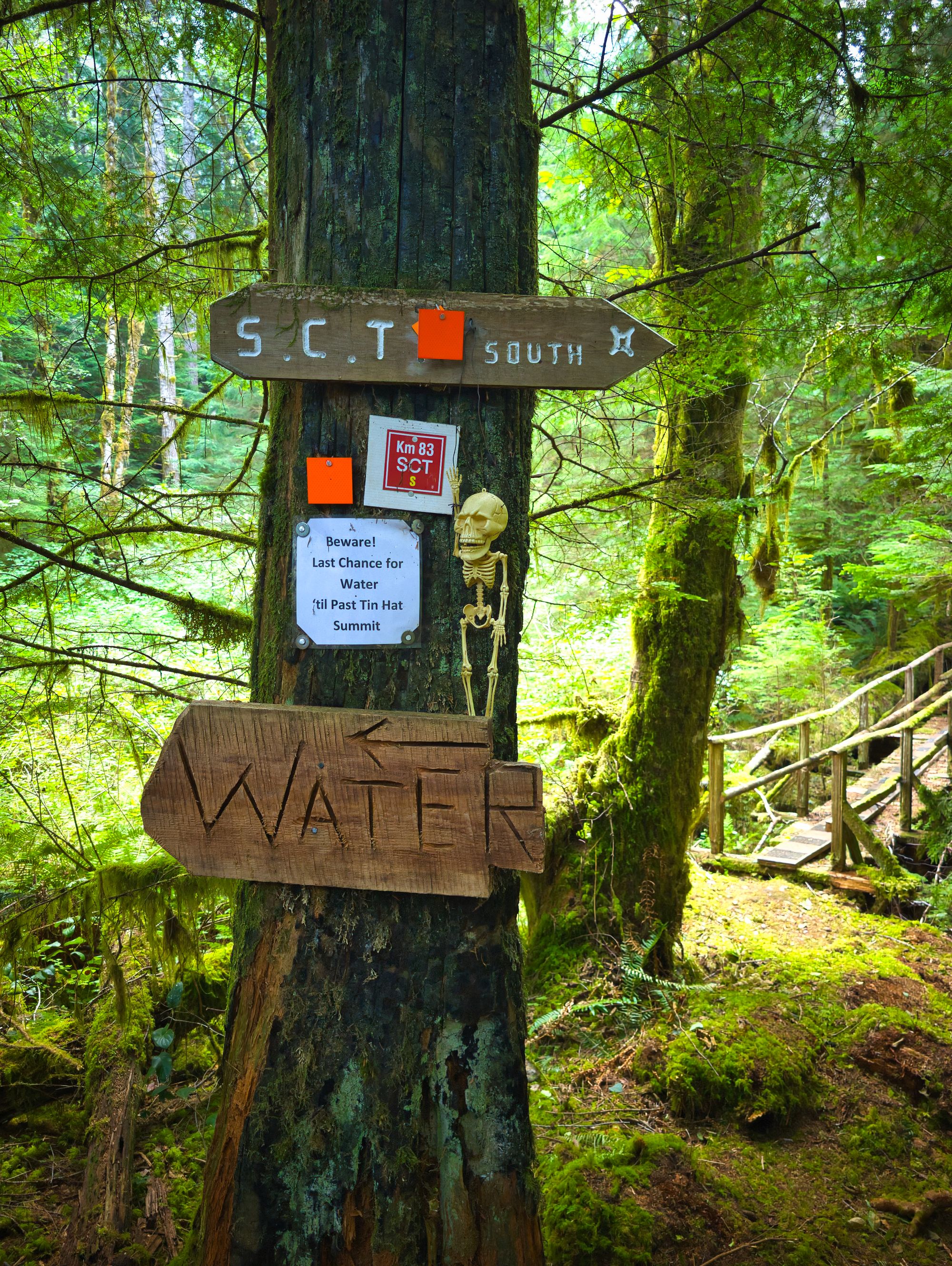
The sun broke through later in the afternoon as we continued our climb. We passed a couple small streams before arriving at the "last water" sign (at KM83) and stopped to fill up. We loaded our 10L MSR Dromedary full, shouldered our heavy packs and carried on.
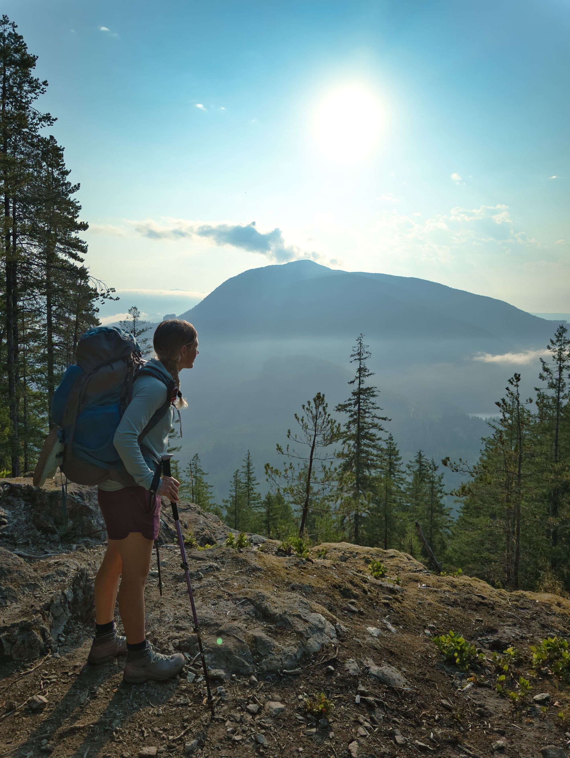
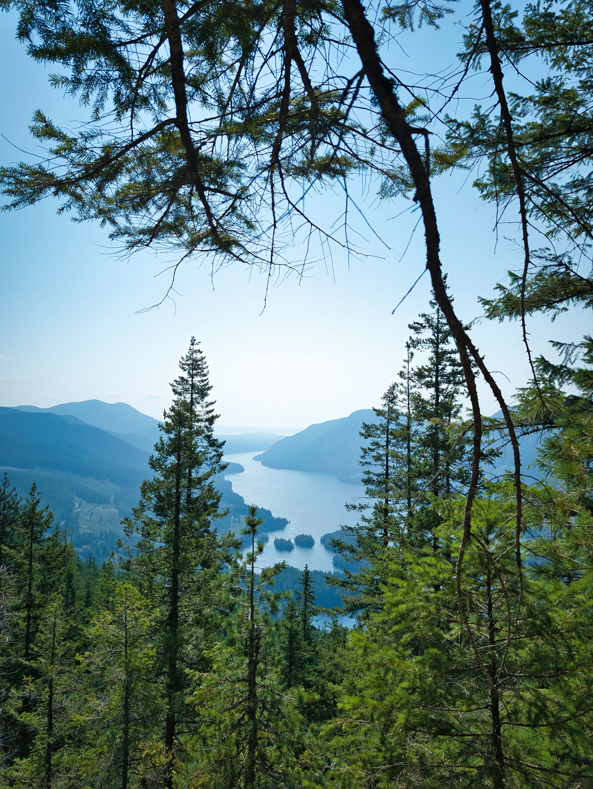
The rest of the climb was a real grind… It started with single track slashing its way diagonally across the mountain, and then began switch-backing up the southwest flank. The trail stayed deep in the trees as we climbed, but occasionally we got peekaboo views out to Haslam Lake to the south. The next few KM markers were missing, but despite other hikers warning us about this, we found not having those mini “goal-posts” made the climb feel longer.
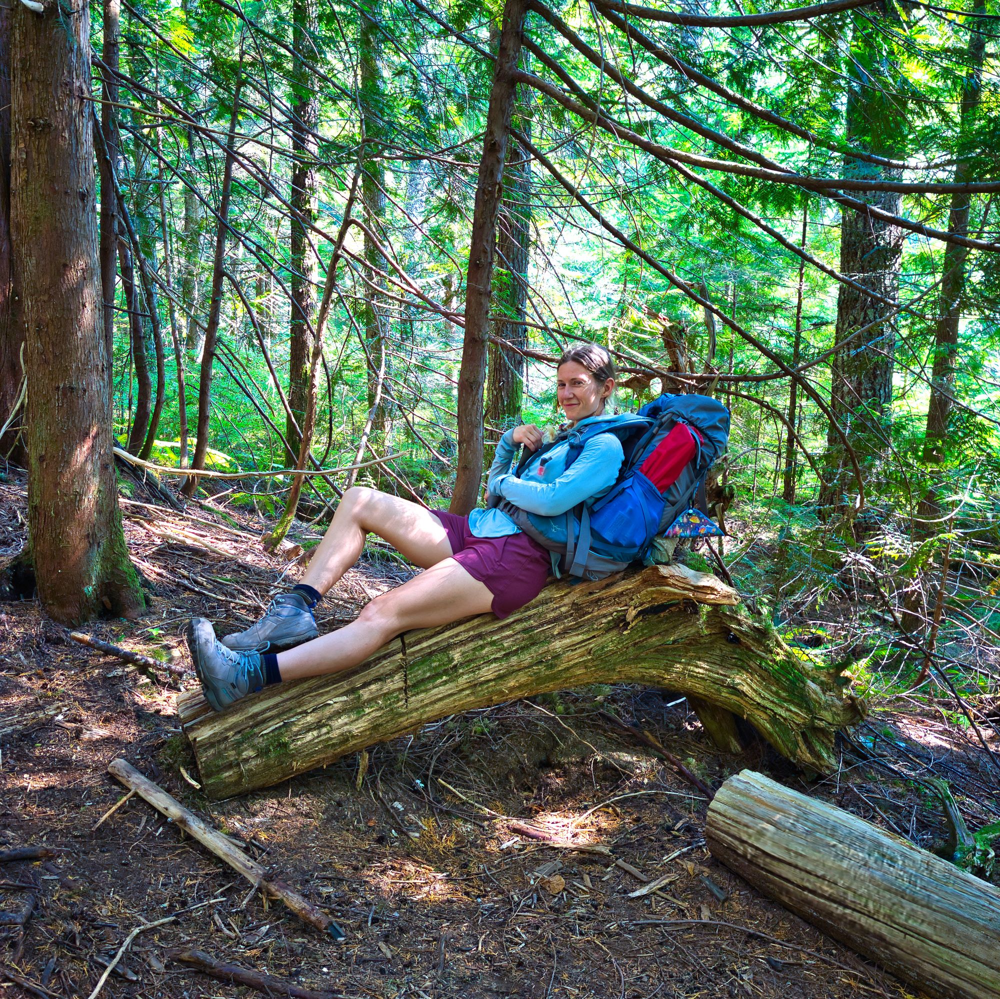
The creek at KM86 that had been reported fairly dry was flowing a bit, likely due to the rain the previous night. We sat on some logs here for a little while, wishing we’d waited to fill up on water to save ourselves a couple kilometres with the extra weight.
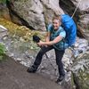
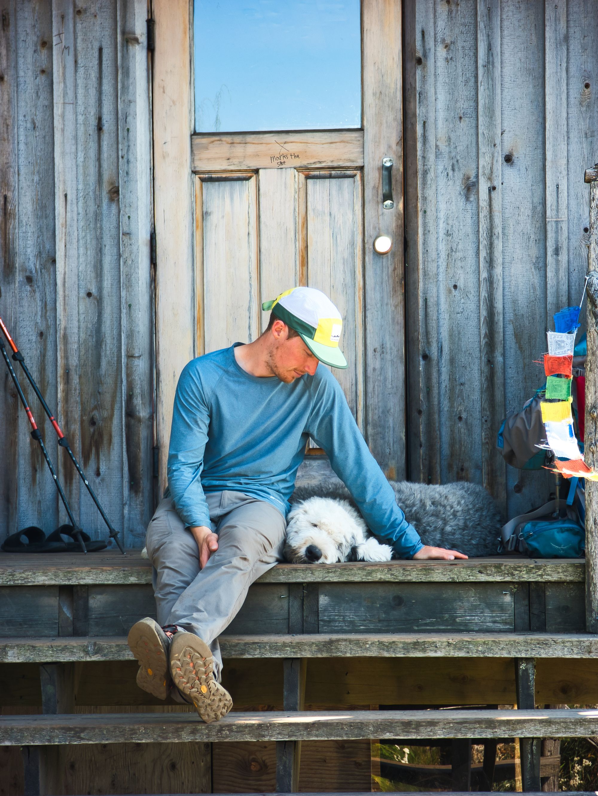
Higher up on the hillside, we started to find tons of huckleberry and blueberry bushes along the sides of the trail. The splash of sugar from these trail snacks really helped keep us going as we wound our way up the mountainside. Just before KM88 the trail joined a logging road heading straight up the mountain. We followed it until it ended and then continued on the steeper trail continuing up towards the hut. We sweated our way up this steeper singletrack until the hut finally revealed itself! We arrived around 3PM.
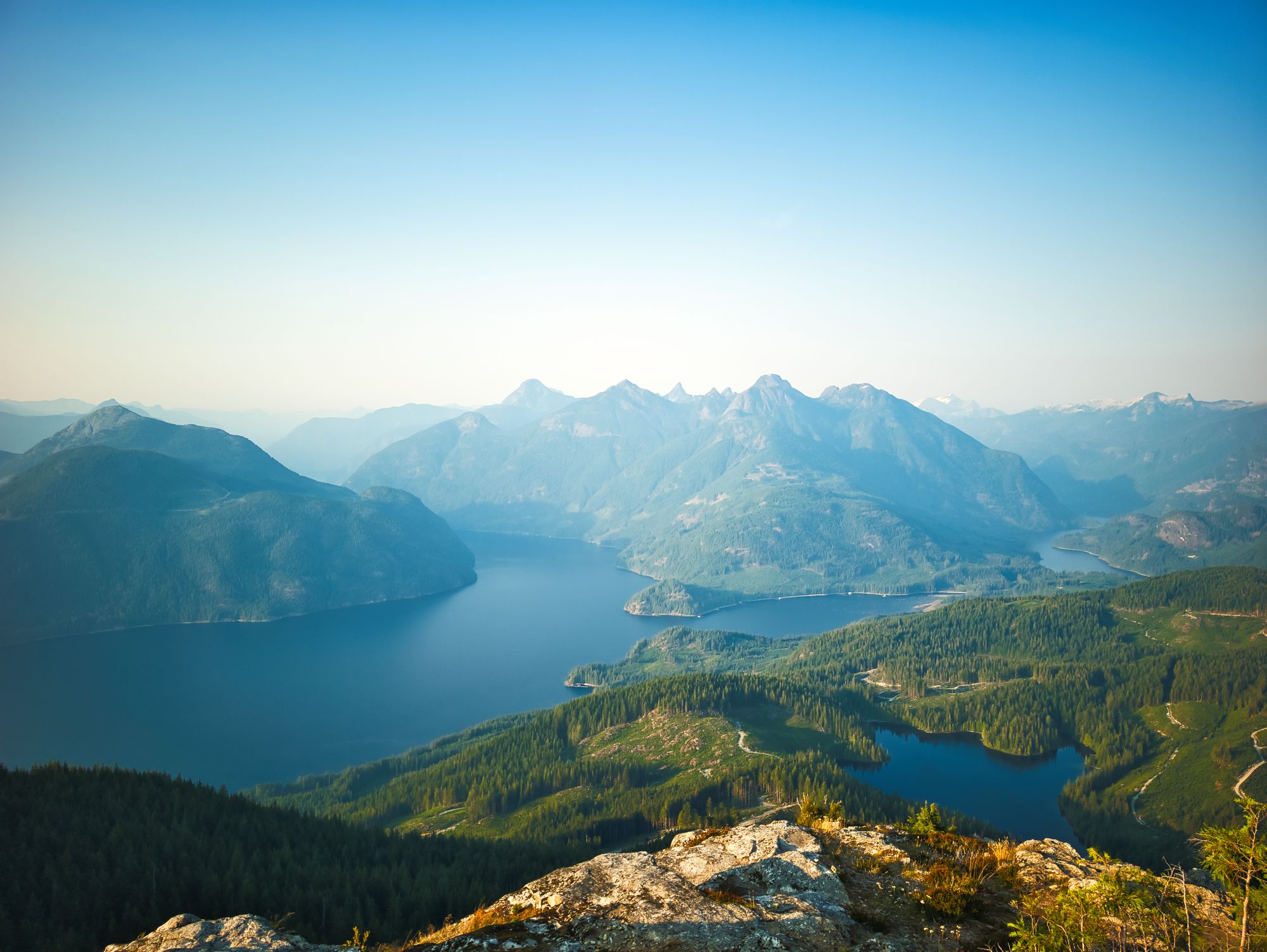
The view from the hut was truly was stupendous. We dropped our packs and said hello to some hikers we'd met the previous day, happy to cool down after quite the climb.
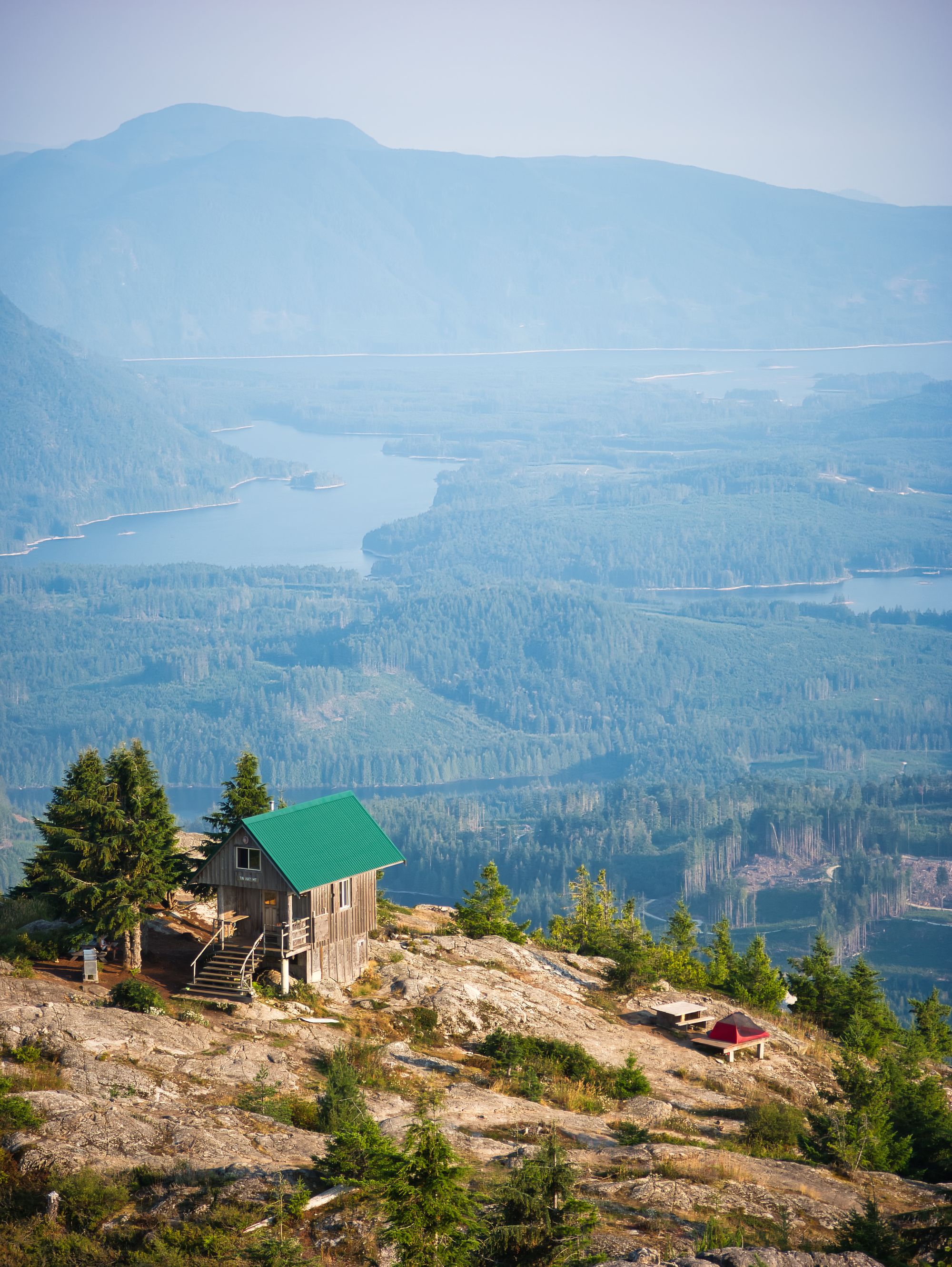
Tin Hat Mountain Hut
Fully enclosed, winterized hut with pellet stove and covered porch. 3 picnic tables, 2 wooden tent pads, 2 composting outhouses. A few more hidden places to pitch a tent, including one up at the summit.
Water source: NO..
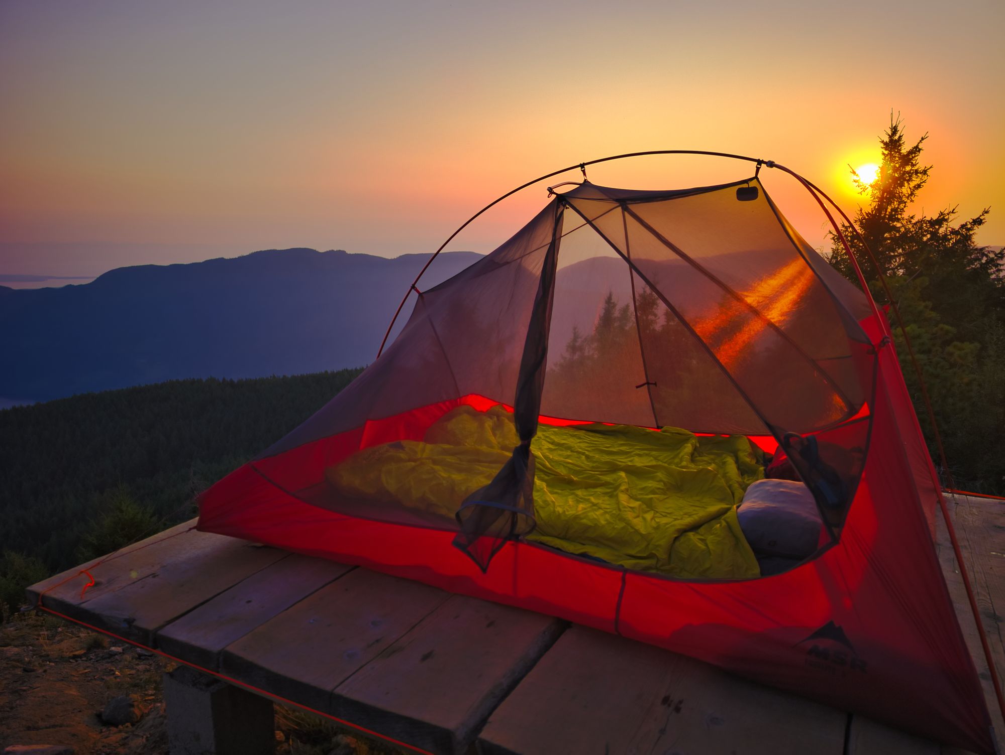
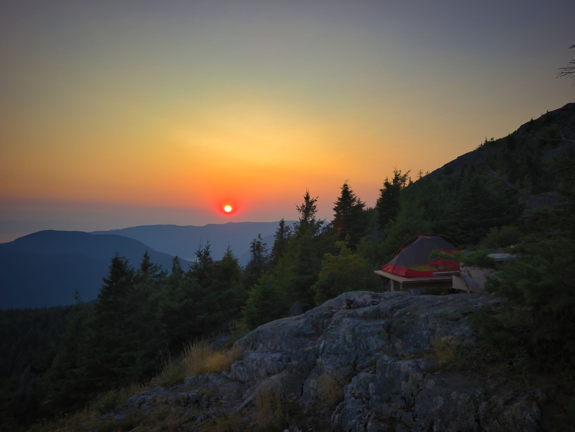
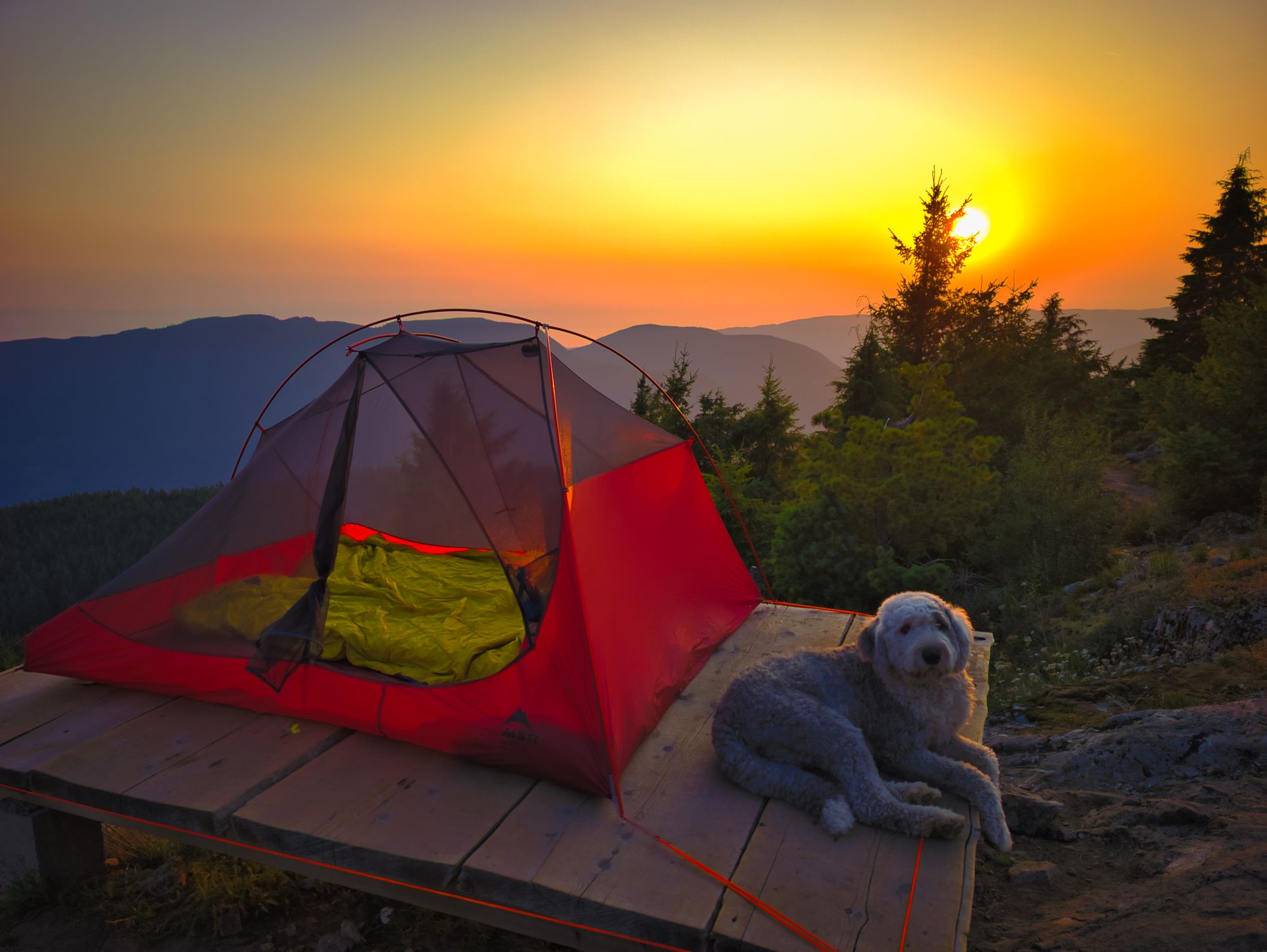
Our snoring friend from the previous night joined us at the hut area soon after, so we decided to set up our tent on the wooden pad overlooking Haslam Lake. We were also told by a local hiker that the hut is frequented by mice. Once camp was set up, we cooked a yummy meal and fed the dog.
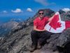
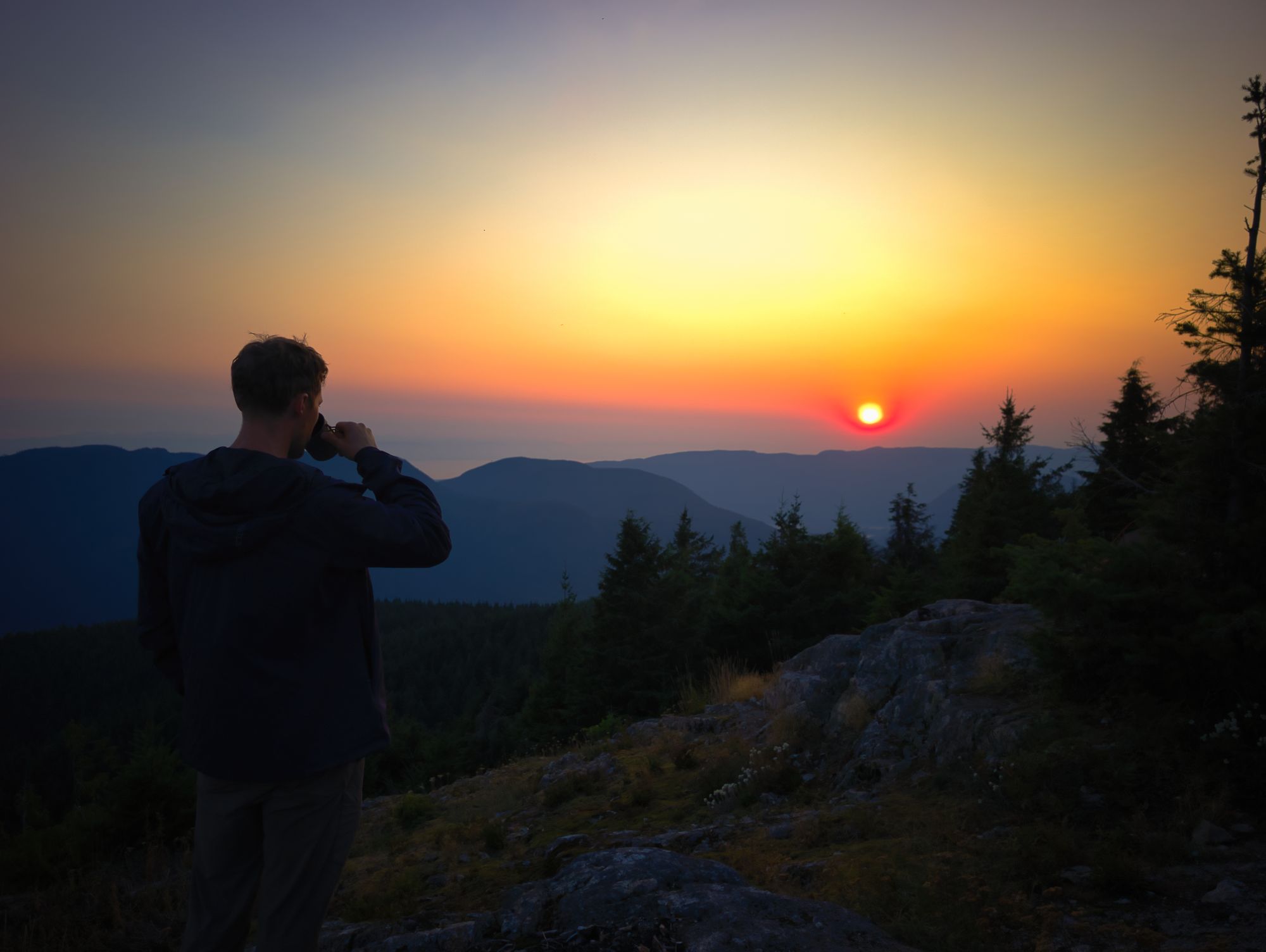
After dinner we hiked up to the summit for dessert – freeze-dried ice cream sandwiches, absolutely incredible – and to admire the views. The trail up from the hut is super short so we were up quick! Would definitely recommend wearing real shoes rather than camp sandals though, as it’s a bit scrambly in a couple parts. We met a solo hiker who'd set up a small tent on a flat spot near the top with a really fantastic view. We sat for a while, looking out over Powell Lake and the surrounding hills.
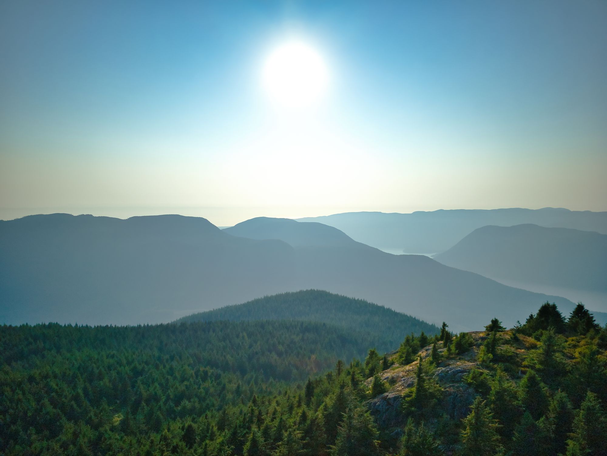
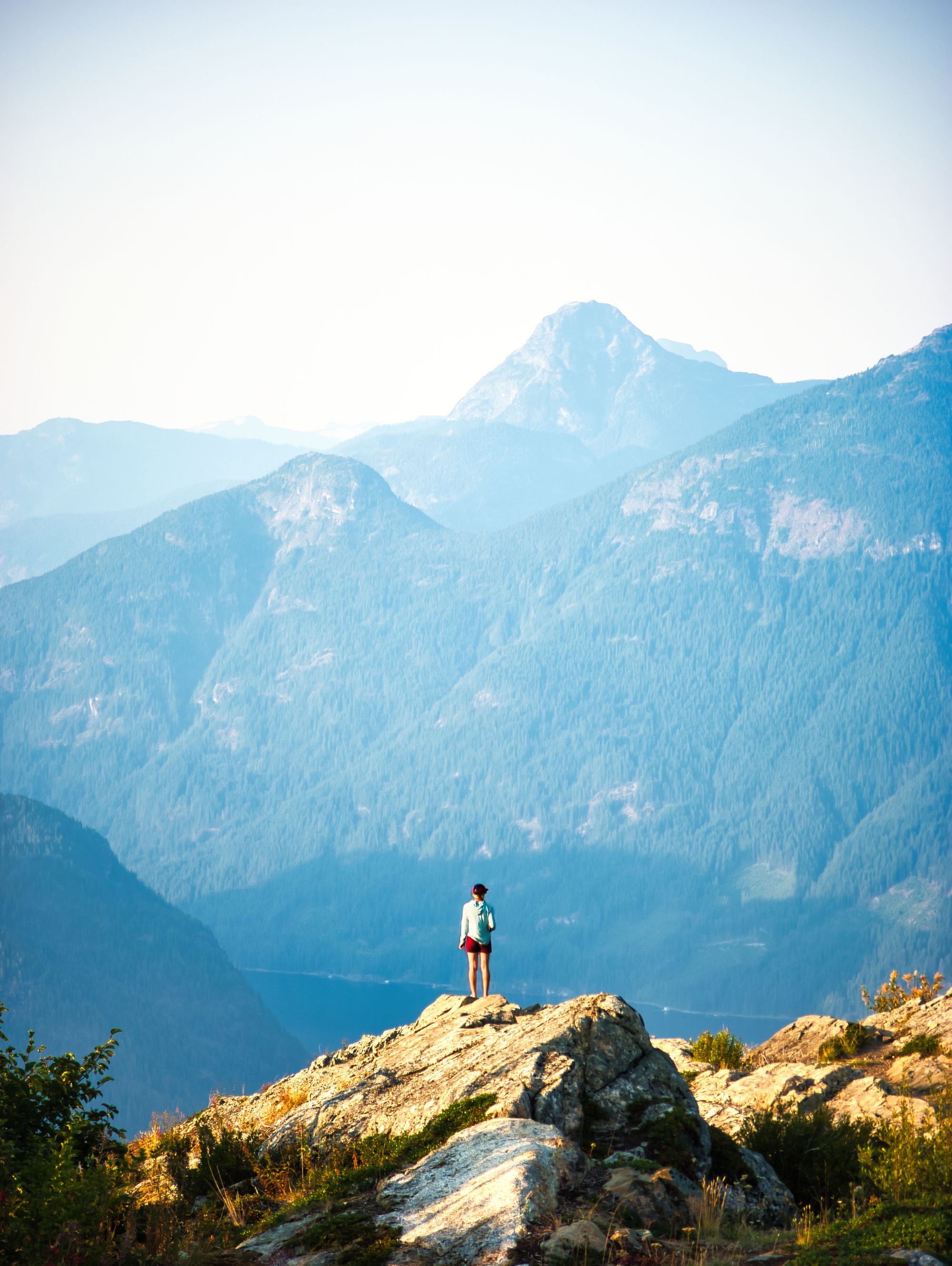
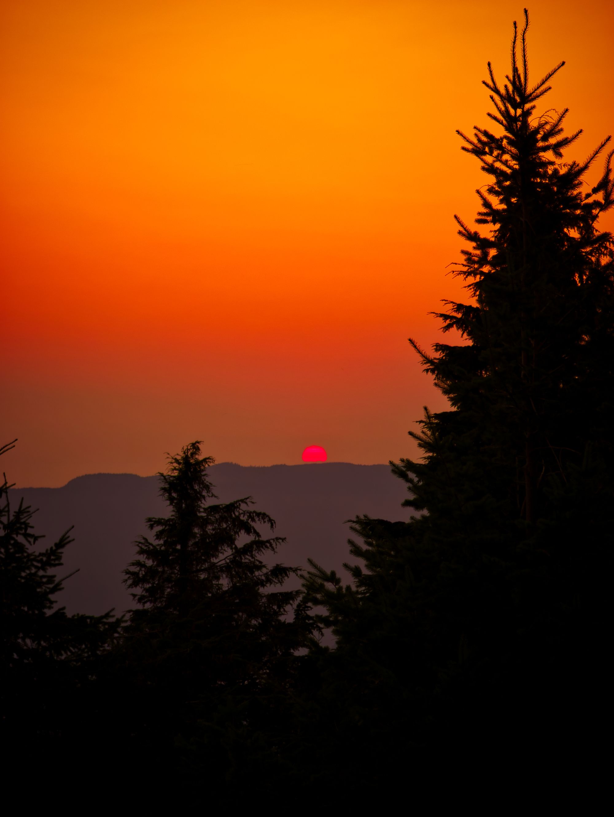
We came back down about an hour before sunset and watched the sun go down with the other hikers staying the night. It was an interesting sunset, the sun red and swollen as it cut through the smoke and haze. It slowly sank beyond the horizon, illuminating the island mountains in the distance as it disappeared from view.
Side note: be careful at the picnic table to the right of the hut. The screws securing the seat to the table are failing, so the bench seat popped up like a teeter-totter when Katie sat on the end!
FAQ/General Trail Information
SCT Day 4: Haywire Bay to Confederation Lake
SCT Day 6: Tin Hat Mountain to Elk Lake Hut