Exploring the Fryatt Valley
A hidden gem of an area within Jasper National Park! A 22km trail gives access to the Alpine Club of Canada's Fryatt Creek Hut and let us enjoy a quiet few days exploring some beautiful Rocky Mountain terrain. We had the pristine turquoise lakes and cozy cabin almost entirely to ourselves.
Dates hiked: July 12-15, 2025
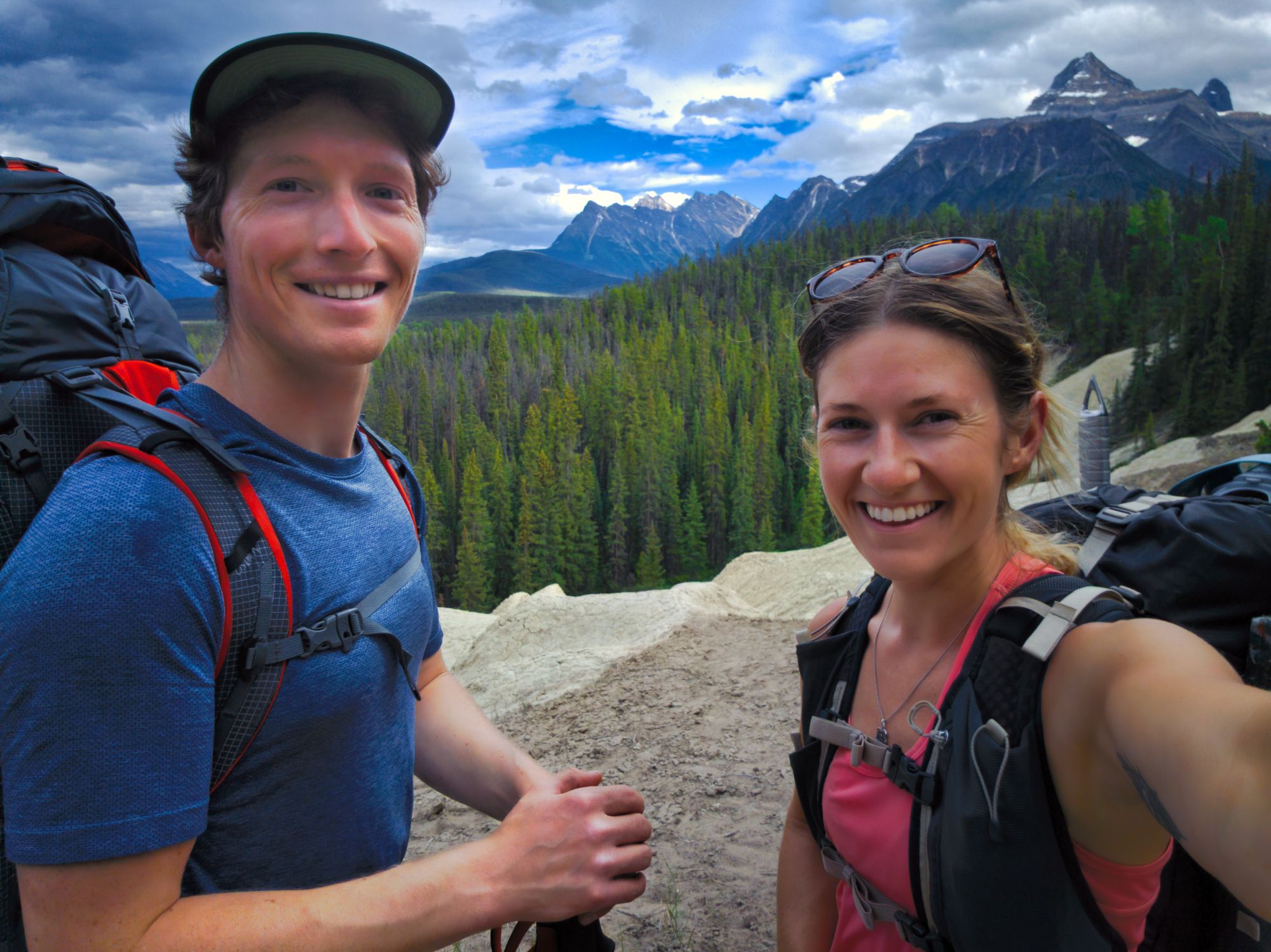
Hikers: Katie & Ryan
Route Outline
| Difficulty | Moderate to Difficult due to overall trail length and steepness of the Headwall. |
|---|---|
| Distance/ Elevation | 22km one way to hut; ~800m elevation gain |
| Synopsis | Despite close proximity to Jasper, this quiet trail is an excellent way to escape the more touristy side of the park as longer access trails deter most day hikers from the area. The Fryatt Valley is a lovely area, allowing access to diverse alpine terrain and multiple mountains in the area. The Alpine Club hut allows for year-round adventures. |
| Getting There | From Jasper, follow highway 93 (Icefields Parkway) south for 30 minutes. Take the 93A turnoff towards Athabasca Falls, and continue past the falls. After 1.3 km, you will see a parking area and the Geraldine Fire Road on the left. If your vehicle is able, drive down the fire road 2.2 km to the Fryatt Valley trailhead. At time of writing, the fire road was well maintained and could be driven all the way in any vehicle. |
| Facilities |
Parks Campsites: designated tent pads, wooden picnic tables, bear caches, fire ring + chopped wood, pit toilet ACC Hut: Cooking supplies, mattresses, barrel toilet, propane cooktops. *Dogs are not allowed in ACC huts* For more details check AlpineClubOfCanada.ca No facilities at the trailhead. |
| Fees |
Jasper National Park Entry Fee: Daily Admission $11/adult/day; yearly pass $75.25/adult. A full breakdown of fees can be found here. Parks Canada Backcountry Fees: camping fee $13.50/person/night; reservation fee $11.50/reservation ACC Hut: $50/person/night (members); $60/person/night (non-members) |
Day 1: Trailhead to Lower Fryatt Camp
Approx. 11 km
We got to the trailhead later than planned (around 5 o'clock in the evening) as we spent the day travelling across BC. We had spent the previous night just east of Kamloops in the back of our car, and thus had a roughly 5-hour drive to Jasper; however, with the electric car we had to make a couple of charging stops which definitely increased our time on the road. Despite the longer overall drive time, we'd still say doing the trip in our EV was worth it – in total we spent only $20 on charging to get from Victoria to Jasper! Besides, during our first charge stop between Kamloops and Jasper we were able to totally organize and pack our backpacks for the trail, which we would have had to do at some point anyways.
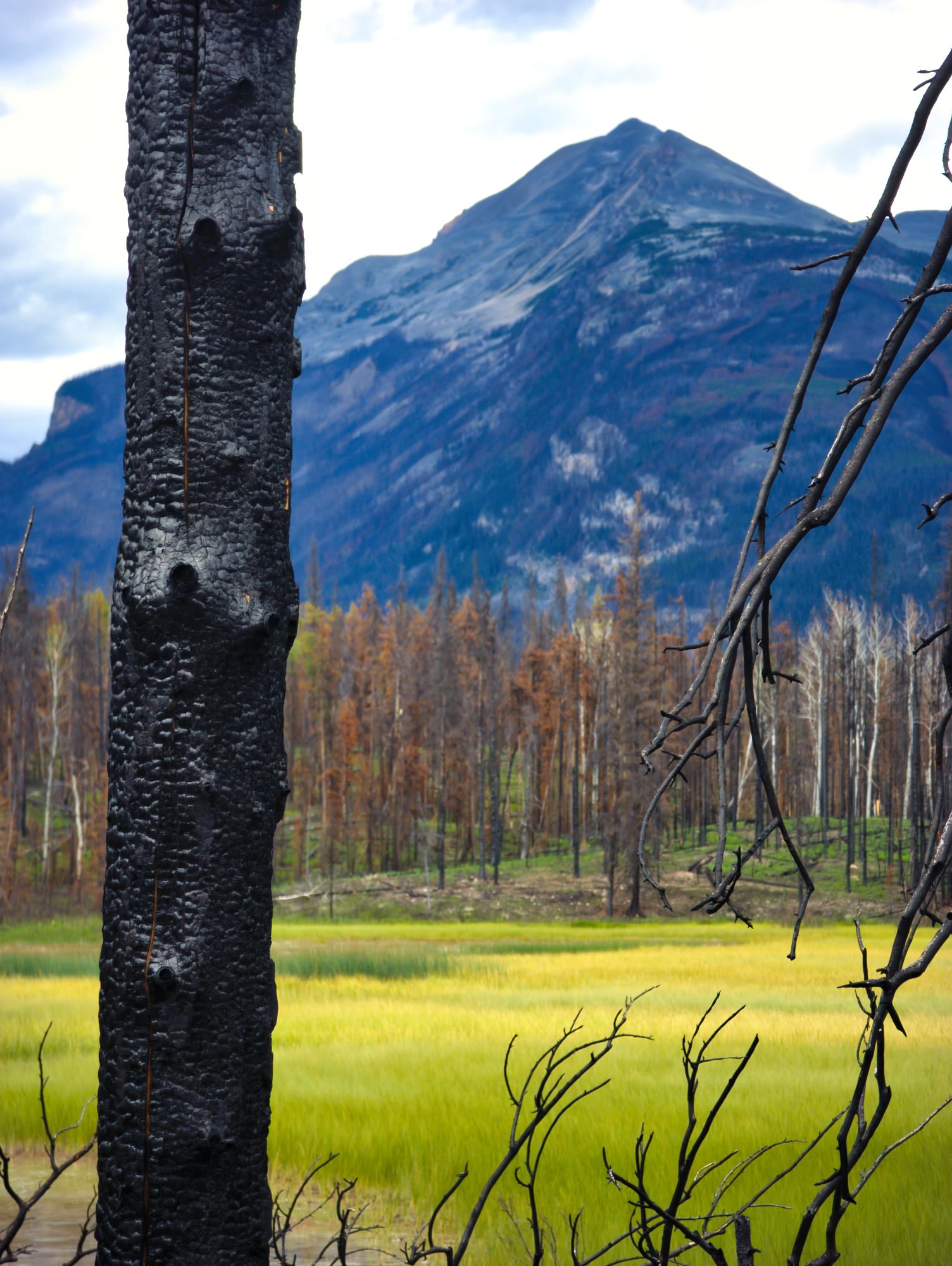
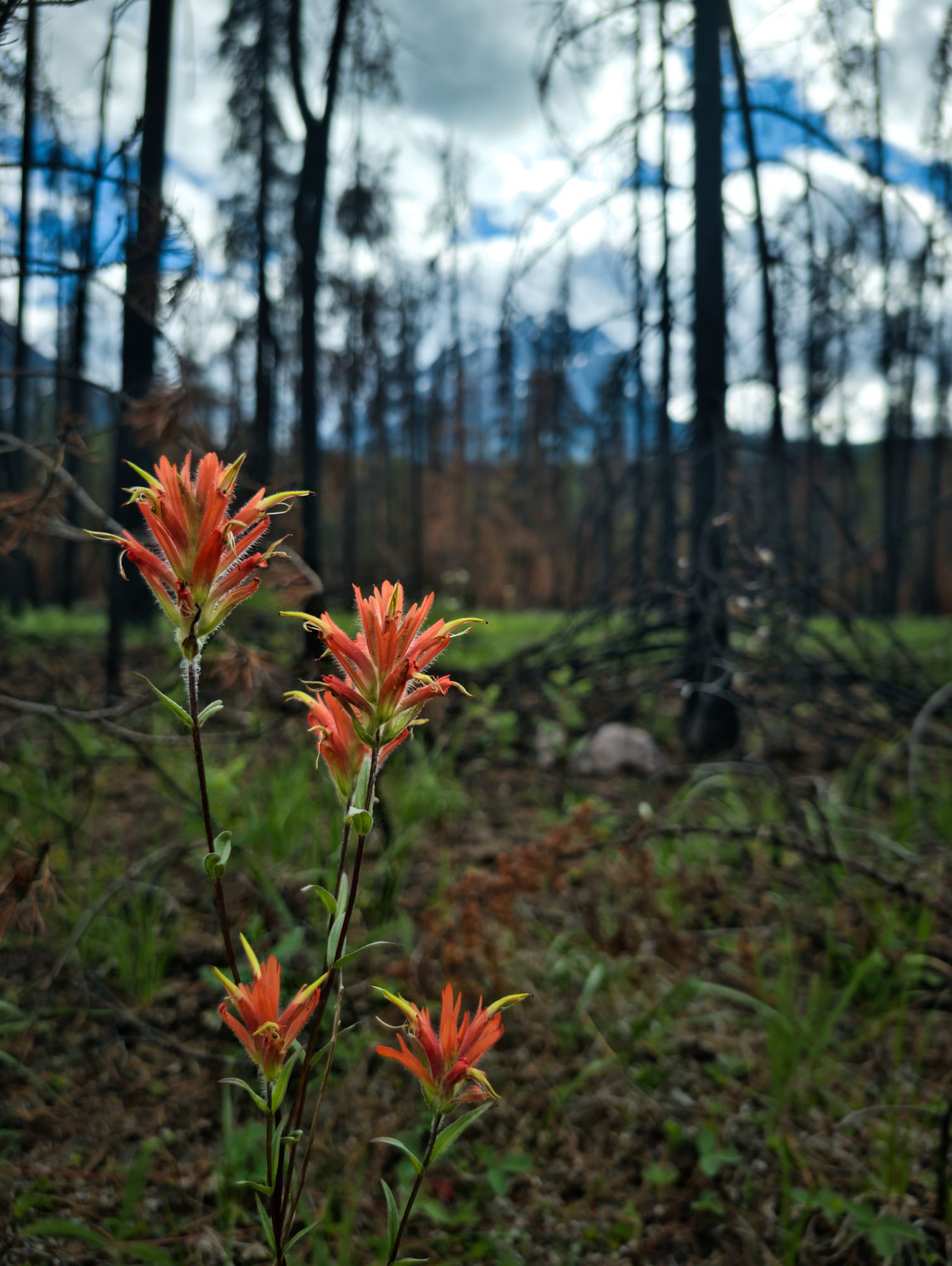
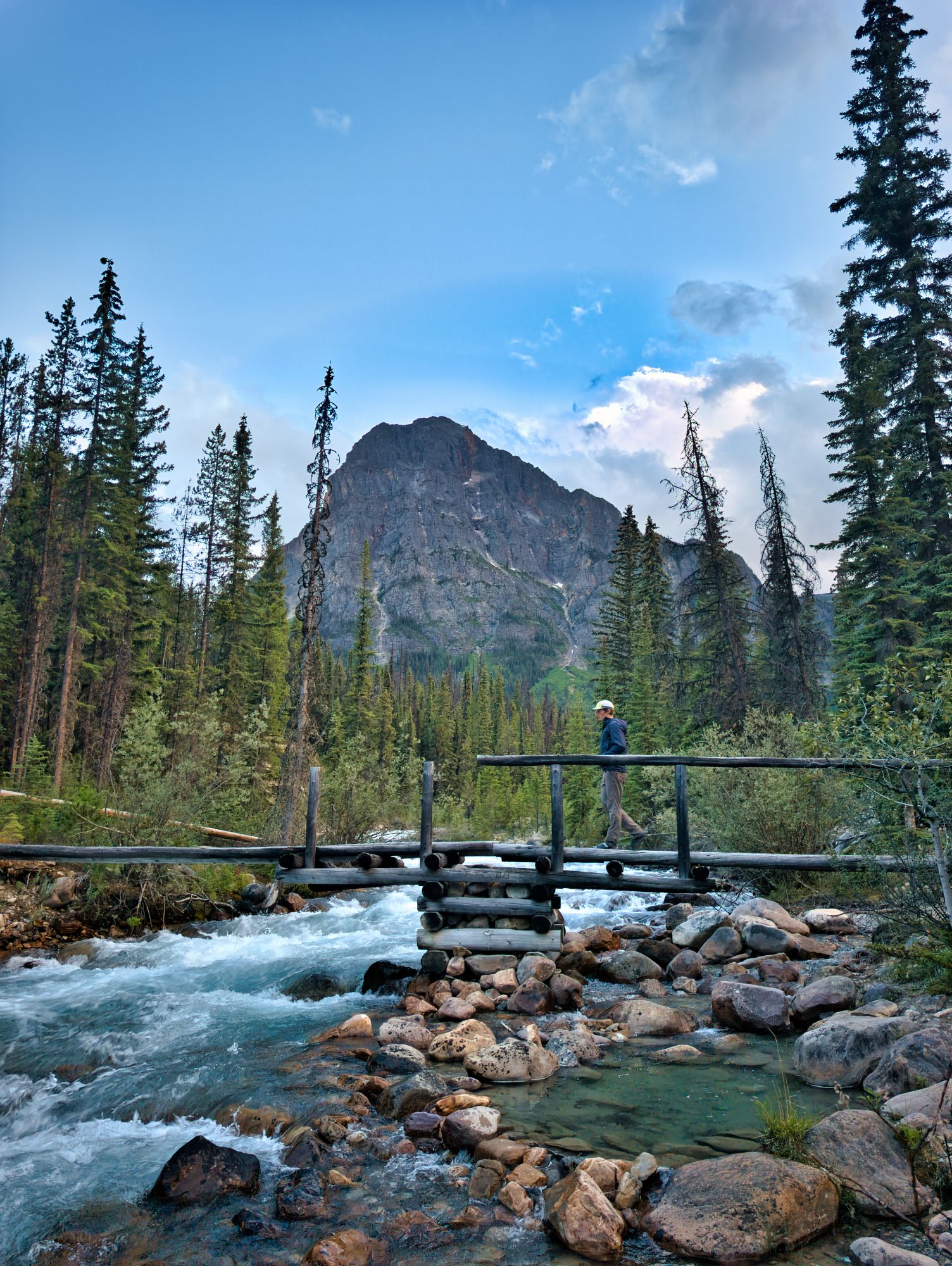
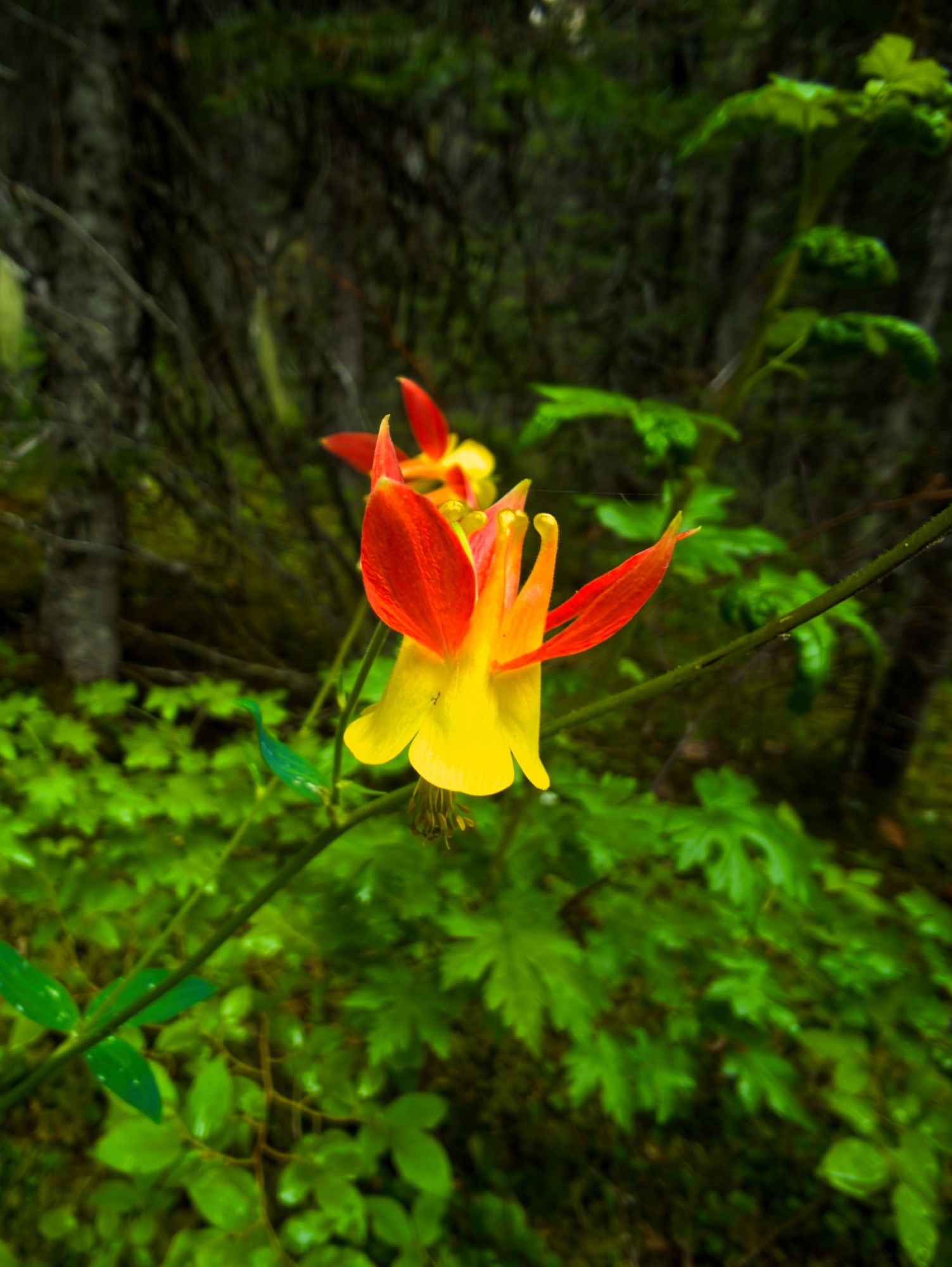
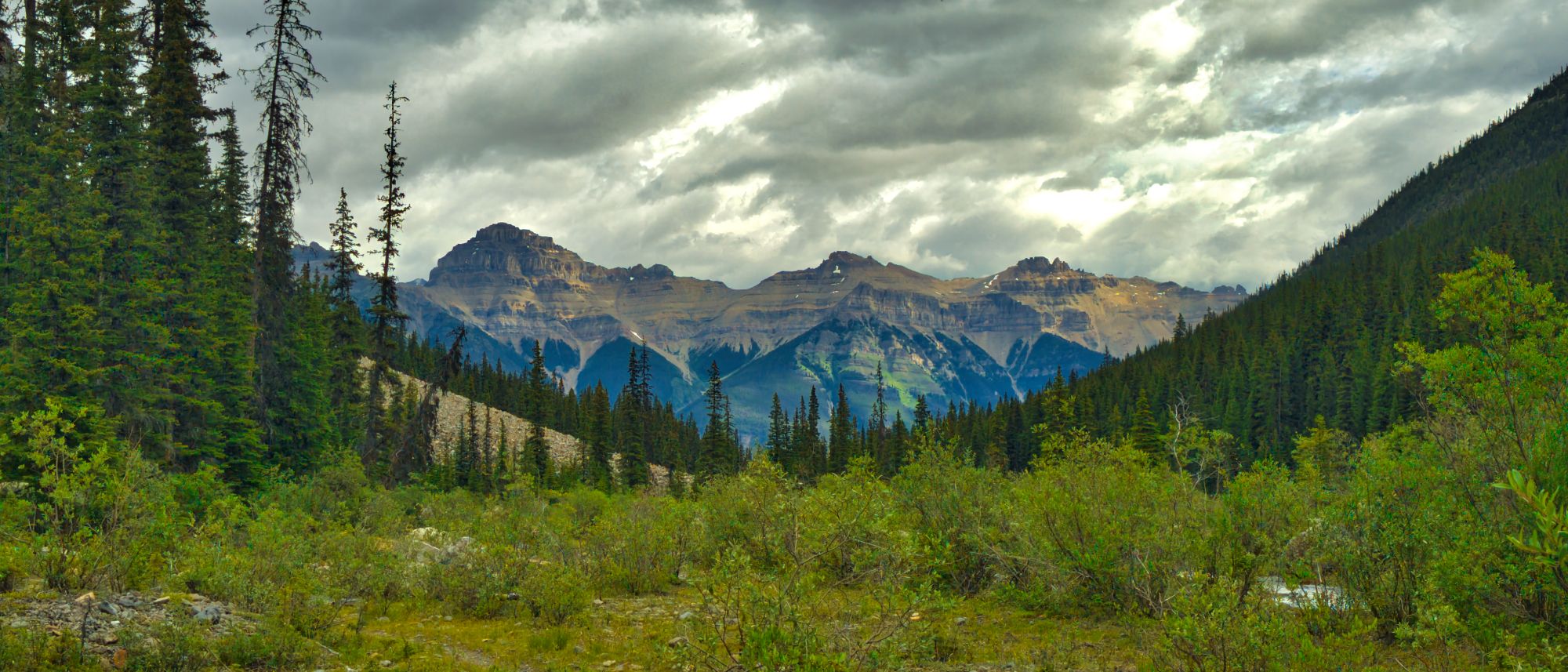
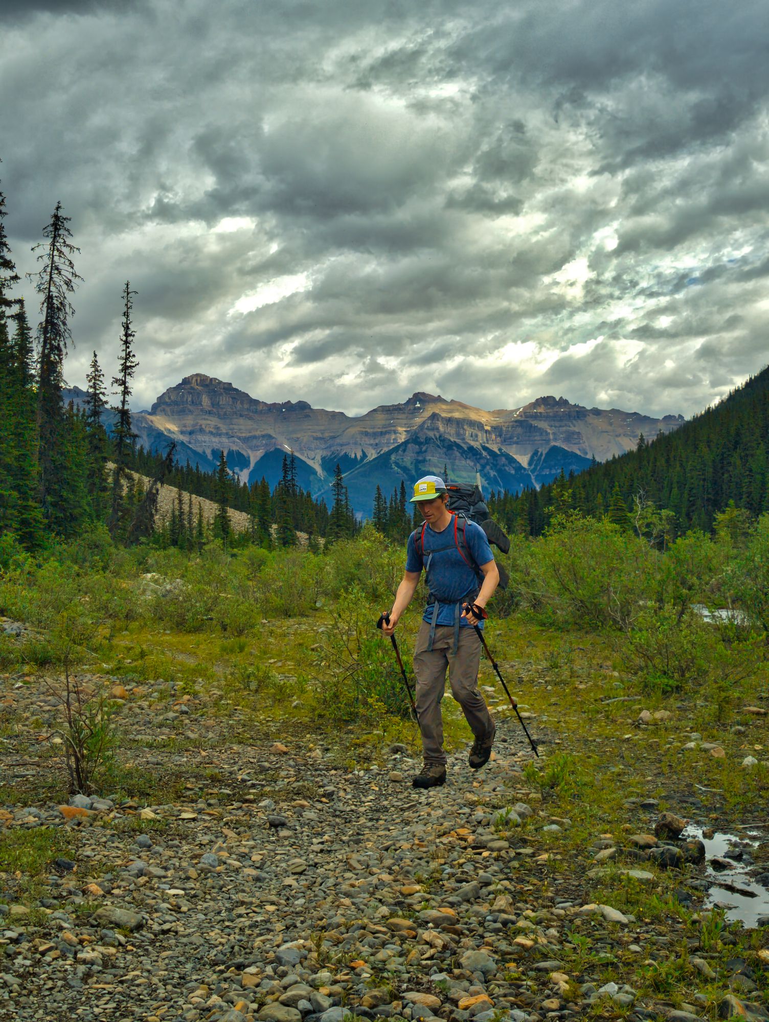
The beginning of the trail follows an abandoned road, wide and flat. The first couple km took us through blackened burn scar from the massive 2024 fire, which was eerie to walk through, but new life already abounds: from grasses and wildflowers to birds and small critters were seen and heard throughout the woods as we walked.
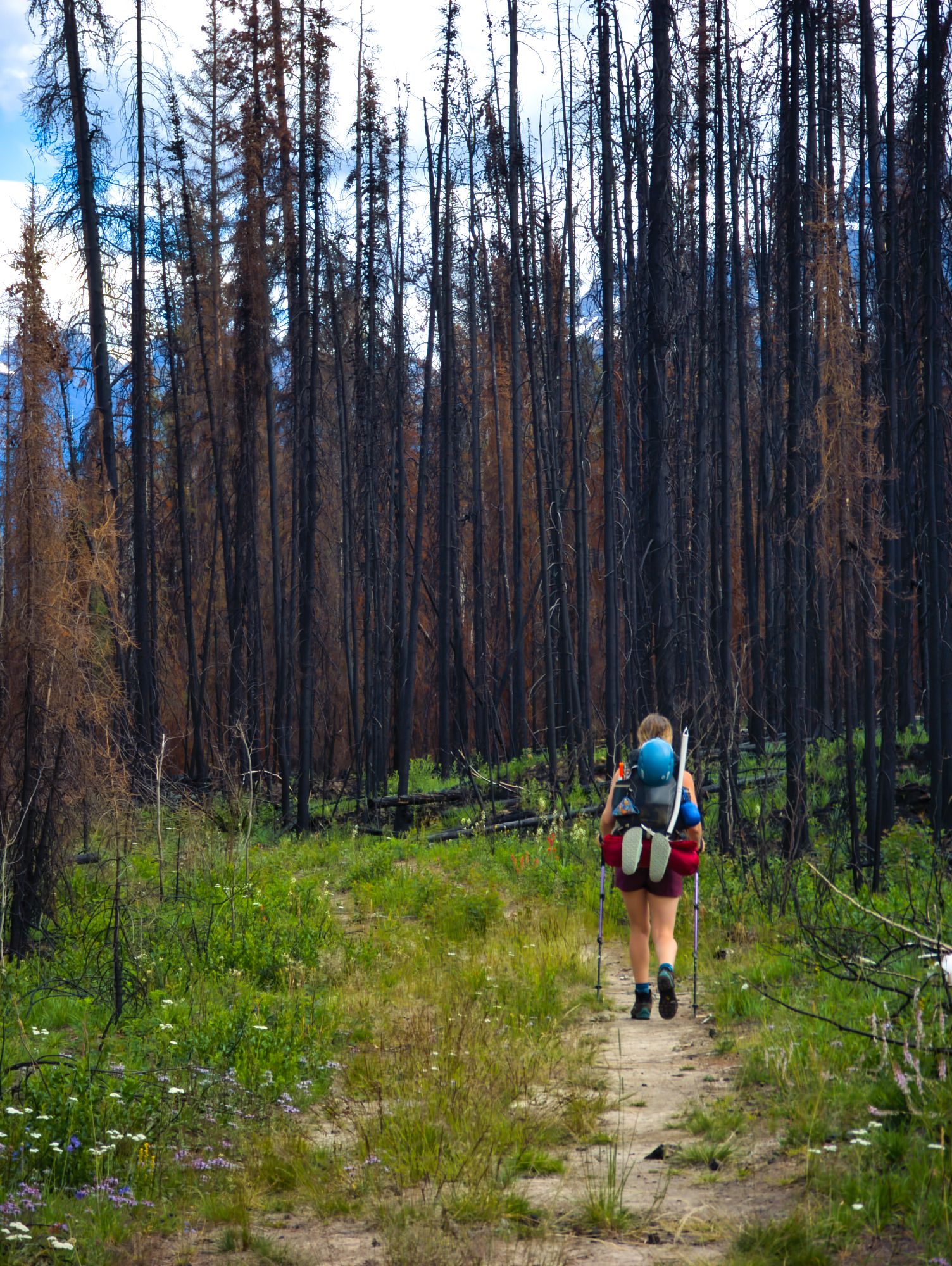
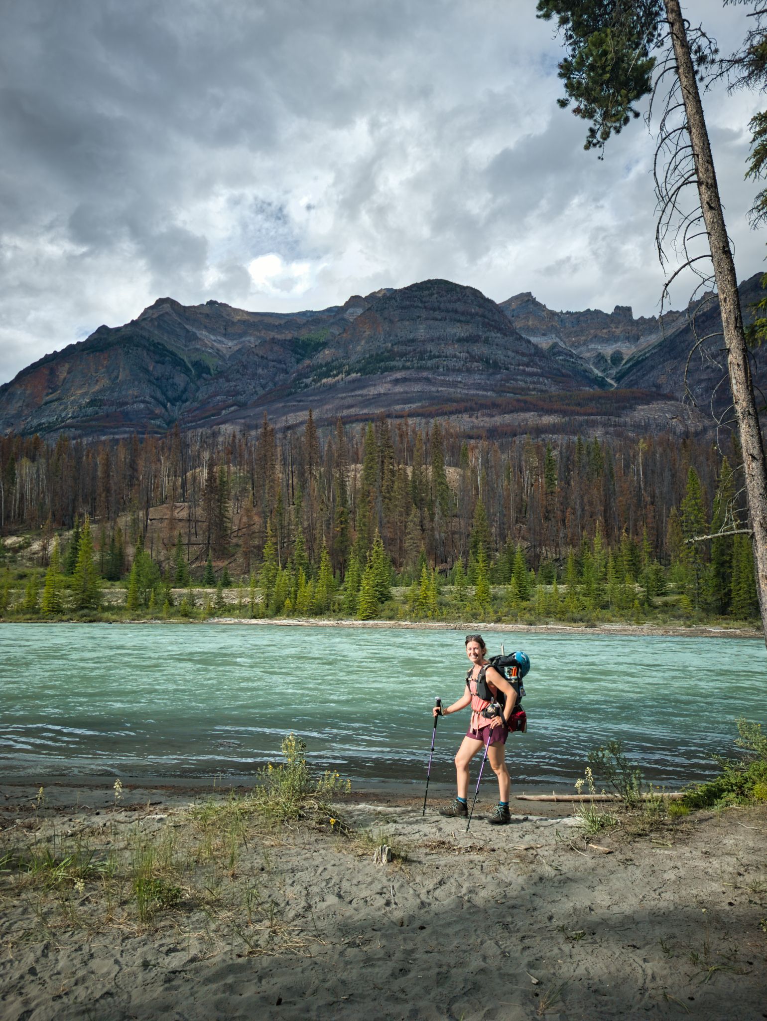
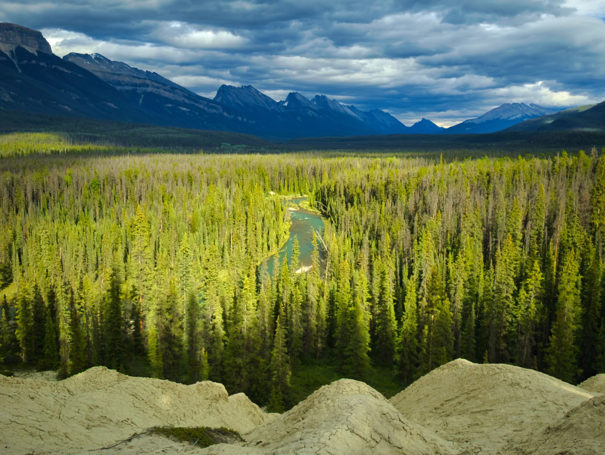
The trail gently winds its way towards the Athabasca River, then runs parallel to it until about KM7.5, where the trail gets right up to the river''s edge, making a potential spot for winter travelers to cross the frozen river to knock about 7-8km off their slog into the hut.
After that the trail veers away from the river towards the Fryatt Valley with a gentle climb that ramps up in a few quick spurts.
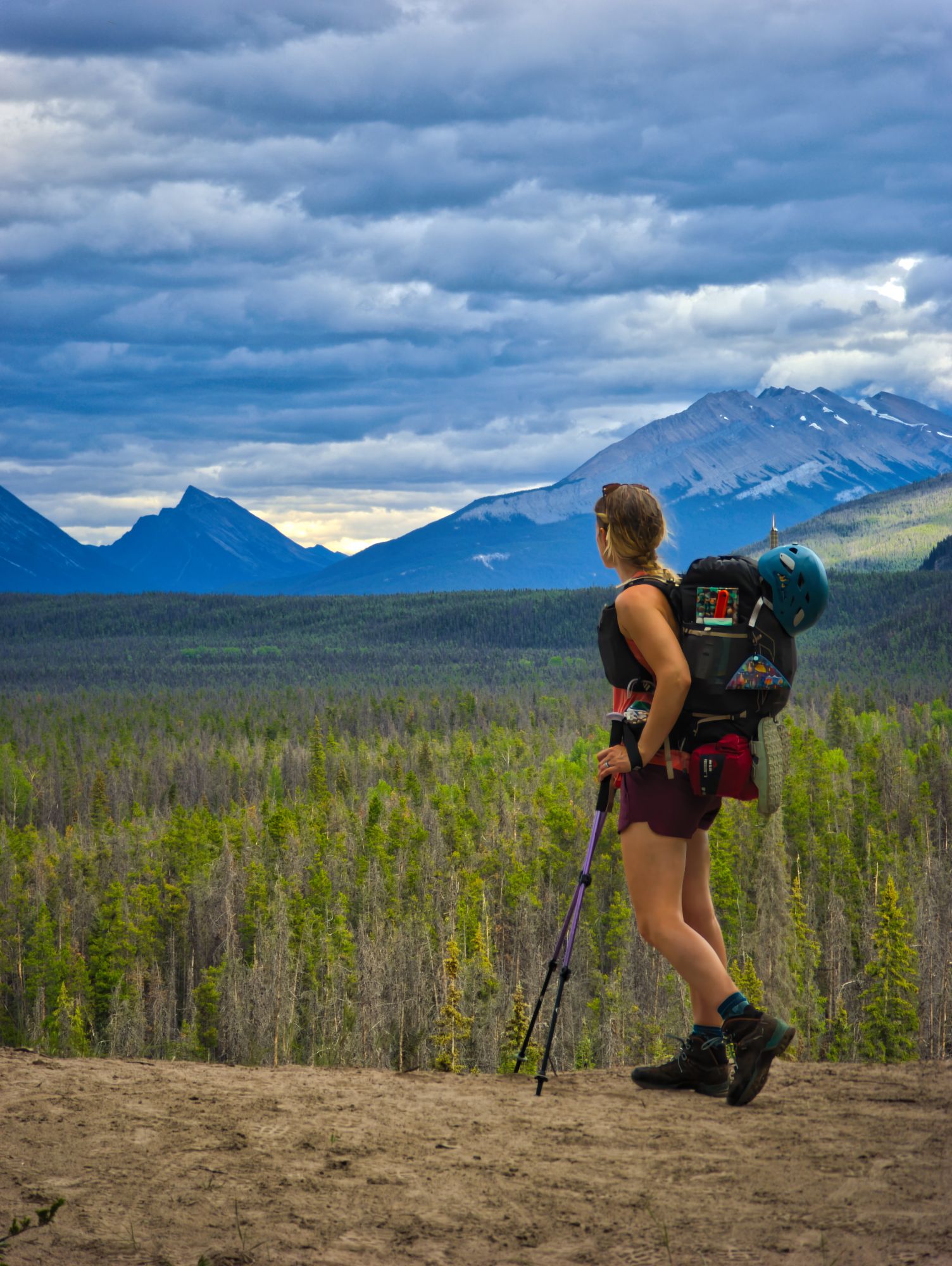
There were a few rocky sections between the river and Lower Fryatt Camp, and some sections that narrowed to a "wide single track" rather than the defined double track of the old road. Overall it was an easy hike and would be very rideable on a mountain bike – which Parks does allow up to the Lower Fryatt campsite. The only parts that would be tricky on a bike were a handful of awkward-height deadfalls across the trail. The highlight of this section was a stunning viewpoint overlooking the Athabasca.
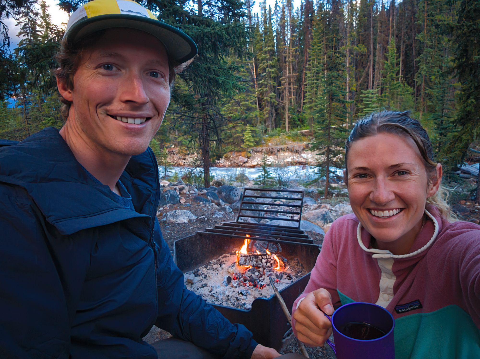
We arrived at a mostly full campsite, with only two tent pads remaining. We set up our tent and started making dinner - a favourite store-bought meal of ours: Backpackers Pantry Pad Thai with Chicken.
We were very surprised to see a Parks Canada-branded firepit at the site, complete with chopped wood for campers to use. We joined another group around the small fire and chatted for a while until we all headed to bed.
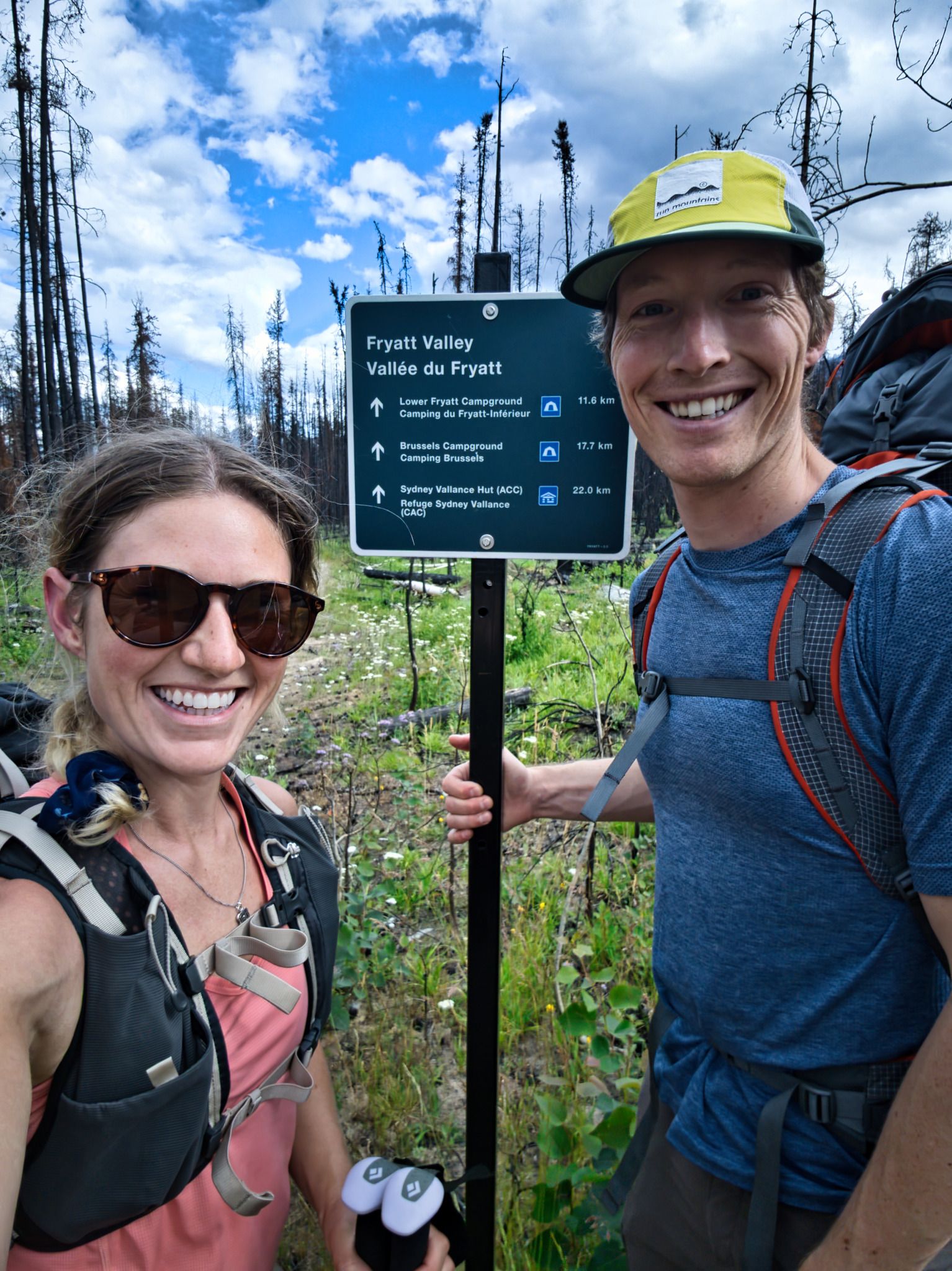
Day 2: Lower Fryatt to ACC Hut
Approx. 11 km
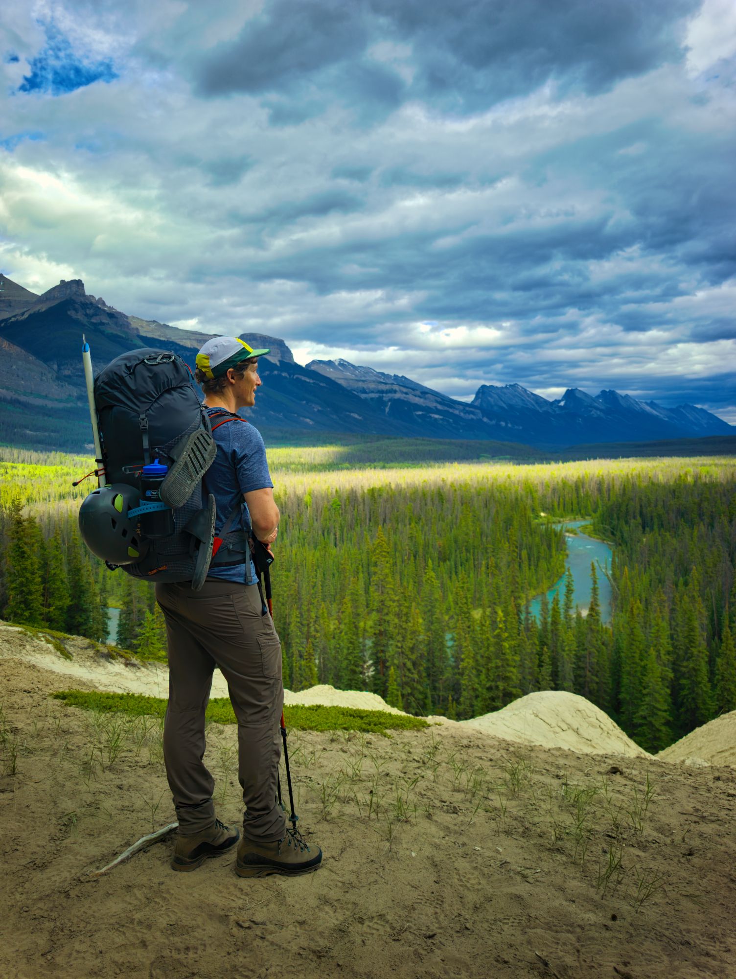
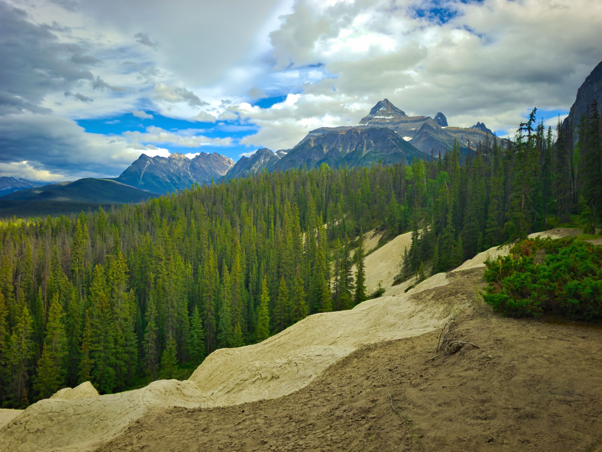
We rose just after 6am, and Ryan packed the tent while I prepared breakfast. We ate alongside other campers at the picnic tables and shared travel plans. Most said that they were headed back to the trailhead, but one couple planned to stay the night at Brussels Campground and then continue to the hut the following day. We looked forward to having their company in a couple days. Once we’d eaten and packed, we set off for the hut!
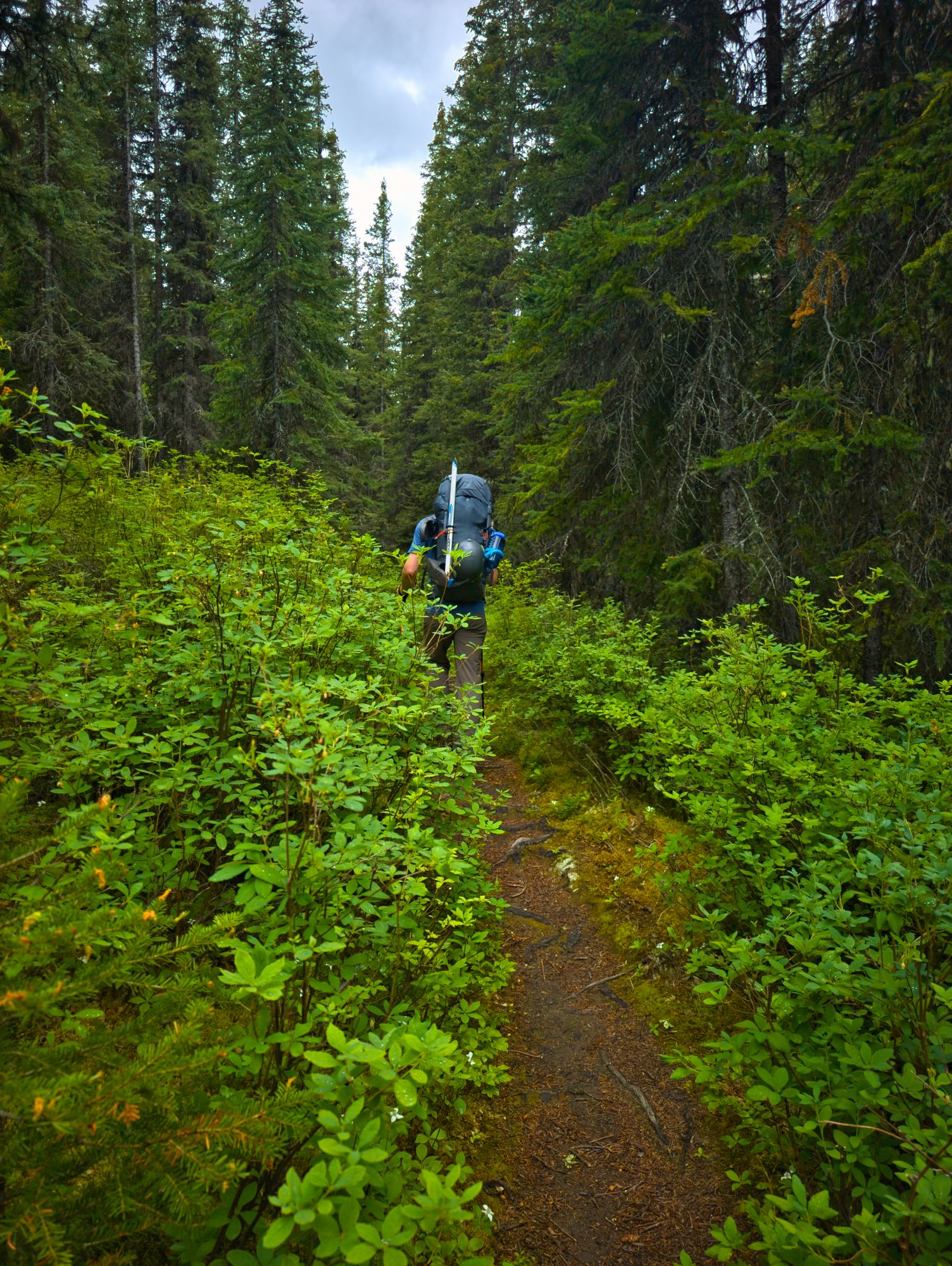
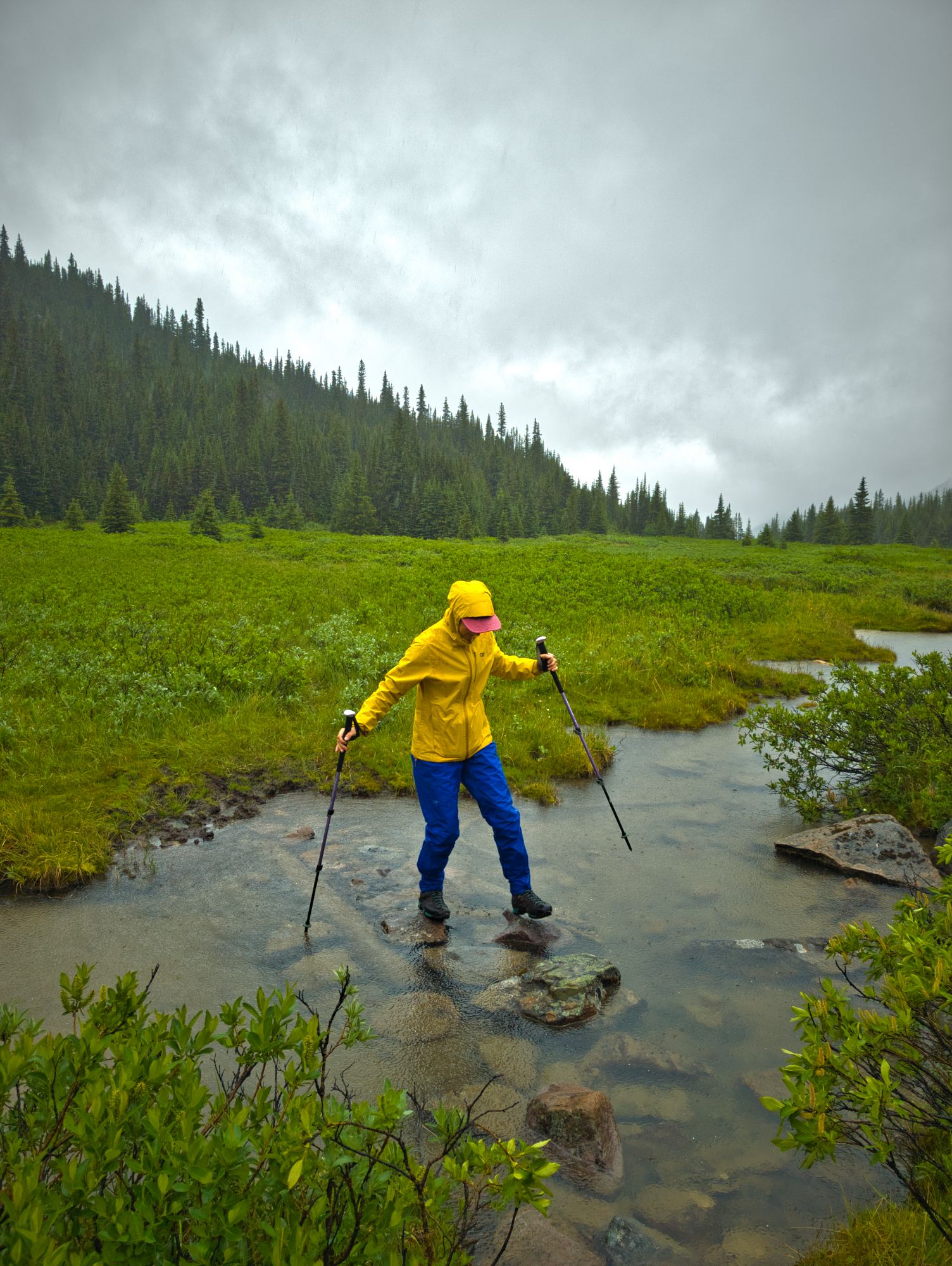
For a number of kilometres, the trail winds its way through the forest at a relatively gentle but steady climb. The underbrush was thick in many places, crowding the trail, and due to the previous night's rain we got quite damp as we walked. We passed a solo hiker heading out who looked totally soaked. Eventually Ryan opted to put his rain pants on, but I didn’t bother since he was in the lead and brushing most of the water away for me :)
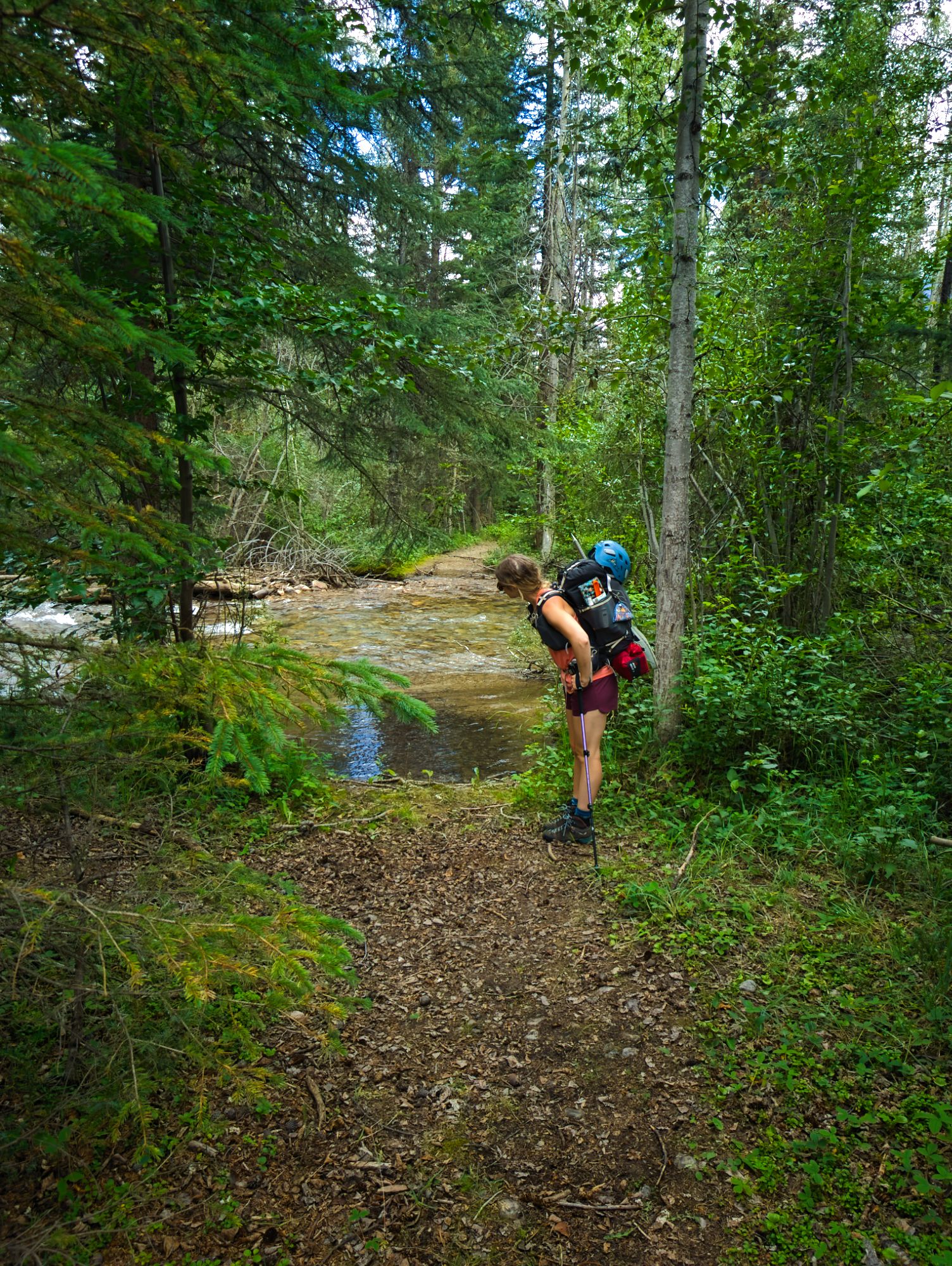
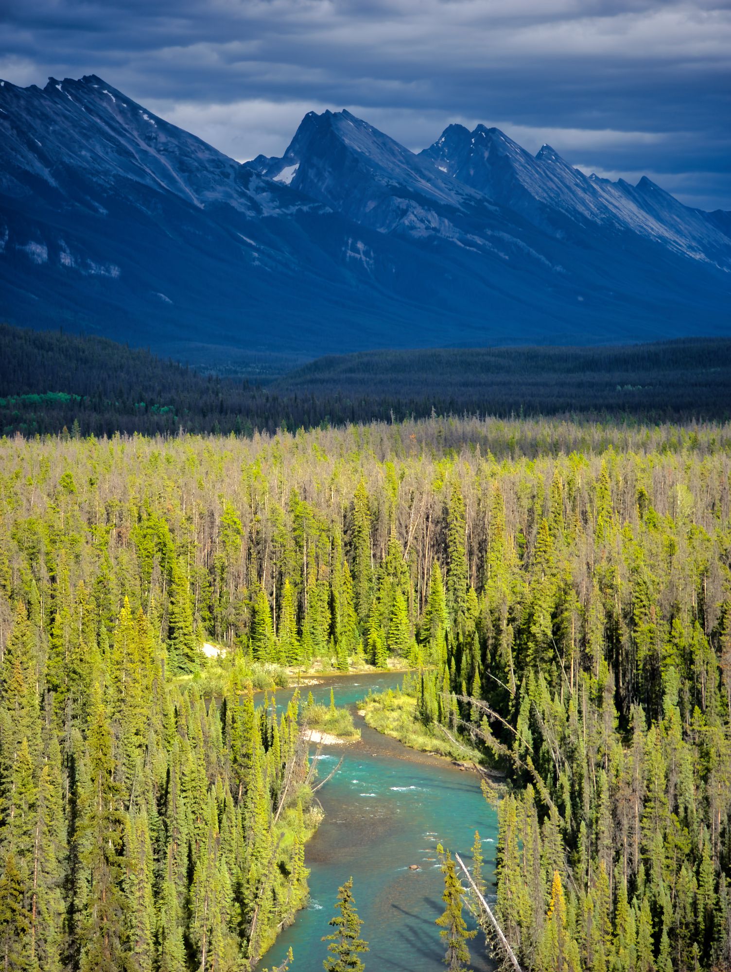
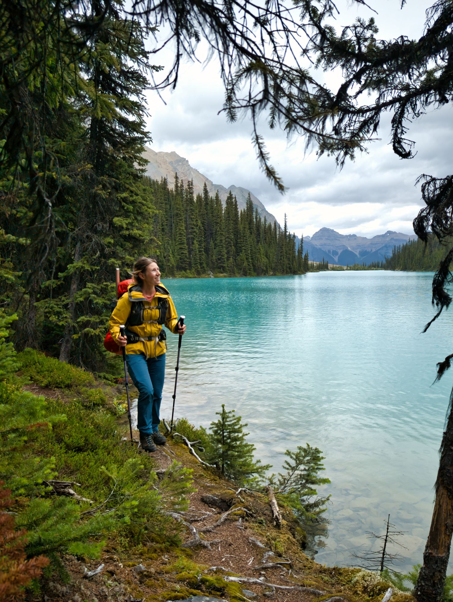
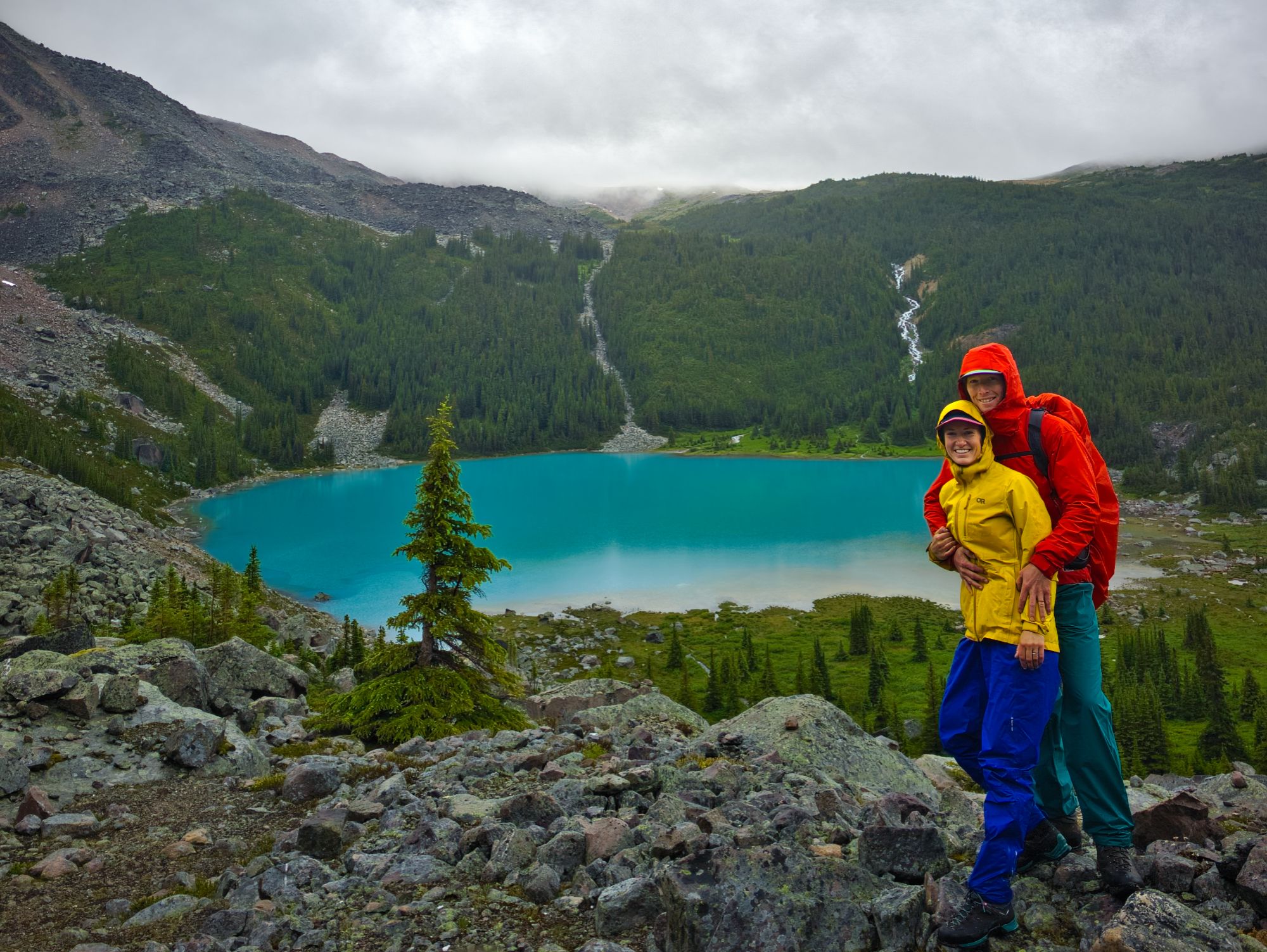
The sound of the rushing creek ebbed and flowed as the trail twisted through the forest. At one point we got very close to the creekside and saw a short trail down to it, so we detoured for a look. Wow! What a stunning valley!
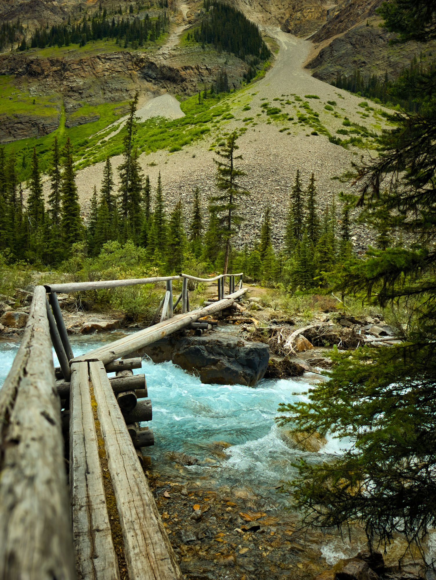
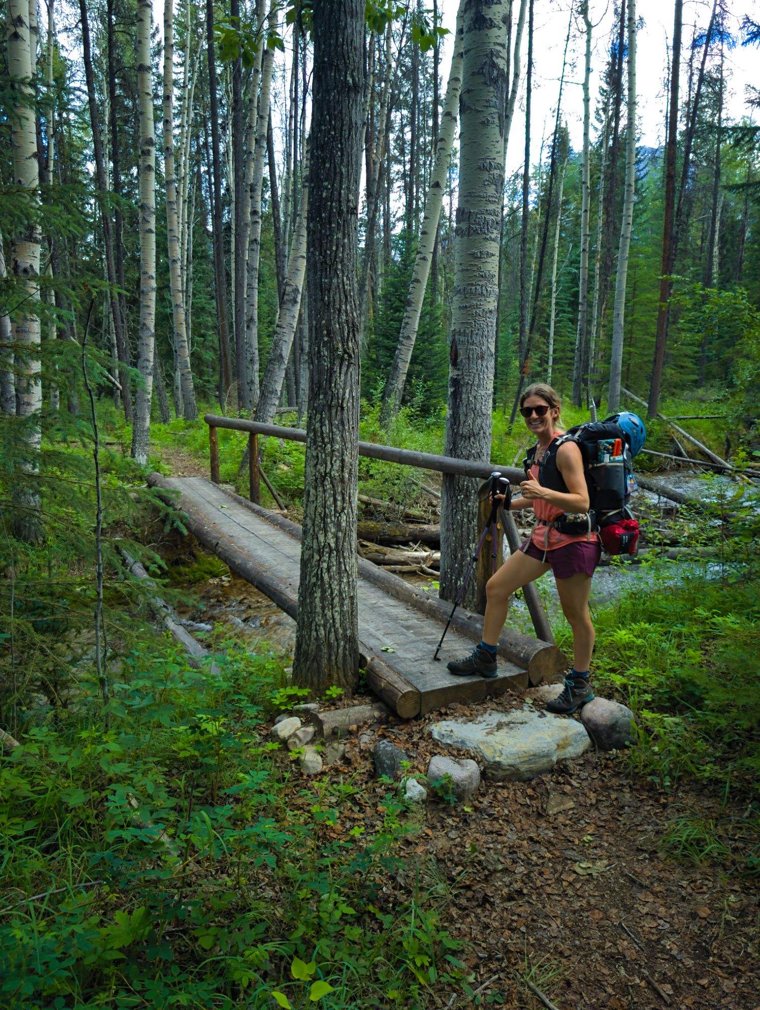
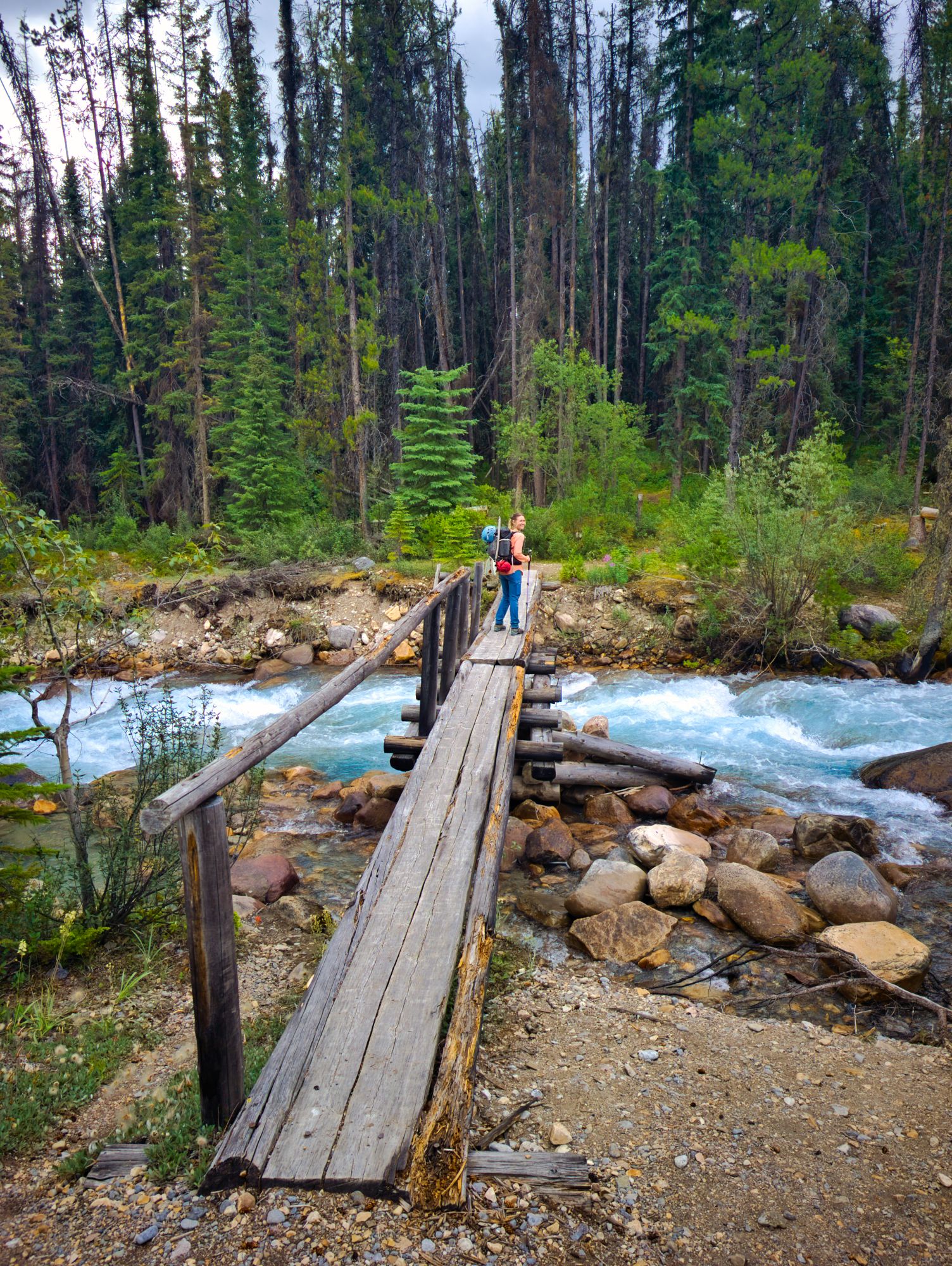
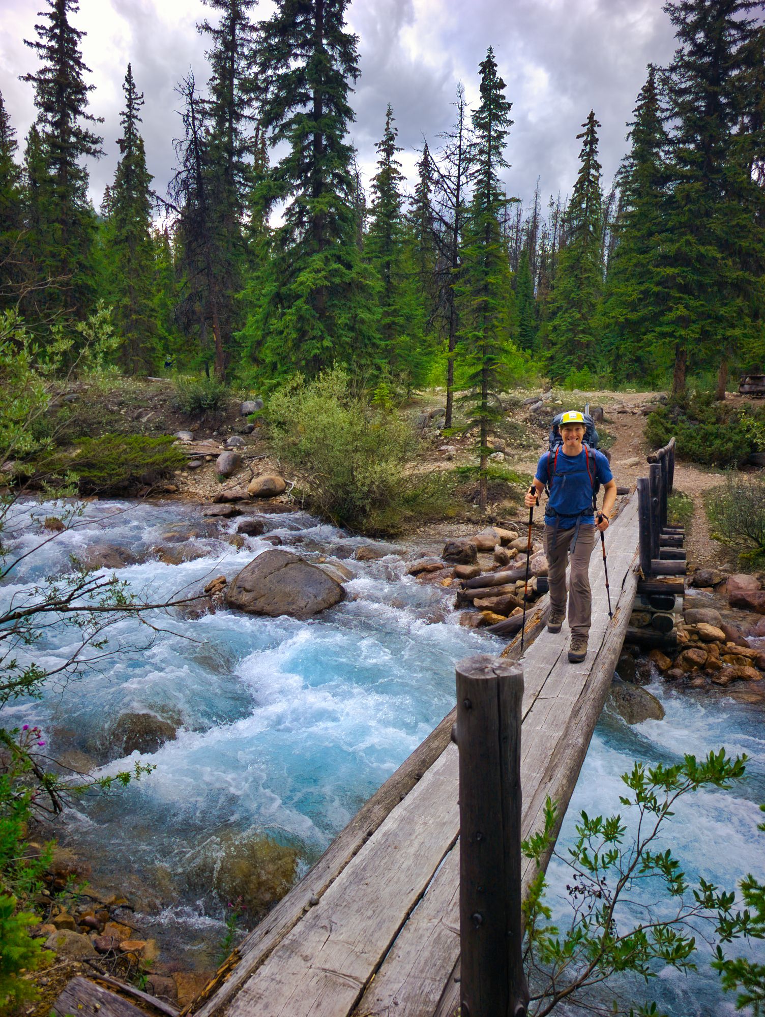
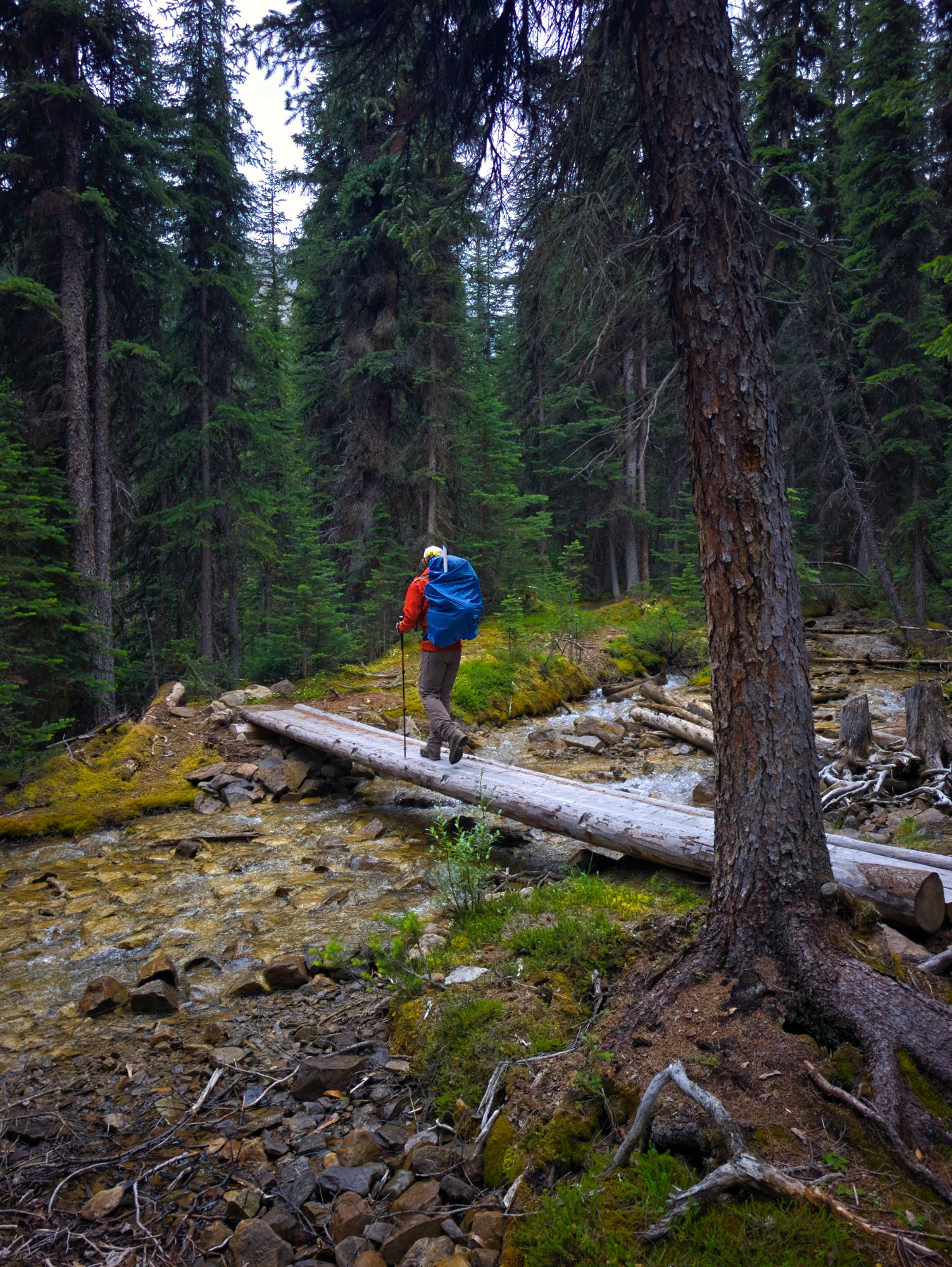
We rejoined the main trail to soon find a log bridge crossing the wide, rushing creek. Once across, the trail followed the rocky creekside where several different routes could be seen picking their way upstream. After about 2km of rocky walking, we arrived at Brussels, the second and final campground along the trail before the hut. We stopped for a quick bathroom break but were eager to get going again as the bugs were pretty bad.
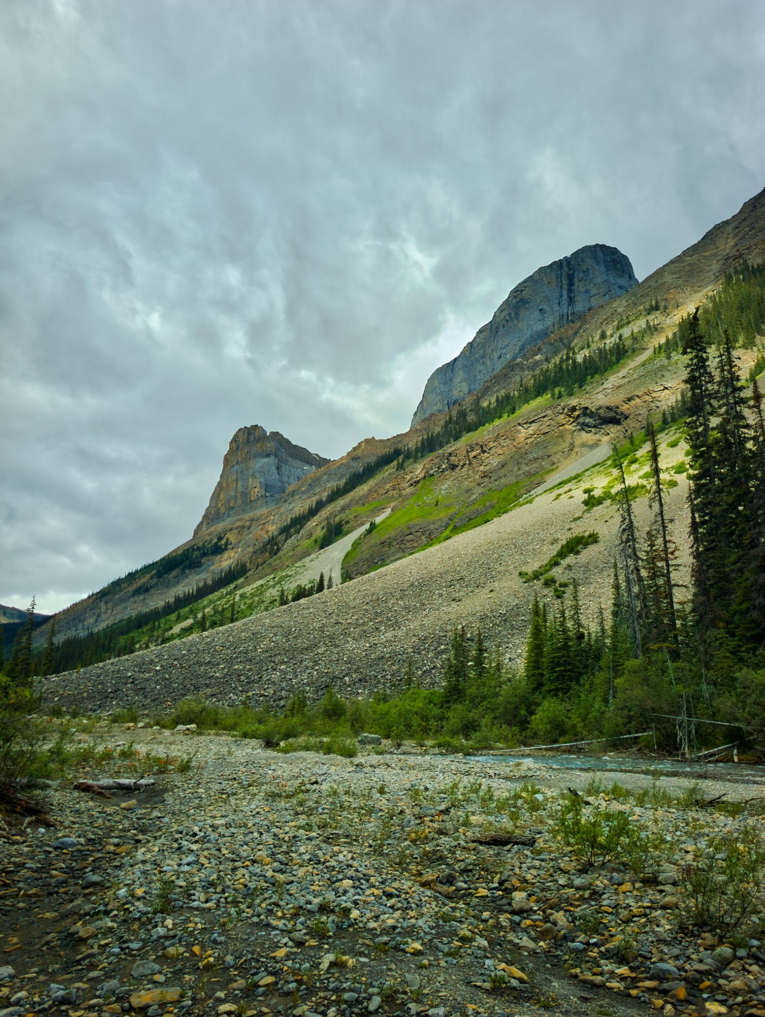
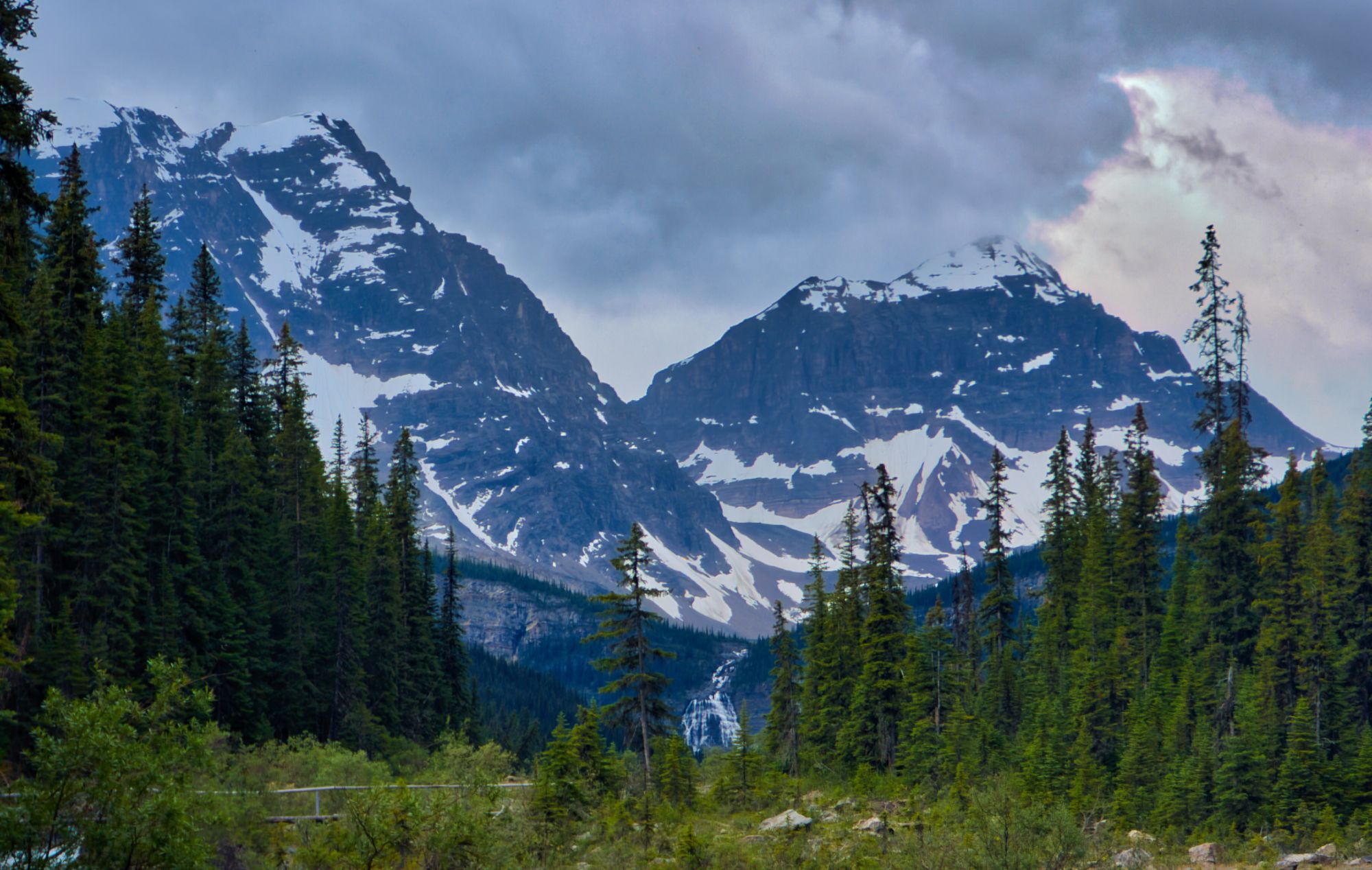
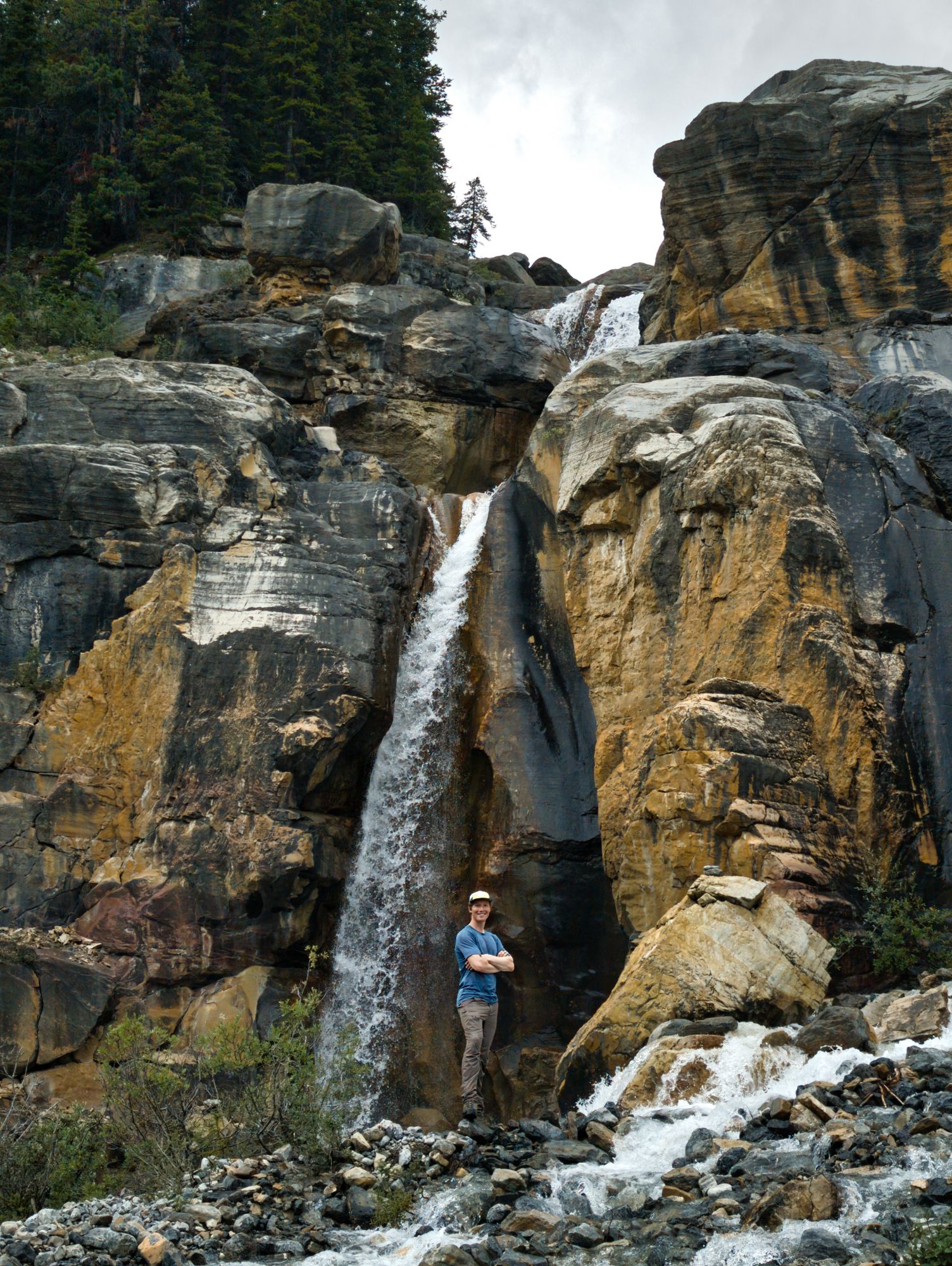
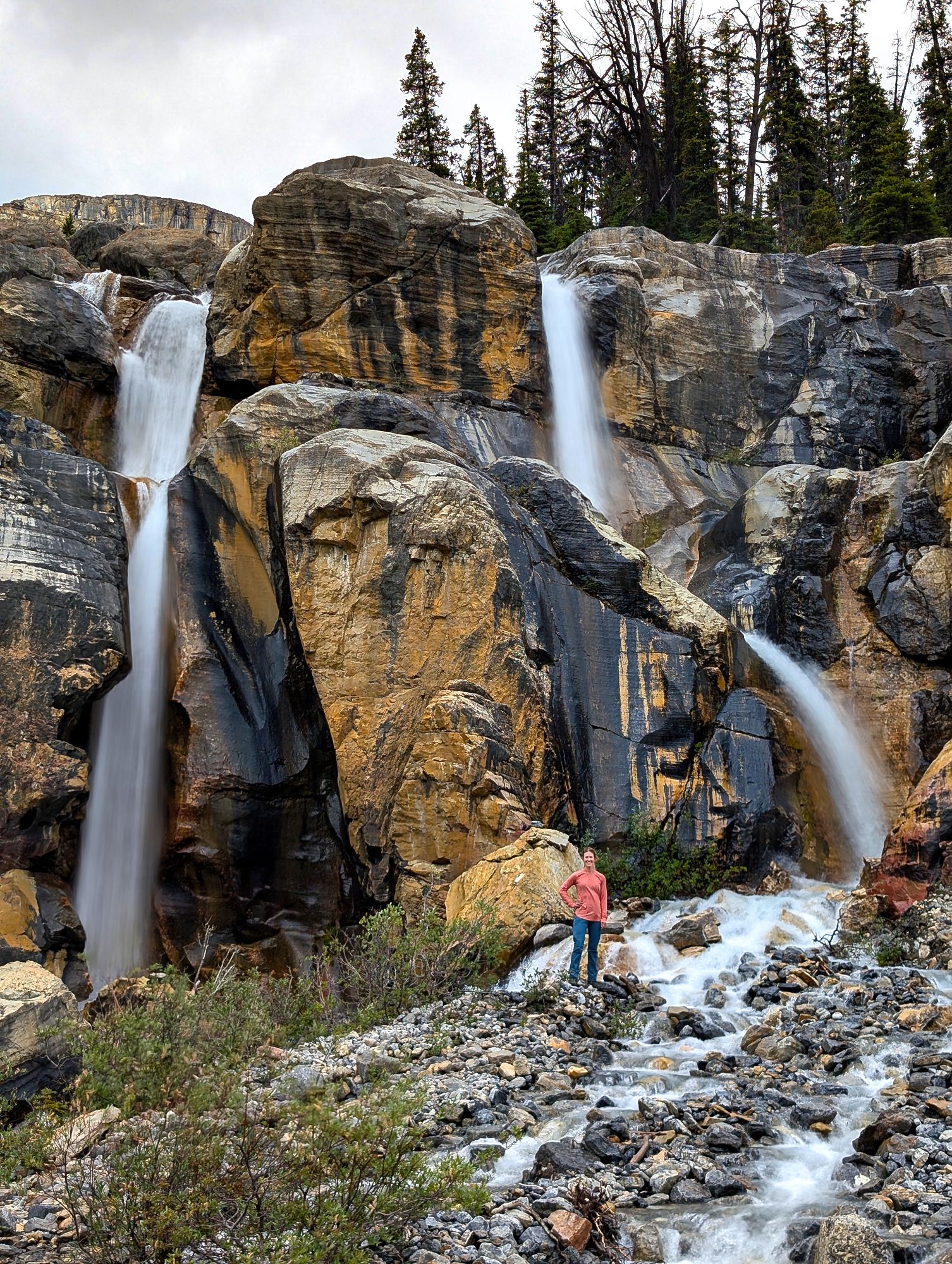
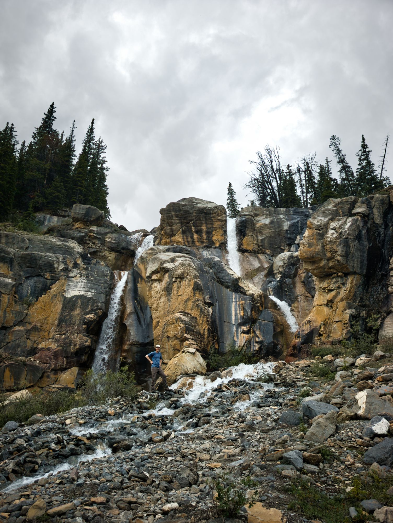
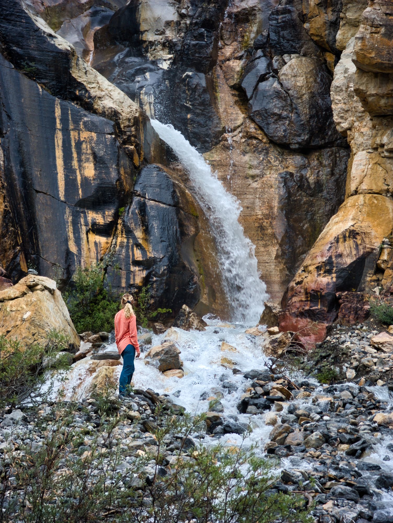
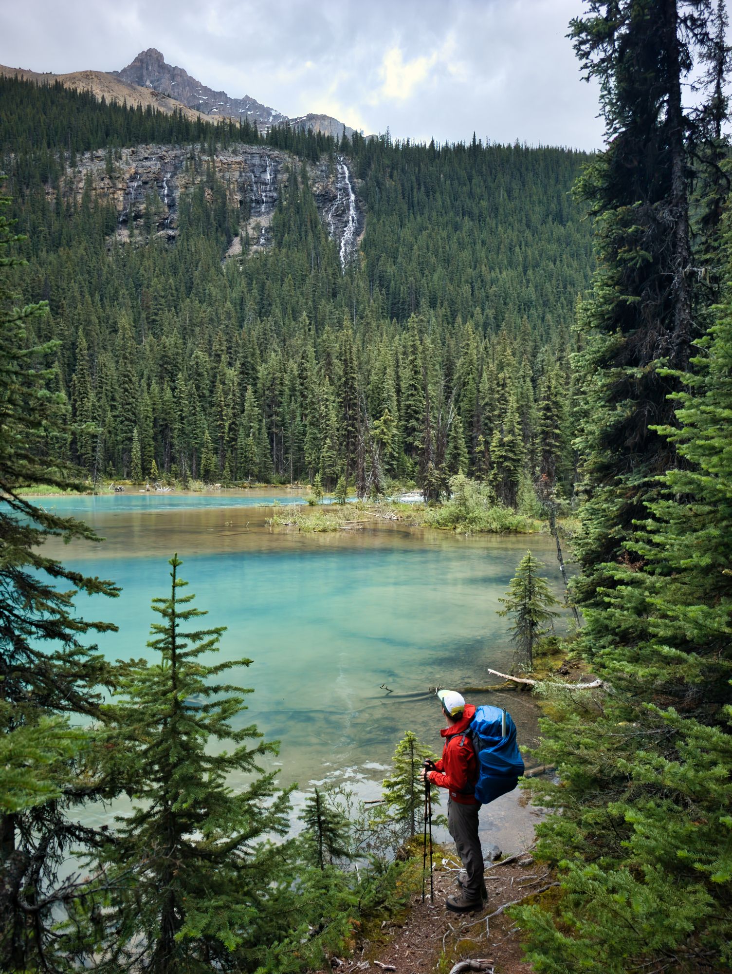
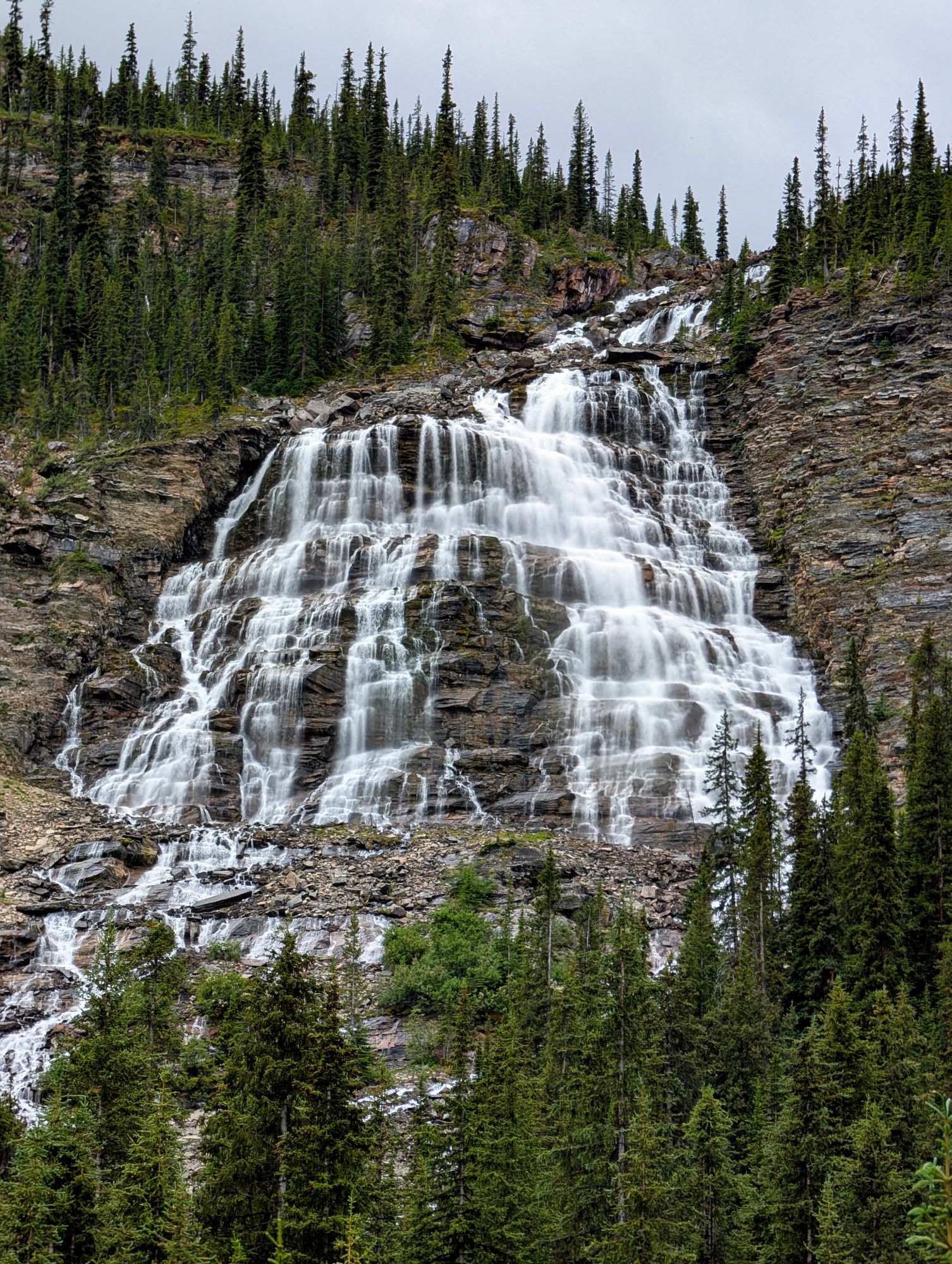
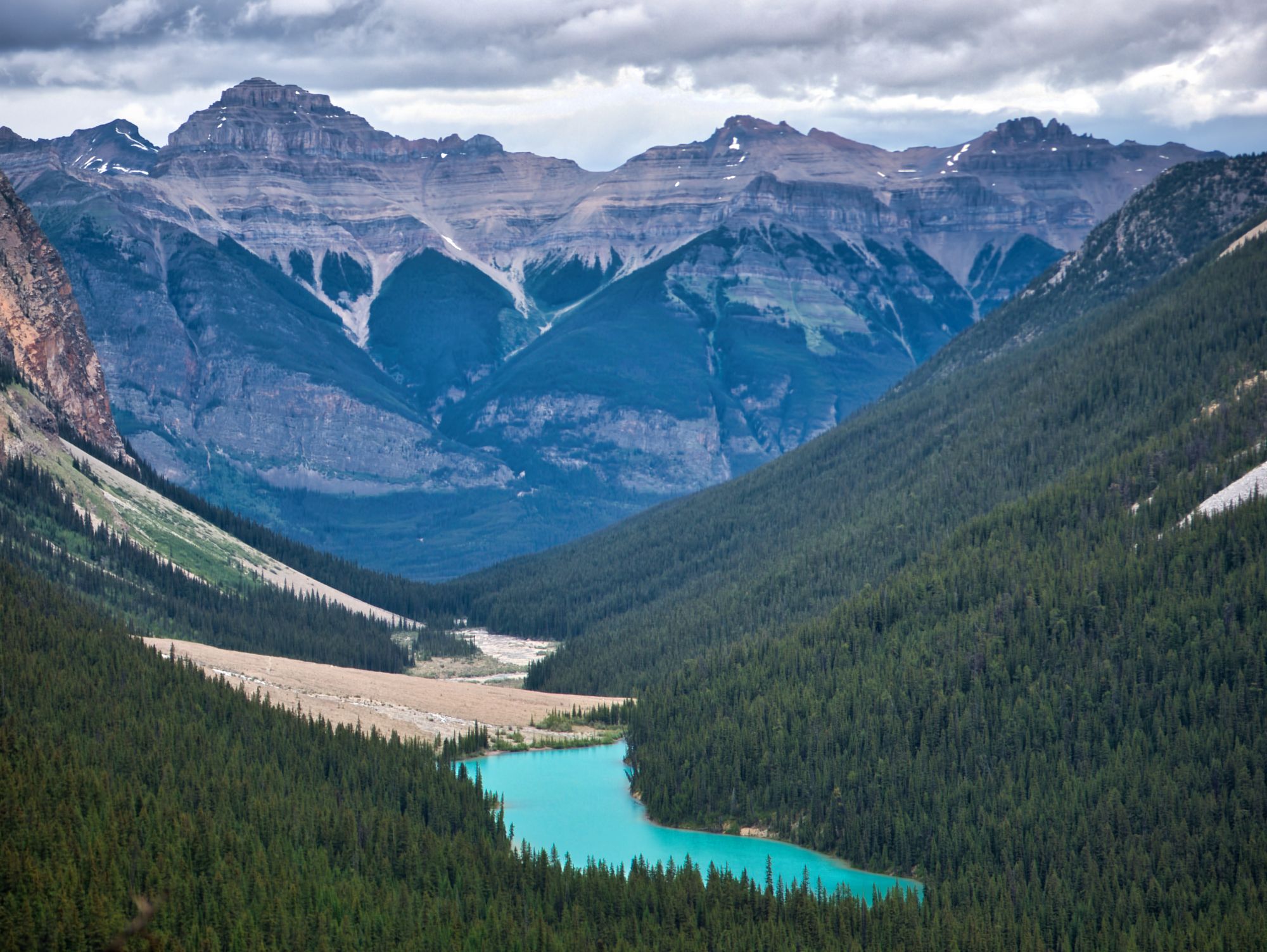
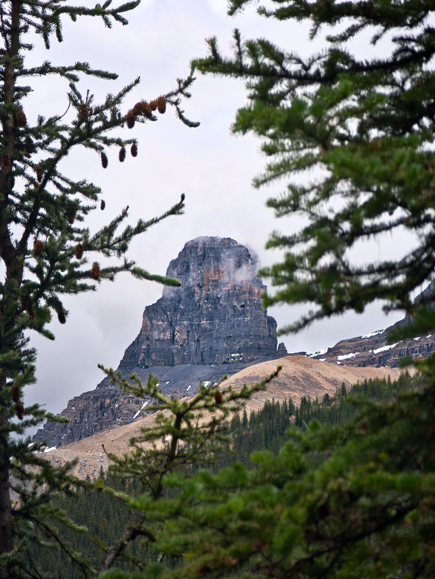
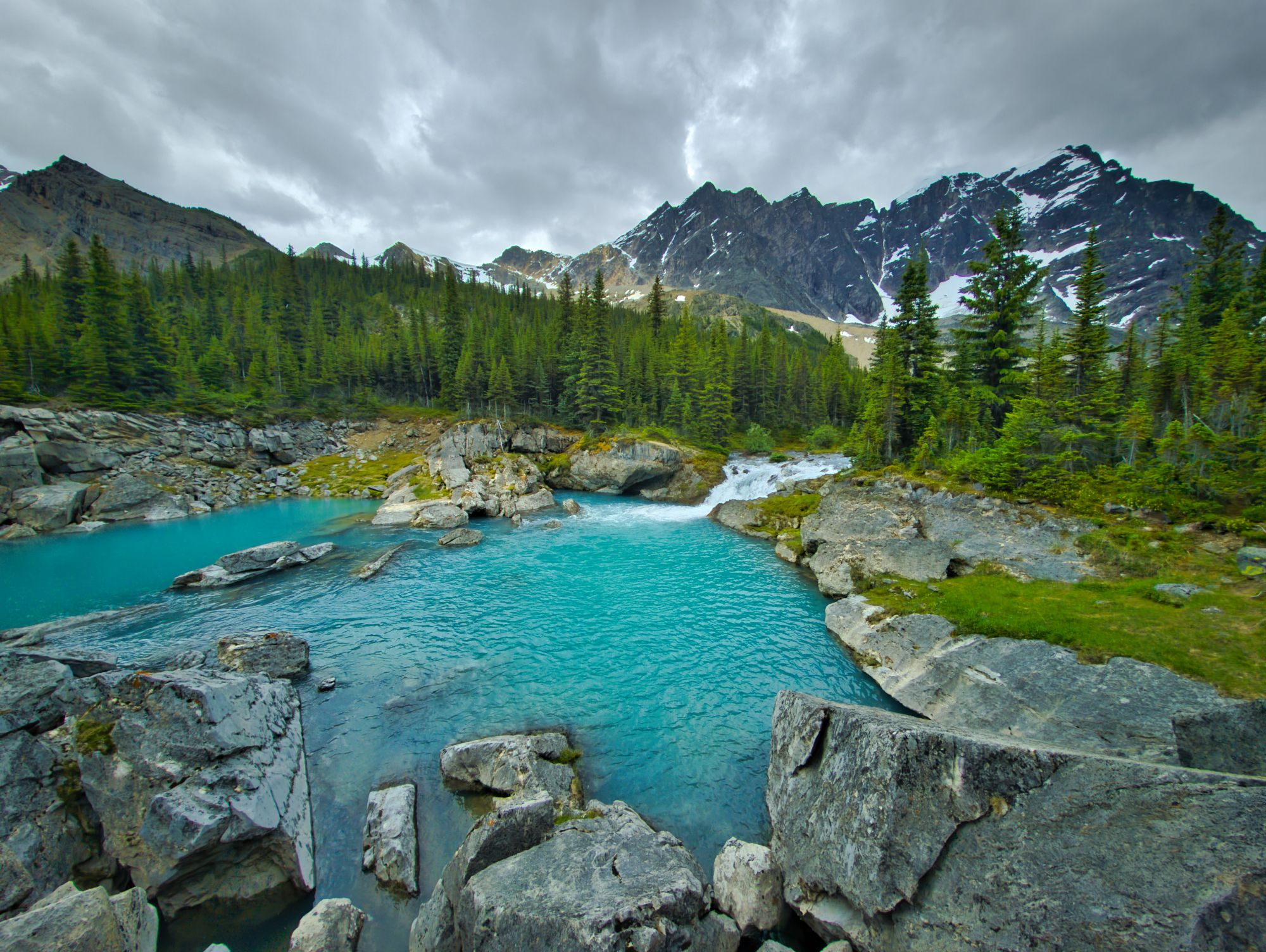
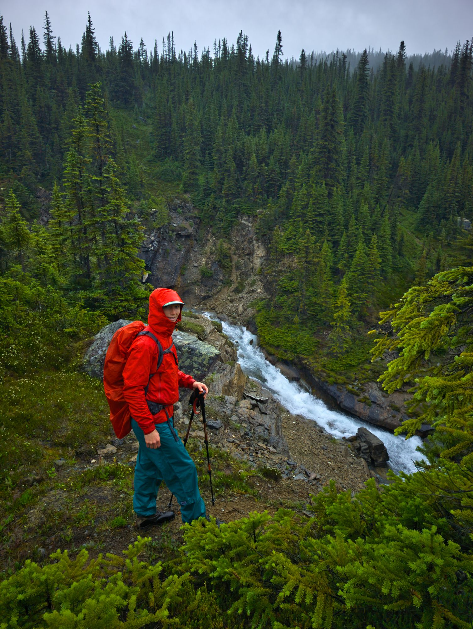
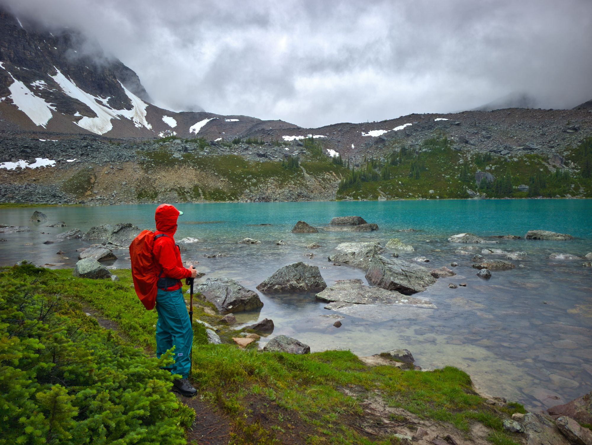
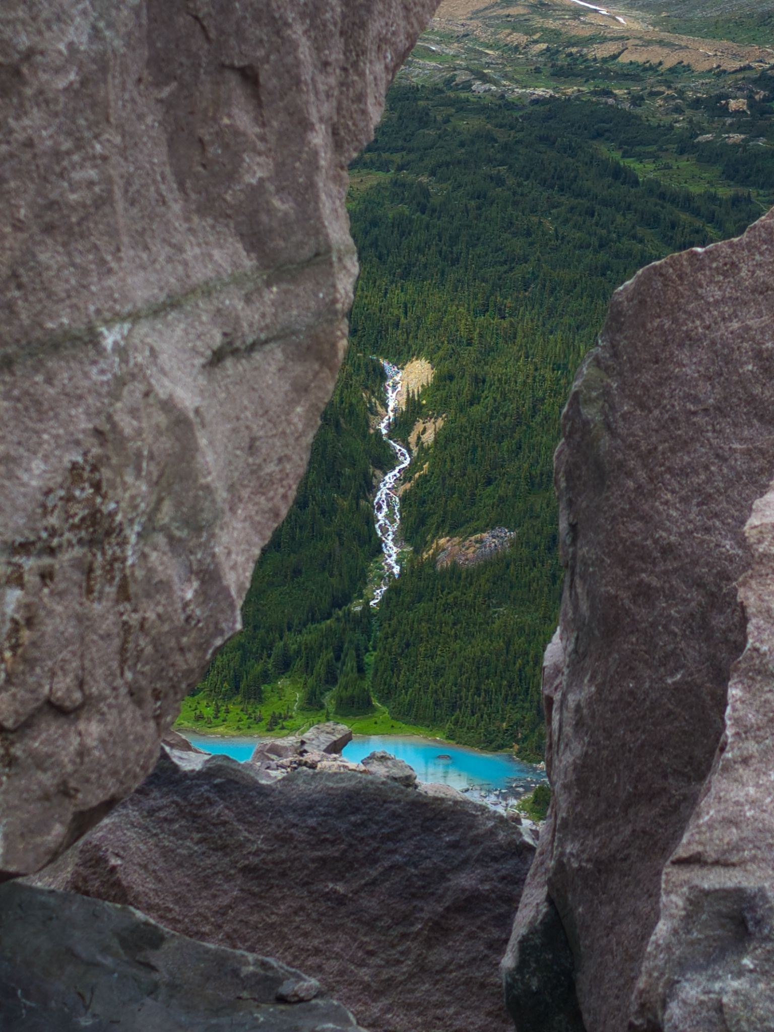
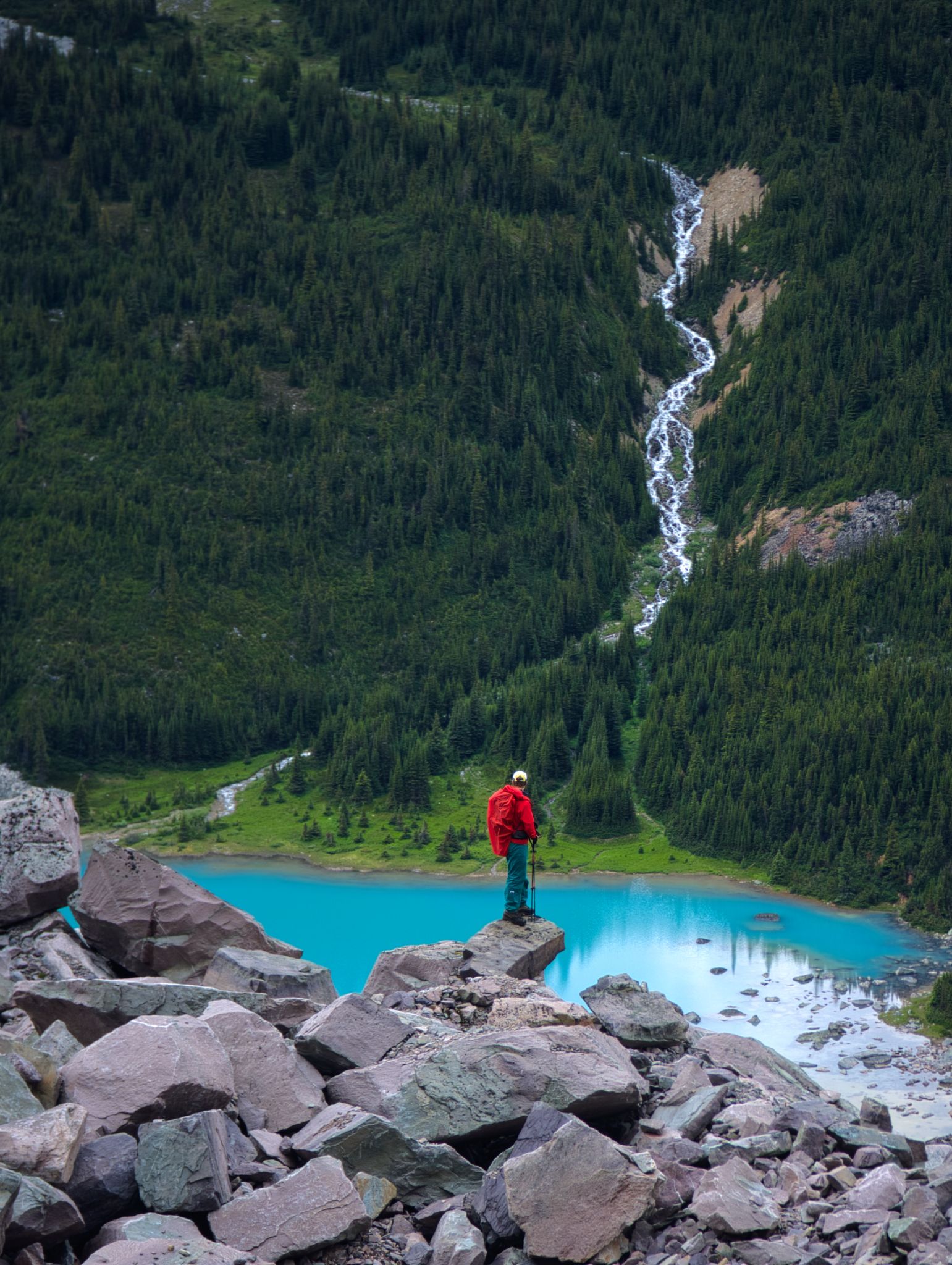
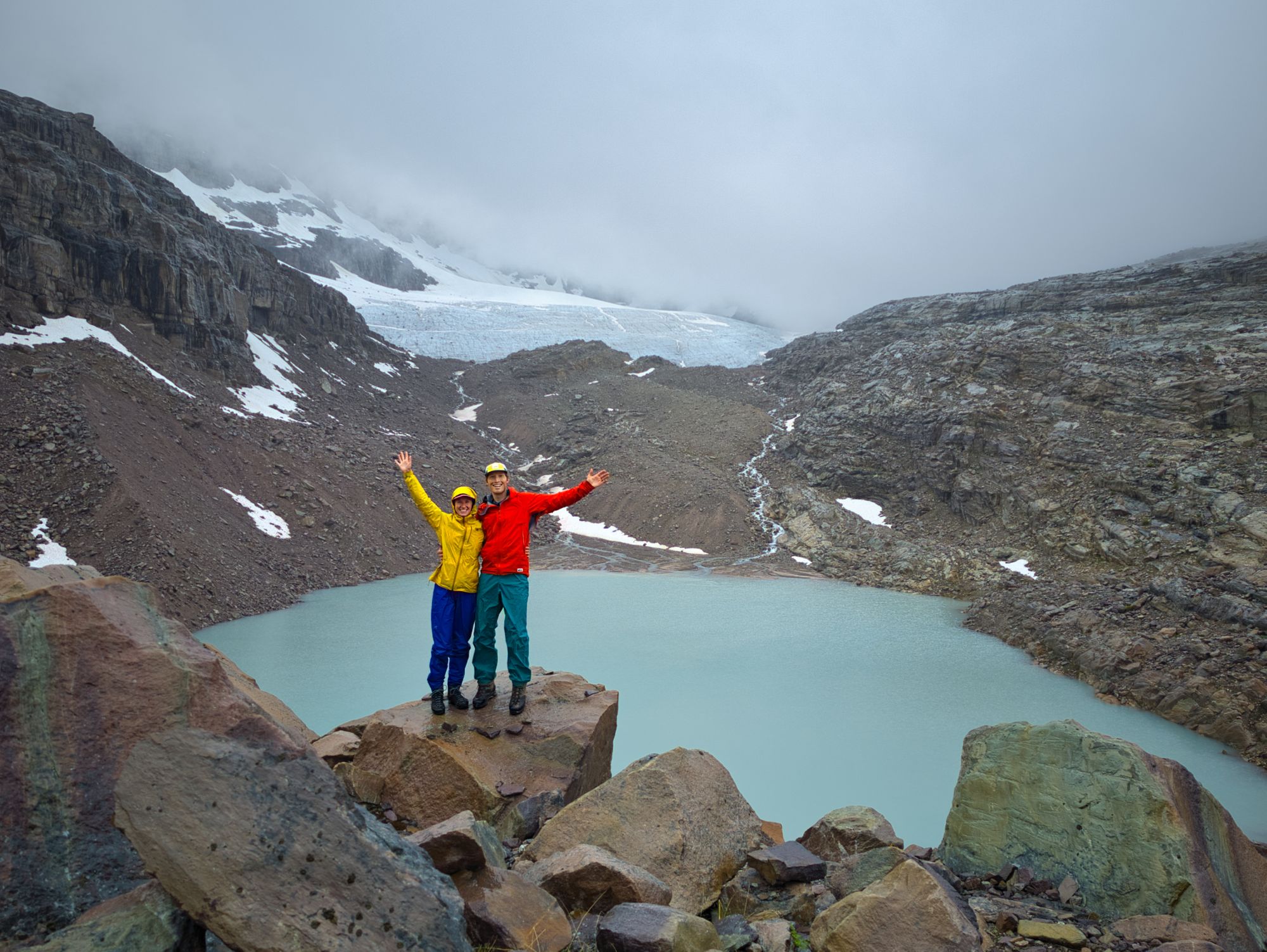
We carried on along the valley floor, the peaks on either side towering over us. We could see waterfalls on both sides rushing meltwater down into Fryatt Creek as we followed it upstream. Then seemingly out of nowhere a huge cairn stood ahead, and just beyond it, the stunning Fryatt Lake.
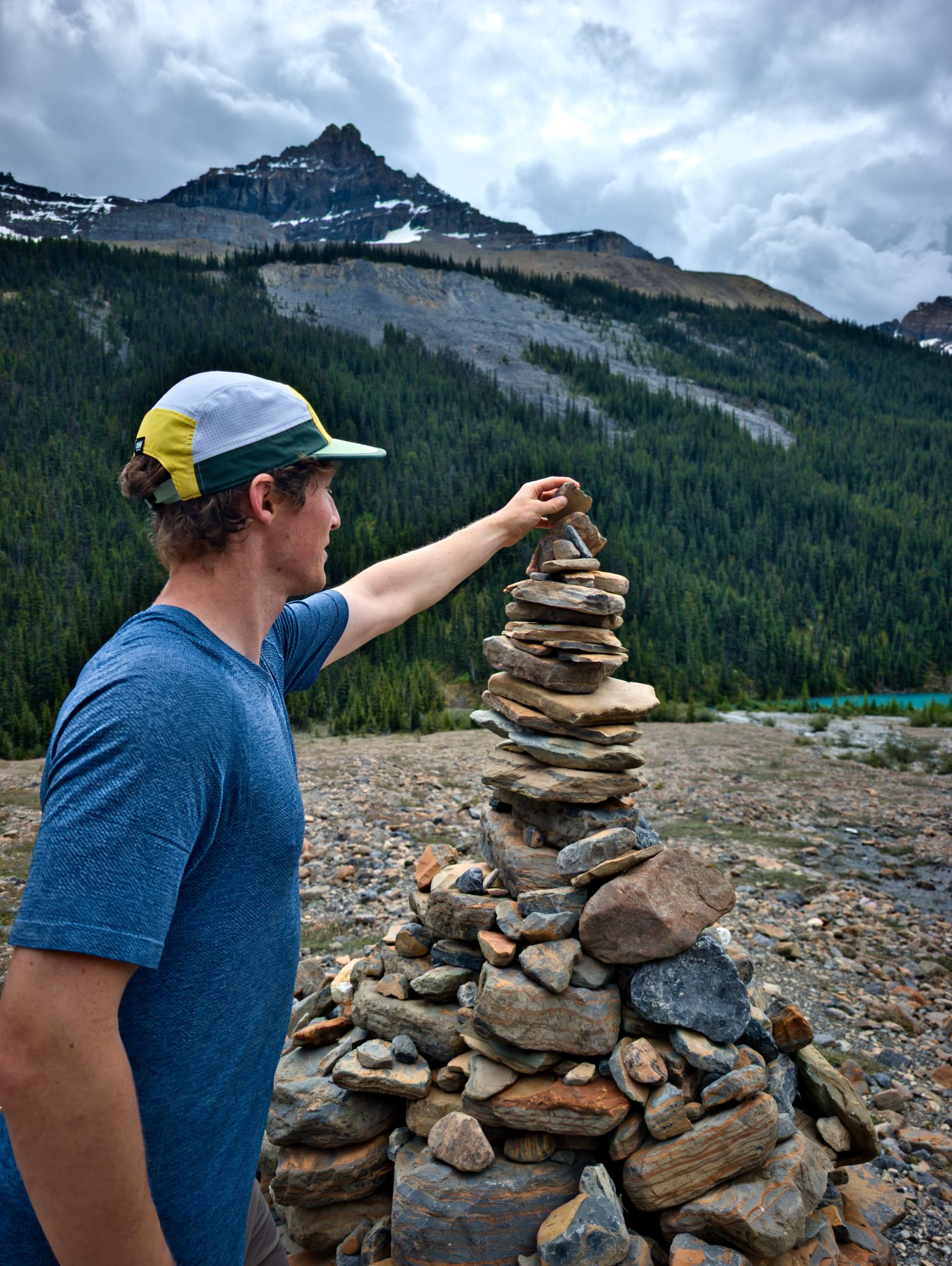
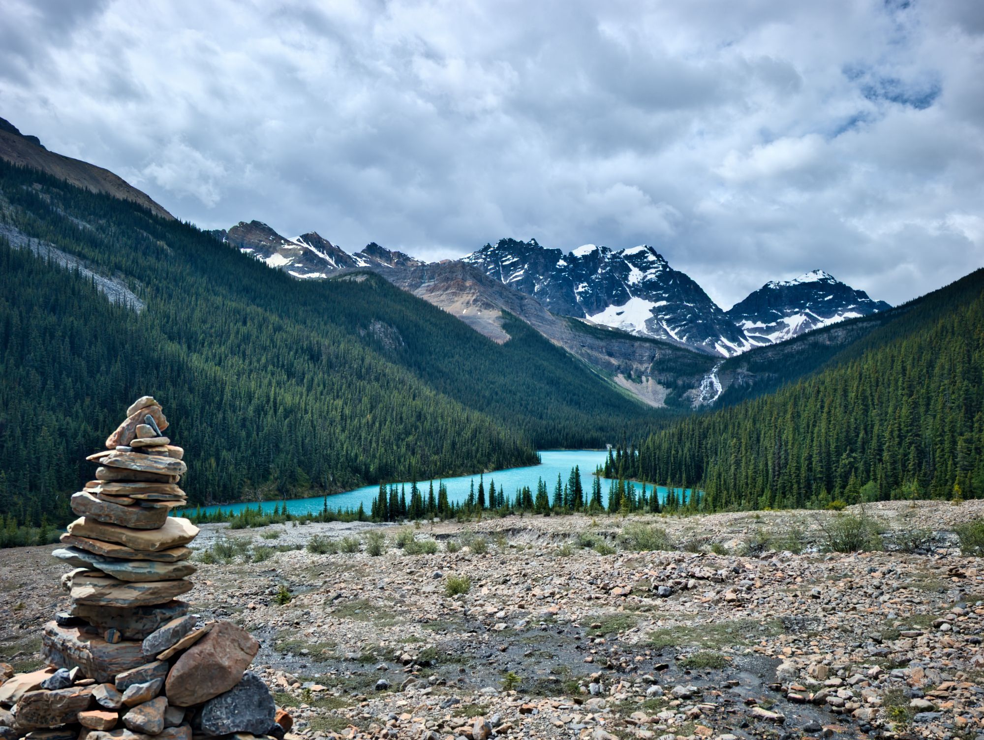
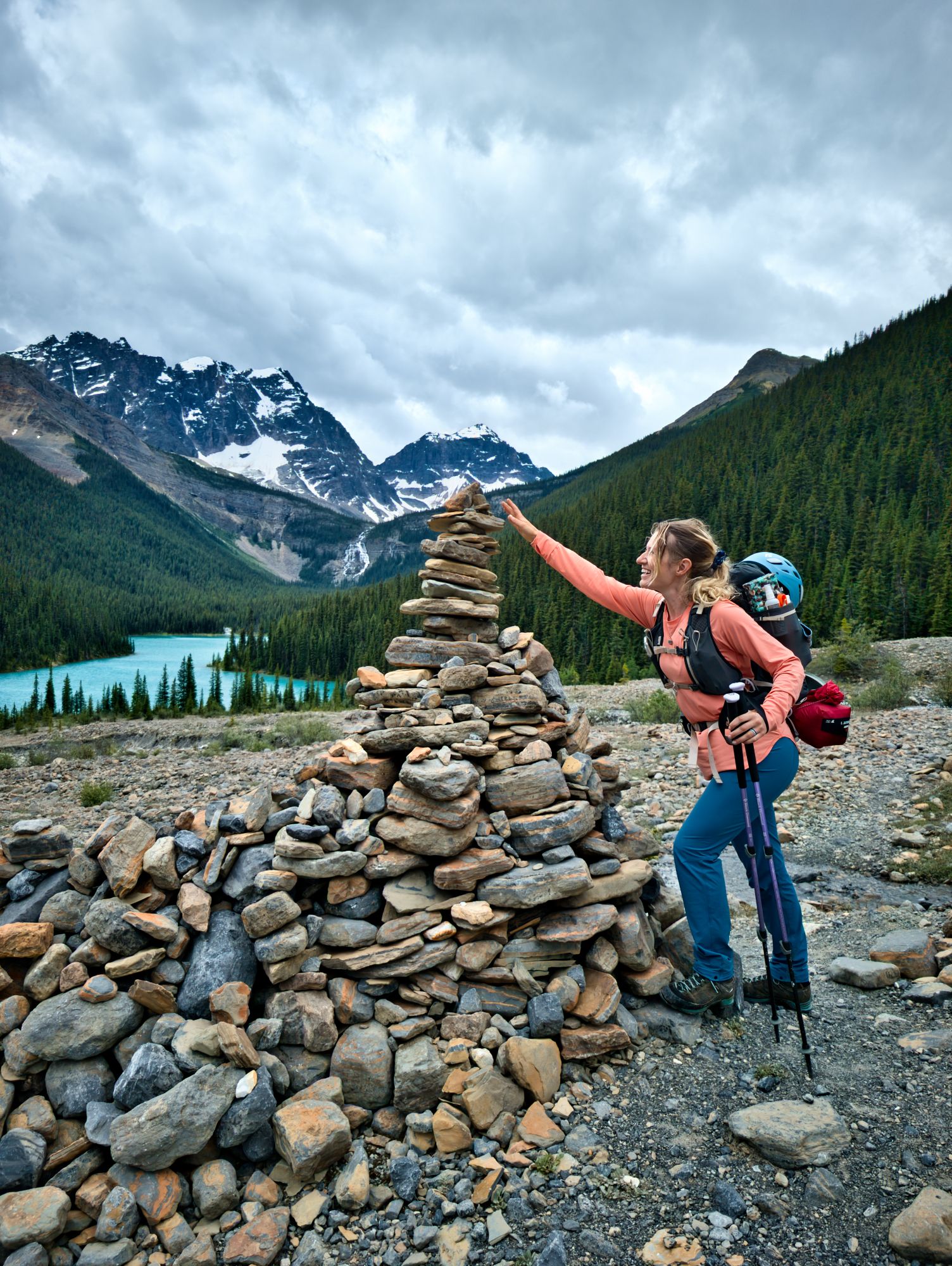
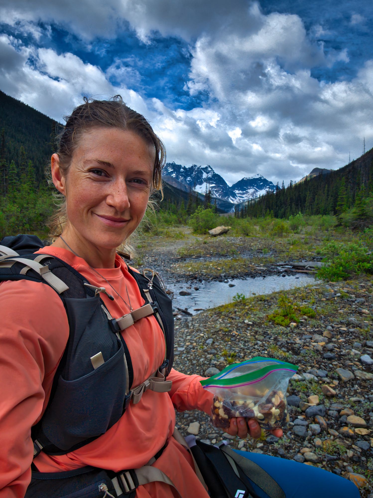
We dropped our packs at the cairn and ventured off to explore a nearby waterfall on the north side of the valley. The breeze at this higher point was doing wonders to keep the bugs away, so after checking out the falls we had lunch at the cairn.
Bellies full, we followed smaller cairns to descend to the lakeshore. After only a few steps it started to rain, so we paused to put on our rain gear. Once we were level with the lake we followed the trail along its northwestern side, getting peekaboo views of peaks through gaps in the trees as we went.
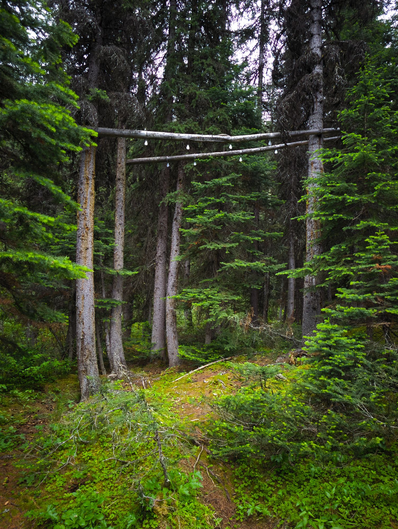
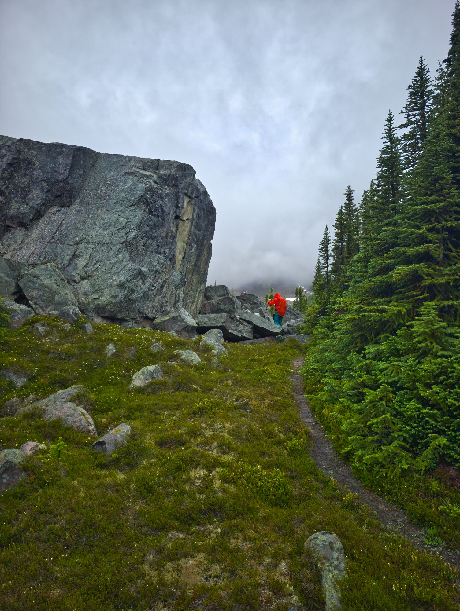
About 3 km past Brussels, just before starting the climb up the dreaded valley headwall, is the old Headwall Campground. This camping area was closed by Parks due to rockfall risk, but a picnic table and the old bear hang remain. We paused to chat with a couple that was stopped for a snack there. They had stayed at the hut the night before, and on their way out had attempted to climb over a shoulder of Mt Fryatt to exit the area via the Geraldine Lakes Trail. They had ended up “cliffed out” and unable to find a safe route, so opted to backtrack to the hut and follow the Fryatt Valley Trail back out. We wished them luck with the long, late day they had ahead of them and steeled ourselves for the final push of our day: the headwall.
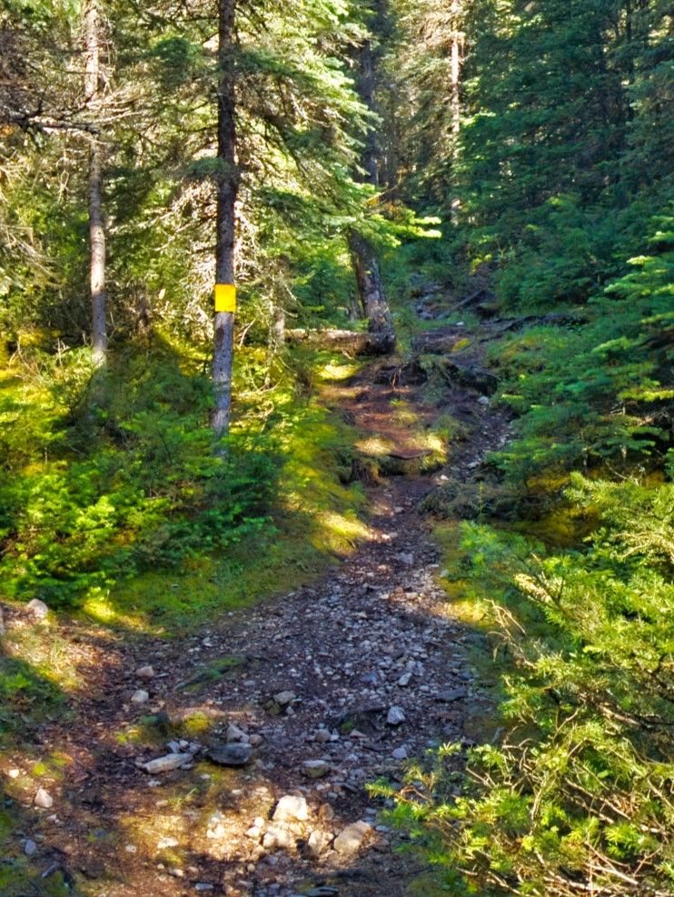
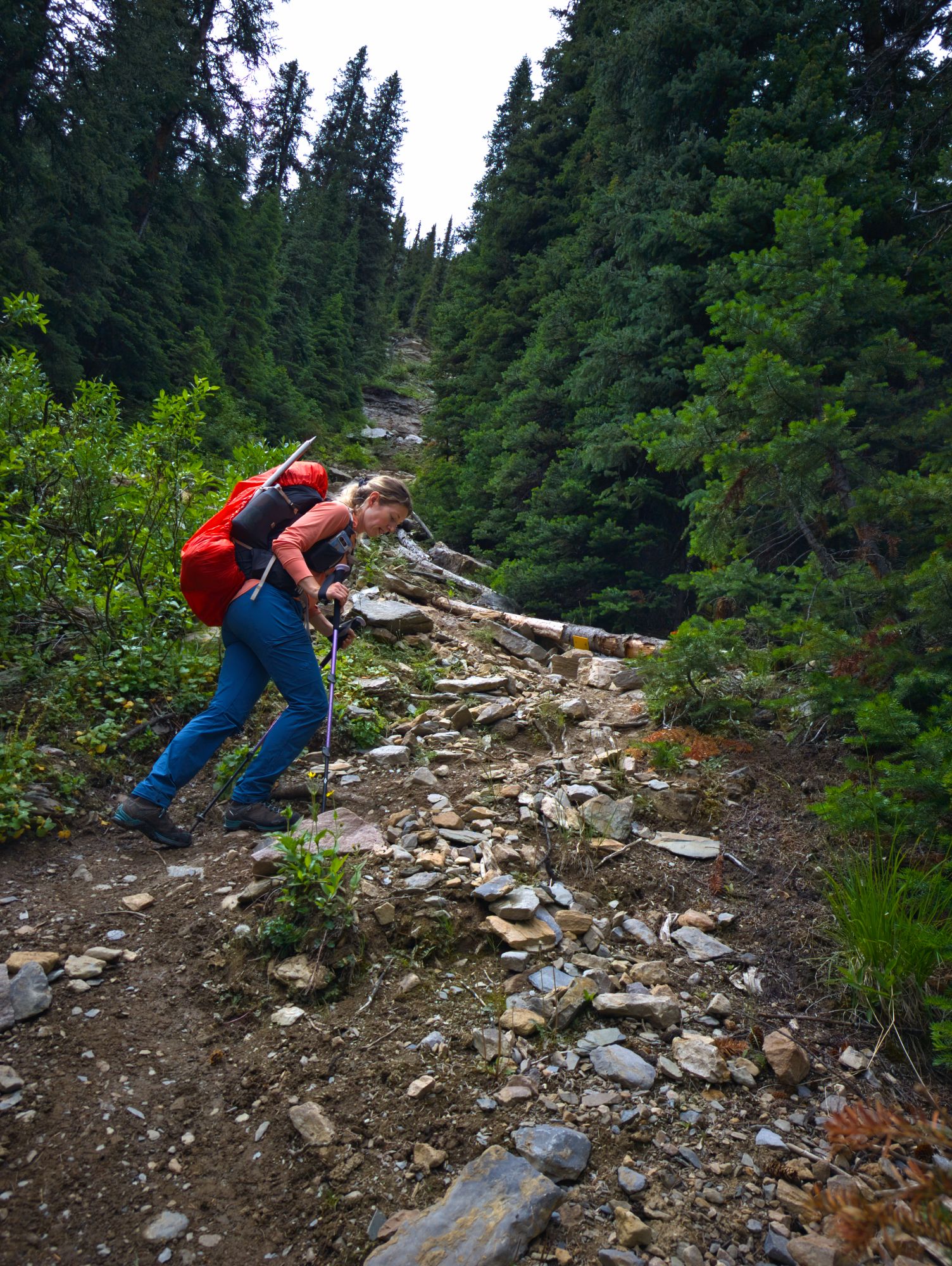
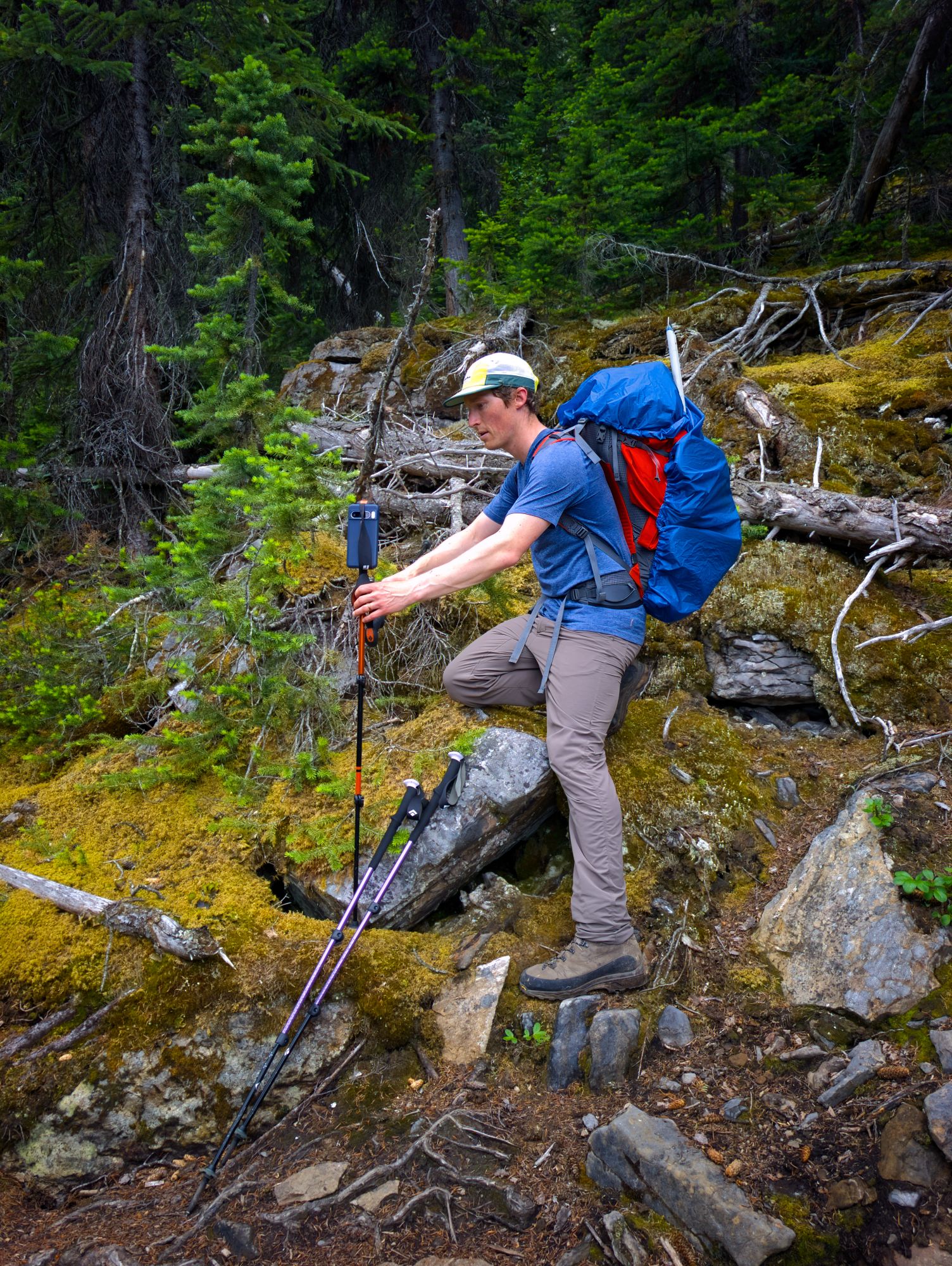
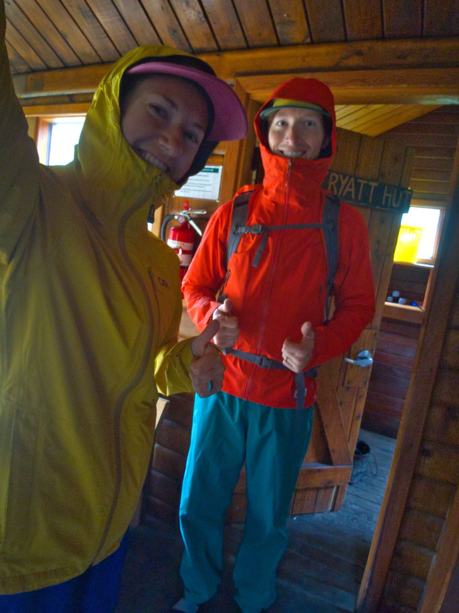
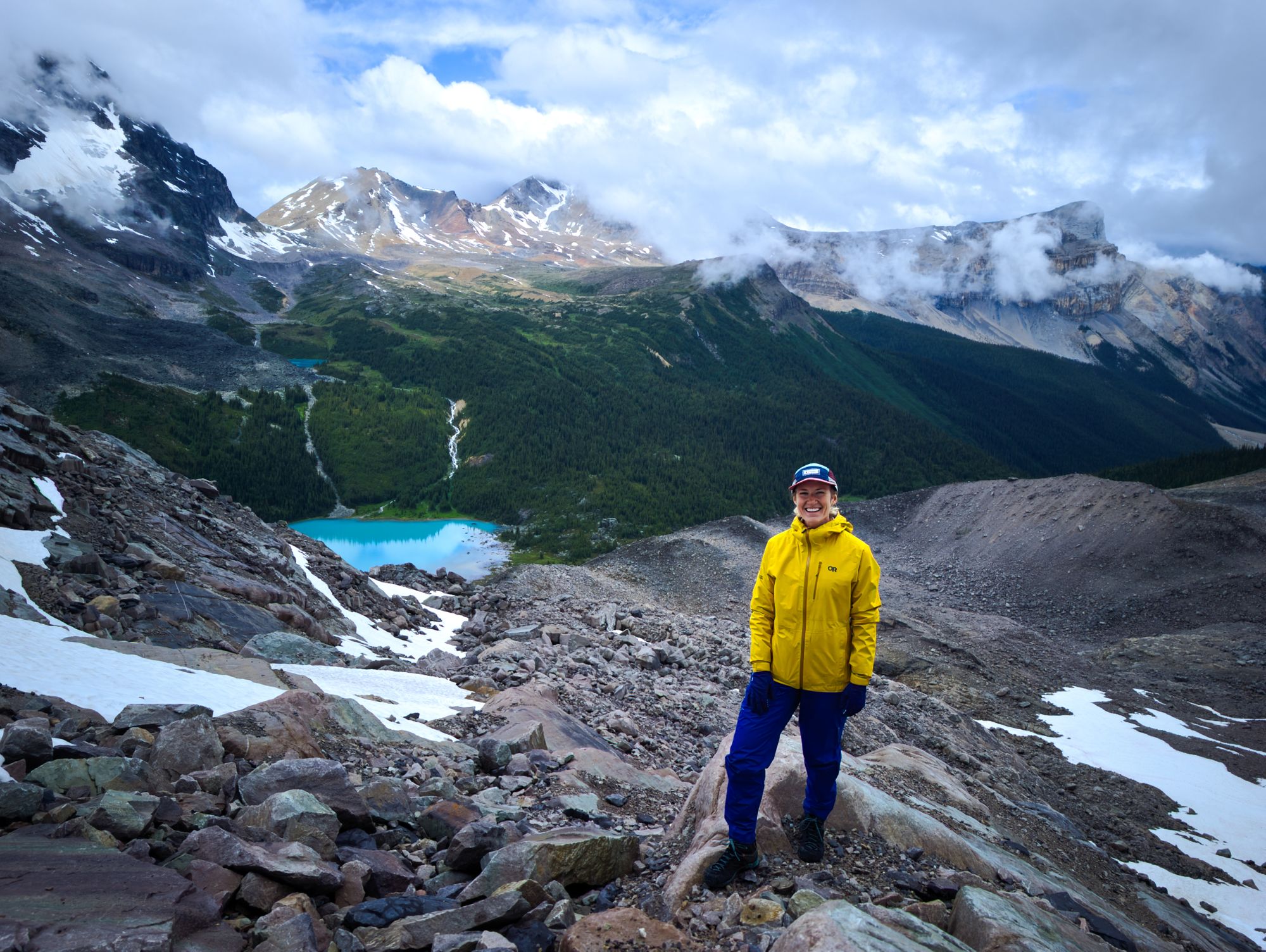
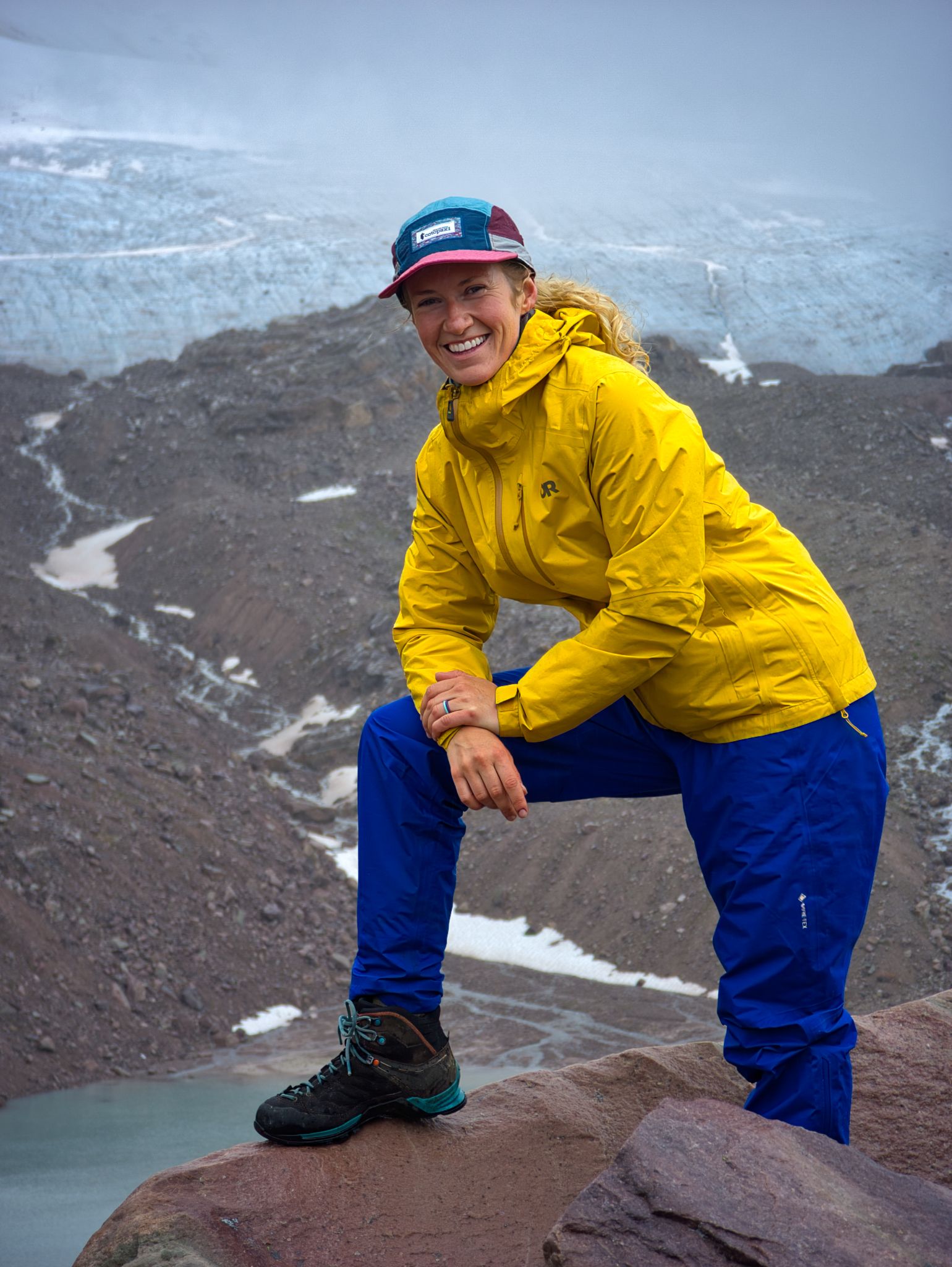
The headwall climb brings hikers up about 200m of elevation in the short distance of 500m laterally, giving an average slope angle of nearly 45°. We drew similarities between it and the “dirt chute” that we hiked as part of our Golden Hinde trek back in 2020. In the Parks Canada guide to the Fryatt area, it’s clearly stated to ensure that you follow the yellow trail markers for this section because veering off the proper route can lead to very difficult and dangerous terrain. While tough, the climb was over quickly and the sharp elevation gain gave us stunning views over the lake and valley below. We always have fun setting up a hiking pole tripod to take photos together!
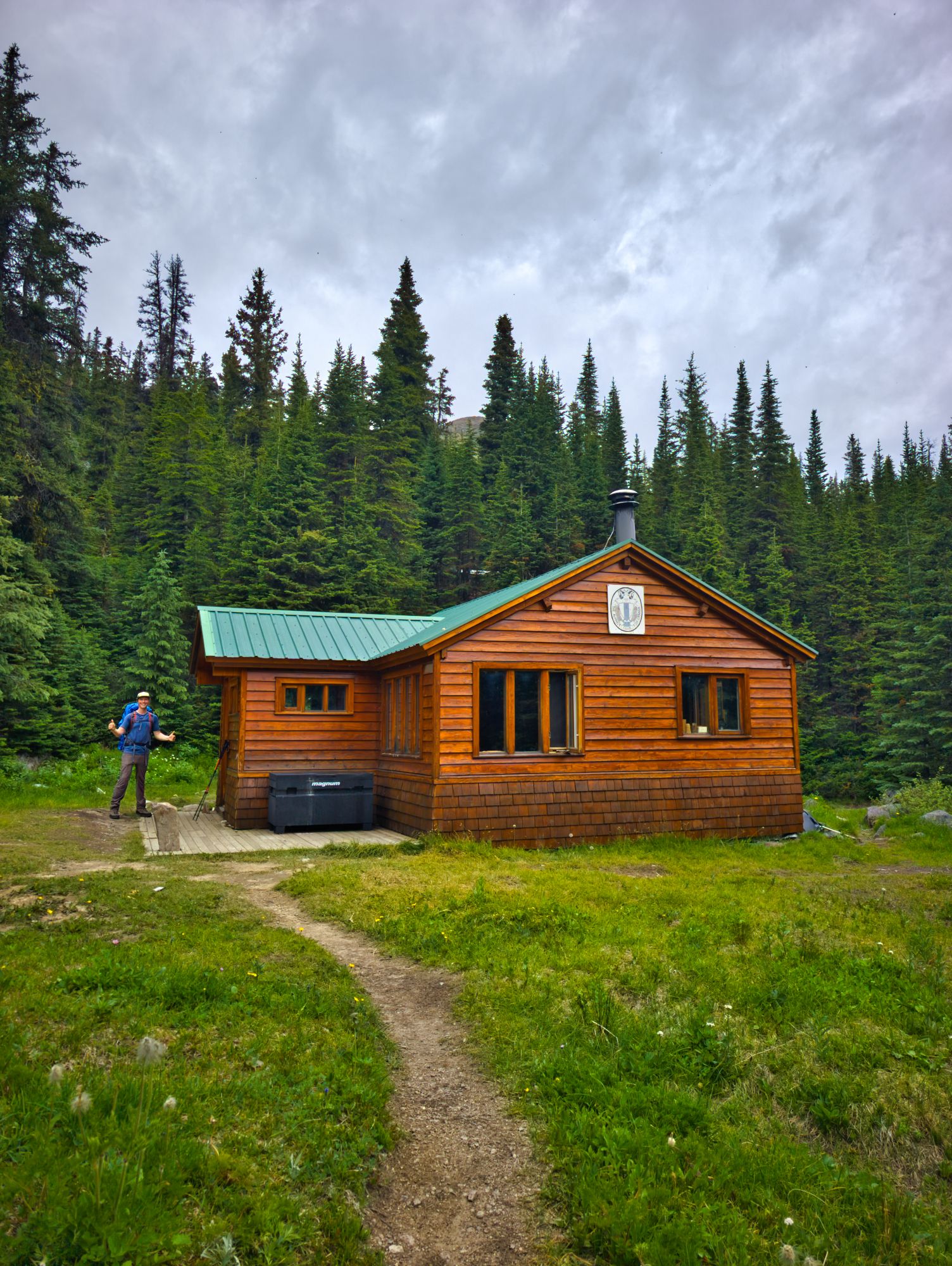
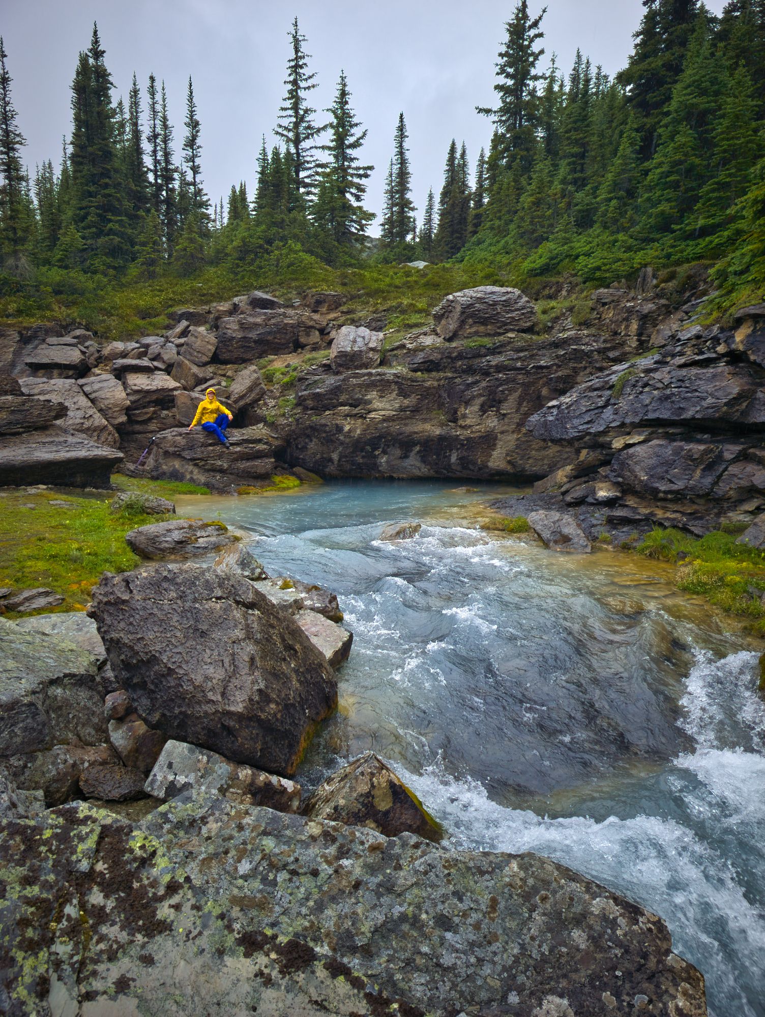
A final 400m of hiking brought us past a lovely ice-blue pool of water with a rushing inflow but no visible outflow, and then finally to an even lovelier sight: the hut!
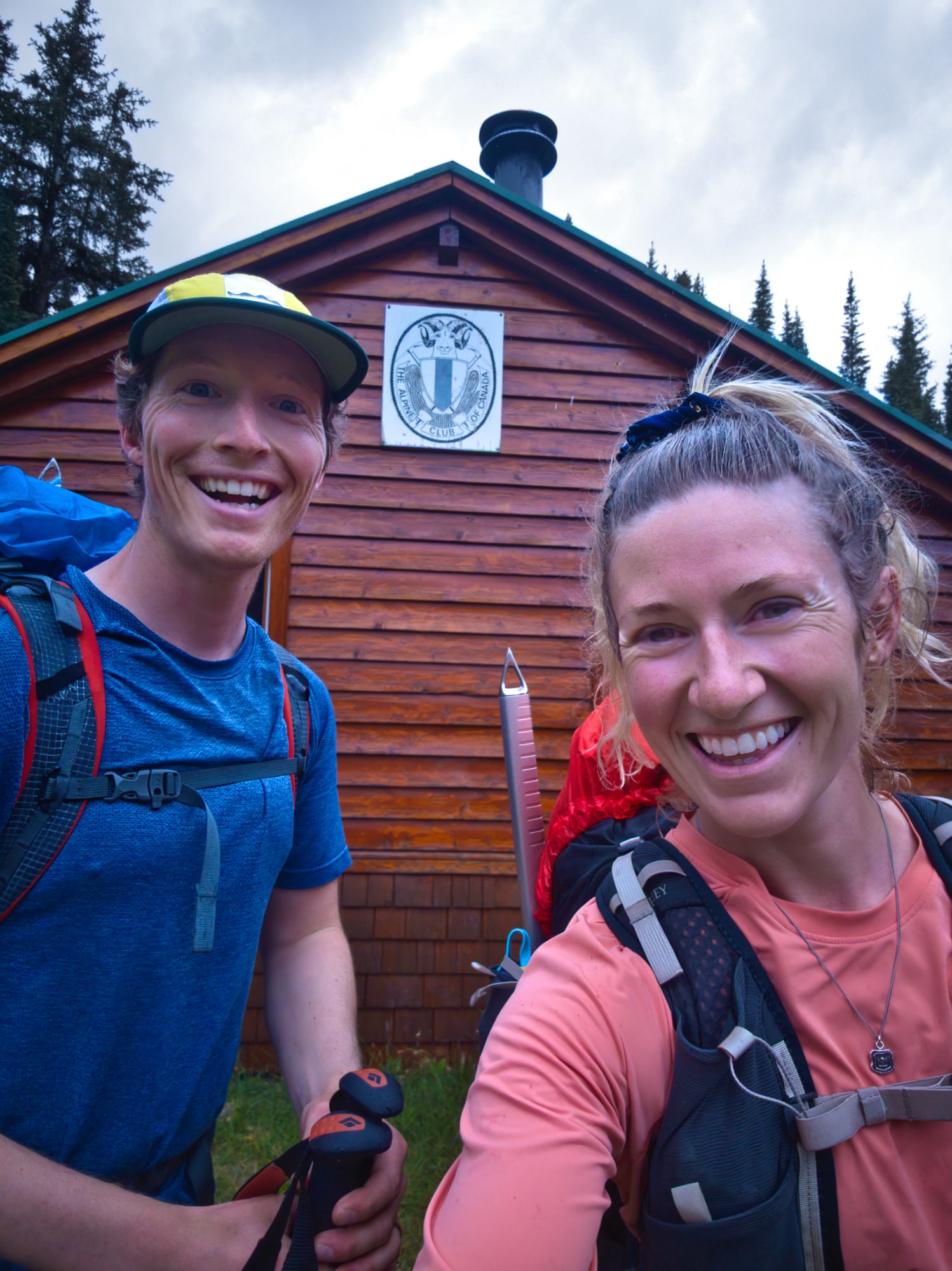
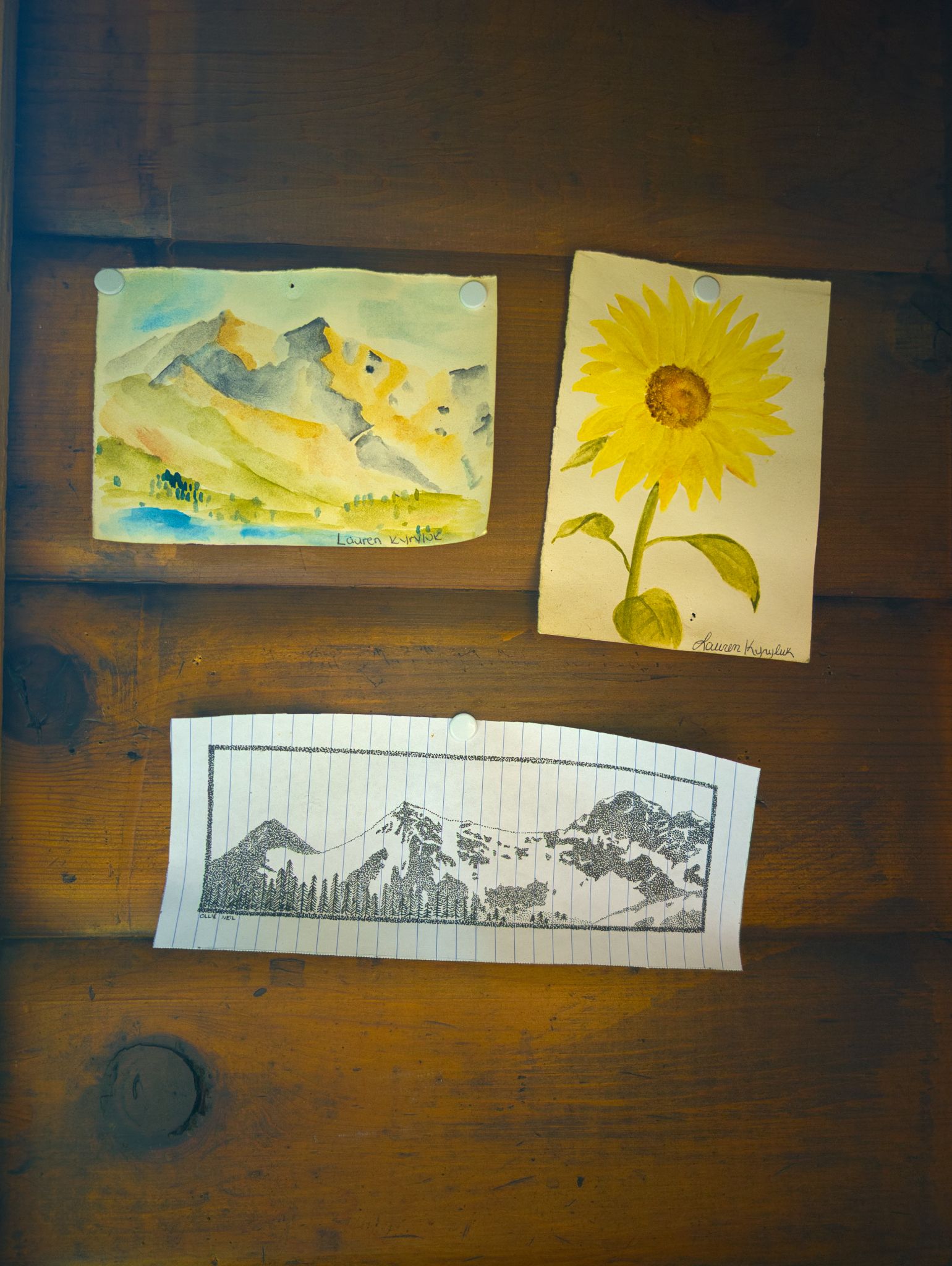
We took some time after arriving to read through entries in the Hut Register, many of which mentioned hikers’ surprise at how quiet this hut is. A few tales recounted the absolute slog of getting up there in the winter – it sounds like the average ski/hike time is about 16 hours one way. A recurrent character throughout the years was Kevin the Porcupine, though he never made an appearance for us. There were many detailed drawings, including artistic maps of the area with names for natural features such as Serenity Pool, which we passed by just before reaching the hut.
While we were relaxing, the other two hut occupants – a father and son from Grand Prairie – arrived after a day exploring the upper valley area. The four of us chatted and made our dinners; for us it was a delicious, home-dehydrated Sweet Potato Chickpea Stew. We learned that the dad's other son (who couldn't join them for this trip) had been the one to first build the massive cairn we saw, years ago on their family's first trip up here!
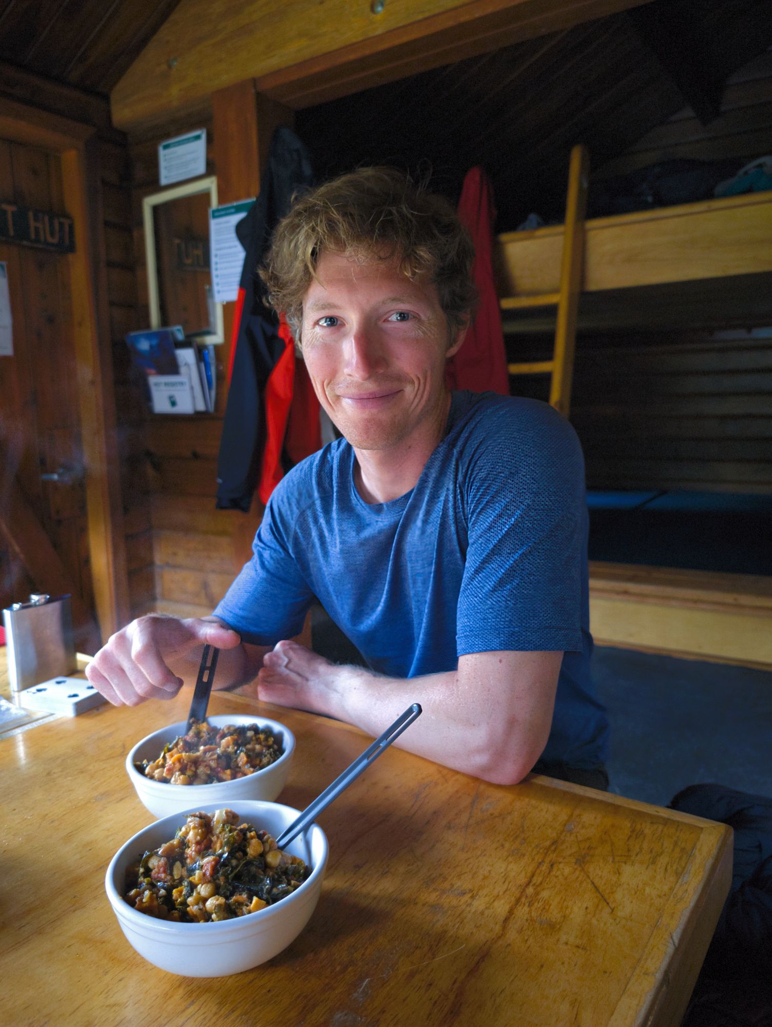
After dinner, we each played our own card games until we offered to teach the other folks Euchre so we could have a game all together. Once our game was done, we all retreated to our beds. It had been a couple of very long days for us so we were happy for the early sleep!
Day 3: Exploring around Fryatt Valley Hut
Approx 8.5 km
Our first morning in the hut, we were gently awoken by our two hut-mates quietly packing up. In the background, all we could hear was rain on the hut’s tin roof… so we let ourselves drift back to sleep.
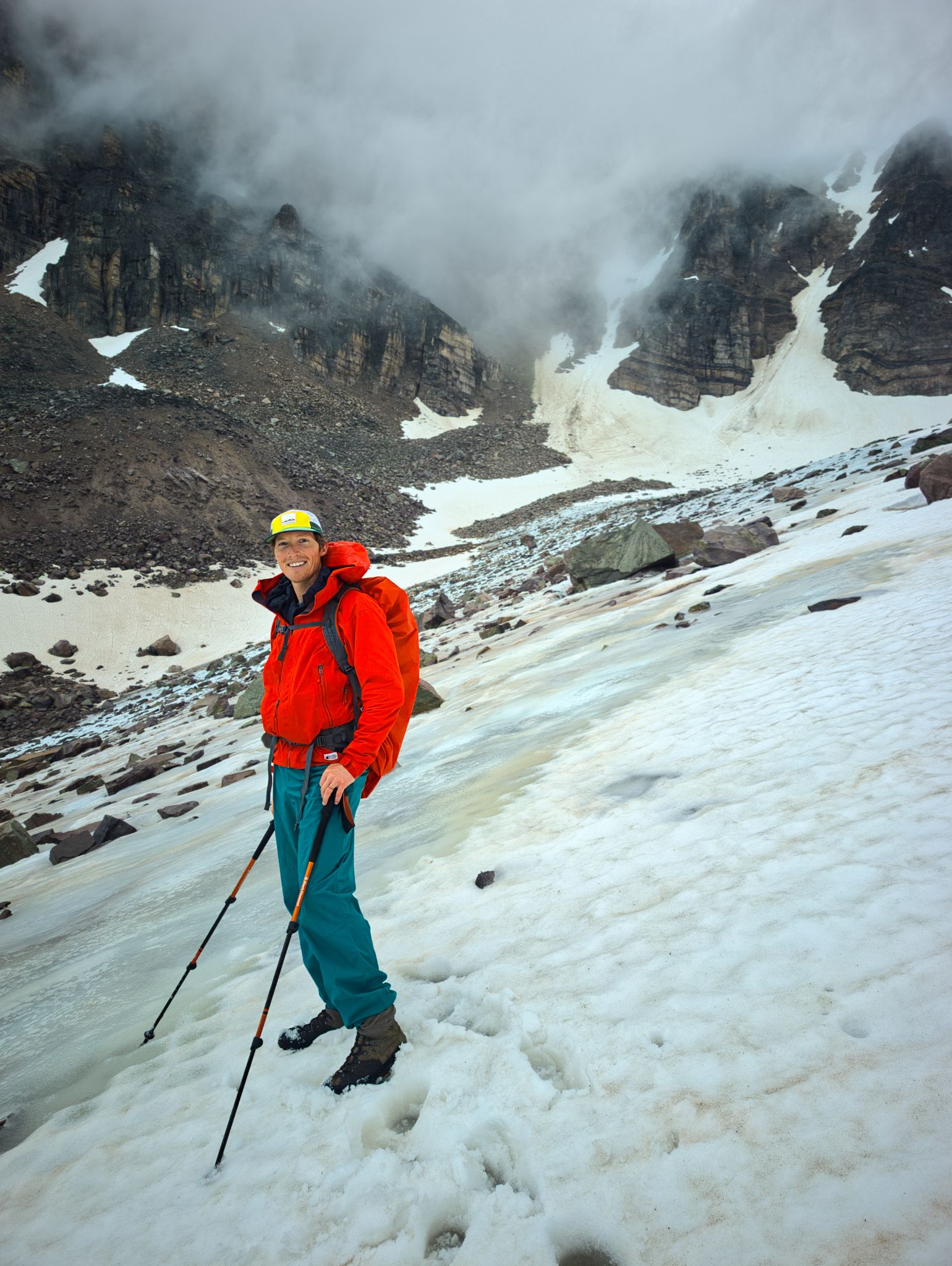
When planning this trip, we intended to attempt a summit of one of the smaller mountains in the Valley, but with the rain, low clouds, and intermittent fog, we decided it would be smarter to explore below the clouds.
After a lazy breakfast we donned our rain gear, head to toe, and set off.
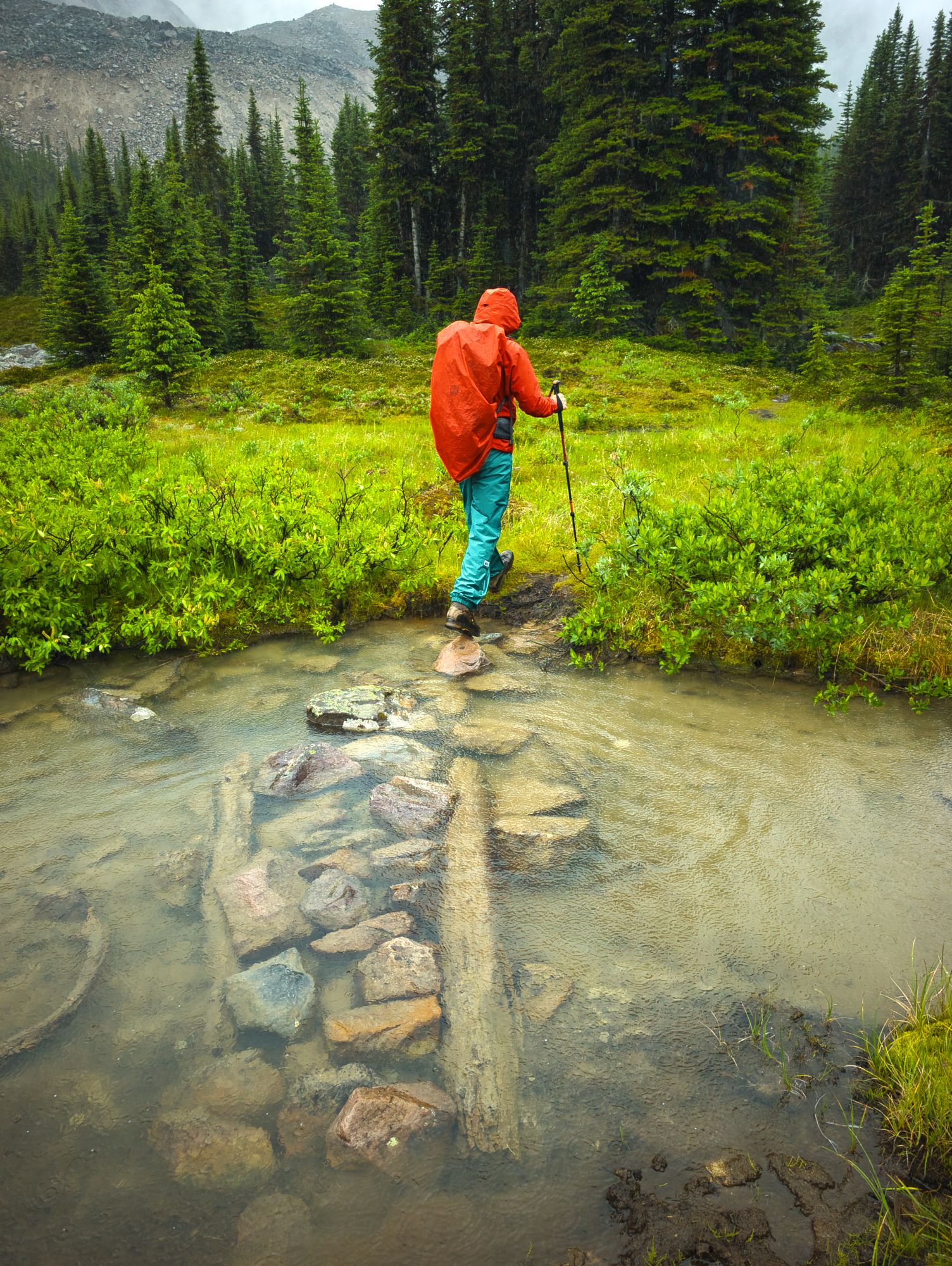
We followed a boggy trail southwest alongside the creek. About 550m on, we came across a large cave that the creek rushes into.
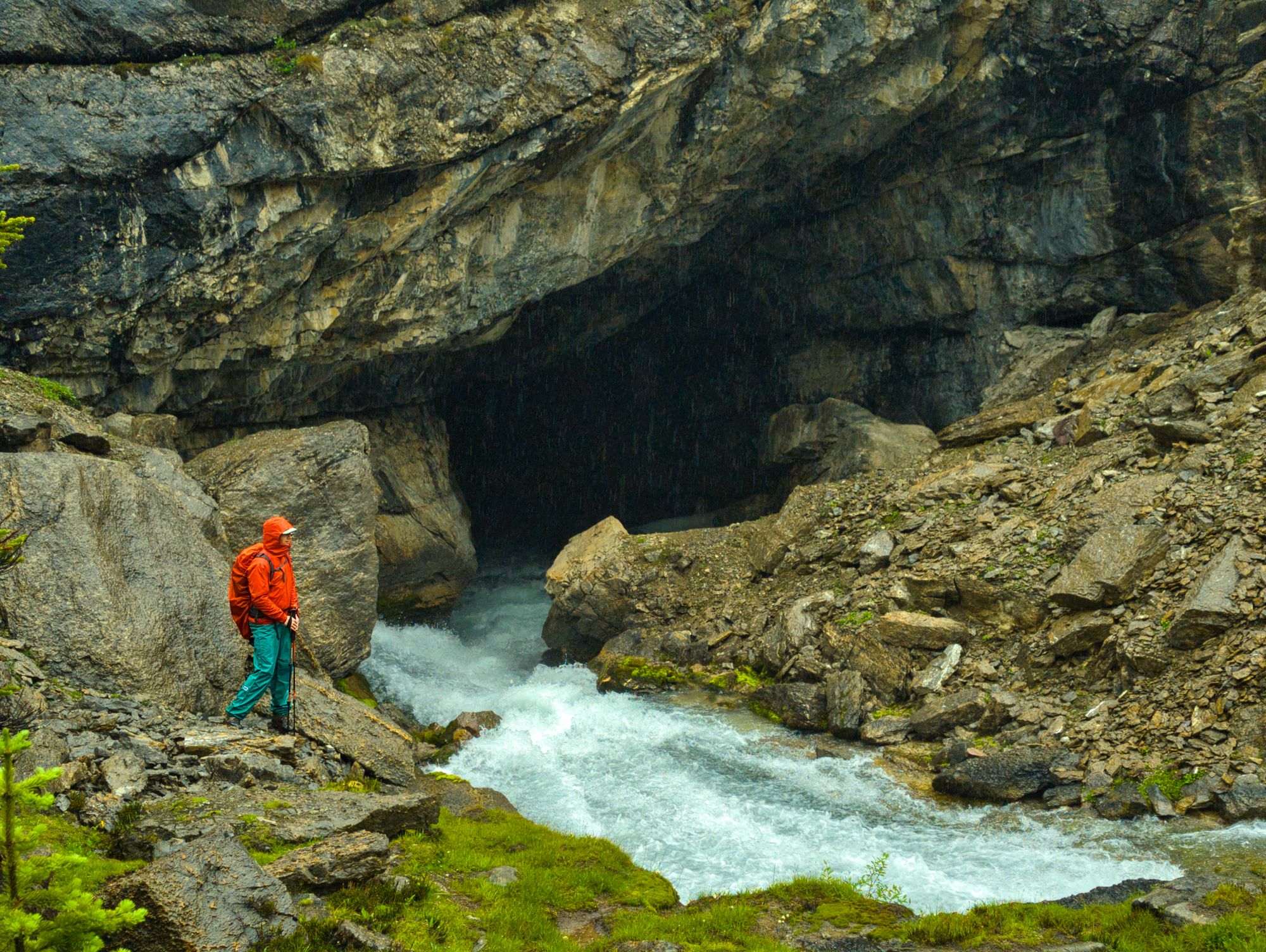
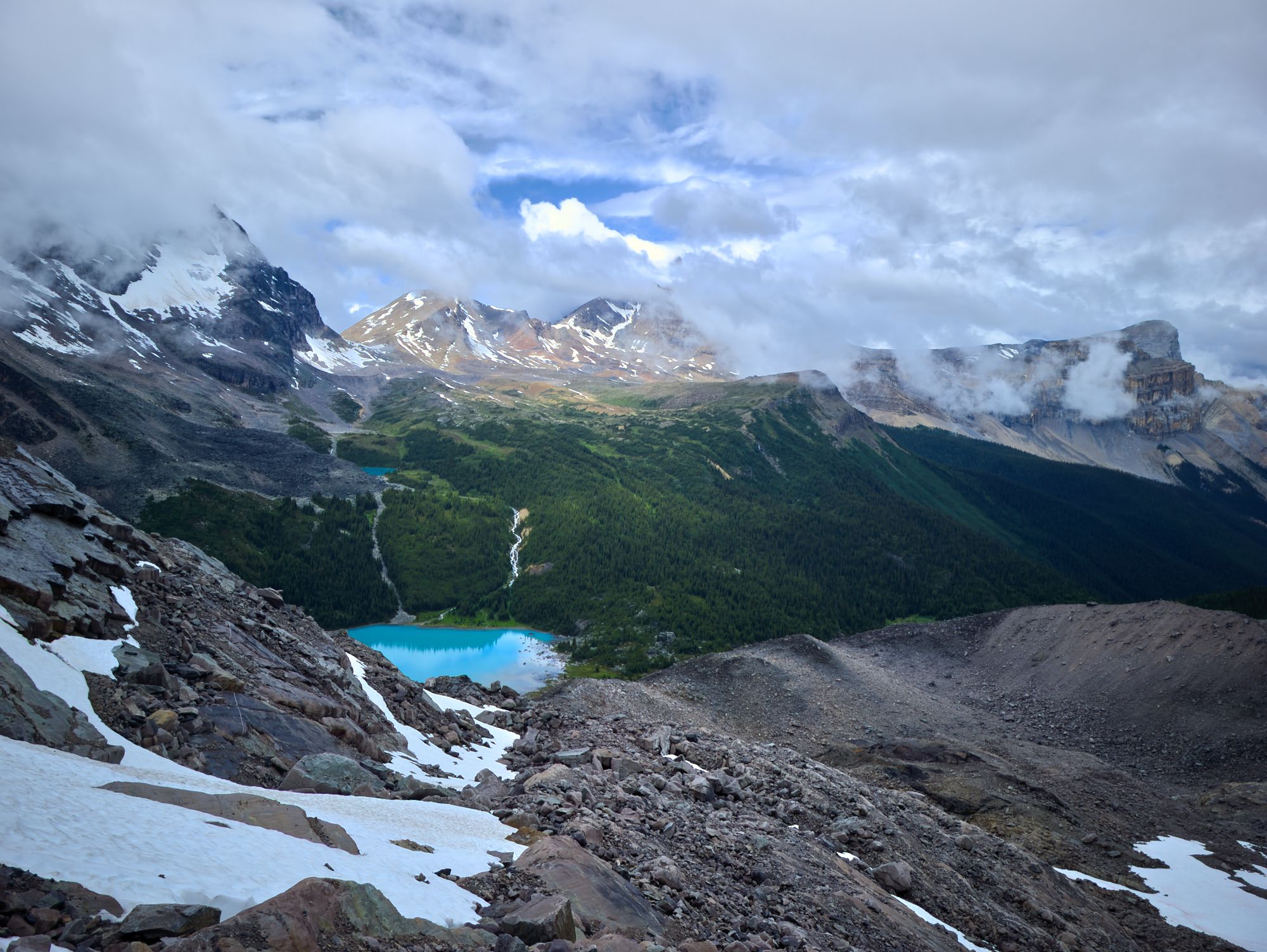
We checked out the cave as much as we safely could, then continued farther upstream where we saw that the creek was gently flowing out of another cave. From there, the trail ventured through a boulder field until we came upon the shoreline of a beautiful turquoise lake.
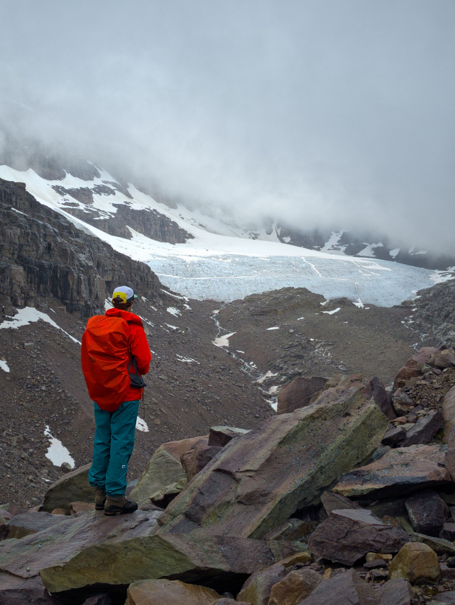
We followed the marshy lakeside to our left, finding our own route as the trail disappeared in the softer ground. Once we were about halfway around the lake, we consulted the map on our Gaia GPS app to decide our next move. The other guys at the hut had talked about getting to the bottom of the glacier at the end of the valley, but a large boulder field of slippery rock barred our way. We decided to avoid the boulders and instead try to get to another glacier that we’d seen from the hut on the south side of the valley, then take advantage of the high ground to plan our next move.
We picked our way up the rocky slope, navigating large and small rocks covered in slippery lichen. As we climbed, the glacier eventually came into view. Sadly we also saw that we couldn't safely get right up to it due to the terrain... So we got as close as we felt comfortable with and then turned around to find ourselves dazzled by the otherworldly blue of the lake below. It was also around this time that we noticed the rain had stopped – yay!
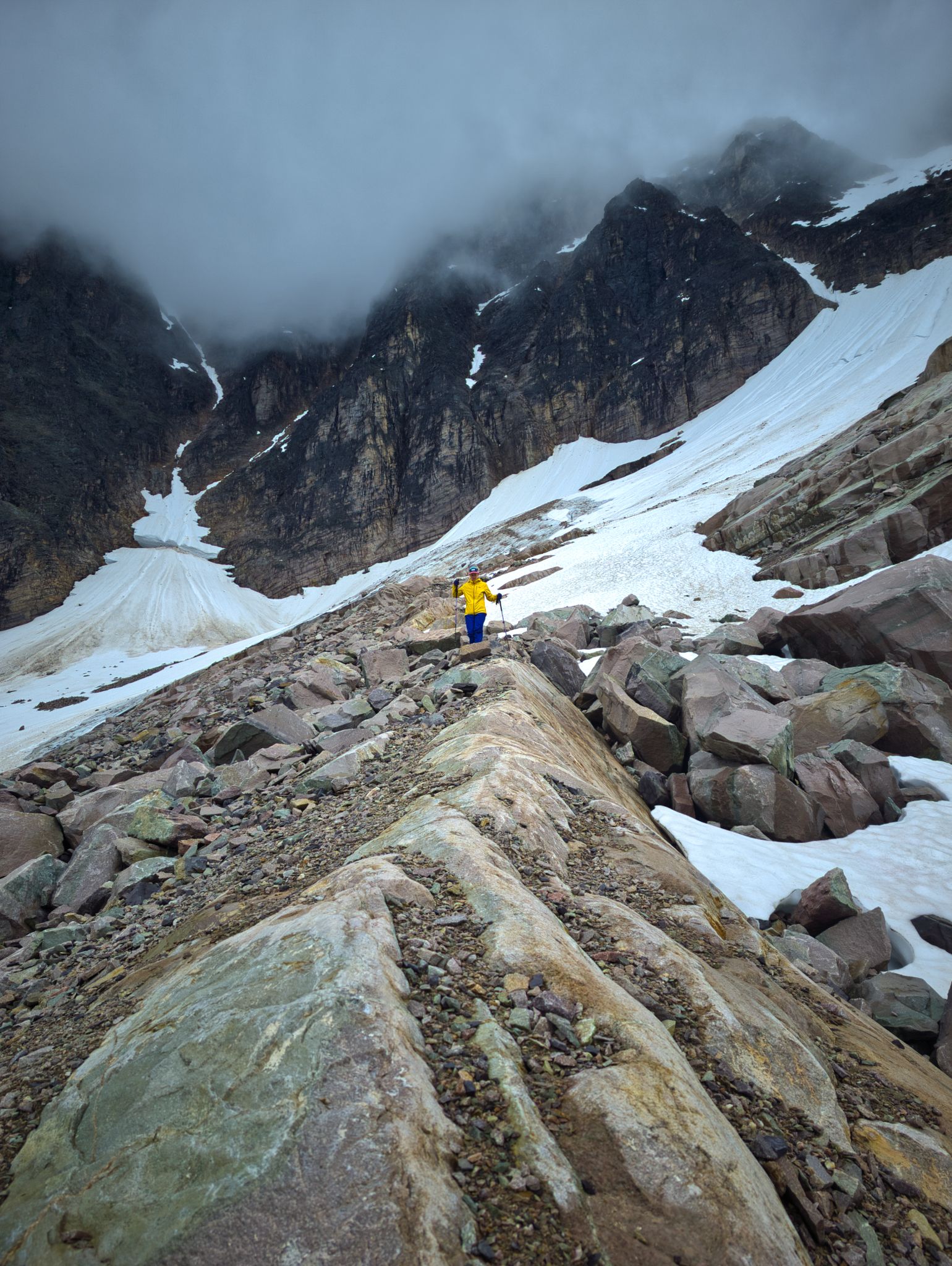
We did a time check and figured we might as well try to make our way towards the glacier at the end of the valley, so we descended a bit and traversed across the scree and talus slope above the boulder fields.
As we crested the rise south of the lake, a large tarn came into view below us. Reading the terrain, we decided the easiest route followed a gentle slope from the tarn up to the southwest, so we continued to pick our way along the moraine.
We soon found a rough route marked by cairns, which we followed until we could see the toe of the glacier to our northwest. Unfortunately, we were approaching our turnaround time (5:30pm), so we made the call to head back down to the hut.
But we still hadn’t touched a glacier… “Wait!” we thought – there was another smaller glacier not too far to our east that we should be able to access in a reasonable time. We traversed across boulder fields to reach it – and walk on it.
Feeling a sense of accomplishment, we had fun boot-skieing down the lower snowfield before rejoining the cairned route above the lake. As we approached the steeper section, we briefly lost the trail but continued in what we knew was the right direction, until I suddenly noticed a small hole in the dirt that had to have been from a hiking pole. The trail was still quite faint and hard to follow until it cut down a grassy slope. When we reached the lakeshore, we took a moment to look around and locate the proper trail, then saved a waypoint in our GPS app for next time.
From the lake, we followed the same trail back to the hut, except for a small detour to find the outflow of the creek downhill from the first cave. By the time we got back to the hut, the clouds had almost completely cleared and the evening sun was shining brightly.
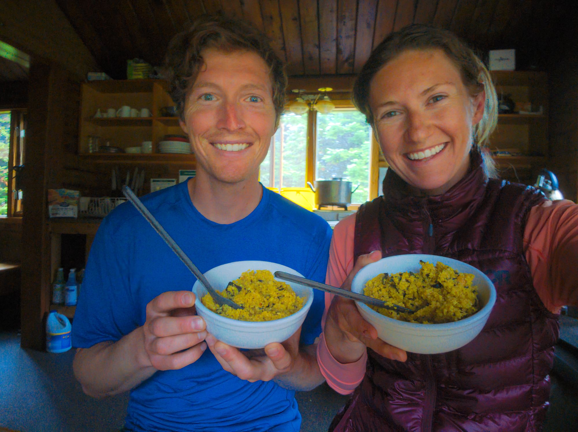
For dinner we ate our second homemade meal – a Cashew Curry Couscous with black fungus. It was pretty good, but we’re planning to add some more curry powder and use a little less salt next time we make it.
We played a game of crib and then went to bed, knowing we had a long hike out the next day. The couple at Lower Fryatt that said they’d be getting to the hut this night never showed; we’re guessing they turned around due to the heavy rain earlier in the day.
Day 4: Fryatt Hut back to Trailhead
Approx. 22 km
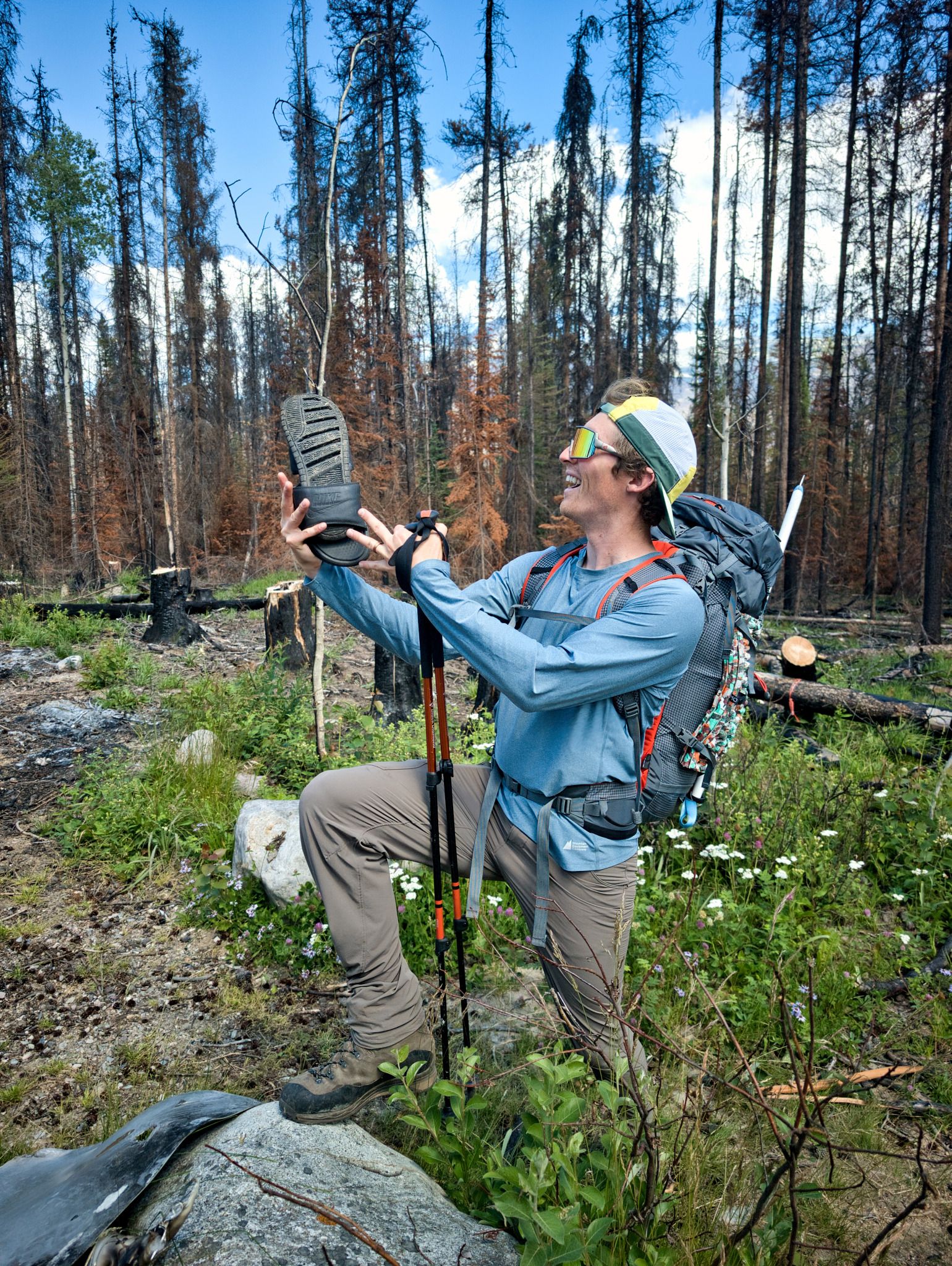
We woke up early to a perfectly clear sky, and sounds of the rushing creek and birds chirping nearby. We ate our oatmeal, packed our gear – wait a minute… where the heck did Ryan’s camp sandals go?? Did the other group accidentally take them yesterday? We searched everywhere to no avail, so we cleaned the hut and pushed off.
Going down the headwall was much easier and faster than the climb two days prior. We were thankful the rain had stopped, because the steep descent would have been treacherous in the wet. We felt bad for the father and son who had hiked out in the downpour the day before.
In what felt like no time at all, we reached the old Headwall Campground, then continued to make quick work of retracing our steps past Fryatt Lake towards the rocky valley. The hike all the way to the bridge flew by, and then we were enveloped by the lush green forest once more.
We continued our brisk pace, the lure of Miette Hot Springs calling to us as we descended, and we arrived at the Lower Fryatt Campground around 11:30am. We enjoyed a slow lunch, taking the time to air out our feet as we ate our tuna and flatbread.
We got back on the trail just before noon and although the rest of the hike out was very easygoing, the last few kilometres to the car seemed to really drag on. We pased at least four groups on their way in, and wondered how many would make it all the way to the hut.
Finally, a glint through the trees! Just around one more bend, there was the trailhead and parking lot. And...! What was that on the big flat boulder there?! Huzzah: Ryan’s sandals :)